webshop.nl
Categorieën
  Sluiten

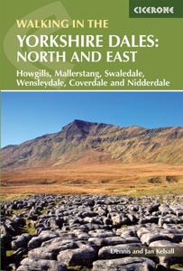
Wandelgids The Yorkshire Dales - Walking in the North and East | Cicerone

This guidebook contains 43 circular day walks in the north and east Yorkshire Dales. It explores the dales, hills and moors between Kirkby Stephen and Pateley Bridge. Walking ranges from gentle three-mile strolls to more strenuous day-long rambles across the Howgills, Wensleydale, Swaledale, Nidderdale, Mallerstang and Coverdale   In this guidebook...
19,95

Webshops met dit product

Webshop
Bezorging
Prijs

Anderen bekeken ook

Wandelgids Walking in the Yorkshire Dales: South and West | Cicerone
Veelzijdige wandelgids van een deel van de Yorkshire Dales, goede kaarten en beschrijvingen en veel keuze uit een behoorlijk aantal wandelingen. Part of a two-book set, this guidebook describes 44 walks in the southern and western Yorkshire Dales, including the famous 23 mile Three Peaks circuit over Pen-y-Ghent, Whernside and Ingleborough. The other, mostly circular routes of 3½ to 13 miles cover the scenic region between Sedbergh, Kirkby Lonsdale, Settle, Skipton and Grassington. The Yorkshire Dales need little introduction: their picturesque scenery and hundreds of miles of footpaths, tracks and bridleways have been attracting walkers for decades. Part of a two-volume set, this guidebook presents over 40 routes in the south and west of the National Park, with bases including Sedburgh, Malham, Grassington, Skipton, Settle and Kirkby Lonsdale. The walks cover the valleys of Wharfedale, Littondale, Malhamdale, Ribblesdale and Dentdale – each with its own distinctive landscape and chara…
19,95
Fietsgids Cycling in the Yorkshire Dales | Cicerone
This guide describes 23 day routes, graded by a combination of distance, climb and overall gradient, all suitable for road bikes and illustrated by detailed maps and profiles. In addition a six-stage tour takes in all the highlights, including Grassington, Leyburn, Hawes, Kirkby Stephen, Ingleton and Settle. And for those who really want to test themselves, the route of the Stage 1 of the 2014 Tour de France, a 206km loop from Leeds to Harrogate, is also included, with an option to close the loop without adding many extra miles.   Appendices include a route summary table to help you choose your route, lots of information about facilities for cyclists along the routes, taking bikes on public transport and basic bike maintenance.   The Vuelta a Dales takes in the best dales, passes and viewpoints as it passes through Grassington, Leyburn, Hawes, Kirkby Stephen, Sedbergh, Ingleton and Settle. The Yorkshire Dales have always welcomed visitors who enjoy the views. For cyclists, the national…
20,95
Wandelgids Walking in Cornwall | Cicerone
40 half to full day rambles on the coasts and inland hills of Cornwall are explored in this guidebook.  Routes range from short, 2 mile strolls to long, wild walks of over 8 miles. With plenty of opportunities to combine routes together, this guide provides a wealth of variety for walkers of all abilities.   The guidebook is divided into 6 sections, including walks on Bodmin Moor (for which good navigational skills are required), the North Coast, Penwith and West Cornwall, the Inland Mining Districts, Land's End and the Lizard and Roseland Peninsulas.    Cornwall has a lot to offer walkers; stunning coastal scenery and long stretches of wild moorland, with quiet estuaries cutting through high and rocky headlands. Birdlife and wildlife, from choughs to falcons to seals are found throughout the county, as are historical sites from the neolithic, to Iron Age hill forts and a long history of mining. The towns and villages of Cornwall, from the popular spots such as St Ives, Newquay and Pad…
19,95
Wandelgids Yorkshire Dales | Pocket Mountains
Handige compacte wandelgids met 40 dagwandelingen. Deze gids bevat kleine kaartjes en leuke uitgebreide informatie over wat er langs de route te zien is. Goede wandelkaarten zijn echter we noodzakelijk voor deze tochten: de Ordnance Survey explorer maps of Landanger maps zijn zeer geschikt.     The Yorkshire Dales combine a wild limestone landscape of high rolling moorland gouged by dramatic caves and cascading waterfalls with peaceful farmland carpeted in wildflowers and dotted with ruined abbeys, ancient stone walls and barns, and timeless villages waiting to be discovered.The 40 moderate walks in this collection from award winning publisher Pocket Mountains highlight the very best the area has to offer and include adventures in Wharfedale, Malhamdale, Nidderdale, Ribblesdale, Wensleydale, Swaledale and Dentdale. Many routes make use of sections of established long-distance trails such as the Pennine Way and the Dales Way.  
10,95
Wandelgids Day Walks in the Yorkshire Dales | Vertebrate Publishing
Day Walks in the Yorkshire Dales is the fourth title in Vertebrate Publishing's series of compact and portable hillwalking guidebooks. This book showcases 20 circular walks in the Yorkshire Dales National Park, between 6 and 11 miles (10 and 17 kilometres) in length, suitable for hillwalkers of all abilities. The routes are split into three geographical areas - south, east, and north - and include walks to the Dales' most regarded beauty spots, such as Malham Cove, Gordale Scar, Brimham Rocks and Hardraw Force, as well as the trio of sought-after peaks Pen-y-ghent, Ingleborough and Whernside.   The author of this guidebook, Bernard Newman, is a freelance outdoor writer and photographer, and former editor of the internationally acclaimed Mountain magazine. A Yorkshire Dales local and graduate geologist, in his route descriptions he explores the incredible geology that has created the breathtaking scenery on show in the Dales. Each route in this guide is described with easy-to-follow dir…
20,95
Wandelgids Walking in Italy's Stelvio National Park | Cicerone
Wandelgids voor de Stelvio Nationaal Park in de Rätische Alpen ( Alpi Retiche ) ten zuiden van de Splügenpas op de grens met het Zwitserse Graubünden. Engelstalige beschrijving van 38 dagwandelingen.   Aanbevolen wandelkaarten 1:25.000 voor deze gids Wandelkaart 008 Ortles - Cevedale - Ortlergebiet | Tabacco Editrice   Wandelkaart 045 Latsch - Martell - Schlanders- Laces - Val Martello - Silandro | Tabacco Editrice   Wandelkaart 048 Val di Peio - Val di Rabbi - Val di Sole | Tabacco Editrice   The wide range of 38 summer day walks in this guide explore the renowned Stelvio National Park in the Italian Rhaetian Alps. Bordering the Dolomites to the east, and Switzerland to the west, the Stelvio is one of the largest protected areas in all of the Alps. Its unspoilt landscape ranges from valley farmland to forested hillsides and alpine meadows, and up to a wilderness of rugged glaciated summits and ridges, the highest of which is Ortler, at 3905m.   The walks, a selection of routes from ea…
20,95
Wandelgids Walking Loch Lomond and The Trossachs | Cicerone
Uitstekende wandelgids, sommige meerdaags, voor dit uitdagende wandelgebied in Schotland. Guidebook to over 70 walking routes in the hills of Loch Lomond and the Trossachs National Park in Scotland's Southern Highlands. Including 21 Munros on less-popular routes, as well as plenty of Corbetts and Grahams. Hill summits of Ben Lomond, the Cobbler, Ben Lui and the Arrochar Alps have plenty of routes to explore. The routes in this guide range from 1 to 17 miles, and are clearly graded for distance and difficulty, as well as dividing between low-level, mid-level and mountain walks. From short, loch-side strolls suitable for all walkers, to long, challenging mountain routes with rocky scrambling, the Loch Lomond and Trossachs hills have plenty to offer.    The glens and mountains walks in this guide are divided into area: the Trossachs, Callander and Loch Lubnaig, Balquhidder and Lochearnhead, Crianlarich to Inveraran, Tyndrum, Ben Lomond, Loch Lomond West, Arrochar Alps and Glen Croe to Loc…
20,95
Wandelgids The Dales Way | Cicerone
A fully waymarked trail from Ilkley to Bowness-on-Windermere, the Dales Way links two of England's most celebrated national parks, the Yorkshire Dales and the Lake District. Well served for accommodation and facilities, and with easy walking on riverside paths, it is one of the gentlest multi-day walks in Britain and therefore an ideal introduction to long-distance walking. It can be comfortably completed in 6-8 days.   The guide offers comprehensive notes on local points of interest, as well as an overview of Dales geology, history, plants and wildlife to enhance the walking experience. The practical information is all there too, including when to go, how to get there and what to take, making for an ideal companion to enjoying this delightful route.   Presented in six daily stages of 7-19 miles (with suggestions for alternative schedules), this guide describes the Way in both directions, with the main route description running from south to north. Step-by-step route description is acc…
20,95
Wandelgids Walking in Provence - East | Cicerone
This guide offers 30 circular day walks in the eastern half of Provence, the large sun-kissed coastal region of south-east France. Spanning from the red rocks in the Ésterel on the Mediterranean to high mountains inland, the walks are set in the areas of the Alpes Maritimes, the Alpes de Haute-Provence and the Mercantour. Provence’s sunshine and Mediterranean charm attract many visitors to its coast, yet the area also has much more to offer the walker. The countryside inland boasts a range of scenery from remote mountaintops to spectacular gorges. History is everywhere, in medieval villages, arcaded streets, abbeys, churches and castles.    This guide covers the eastern regions, with its companion volume, Walking in Provence: West, covering the rest of this fascinating and historic landscape. The walking is incredibly diverse, and explores the country that hugs the Côte d'Azur and Italian border. The Alpes Maritimes rise craggy and wild above towns as unique as Grasse, Cannes and Monac…
21,95
Wandelgids Walking in the Salzkammergut - the Austrian Lake District | Cicerone
Guidebook describing 30 day walks among the lakes and mountains of Austria's Salzkammergut. Easily accessible from Salzburg, the area is sometimes described as the Austrian Lake District. Routes range from easy lakeside strolls and walks to local points of interest to more strenuous through-routes and ascents of the neighbouring peaks. Guidebook of 30 stunning day walks in the beautiful Salzkammergut lake district of Austria. Easy to get to from Linz and Salzburg, the area is studded with lakes and bristling with mountain peaks, and has a great range of waymarked trails, from lakeside strolls to challenging mountain walks. The routes in this book are within the capabilities of any reasonably fit walker, many are suitable for family hiking, and cablecars and lifts can often be used to make walks shorter or easier. Walks range from 6 to 16km and a simple grading system makes it easy to choose the right one.   Walks are centred around a number of bases, such as Bad Ischl, Fuschl am See, S…
24,95

Klanten-reviews van Wandelgids The Yorkshire Dales - Walking in the North and East | Cicerone

Er zijn nog geen beoordelingen voor dit productBen jij de eerste die een review plaatst?

Meer over Wandelgids The Yorkshire Dales - Walking in the North and East | Cicerone

Productomschrijving

This guidebook contains 43 circular day walks in the north and east Yorkshire Dales. It explores the dales, hills and moors between Kirkby Stephen and Pateley Bridge. Walking ranges from gentle three-mile strolls to more strenuous day-long rambles across the Howgills, Wensleydale, Swaledale, Nidderdale, Mallerstang and Coverdale   In this guidebook, 43 circular walks, ranging from 3-mile strolls to full-day adventures are explored in the northern and eastern Dales. Few areas in England are as appealing as the Yorkshire Dales and this volume of a two-part guide provides walkers with a comprehensive walking guide to the whole of the region.     Each valley has a character and history of its own and this guide covers the varied fell and dale landscapes of the Howgills, Mallerstang, Swaledale, Wensleydale, Coverdale and Nidderdale. Spectacular waterfalls, dramatic gorges, expansive heather moors, rich woodlands and colourful flower meadows are just some of the natural delights encountered along the way, while elsewhere intriguing relics of lead mining and quarrying scatter remote valleys and lonely hilltops.    The guidebook combines detailed route descriptions together with maps for every walk. It also includes information on points of interest along the way, as well as necessary practical information.    Steden en Dorpen Hawes, Grassington, Sedburgh, Kirkby Lonsdale, Ingleton, aysgarth, Reeth, Kirkby Stephen, Settle, Pateley Bridge    
Webshop.nl maakt gebruik van cookies. Ga je verder op onze website, ga dan akkoord met het plaatsen van cookies en de verwerking van deze data door ons en vermelde partners.