webshop.nl
Categorieën
  Sluiten

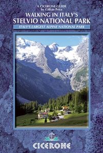
Wandelgids Walking in Italy's Stelvio National Park | Cicerone

Wandelgids voor de Stelvio Nationaal Park in de Rätische Alpen ( Alpi Retiche ) ten zuiden van de Splügenpas op de grens met het Zwitserse Graubünden. Engelstalige beschrijving van 38 dagwandelingen.   Aanbevolen wandelkaarten 1:25.000 voor deze gids Wandelkaart 008 Ortles - Cevedale - Ortlergebiet | Tabacco Editrice   Wandelkaart 045 Latsch - Mart...
20,95

Webshops met dit product

Webshop
Bezorging
Prijs

Anderen bekeken ook

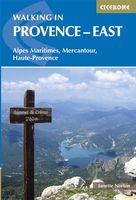
Wandelgids Walking in Provence - East | Cicerone
This guide offers 30 circular day walks in the eastern half of Provence, the large sun-kissed coastal region of south-east France. Spanning from the red rocks in the Ésterel on the Mediterranean to high mountains inland, the walks are set in the areas of the Alpes Maritimes, the Alpes de Haute-Provence and the Mercantour. Provence’s sunshine and Mediterranean charm attract many visitors to its coast, yet the area also has much more to offer the walker. The countryside inland boasts a range of scenery from remote mountaintops to spectacular gorges. History is everywhere, in medieval villages, arcaded streets, abbeys, churches and castles.    This guide covers the eastern regions, with its companion volume, Walking in Provence: West, covering the rest of this fascinating and historic landscape. The walking is incredibly diverse, and explores the country that hugs the Côte d'Azur and Italian border. The Alpes Maritimes rise craggy and wild above towns as unique as Grasse, Cannes and Monac…
21,95
Wandelgids Italy's Sibillini National Park | Cicerone
Walking and trekking guidebook to Italy's Sibillini National Park in the Apennines. 21 day walks and an 8-stage multi-day trek, the 120km Grande Anello dei Sibillini are explored alongside sketch maps and plenty of practical information. Easily reached from airports on the Adriatic coast and Rome, the Sibillini straddles the Marche and Umbria.   Seasons Seasons Refuges open from mid-April to mid-October; August and midsummer weekends very busy; higher ridges may have snow until June; excellent winter walking with snowshoes or touring skis, best with a local guide   Centres Centres Amandola, Balzo, Castelluccio, Norcia, Nursia, Preci, Castelsantangelo, Visso, Ancona, Pescara, Perugia   Difficulty Difficulty Something for all abilities, low-level strolls, ridges and walkers' peaks; the GAS requires no mountaineering expertise   Must See Must See The Grande Anello dei Sibillini 8-day trek, Sibillini National Park, Monte Vettore, Monte Sibilla, Piano Grande, Monte Bove   THE GAS – GRANDE A…
19,95
Wandelgids Walking in Tuscany - Toscane | Cicerone
Uitstekende wandelgids van Toscane. Goed beschreven met veel praktische informatie om de route te kunnen lopen, inclusief redelijke kaarten. Aanbevolen wandelkaarten De meeste wandelingen (maar lang niet allemaal!) in deze gids worden gedekt door wandelkaart: Wandelkaart - Fietskaart 2440 Toscana | Kompass Voor de andere gebieden staan de kaarten hier onder per gebied genoemd. A guidebook to walks in the Italian region of Tuscany. 43 graded routes range from 2.5 to 18km, and take in the Renaissance splendour of Florence and Siena, the World Heritage scenery of Val d'Orcia and San Gimignano and the stunning island of Elba. Alongside detailed route descriptions and clear mapping there is essential practical information on public transport and food and drink, as well as a comprehensive list of accommodation, and a useful Italian–English glossary. The guide is packed with interesting details about the area’s wildlife, landscape, culture and history, making it a perfect companion to getting…
23,95
Wandelgids Walking in Provence - West | Cicerone
This guide offers 30 circular day walks in the western half of Provence, the large sun-kissed coastal region of south-east France. Spanning from the Baronnies in the north to the Ste-Baume ridge in the south, the walks are set in the areas of the Drôme Provençale, Vaucluse and the Var. Provence’s sunshine and Mediterranean charm attract many visitors to its coast, yet the area also has much more to offer the walker. The countryside inland boasts a range of scenery from remote mountaintops to spectacular gorges. History is everywhere, in medieval villages, arcaded streets, abbeys, churches and castles.    This guide covers the western regions, with its companion volume, Walking in Provence: East, covering the rest of this fascinating and historic landscape. The walking is incredibly diverse; from the green waves of the Barronies hills in Drôme Provençale, to the unforgettable silhouette of Mont Ventoux giving way to limestone plateaux cut with ravines in the Vauclause. Further south lie…
21,95
Wandelgids Walking in Cornwall | Cicerone
40 half to full day rambles on the coasts and inland hills of Cornwall are explored in this guidebook.  Routes range from short, 2 mile strolls to long, wild walks of over 8 miles. With plenty of opportunities to combine routes together, this guide provides a wealth of variety for walkers of all abilities.   The guidebook is divided into 6 sections, including walks on Bodmin Moor (for which good navigational skills are required), the North Coast, Penwith and West Cornwall, the Inland Mining Districts, Land's End and the Lizard and Roseland Peninsulas.    Cornwall has a lot to offer walkers; stunning coastal scenery and long stretches of wild moorland, with quiet estuaries cutting through high and rocky headlands. Birdlife and wildlife, from choughs to falcons to seals are found throughout the county, as are historical sites from the neolithic, to Iron Age hill forts and a long history of mining. The towns and villages of Cornwall, from the popular spots such as St Ives, Newquay and Pad…
19,95
Wandelgids Walking in the Thames Valley | Cicerone
Walking in the Thames Valley offers 25 challenging circular walks around the River Thames and River Kennet in the south of England, taking in the Southern Chilterns, the Berkshire and North Hampshire Downs, Southern Oxfordshire and the eastern edge of Wiltshire. All routes are within easy reach of Reading, Newbury, Abingdon and London. While some walks visit Iron Age hill forts, others pass more modern features such as Wilton Windmill and the Kennet and Avon Canal. Some follow sections of the Ridgeway, while others meander along the banks of the Thames. What they all have in common is that they take the keen rambler to some of the best parts of the Thames Valley – a patchwork of open chalk grassland, broadleaved woodland and farmland and home to two Areas of Outstanding Natural Beauty. • walks from 10 to 18 miles, including one 2-day route • shorter, less strenuous alternatives for many of the walks • detailed route descriptions with information on local points of interest, OS mapping …
18,50
Wandelgids Walking in the Auvergne | Cicerone
Uitgebreide wandelgids van de Auvergne: goede beschrijvingen, veel keuze, kaarten wat minder goed. This handy guidebook offers the finest day walks in five different areas of the Auvergne, an often-forgotten region in central France perfect for accessible day walking in a unique and spectacular landscape. Towns such as Vichy, Clermont-Ferrand and Puy-en-Velay also offer delightful places to base yourself for that perfect walking holiday. The ridges, rocky peaks and verdant valleys of the Cantal supervolcano dominate south-western Auvergne. The centre of the region hosts the unique chain of 'puys' with their pudding bowl forms and the pristine crater lakes of the Sancy massif. In the north, the Montagne Bourbonnaise preserves a pastoral way of life which is quintessentially French while the Haute Loire's rivers and medieval abbeys reward those venturing further off the beaten track. Notes on the geology and history of points of interest passed en route help you to get the most out of yo…
19,95
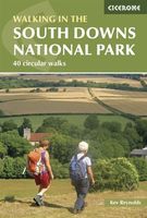
Wandelgids Walking in the South Downs National Park | Cicerone
Goede wandelgids uit de bekende Cicerone serie, dus met mooie foto's en duidelijke routebeschrijvingen en kaartjes. Guidebook to 40 day walks in the South Downs National Park. The walks, which are designed to suit all abilities, are dotted all over the National Park and range from 4¾ miles (7.5km) to 11 miles (17.5km). Each walk is circular, and where possible begins and ends at a place accessible by public transport.    With some of the most iconic landscapes in southern England, including the white chalk cliffs of Beachy Head and the Seven Sisters, and such well-loved landmarks as Ditchling Beacon and atmospheric ancient monuments like the Cissbury Ring, walking in the park proves a delightful experience mile after mile.    Step-by-step route descriptions are accompanied by 1:50,000 OS mapping. Also included is information on the plants and wildlife of the Downs, as well as handy practical information on accommodation, car parking and public transport.
20,50
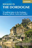
Wandelgids walking in the Dordogne | Cicerone
Uitstekende wandelgids van dit geweldige gebied. goed beschreven met veel praktische informatie om de route te kunnen lopen, inclusief redelijke kaarten. Guidebook to 35 half-day and day walks in France's beautiful Dordogne region, based around Bergerac, Lalinde, Sarlat and Souillac (Lot). The walks, which range from 6 to 18.5km, take in the region’s myriad delights, from spectacular gorges to enchanting chateaux and charming medieval villages. All walks are within the capacity of the average walker, and are on well-marked paths or quiet roads. They are graded easy or medium; there are no long, steep climbs or abrupt descents.    There are step-by-step descriptions and maps for each route. Also included is information on the history, flora and fauna of the region, together with practical pointers such as what to take and when to go, as well as notes on waymarking, accommodation and transport. A route summary table and glossary are also provided.   Lying in south west France, the Dordog…
20,95
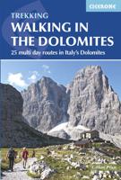
Wandelgids Walking in the Dolomites - Dolomieten | Cicerone
Uitstekende wandelgids van een gerenommeerde Engelse uitgever. De tochten zijn met zorg beschreven en voorzien van allerhande nuttige informatie. Guidebook to 25 multi day walks in the Dolomites mountains of northeast of Italy. The walks are mostly circular and 2 to 4 days long, and take in the Marmarole, Marmolada, Civet, Sella and Cortina Dolomites among others. Includes notes on accommodation, wildlife, transport, equipment, a glossary and other practical information. This guidebook describes 25 hut-to-hut treks in the Dolomites of northern Italy, covering 15 regions including Cortina, Sella, Sesto, Marmolada and Latemar. Ranging from 11.3km to 40.8km and from two to four days, the graded routes are suitable for walkers with a reasonable level of fitness and experience of mountain terrain, and some feature exposed sections which demand a good head for heights. They take advantage of the region's network of mountain refuges and efficient public transport system, with the majority of …
23,95

Klanten-reviews van Wandelgids Walking in Italy's Stelvio National Park | Cicerone

Er zijn nog geen beoordelingen voor dit productBen jij de eerste die een review plaatst?

Meer over Wandelgids Walking in Italy's Stelvio National Park | Cicerone

Productomschrijving

Wandelgids voor de Stelvio Nationaal Park in de Rätische Alpen ( Alpi Retiche ) ten zuiden van de Splügenpas op de grens met het Zwitserse Graubünden. Engelstalige beschrijving van 38 dagwandelingen.   Aanbevolen wandelkaarten 1:25.000 voor deze gids Wandelkaart 008 Ortles - Cevedale - Ortlergebiet | Tabacco Editrice   Wandelkaart 045 Latsch - Martell - Schlanders- Laces - Val Martello - Silandro | Tabacco Editrice   Wandelkaart 048 Val di Peio - Val di Rabbi - Val di Sole | Tabacco Editrice   The wide range of 38 summer day walks in this guide explore the renowned Stelvio National Park in the Italian Rhaetian Alps. Bordering the Dolomites to the east, and Switzerland to the west, the Stelvio is one of the largest protected areas in all of the Alps. Its unspoilt landscape ranges from valley farmland to forested hillsides and alpine meadows, and up to a wilderness of rugged glaciated summits and ridges, the highest of which is Ortler, at 3905m.   The walks, a selection of routes from each of the Stelvio's valleys, are graded for difficulty and each is designed to fit into a single day, be it a couple of hours or a full day out. There is something here for many active holidaymakers, from easy strolls to strenuous climbs to panoramic peaks for experienced walkers. Also included are spectacular non-glacier summits that are accessible to walkers who want to go that bit further. A handful of walks do include brief stretches across rock faces aided by anchored cable. While they are not strictly climbing routes requiring specialist equipment, it is essential to keep away from them in bad weather.   The guidebook also includes plenty of background information on local wildlife and cuisine, as well as planning details such as what to take and dos and don'ts. An extensive appendix also contains accommodation suggestions, including campsites, B&Bs, hotels and mountain huts – known locally as ‘rifugios’.   38 routes offering something suitable for all active holidaymakers, from easy strolls to strenuous climbs the first English-language guide to the area easily accessible from Milan, Verona and Innsbruck   Seasons late June through to October   Centres Bormio, S Caterina Valfurva, Sulden, Martell, St Gertraud, Peio, Rabbi, Malè   Difficulty single day walking routes graded 1 to 3 to allow for beginners as well as experienced walkers ready for peaks. Walks easily extended into multi-day expereinces with overnight stays in alpine refuges   Must See the thrilling Stelvio Pass on foot or by bus, the Forno glacier, the Ortler and Cevedale mountains, ibex and chamois in Val Zebrù, Martelltal and Valle di Rabbi, lammergeiers and eagles, traditional Ultental
Webshop.nl maakt gebruik van cookies. Ga je verder op onze website, ga dan akkoord met het plaatsen van cookies en de verwerking van deze data door ons en vermelde partners.