webshop.nl
Categorieën
  Sluiten

Wandelgids The Dales Way | Cicerone

A fully waymarked trail from Ilkley to Bowness-on-Windermere, the Dales Way links two of England's most celebrated national parks, the Yorkshire Dales and the Lake District. Well served for accommodation and facilities, and with easy walking on riverside paths, it is one of the gentlest multi-day walks in Britain and therefore an ideal introduction...
20,95

Webshops met dit product

Webshop
Bezorging
Prijs

Anderen bekeken ook

Wandelgids The Pennine Way | Cicerone
Uitstekende wandelgids van de Pennine Way, waarbij naast alle noodzakelijke informatie ook gebruik gemaakt wordt van de echte topografische kaart. inclusief gidsje met routekaarten van 1:25000  Guidebook to the Pennine Way National Trail with OS map booklet. The 270 mile route from Edale to Kirk Yetholm takes three weeks to walk and is suitable for fit and experienced long distance walkers. The route crosses the Peak District, Yorkshire Dales and North Pennines National Parks. Includes separate OS 1:25,000 map booklet of the route. The Pennine Way is Britain's oldest, toughest long-distance footpath – and arguably its most iconic. Now a National Trail, the 427km (265½ mile) route from Edale in Derbyshire to Kirk Yetholm in the Scottish Borders offers wayfarers the opportunity to immerse themselves in wild beauty of the North. The Pennines boast rolling hills, sweeping moorland and wide glacial valleys, and the Pennine Way has come to embody personal challenge and adventure.    This gui…
23,95
Wandelgids - Pelgrimsroute The Pilgrims' Way | Cicerone
Uitstekende wandelgids van de Pilgrims' Way, waarbij naast alle noodzakelijke informatie ook gebruik gemaakt wordt van de echte topografische kaart.  This guidebook details the Pilgrims' Way, an historic pilgrimage route to Canterbury Cathedral in Kent, home of the shrine of the martyred archbishop, St Thomas Becket. The route is described both from Winchester in Hampshire (136½ miles) and London's Southwark Cathedral (90¼ miles), with an optional spur to Rochester Cathedral.   With relatively easy walking on ancient byways, the route from Winchester is presented in 15 stages of 4¾-13½ miles: it can be comfortably completed in under a fortnight. It follows a major chalk ridge through scenic countryside, taking in characterful towns and villages and historic churches. The route from Southwark is described in 10 stages and includes a visit to the ruined Lesnes Abbey.   Detailed route description is accompanied by 1:50,000 OS mapping, advice on making the most of a trip and information on…
18,50
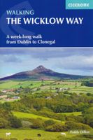
Wandelgids Walking the Wicklow Way | Cicerone
The Wicklow Way was the first long-distance walking trail to be established in Ireland. Coming in at 130km (81 miles), the route traverses the county of Wicklow, from Marlay Park on the outskirts of Dublin to Clonegal, just over the county border in neighbouring Carlow, and can be comfortably completed in a week. The guide also details several adjacent trails that can be interchanged with the main route, and short detours off-route (also described) lead to welcoming villages offering accommodation and a range of other facilities. The route is presented in seven stages, each with an overview followed by clear route description and mapping. There are elevation profiles and notes on local points of interest. In addition to background information about the county's history, geology, plants and wildlife, you will find all the information you need to walk the route, with helpful advice on transport, accommodation and kit. Accommodation listings, useful contacts and a glossary of Irish place-…
18,95
Wandelgids Walking in the Yorkshire Dales: South and West | Cicerone
Veelzijdige wandelgids van een deel van de Yorkshire Dales, goede kaarten en beschrijvingen en veel keuze uit een behoorlijk aantal wandelingen. Part of a two-book set, this guidebook describes 44 walks in the southern and western Yorkshire Dales, including the famous 23 mile Three Peaks circuit over Pen-y-Ghent, Whernside and Ingleborough. The other, mostly circular routes of 3½ to 13 miles cover the scenic region between Sedbergh, Kirkby Lonsdale, Settle, Skipton and Grassington. The Yorkshire Dales need little introduction: their picturesque scenery and hundreds of miles of footpaths, tracks and bridleways have been attracting walkers for decades. Part of a two-volume set, this guidebook presents over 40 routes in the south and west of the National Park, with bases including Sedburgh, Malham, Grassington, Skipton, Settle and Kirkby Lonsdale. The walks cover the valleys of Wharfedale, Littondale, Malhamdale, Ribblesdale and Dentdale – each with its own distinctive landscape and chara…
19,95
Wandelgids - Fietsgids Hiking and Cycling the California Missions Trail - Californie | Cicerone
Guidebook to hiking or cycling the 800 mile (1289km) California Missions Trail between San Francisco Bay and San Diego. The pilgrimage trail takes in 21 historic Spanish missions and can be completed in 50-60 walking days or 2-3 weeks cycling. With 1:100,000 mapping, route description, and details of accommodation and facilities for each stage. Ancient footpaths became connecting routes between the Spanish missions, pueblos, and presidios in the period 1769 to 1823. Over time these routes became automobile roadways and were marked with bells starting in 1906 to promote and preserve the El Camino Real. Today, the California Missions Trail follows a pedestrian route through urban cities and historic towns, through forest paths and country lanes, to each of the twenty-one historic Spanish missions. The 800-mile California Missions Trail leads walkers and cyclists through some of the most scenic and historic sites of one of America's most beautiful states. The 21 missions, founded 200-250 …
26,50
Wandelgids The Cathar Way | Cicerone
Guidebook to the GR367 Cathar Way (Sentier Cathare) in the Languedoc region of southern France. The 260km waymarked trail from Port la Nouvelle on the Mediterranean to Foix traces the history of the Cathars through the Eastern foothills of the Pyrenees. Split into 13 stages and offering a northern variant, the route takes about 2 weeks to complete. Two of the southernmost départements of France, the Pyrénées-Orientales and Ariège are inextricably linked with the history of the Cathars, a heretical Christian sect who were subjected to a crusade in the thirteenth century. Striking castles built on jagged rocky precipices are a highlight of the region and a reminder of those turbulent times. This guidebook describes the 260km Cathar Way (Sentier Cathare or GR367), a long-distance trail from Port-la-Nouvelle on the Mediterranean coast to Ariége's departmental capital Foix linking several of the impressive Cathar castles. The route follows ancient footpaths, jeep tracks and country lanes an…
22,95
Wandelgids Walking in Zermatt and Saas-Fee | Cicerone
Wandelgids met dagtochten: goed beschreven met veel praktische informatie om de route te kunnen lopen, inclusief redelijke kaarten. Enorm veel keus in een groot gebied! Guidebook describing 50 varied walks in the Valais region in the heart of the Swiss Alps. The graded day walks based around the popular resort towns of Zermatt and Saas-Fee explore the Mattertal and Saastal valleys and the surrounding mountains. Ranging from 4 to 18km, the easily accessible routes make use of the area's extensive network of well-made mountain paths and its lift system. There are walks here to suit all tastes, from low-level lake walks or easy strolls up to mountain restaurants, through to serious mountain outings on steep and rocky trails. Distance, walking time and difficulty are shown for each route, and the detailed route description is accompanied by clear mapping.   Dominated by 4000m the giants, the Matterhorn and Monte Rosa, this is a land of contrasts, with snow-capped mountains and glaciers abo…
23,95
Wandelgids Walking the John o' Groats Trail | Cicerone
Guide to the John o' Groats Trail, a 233km walking route linking Inverness with John o' Groats on the northeast tip of mainland Britain. Much of the walking is coastal, with the northern half characterised by its spectacular seacliffs; however, there is some inland walking too, and the scenery is varied, ranging from dunes and deserted sandy beaches to beautiful woodland. With rough ground and some exposed clifftop walking, the route is suited to experienced hikers.   It takes around a fortnight to complete. The route is described in 14 stages, each of which includes: an overview map; step-by-step route description illustrated with custom mapping; details of accommodation, facilities and transport links; and information on local points of interest. While the main route description is from south to north, notes are supplied for southbound walkers.   Also included is a bonus route linking the trail with the Great Glen, for the benefit of walkers undertaking the Land's End to John o' Groa…
23,95
Wandelgids The Cambrian Way | Cicerone
Uitstekende wandelgids van de Cambrian Way, waarbij naast alle noodzakelijke informatie ook gebruik gemaakt wordt van de echte topografische kaart.  Dubbed 'the mountain connoisseurs' walk', the Cambrian Way stretches 479km between the mighty castles of Cardiff in the south and Conwy on the north coast. Traversing the heartland of Wales, the challenging route crosses the Brecon Beacons, the Cambrian Mountains and Snowdonia, passing through two national parks and visiting many of the country's iconic summits, including Pen y Fan, Pumlumon, Cadair Idris and Snowdon itself. It can be walked in three weeks (or in shorter sections) and is suitable for experienced hillwalkers with sound navigational skills.   The guide presents the route in 21 stages, offering comprehensive route description illustrated with OS 1:50,000 mapping and elevation profiles. Details of accommodation and facilities are provided, along with a helpful trek planner showing their distribution along the route: although t…
20,95
Wandelgids Alta Via 1 - Trekking in the Dolomites | Cicerone
Uitstekende wandelgids van een gerenommeerde Engelse uitgever. De tochten zijn met zorg beschreven en voorzien van allerhande nuttige informatie. The Alta Via 1 is one of Italy's most famous and most popular long-distance routes and is the easiest of six Alta Via routes that traverse the magnificent Dolomites. The hut-to-hut trail extends 115km from Lago di Braies to La Pissa, boasting spectacular alpine vistas. Although it demands a moderate level of fitness, it is well waymarked and follows clear well-trodden paths, making for an ideal introduction to trekking in the Dolomites.   Welcoming refuges offer meals and accommodation along the way, though camping is also possible on the middle stages (restrictions apply elsewhere). The route is presented in 11 stages, each with overview statistics, a brief summary of the day's walking and detailed route description illustrated with clear mapping. There are also comprehensive notes on the huts the route passes, with contact details and tips …
23,95

Klanten-reviews van Wandelgids The Dales Way | Cicerone

Er zijn nog geen beoordelingen voor dit productBen jij de eerste die een review plaatst?

Meer over Wandelgids The Dales Way | Cicerone

Productomschrijving

A fully waymarked trail from Ilkley to Bowness-on-Windermere, the Dales Way links two of England's most celebrated national parks, the Yorkshire Dales and the Lake District. Well served for accommodation and facilities, and with easy walking on riverside paths, it is one of the gentlest multi-day walks in Britain and therefore an ideal introduction to long-distance walking. It can be comfortably completed in 6-8 days.   The guide offers comprehensive notes on local points of interest, as well as an overview of Dales geology, history, plants and wildlife to enhance the walking experience. The practical information is all there too, including when to go, how to get there and what to take, making for an ideal companion to enjoying this delightful route.   Presented in six daily stages of 7-19 miles (with suggestions for alternative schedules), this guide describes the Way in both directions, with the main route description running from south to north. Step-by-step route description is accompanied by 1:100,000 mapping, and a trek planner, showing where facilities are available, is included to facilitate planning. Accommodation listings and useful contacts can be found in the appendices. A separate, conveniently sized map booklet located in the back-cover sleeve provides all the OS 1:25,000 mapping needed to complete the trail.
Webshop.nl maakt gebruik van cookies. Ga je verder op onze website, ga dan akkoord met het plaatsen van cookies en de verwerking van deze data door ons en vermelde partners.