webshop.nl
Categorieën
  Sluiten

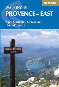
Wandelgids Walking in Provence - East | Cicerone

This guide offers 30 circular day walks in the eastern half of Provence, the large sun-kissed coastal region of south-east France. Spanning from the red rocks in the Ésterel on the Mediterranean to high mountains inland, the walks are set in the areas of the Alpes Maritimes, the Alpes de Haute-Provence and the Mercantour. Provence’s sunshine and Me...
21,95

Webshops met dit product

Webshop
Bezorging
Prijs

Anderen bekeken ook

Wandelgids Walking in Provence - West | Cicerone
This guide offers 30 circular day walks in the western half of Provence, the large sun-kissed coastal region of south-east France. Spanning from the Baronnies in the north to the Ste-Baume ridge in the south, the walks are set in the areas of the Drôme Provençale, Vaucluse and the Var. Provence’s sunshine and Mediterranean charm attract many visitors to its coast, yet the area also has much more to offer the walker. The countryside inland boasts a range of scenery from remote mountaintops to spectacular gorges. History is everywhere, in medieval villages, arcaded streets, abbeys, churches and castles.    This guide covers the western regions, with its companion volume, Walking in Provence: East, covering the rest of this fascinating and historic landscape. The walking is incredibly diverse; from the green waves of the Barronies hills in Drôme Provençale, to the unforgettable silhouette of Mont Ventoux giving way to limestone plateaux cut with ravines in the Vauclause. Further south lie…
21,95
Reisgids Eyewitness Travel Provence and the Cote d'Azur | Dorling Kindersley
Prachtig geillustreerde reisgids met o.a. 3D tekeningen, fraaie kaarten en geweldige foto’s. Daarnaast uitgebreide achtergrondbeschrijvingen. Echt om in de stemming te komen! Groot formaat gids. Engelstalig France’s most alluring region promises fragrant fields of lavender, incredible ancient relics, and celebrated art collections. Sandy Riviera beaches, glitzy resorts, and hilltop villages may come to mind when you think of Provence and the Côte d’Azur, but this region is also a haven for lovers of the great outdoors. Its array of stunning natural landscapes includes the alpine wilderness of Parc National du Mercantour, the rugged coastal cliffs of the Calanques, and the dramatic Gorges du Verdon – Europe’s deepest canyon.   Whether you want to watch flocks of flamingos strutting across the wild wetlands of the Camargue, visit lush vineyards in the Rhône valley or simply soak up the sun in St-Tropez, your DK Eyewitness travel guide makes sure you experience all that the Provence and C…
19,95
Wandelgids Walking in the Haute Savoie North | Cicerone
Uitstekende wandelgids van dit geweldige gebied. Goed beschreven met veel praktische informatie om de route te kunnen lopen, inclusief redelijke kaarten. A guidebook of half and full-day walks in the lovely Haute Savoie mountains of France. This guide describes 30 circular routes of between 7 and 13km, based around Evian-les-Bains, Morzine, Abondance, Châtel, St-Julien-en-Genevois, Bellevaux, Boège and Habère-Poche. Graded from easy to difficult, there are walks to suit most abilities, but a few have some exposed sections and need a head for heights.   The guide is divided into 6 areas covering the Salève and Vuache, the Vallée Verte, the Vallée du Brevon, Pre-Alpes du Léman and Val d'Abondance. Alongside a detailed route description and map, each walk has a summary of all you need to know before you set out (distance, time to walk, ascent, maximum altitude and instructions for accessing the start). The guidebook includes advice on travel, accommodation and equipment, as well as inform…
20,95
Wandelgids Walking in the Haute Savoie: South | Cicerone
Uitstekende wandelgids van dit geweldige gebied. goed beschreven met veel praktische informatie om de route te kunnen lopen, inclusief redelijke kaarten.   A guidebook of walks in the lovely Haute Savoie mountains of France. This guide describes 30 circular routes of between 7 and 20km, based around Annecy, La Clusaz, Grand Bornand, Plateau d'Assy, Samoëns, Sixt, Sallanches, Thônes, la Roche-sur-Foron. Graded from easy to difficult, there are walks to suit most abilities, but a few have some exposed sections and need a head for heights.   The guidebook is divided into 6 areas covering the Arve Valley, the Haut Giffre valley, the Chaîne des Aravis (north and south), Plateau de la Borne and Lake Annecy. Alongside a detailed route description and map, each walk has a summary of all you need to know before you set out (distance, time to walk, ascent, maximum altitude, grade and instructions for accessing the start). There is advice on travel, accommodation and equipment, as well as informa…
20,95
Wandelgids Walking in the Salzkammergut - the Austrian Lake District | Cicerone
Guidebook describing 30 day walks among the lakes and mountains of Austria's Salzkammergut. Easily accessible from Salzburg, the area is sometimes described as the Austrian Lake District. Routes range from easy lakeside strolls and walks to local points of interest to more strenuous through-routes and ascents of the neighbouring peaks. Guidebook of 30 stunning day walks in the beautiful Salzkammergut lake district of Austria. Easy to get to from Linz and Salzburg, the area is studded with lakes and bristling with mountain peaks, and has a great range of waymarked trails, from lakeside strolls to challenging mountain walks. The routes in this book are within the capabilities of any reasonably fit walker, many are suitable for family hiking, and cablecars and lifts can often be used to make walks shorter or easier. Walks range from 6 to 16km and a simple grading system makes it easy to choose the right one.   Walks are centred around a number of bases, such as Bad Ischl, Fuschl am See, S…
24,95
Wandelgids Walking in the Auvergne | Cicerone
Uitgebreide wandelgids van de Auvergne: goede beschrijvingen, veel keuze, kaarten wat minder goed. This handy guidebook offers the finest day walks in five different areas of the Auvergne, an often-forgotten region in central France perfect for accessible day walking in a unique and spectacular landscape. Towns such as Vichy, Clermont-Ferrand and Puy-en-Velay also offer delightful places to base yourself for that perfect walking holiday. The ridges, rocky peaks and verdant valleys of the Cantal supervolcano dominate south-western Auvergne. The centre of the region hosts the unique chain of 'puys' with their pudding bowl forms and the pristine crater lakes of the Sancy massif. In the north, the Montagne Bourbonnaise preserves a pastoral way of life which is quintessentially French while the Haute Loire's rivers and medieval abbeys reward those venturing further off the beaten track. Notes on the geology and history of points of interest passed en route help you to get the most out of yo…
19,95
Wandelgids The Yorkshire Dales - Walking in the North and East | Cicerone
This guidebook contains 43 circular day walks in the north and east Yorkshire Dales. It explores the dales, hills and moors between Kirkby Stephen and Pateley Bridge. Walking ranges from gentle three-mile strolls to more strenuous day-long rambles across the Howgills, Wensleydale, Swaledale, Nidderdale, Mallerstang and Coverdale   In this guidebook, 43 circular walks, ranging from 3-mile strolls to full-day adventures are explored in the northern and eastern Dales. Few areas in England are as appealing as the Yorkshire Dales and this volume of a two-part guide provides walkers with a comprehensive walking guide to the whole of the region.     Each valley has a character and history of its own and this guide covers the varied fell and dale landscapes of the Howgills, Mallerstang, Swaledale, Wensleydale, Coverdale and Nidderdale. Spectacular waterfalls, dramatic gorges, expansive heather moors, rich woodlands and colourful flower meadows are just some of the natural delights encountered …
19,95
Wandelgids Walking in Cornwall | Cicerone
40 half to full day rambles on the coasts and inland hills of Cornwall are explored in this guidebook.  Routes range from short, 2 mile strolls to long, wild walks of over 8 miles. With plenty of opportunities to combine routes together, this guide provides a wealth of variety for walkers of all abilities.   The guidebook is divided into 6 sections, including walks on Bodmin Moor (for which good navigational skills are required), the North Coast, Penwith and West Cornwall, the Inland Mining Districts, Land's End and the Lizard and Roseland Peninsulas.    Cornwall has a lot to offer walkers; stunning coastal scenery and long stretches of wild moorland, with quiet estuaries cutting through high and rocky headlands. Birdlife and wildlife, from choughs to falcons to seals are found throughout the county, as are historical sites from the neolithic, to Iron Age hill forts and a long history of mining. The towns and villages of Cornwall, from the popular spots such as St Ives, Newquay and Pad…
19,95
Wandelgids Walking in Tuscany - Toscane | Cicerone
Uitstekende wandelgids van Toscane. Goed beschreven met veel praktische informatie om de route te kunnen lopen, inclusief redelijke kaarten. Aanbevolen wandelkaarten De meeste wandelingen (maar lang niet allemaal!) in deze gids worden gedekt door wandelkaart: Wandelkaart - Fietskaart 2440 Toscana | Kompass Voor de andere gebieden staan de kaarten hier onder per gebied genoemd. A guidebook to walks in the Italian region of Tuscany. 43 graded routes range from 2.5 to 18km, and take in the Renaissance splendour of Florence and Siena, the World Heritage scenery of Val d'Orcia and San Gimignano and the stunning island of Elba. Alongside detailed route descriptions and clear mapping there is essential practical information on public transport and food and drink, as well as a comprehensive list of accommodation, and a useful Italian–English glossary. The guide is packed with interesting details about the area’s wildlife, landscape, culture and history, making it a perfect companion to getting…
23,95
Wandelgids Walks In The Valais | Cicerone
Uitstekende wandelgids van dit geweldige gebied. goed beschreven met veel praktische informatie om de route te kunnen lopen, inclusief redelijke kaarten. 120 routes throughout the Swiss Valais in the Pennine Alps, with such peaks as the Matterhorn, Dent Blanche and Monte Rosa providing a perfect background. Detailed coverage of Bettmeralp, Lötschental, Saastal, Mattertal, Turtmanntal, Val d’Annivers, Val d’Hérens, Val de Nendaz, Val de Bagnes, Val d’Entremont, Val ferret, Vallée de Trient. The Matterhorn, Monte Rosa, Zinarothorn, Ober Gabelhorn, Dent Blanche, Weisshorn, Bietschhorn, Grand Combin – these are some of the most dramatic mountains in Europe. Here they form a backdrop to a series of routes that should answer the dreams of any keen mountain walker. Best known, perhaps, for the resorts of Zermatt and Saas Fee, the Valais district of Switzerland is also the location of the Lötschental and Turtmanntal, the Vals d'Anniviers, Hérens, Bagnes and Ferret – valleys in which there are …
24,95

Klanten-reviews van Wandelgids Walking in Provence - East | Cicerone

Er zijn nog geen beoordelingen voor dit productBen jij de eerste die een review plaatst?

Meer over Wandelgids Walking in Provence - East | Cicerone

Productomschrijving

This guide offers 30 circular day walks in the eastern half of Provence, the large sun-kissed coastal region of south-east France. Spanning from the red rocks in the Ésterel on the Mediterranean to high mountains inland, the walks are set in the areas of the Alpes Maritimes, the Alpes de Haute-Provence and the Mercantour. Provence’s sunshine and Mediterranean charm attract many visitors to its coast, yet the area also has much more to offer the walker. The countryside inland boasts a range of scenery from remote mountaintops to spectacular gorges. History is everywhere, in medieval villages, arcaded streets, abbeys, churches and castles.    This guide covers the eastern regions, with its companion volume, Walking in Provence: West, covering the rest of this fascinating and historic landscape. The walking is incredibly diverse, and explores the country that hugs the Côte d'Azur and Italian border. The Alpes Maritimes rise craggy and wild above towns as unique as Grasse, Cannes and Monaco. The Mercantour National Park in contrast is a partially uninhabited area of high mountains, alpine lakes and red rock gorges known for its wildlife. Further north in the Alpes de Haute-Provence is a largely unspoilt geological playground, including such spectacles as the Verdon Gorge with villages and ancient sites throughout.   Suitable for all walkers of average fitness levels, the walks range from 4 to 21 kilometres in length, and are graded for difficulty from short, easy routes to more challenging walks that can include precipitous sections, but no special equipment is needed. 30 day walks in the Alpes Maritimes, Alpes de Haute-Provence and Mercantour in the sunny south-east corner of France walks illustrated with clear sketch maps and height profiles, as well as inspiring photographs all the practical information required for a perfect trip from public transport to maps and market days Seasons walks near the coast can be made at any time of the year, but the high trails in the Mercantour are restricted to snow-free months in summer and autumn   Centres Vence and Grasse (Alpes Maritimes); Digne-les-Bains and Castellane (Alpes de Haute-Provence); Guillaumes and the Val d'Entraunes (Mercantour)   Difficulty circular day walks, suitable for averagely fit people and graded Easy, Medium or Difficult, depending on length, total ascent and terrain; easy walks are short, while difficult ones take up to eight hours and may include sections which are precipitous or difficult to navigate; no special equipment is needed.   Must See dramatic mountain ridges, alpine lakes and deep river gorges; perched medieval villages, ruined castles and churches; the red rocks in the Estérel on the Mediterranean coast to high mountains in the Mercantour   Wandelingen Alpes Maritimes Walk 1 Baou des Noirs and Baou des Blancs Walk 2 Baou de St-Jeannet Walk 3 Chemin du Paradis Walk 4 Pic de Courmettes and Puy de Tourrettes Walk 5 Baou de St-Jean Walk 6 The Route Napoléon Walk 7 Vallée de la Siagne Walk 8 Pic du Cap Roux Walk 9 Estérel Circuit and Lac de l’Ecureuil Walk 10 Mont Vinaigre   Alpes de Haute-Provence Location of Walks Walk 11 Three Chapels Walk from Digne-les-Bains Walk 12 Walk in the Réserve Géologique Walk 13 Bigue du Siron Walk 14 The Cousson Walk 15 The Cucuyon Walk 16 Rochers des Mées Walk 17 Gorges de Trévans Walk 18 The Verdon Gorge – Sentier Blanc-Martel Walk 19 Lower Verdon Gorge Walk 20 Sommet de Crémon   Mercantour Location of Walks Walk 21 Moulin de la Barlatte Walk 22 Plateau de la Lare from Sauze Walk 23 Gorges de Daluis Walk 24 Circuit from St-Martin d’Entraunes Walk 25 Col des Champs from Entraunes Walk 26 Lakes Circuit from the Col de la Cayolle Walk 27 Mont Pelat Walk 28 Circuit above Péone Walk 29 Mont Mounier Walk 30 Around Mont d’Auvare  
Webshop.nl maakt gebruik van cookies. Ga je verder op onze website, ga dan akkoord met het plaatsen van cookies en de verwerking van deze data door ons en vermelde partners.