webshop.nl
Categorieën
  Sluiten

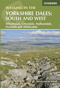
Wandelgids Walking in the Yorkshire Dales: South and West | Cicerone

Veelzijdige wandelgids van een deel van de Yorkshire Dales, goede kaarten en beschrijvingen en veel keuze uit een behoorlijk aantal wandelingen. Part of a two-book set, this guidebook describes 44 walks in the southern and western Yorkshire Dales, including the famous 23 mile Three Peaks circuit over Pen-y-Ghent, Whernside and Ingleborough. The oth...
19,95

Webshops met dit product

Webshop
Bezorging
Prijs

Anderen bekeken ook

Wandelgids Day Walks in the Yorkshire Dales | Vertebrate Publishing
Day Walks in the Yorkshire Dales is the fourth title in Vertebrate Publishing's series of compact and portable hillwalking guidebooks. This book showcases 20 circular walks in the Yorkshire Dales National Park, between 6 and 11 miles (10 and 17 kilometres) in length, suitable for hillwalkers of all abilities. The routes are split into three geographical areas - south, east, and north - and include walks to the Dales' most regarded beauty spots, such as Malham Cove, Gordale Scar, Brimham Rocks and Hardraw Force, as well as the trio of sought-after peaks Pen-y-ghent, Ingleborough and Whernside.   The author of this guidebook, Bernard Newman, is a freelance outdoor writer and photographer, and former editor of the internationally acclaimed Mountain magazine. A Yorkshire Dales local and graduate geologist, in his route descriptions he explores the incredible geology that has created the breathtaking scenery on show in the Dales. Each route in this guide is described with easy-to-follow dir…
20,95
Wandelgids The Yorkshire Dales - Walking in the North and East | Cicerone
This guidebook contains 43 circular day walks in the north and east Yorkshire Dales. It explores the dales, hills and moors between Kirkby Stephen and Pateley Bridge. Walking ranges from gentle three-mile strolls to more strenuous day-long rambles across the Howgills, Wensleydale, Swaledale, Nidderdale, Mallerstang and Coverdale   In this guidebook, 43 circular walks, ranging from 3-mile strolls to full-day adventures are explored in the northern and eastern Dales. Few areas in England are as appealing as the Yorkshire Dales and this volume of a two-part guide provides walkers with a comprehensive walking guide to the whole of the region.     Each valley has a character and history of its own and this guide covers the varied fell and dale landscapes of the Howgills, Mallerstang, Swaledale, Wensleydale, Coverdale and Nidderdale. Spectacular waterfalls, dramatic gorges, expansive heather moors, rich woodlands and colourful flower meadows are just some of the natural delights encountered …
19,95
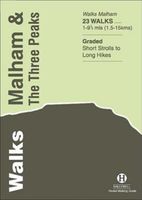
Wandelgids Malham and the Three Peaks | Hallewell Publications
Last rewalked and updated in 2021, Walks Malham & The Three Peaks covers part of The Yorkshire Dales National Park - an area of rolling green hills, dramatic limestone features and quaint villages. The Park covers five main dales (valleys) and this guide covers Ribblesdale and the surrounding hills, along with the smaller Malhamdale. This area contains the finest hill walking in the Dales (with paths up the `Three Peaks': Whernside, Ingleborough and Pen-y-ghent) plus the most dramatic limestone features: Malham Cove and Gordale Scar. The 23 walks featured range from 1 mile to 9.5 miles (1.5-15km). Routes include: Whernside, three routes up Ingleborough, Ingleton Waterfalls Walk, Pen-y-ghent, Victoria Cave Loop, Gordale Scar & Malham Cove and Malham to Settle. Now in its 2nd edition, this book is part of a popular series of A6 pocket walking guides which describe routes which are suitable for walkers of all abilities and to suit all tastes. Route descriptions are accompanied by 2-colour…
5,95
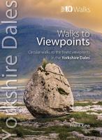
Wandelgids Viewpoints Yorkshire Dales ( | Northern Eye Books
One of eight books in the popular Yorkshire Dales: Top 10 Walks series. Handy, pocket-sized, full colour walking guides written by experts. This attractive and cleverly structured guide gives walkers ten easy, circular walks to the most amazing viewpoints in the Yorkshire Dales National Park in a popular pocketable format.   With clear information, an overview and introduction for each walk, expertly written numbered directions, large scale Ordnance Survey maps, superb eye-grabbing panoramic photographs, and interpretation of points of interest along the way, these guides set a new standard in clarity and ease-of-use. Featured walks include: Crummack Dales, Orton & Beacon Hill, Malham & Watlowes Valley, Trollers Gill & Appletreewick, Twistleton Scars, Upper Wharfesdale, Flasby Fell, Capplestone Gate, Semerwater and Dentdale & Deepdale. Frank Kew is a retired lecturer, author and tour leader with a detailed knowledge of bucolic landscapes, villages, tea shops and pubs of the Yorkshire D…
10,95
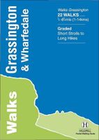
Wandelgids Grassington and Wharfedale | Hallewell Publications
The Yorkshire Dales National Park - an area of rolling green hills, dramatic limestone features and quaint villages - has five main dales (valleys). Walks Grassington & Wharfedale covers Wharfedale - containing the villages of Grassington and Kettlewell - plus the town of Skipton. In the north the walks run by the riverside or climb onto the grassy hills; in the south the rock changes from limestone to sandstone and there are routes through the narrow wooded valley north of Castle Bolton or onto the heather moors to either side. The 22 walks featured range from 0.5 miles to 8.5 miles (1-14km). Routes include: Buckden Loop, a circuit from Kettlewell via Starbotton and Moor End, Grassington to Burnsall, Bolton Abbey & The Strid and Skipton Woods. Part of a popular series of A6 pocket walking guides which describe routes which are suitable for walkers of all abilities and to suit all tastes. Route descriptions are accompanied by 2-colour sketch maps. The guides are illustrated with line i…
5,95
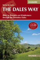
Wandelgids The Dales Way | Cicerone
A fully waymarked trail from Ilkley to Bowness-on-Windermere, the Dales Way links two of England's most celebrated national parks, the Yorkshire Dales and the Lake District. Well served for accommodation and facilities, and with easy walking on riverside paths, it is one of the gentlest multi-day walks in Britain and therefore an ideal introduction to long-distance walking. It can be comfortably completed in 6-8 days.   The guide offers comprehensive notes on local points of interest, as well as an overview of Dales geology, history, plants and wildlife to enhance the walking experience. The practical information is all there too, including when to go, how to get there and what to take, making for an ideal companion to enjoying this delightful route.   Presented in six daily stages of 7-19 miles (with suggestions for alternative schedules), this guide describes the Way in both directions, with the main route description running from south to north. Step-by-step route description is acc…
20,95
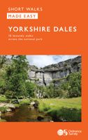
Wandelgids Yorkshire Dales | Ordnance Survey
Enjoy the magnificent waterfalls, sweeping scenery and cosy Dale pubs with ten short, leisurely walks suitable for all ages and abilities. Discover the Yorkshire Dales with its natural wonders, lush wildlife and quaint villages on accessible, tried-and-tested walks which everyone can go on – no walking experience required.   Yorkshire Dales Short Walks Made Easy include:   - Walk the banks of the River Eden through Westmorland and explore the limestone scenery around Kirkby Stephen - See some of the iconic waterfalls for which the Yorkshire Dales are famous in Upper Swaledale on a walk to East Gill Force and Kisdon Force - Discover Heriot Country around the village of Askrigg, surrounded by wildflower meadows - See the iconic Ribblehead Viaduct on a moorland walk in the shadow of Whernside, Yorkshire’s highest hill - Follow the River Wharfe through wildflower meadows through Grassington - Take in unmissable Malham Cove, one of England’s most spectacular natural features   OS Short Walk…
9,95
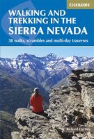
Wandelgids Walking and trekking in the Sierra Nevada | Cicerone
Uitstekende wandelgids voor de Sierra Nevada. Goed beschreven met veel praktische informatie om de route te kunnen lopen, inclusief redelijke kaarten. Aanbevolen wandelkaarten Wandelkaart NP Sierra Nevada met Alpujarras | Editorial Penibetica 1:40.000 of Wandelkaart Sierra Nevada en Alpujarras | Editorial Alpina - 1:40.000 Wandelkaart Sierra Nevada - la integral de los 3000 | Editorial Piolet 1:25.000   This guidebook presents 33 graded walks and 5 high mountain scrambles in the striking Sierra Nevada, the highest mountain range in mainland Spain and in western Europe outside the Alps. Easily accessible from Granada and Málaga, it is a world of soaring, snow-clad peaks and deep valleys, far removed from the crowded beaches of the Costa del Sol just two hours away. The routes are spread across the national park, with attractive towns and villages such as Trevélez, Lanjarón, Hoya de la Mora and Cumbres Verdes serving as potential bases for a walking holiday.   The walks have been careful…
20,95
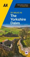
Wandelgids 50 Walks in the Yorkshire Dales | AA Publishing
Uitstekende wandelgids met een aantal dagtochten tussen de 5 en 15 kilometer. Niet heel erg lang dus, maar wel op de mooiste plekken en goed beschreven en prima kaartmateriaal.   Walking is one of Britain’s favourite leisure activities, and this great pocket-sized walking guide to the Yorkshire Dales features a variety of mapped walks to suit all abilities. Contained within the guide are 50 walks of 2 – 10 miles and also features all the practical detail you need, accompanied by fascinating background reading on the history and wildlife of the area, and an introduction to each walk. All walks are annotated with local points of interest and places to stop for refreshments. And every walk is given a summary of distance, time, gradient, level of difficulty, type of surface and access, landscape, dog friendliness, parking and public toilets.
19,95
Wandelgids Mountain Walks Yorkshire Three Peaks: | Vertebrate Publishing
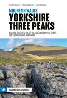
Mountain Walks Yorkshire Three Peaks by Hannah Collingridge is a guide to walking routes on and around Pen-y-ghent, Ingleborough and Whernside in the Yorkshire Dales National Park. Alongside the routes to the peaks themselves, there are also valley walks for mixed-weather days and those new to hillwalking.   The routes explore the local area, visiting local caves and beauty spots and showcasing the stunning limestone scenery; even those who are familiar with the area will find new and imaginative route ideas to discover. Whether you aspire to walk in the southern Dales on a straightforward route, or you’re looking to take on the full Three Peaks challenge, this is the only guidebook you need.   Together with stunning photography, each route features Ordnance Survey 1:25,000 maps; easy-to-follow, detailed directions; downloadable GPX files; essential information about public transport and safety advice; details about the terrain and navigation; and information about facilities, refreshm…
20,95

Klanten-reviews van Wandelgids Walking in the Yorkshire Dales: South and West | Cicerone

Er zijn nog geen beoordelingen voor dit productBen jij de eerste die een review plaatst?

Meer over Wandelgids Walking in the Yorkshire Dales: South and West | Cicerone

Productomschrijving

Veelzijdige wandelgids van een deel van de Yorkshire Dales, goede kaarten en beschrijvingen en veel keuze uit een behoorlijk aantal wandelingen. Part of a two-book set, this guidebook describes 44 walks in the southern and western Yorkshire Dales, including the famous 23 mile Three Peaks circuit over Pen-y-Ghent, Whernside and Ingleborough. The other, mostly circular routes of 3½ to 13 miles cover the scenic region between Sedbergh, Kirkby Lonsdale, Settle, Skipton and Grassington. The Yorkshire Dales need little introduction: their picturesque scenery and hundreds of miles of footpaths, tracks and bridleways have been attracting walkers for decades. Part of a two-volume set, this guidebook presents over 40 routes in the south and west of the National Park, with bases including Sedburgh, Malham, Grassington, Skipton, Settle and Kirkby Lonsdale. The walks cover the valleys of Wharfedale, Littondale, Malhamdale, Ribblesdale and Dentdale – each with its own distinctive landscape and character. Also included is the Yorkshire Three Peaks, a 23 mile (37km) challenge to bag three iconic summits – Pen-y-ghent, Whernside and Ingleborough.   Mostly circular and ranging from 3.5 to 13 miles (6–21km), the routes showcase Yorkshire's diverse landscapes, beautiful views and rich heritage and celebrate the 'ups, downs and endless in-betweens' of the Dales. With the exception of the Three Peaks walk, they are designed to suit most abilities: steeper sections are rare and usually short-lived. Detailed route description and 1:50,000 OS mapping are provided for each route, along with information on nearby points of interest and facilities. In addition, an introduction presents an overview of the region's plants and wildlife, geology and history and offers an insight into iconic local industries such as farming and quarrying. From bucolic pastureland to wild moors, the Dales have it all. Highlights include delightful riverside walking in Wharfedale, spectacular views of the distant Howgills and Lake District Fells, and the arresting limestone cliffs of Malham Cove. Charming villages and cosy pubs offer a warm welcome, but it is also possible to find tranquility and seclusion. The walks in this guide take in rolling hills, sweeping valleys and dancing streams, providing a wonderful introduction to this magnificent area.
Webshop.nl maakt gebruik van cookies. Ga je verder op onze website, ga dan akkoord met het plaatsen van cookies en de verwerking van deze data door ons en vermelde partners.