webshop.nl
Categorieën
  Sluiten

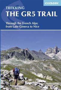
Wandelgids The GR5 Trail - The Alps | Cicerone

Engelsetalige wandelgids van het beroemde GR 5 pad in de Franse Alpen. Dezse gids beschrijft de gehele route van de GR 5 van het meer van Geneve tot aan Nice en de Middellandse zee. Goede beschrijvingen en informatie; kaartmateriaal is vrij beperkt. An essential guidebook for walking the GR5, one of the world's most spectacular long-distance trails...
26,95

Webshops met dit product

Webshop
Bezorging
Prijs

Anderen bekeken ook

Wandelgids Walks In The Valais | Cicerone
Uitstekende wandelgids van dit geweldige gebied. goed beschreven met veel praktische informatie om de route te kunnen lopen, inclusief redelijke kaarten. 120 routes throughout the Swiss Valais in the Pennine Alps, with such peaks as the Matterhorn, Dent Blanche and Monte Rosa providing a perfect background. Detailed coverage of Bettmeralp, Lötschental, Saastal, Mattertal, Turtmanntal, Val d’Annivers, Val d’Hérens, Val de Nendaz, Val de Bagnes, Val d’Entremont, Val ferret, Vallée de Trient. The Matterhorn, Monte Rosa, Zinarothorn, Ober Gabelhorn, Dent Blanche, Weisshorn, Bietschhorn, Grand Combin – these are some of the most dramatic mountains in Europe. Here they form a backdrop to a series of routes that should answer the dreams of any keen mountain walker. Best known, perhaps, for the resorts of Zermatt and Saas Fee, the Valais district of Switzerland is also the location of the Lötschental and Turtmanntal, the Vals d'Anniviers, Hérens, Bagnes and Ferret – valleys in which there are …
24,95
Wandelgids The GR5 Trail Vosges and Jura | Cicerone
Uitstekende wandelgids van dit geweldige gebied. goed beschreven met veel praktische informatie om de route te kunnen lopen, inclusief redelijke kaarten. This guidebook describes a long-distance walking route through the delightful Vosges and Jura. Situated in France near the eastern border, the three regional parks of the Ballons des Vosges, Northern Vosges and Jura Mountains boast verdant forests, striking rock features and low rounded summits offering spectacular views. Yet, in spite of their extensive network of well-maintained paths, they are not high profile tourist destinations. This walk offers a chance to uncover the hidden secrets of this fascinating area, from its rich wildlife to ancient ruins. Starting in Wissembourg at the northeastern tip of France, the route follows the GR53 southwest to Schirmeck, before picking up the central section of the much-celebrated GR5 (which runs from the Hook of Holland to Nice) between Schirmeck and Nyon on Lake Geneva. The scenery is as va…
23,95
Wandelgids - Pelgrimsroute Via Francigena part 2 | Cicerone
Guidebook to the Via Francigena pilgrim route from Lausanne to Lucca. Starting at Lake Geneva (Lac Léman), the 725km route crosses the Alps at historic Great Saint Bernard Pass, descends the Po Valley, then climbs to cross the Cisa Pass into Tuscany. Described in 32 stages, with information on facilities and pilgrim hostels.   Seasons Suitable for walking in spring, summer and autumn. The Great Saint Bernard Pass is fully open to hikers only in August and September.   Centres Lausanne, Martigny, Great Saint Bernard Pass, Aosta, Ivrea, Vercelli, Pavia, Piacenza, Pontremoli, Pietrasanta, Lucca.   Difficulty Each stage is graded for difficulty (1-4). A few mountainous stages include steep and slippery slopes. No special gear is required to walk the Via Francigena in season, but off-season crossings of the Great Saint Bernard Pass require winter mountain gear and careful attention to changing mountain conditions.   Must See Dazzling Lake Geneva, the 1500-year-old Abbey of Saint…
22,95
Wandelgids Trekking in the Apennines - Apennijnen | Cicerone
Uitstekende wandelgids die in etappes de route nauwkeurig beschijft; ook de zijtakken en alternatieve routes koman aan bod. Kaarten zijn schetsmatig en in onze ogen onvoldoende bij slechte weersomstandigheden. Wij raden dan ook om er losse kaarten bij te kopen, voor zover verkrijgbaar! Guidebook to the Grand Apennines Trek, or Grande Escursione Appenninica (GEA). Through Tuscany and Emilia-Romagna and two National Parks, this 400km, 23 day trail explores the mountains, forests and hills of central Italy. Suitable for a range of walkers, it can be split into shorter sections or day walks if needed. This guidebook describes the Grande Escursione Appenninica (GEA), a nearly 400km long, three week trek crossing the Appenines in 23 stages, from Bocca Trabaria to Passo Due Santi on the edge of Liguria. The route dips in and out of Tuscany and Emilia-Romagna, never dropping below 400 metres. Best walked between spring and autumn, it is suitable for any reasonably fit walker. Highlights includ…
22,95
Wandelgids Walking in Provence - East | Cicerone
This guide offers 30 circular day walks in the eastern half of Provence, the large sun-kissed coastal region of south-east France. Spanning from the red rocks in the Ésterel on the Mediterranean to high mountains inland, the walks are set in the areas of the Alpes Maritimes, the Alpes de Haute-Provence and the Mercantour. Provence’s sunshine and Mediterranean charm attract many visitors to its coast, yet the area also has much more to offer the walker. The countryside inland boasts a range of scenery from remote mountaintops to spectacular gorges. History is everywhere, in medieval villages, arcaded streets, abbeys, churches and castles.    This guide covers the eastern regions, with its companion volume, Walking in Provence: West, covering the rest of this fascinating and historic landscape. The walking is incredibly diverse, and explores the country that hugs the Côte d'Azur and Italian border. The Alpes Maritimes rise craggy and wild above towns as unique as Grasse, Cannes and Monac…
21,95
Wandelgids The Cleveland way and the Yorkshire Wolds way | Cicerone
Uitstekende wandelgids van de Cotswolds Way, waarbij naast alle noodzakelijke informatie ook gebruik gemaakt wordt van de echte topografische kaart. Inclusief gidsje met routekaarten van 1:25000 Guidebook to the Cleveland Way and Yorkshire Wolds Way National Trails, plus the Tabular Hills Walk link route. The guidebook also contains a 1:25,000 scale OS route map booklet of the Cleveland Way.   The Cleveland Way National Trail, described in seven day stages, is a fine 177km (110 miles) walk around the North York Moors National Park from Helmsley to Filey. The Yorkshire Wolds Way is one of the quietest of Britain's National Trails and wanders for 130km (80 miles) through gentle, cultivated and sparsely populated countryside. Described here in nine day stages, from Hessle near Redcar to Filey, it links end-to-end with the Cleveland Way on the coast. Also described is the three-day, 80km (50 mile) Tabular Hills Walk, a Regional Trail that allows walkers to close the loop of the Cleveland W…
25,95
Wandelgids Chamonix to Zermatt | Cicerone
Uitstekende wandelgids die in etappes de route nauwkeurig beschrijft; ook de zijtakken en alternatieve routes koman aan bod. Kaarten zijn schetsmatig en in onze ogen onvoldoende, zeker bij slechte weersomstandigheden. Wij raden dan ook om er losse kaarten bij te kopen. A guidebook to the classic Chamonix to Zermatt trek from Mont Blanc to the Matterhorn. The 225km Walker's Haute Route through the French and Swiss Alps crosses 11 passes, gains more than 14,000m in height and is a strong contender for the title of Most Beautiful Walk in Europe. The high-level route is described in 14 day stages, with optional variants, and is suitable for walkers with a good level of fitness and some previous alpine trekking experience. The final approach to Zermatt adopts the dramatic Europaweg, a high-level traverse of the east wall of the Mattertal, crossing the 500-metre suspension bridge at Randa. An alternative valley route to Zermatt can be taken if this does not appeal. Alongside clear route desc…
22,95
Wandelgids Trekking in the Alps | Cicerone
All the rich scenic diversity for which the Alps are renowned is celebrated here, while the 20 treks described include well-known classics as well as newly-created multi-day routes. The eight talented writers and photographers brought together to produce this book are among the most experienced of Alpine trekkers. Between them they have explored every corner of Europe’s premier mountain range, written dozens of guides and, in some cases, led trekking holidays there in order to share their enthusiasm for the Alps with other walkers. And that is the prime motivation for Trekking in the Alps – an inspiration and a celebration of the very best of these mountains. Best-known treks Tour of Mont Blanc; Tour of the Matterhorn; Tour of Monte Rosa; Walker’s Haute Route; Tour of the Jungfrau Region; Tour of the Vanoise; Dolomites AV 1 & 2 Longer trans-Alpine treks GR5 (Lake Geneva to Nice); Eastern Alps E5; Italian Alps GTA; Traverse of the Slovenian Alps For the Alpine adventurer Alpine Pass Rou…
25,95
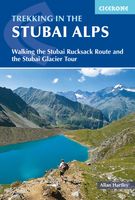
Wandelgids Trekking in the Stubaier Alps | Cicerone
Uitstekende wandelgids van Cicerone over de Stubaier Alpen, waarbij de nadruk ligt op een tweetal meerdaagse routes: Huttentochten voor een gemiddelde en wat meer gevorderde wandelaar. Goede praktische informatie, kaartmateriaal beperkt. Aanbevolen wandelkaarten bij deze gids Schaal 1:25.000 Wandelkaart 31/1 Alpenvereinskarte Stubaier Alpen - Hochstubai Wandelkaart 31/2 Alpenvereinskarte Stubaier Alpen - Sellrain Of schaal 1:50.000 Wandelkaart 83 Stubaier Alpen Kompass Of all the many Alpine areas, few can match the Stubai in the Austrian Tyrol as a venue for a first Alpine season. Shapely peaks, good paths and some of the best huts in the Alps make it ideal for the novice who wants to extend their experience beyond Britain. Of all the many Alpine areas, few can match the Stubai in the Austrian Tyrol as a venue for a first Alpine season. Shapely peaks, good paths and some of the best huts in the Alps make it ideal for the novice who wants to extend their experience beyond Britain. This…
21,95
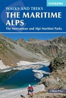
Wandelgids Walks and Treks in the Maritime Alps - Alpes Maritime | Cicerone
Uitstekende wandelgids van dit geweldige gebied. goed beschreven met veel praktische informatie om de route te kunnen lopen, inclusief redelijke kaarten. Guidebook to walking and trekking in the Maritime Alps on the border of Italy and France, just north of Nice. It includes 18 graded day walks, on both the French and the Italian sides, ranging from 6km to 20km in length and suitable for a range of abilities. There are also 6 long treks, including a 5-day traverse of the Parc National du Mercantour and a 7-day traverse of the Parco Naturale delle Alpi Marittime.   Detailed route descriptions sit alongside colour maps, and there is full information about accommodation options down in the valleys and up in the mountains. Useful French-English and Italian-English glossaries of walking terminology are included, too.    Rising to over 3000m above the sun-drenched French Riviera, the Maritime Alps form the western edge of the mighty Alpine chain. Wildflower lovers will also appreciate the re…
25,95

Klanten-reviews van Wandelgids The GR5 Trail - The Alps | Cicerone

Er zijn nog geen beoordelingen voor dit productBen jij de eerste die een review plaatst?

Meer over Wandelgids The GR5 Trail - The Alps | Cicerone

Productomschrijving

Engelsetalige wandelgids van het beroemde GR 5 pad in de Franse Alpen. Dezse gids beschrijft de gehele route van de GR 5 van het meer van Geneve tot aan Nice en de Middellandse zee. Goede beschrijvingen en informatie; kaartmateriaal is vrij beperkt. An essential guidebook for walking the GR5, one of the world's most spectacular long-distance trails. The GR5 makes its way through the Alps from the shores of Lac Léman at Geneva to the Mediterranean at Nice. A route of 674km (420 miles), it can be trekked in a month, or split over a series of summer trips. The GR5 is well within the reach of fit and moderately experienced walkers and backpackers. There is good signposting and waymarking, and accommodation, food and drink are all available at regular intervals. The paths and tracks are generally well graded, while steep climbs are tackled on zigzag paths, so the overall gradient is not so severe. Every summer, thousands of walkers embark on this trek.   This guidebook also describes some scenic variant routes, including the stunning GR55 through the Vanoise National Park and the delightful GR52 that crosses the Mercantour National Park. Full descriptions and maps are provided for these alternatives. The book includes daily stages, timings, ascents and descents, full-colour mapping and gradient profiles, alongside information about facilities and services along the route. The result is an ideal companion to planning and completing your trek.   Dorpen en steden Geneva; Chamonix; Modane; Briançon; Nice   Etappes STAGE 1 La Léman to Les Houches Day 1 St Gingolph to La Chapelle d’Abondance (direct route) Day 1 Thonon-les-Bains to Chevenoz (alternative Day 1) Day 2 Chevenoz to La Chapelle d’Abondance (alternative Day 2) Day 3 La Chapelle d’Abondance to Chésery Day 4 Chésery to Samoëns Day 5 Samoëns to Refuge de Moëde Anterne Day 6 Refuge de Moëde Anterne to Les Houches STAGE 2 Les Houches to Landry Day 7 Les Houches to Les Contamines Day 7a Les Houches to Les Contamines (high-level route) Day 8 Les Contamines to Plan de la Lai Day 9 Plan de la Lai to Landry STAGE 3 Landry to Modane GR5 Route Day 10 Landry to Refuge d’Entre-le-Lac Day 11 Refuge d’Entre-le-Lac to Val d’Isère Day 12 Val d’Isère to Bessans Day 13 Bessans to Refuge du Plan du Lac Day 14 Refuge du Plan du Lac to Le Montana Day 15 Le Montana to Modane/Fourneaux GR55 High-level route (Refuge d’Entre-le-Lac to Modane) Day 11 Refuge d’Entre-le-Lac to Refuge d’Entre Deux Eaux Day 12 Refuge d’Entre Deux Eaux to Roc de la Pêche Day 13 Roc de la Pêche to Modane/Fourneaux GR5E Low-level route (Bonneval-sur-Arc to Modane) Day 13 Bonneval-sur-Arc to Lanslevillard Day 14 Lanslevillard to Bramans Day 15 Bramans to Modane/Fourneaux STAGE 4 Modane to Ceillac Day 16 Modane/Fourneaux to Refuge du Thabor Day 17 Refuge du Thabor to Plampinet Day 17a La Vallée Étroite to Plampinet (GR5B alternative) Day 18 Plampinet to Briançon Day 18a Névache to Briançon (GR5C alternative) Day 19 Briançon to Brunissard Day 20 Brunissard to Ceillac STAGE 5 Ceillac to Auron Day 21 Ceillac to La Barge/Maljasset Day 22 La Barge/Maljasset to Larche Day 23 Larche to Bousieyas Day 24 Bousieyas to Auron STAGE 6 Auron to Nice – GR5 Day 25 Auron to Refuge de Longon Day 26 Refuge de Longon to St Dalmas Day 27 St Dalmas to Utelle Day 28 Utelle to Aspremont Day 29 Aspremont to Nice STAGE 7 St Dalmas to Garavan/Menton – GR52 Day 27 St Dalmas to Le Boréon Day 28 Le Boréon to Refuge de Nice Day 29 Refuge de Nice to Refuge des Merveilles Day 30 Refuge des Merveilles to Camp d’Argent Day 31 Camp d’Argent to Sospel Day 32 Sospel to Garavan/Menton GR-5
Webshop.nl maakt gebruik van cookies. Ga je verder op onze website, ga dan akkoord met het plaatsen van cookies en de verwerking van deze data door ons en vermelde partners.