webshop.nl
Categorieën
  Sluiten

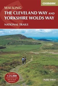
Wandelgids The Cleveland way and the Yorkshire Wolds way | Cicerone

Uitstekende wandelgids van de Cotswolds Way, waarbij naast alle noodzakelijke informatie ook gebruik gemaakt wordt van de echte topografische kaart. Inclusief gidsje met routekaarten van 1:25000 Guidebook to the Cleveland Way and Yorkshire Wolds Way National Trails, plus the Tabular Hills Walk link route. The guidebook also contains a 1:25,000 scal...
25,95

Webshops met dit product

Webshop
Bezorging
Prijs

Anderen bekeken ook

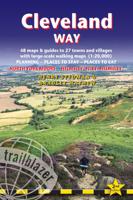
Wandelgids Cleveland Way | Trailblazer Guides
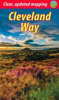
All the information you need to enjoy your hiking adventure along the Cleveland Way in this fully revised and updated 2nd edition. In the beautiful, wild countryside of the North York Moors National Park in northern England lies this fabulous trail, the Cleveland Way. The 110-mile route runs from Helmsley near Thirsk around the western edge of the park to reach the coast at Saltburn-by-the-Sea.   It then continues along the eastern edge of the park south down the coast through Whitby, Robin Hood's Bay and Scarborough to finish in Filey. Combining moorland and coast there's wonderful scenic variety to this walk, with crumbling castles and idyllic fishing villages to explore. The guide includes:48 large-scale walking maps - at just under 1:20,000 - showing route times, places to stay, places to eat, points of interest, and 8 town plans10 colour stage maps to help plan your walk, including hills and descents, and two colour overview mapsPlaces to stay with reviews - campsites, bunkhouses,…
19,95
Wandelgids Cleveland Way | Aurum Press
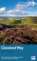
Uitstekend routeboek met goede kaarten van Ordnance Survey. Praktische info voor overnachten enigzins beperkt achterin. The beautifully varied Cleveland Way winds for over a hundred miles around the North York Moors National Park, from the ancient moorland town of Helmsley to the seafront at Filey, passing stunning historic sites like Helmsley Castle and Rievaulx Abbey along the way.  Attractive farmland, woods and heather moorland, a blaze of purple in late-summer, dominate the first half of the walk, later replaced by dramatic cliffs, secluded coves and sandy beaches.   This comprehensive, fully updated official guide is the only companion you need – whether you’re interested in the industrial history of ironstone mining, or a weekend stroller seeking a coastal walk out of the seaside resort of Scarborough.   Ordnance Survey maps for the whole route Background information on everything from archaeology to wildlife Comprehensive information on places of interest, public transport a…
20,95
Wandelgids Cleveland Way | Rucksack Readers
“A testament to excellent research, writing and photography” - Malcolm Hodgson, Trail Manager   The Cleveland Way is one of England’s oldest and best-loved National Trails. It runs for 108 miles (174 km) around the North York Moors National Park, starting inland at Helmsley, offering panoramic views over the vales of York and Mowbray and from the Cleveland Hills. After reaching the coast at Saltburn, it heads south along the dramatic sea cliffs, with their tales of shipwrecks and smugglers, to end at Filey.   The route features ancient burial mounds, ruined castles, abbeys and Roman remains, with more recent traces of industrial history. Vast areas of heather moorland are host to a wide range of wildlife. The Cleveland Way is easily accessible by public transport and is divided into easy stages by villages of character with friendly pubs and accommodation. Above all, walkers are welcomed with warm Yorkshire hospitality.   Our new second edition has larger-scale mapping, several route u…
19,95
Wandelgids The Great Glen Way | Cicerone
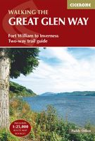
Uitstekende wandelgids van de Great Glen Way, waarbij naast alle noodzakelijke informatie ook gebruik gemaakt wordt van de echte topografische kaart. inclusief gidsje met routekaarten van 1:25000 (deze is hier ook los te bestellen)   Guidebook to walking the Great Glen Way, one of Scotland’s Great Trails that runs along the Great Glen between Fort William and Inverness. The guidebook - which includes both a guide to the route and a separate OS map booklet – describes the route in both directions.   Ideal as an introduction to long-distance walking, the 79-mile Great Glen Way is split into six stages easily walked within a week, with high- and low-level options given for two of these. An alternative route past the northern side of Loch Oich (via Invergarry) is also described.   The guidebook includes practical information, 1:100,000 OS mapping, step-by-step route descriptions for every stage of the walk and lists the facilities found along the way. A separate booklet of 1:25,000 OS mapp…
22,50
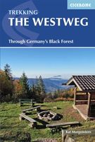
Wandelgids The Westweg | Cicerone
Uitstekende wandelgids van een meerdaagse tocht in het Zwarte Woud in Duitsland. Goede beschrijvingen, veel praktische informatie en redelijke kaarten al zullen deze niet helemaal voldoende zijn. Guidebook to the Westweg (Westway), a 285km walk across Germany's Black Forest from Pforzheim to Basel. This classic route, which includes Feldberg, Black Forest's highest peak, takes 13 to 14 days, each day stage ranging from 15 to 28km. Two variants are described, both well way-marked and suitable for those new to long distance walking. This guidebook is all you need to discover The Westweg, a 285km walk along the length Germany's Black Forest from Pforzheim to Basel. This classic long-distance trail takes around two weeks to walk, in stages of 15-28km. The route is well way-marked and suitable for experienced hikers and those new to long distance walking, though some sections are steep. The Westweg incorporates many of the region's highlights, such the Schwarzwald National Park, the source …
23,95
Wandelkaart Cleveland Way | Harvey Maps
Mooie, duidelijke kaart van de Cleveland Way in Noord-Engeland. Geplastificeerd met veel extra informatie en uitsnedes van de route.    Leap forward in technical excellence. Tough, light and 100% waterproof Compact and light - the map itself weighs just 60gms - a third of the weight of a laminated map, and much less bulky. And you can fold or refold it time and again, or stuff it in your back pocket and it won't fall to pieces. Shows the entire route on one sheet.   174km (109 miles) from Helmsley across the North York Moors National Park to Saltburn and along the coast via Scarborough ending at Filey.   Information on finding accommodation, camping, food. Directions to the start. Also Ranger Service contact numbers and enlargements of towns/villages showing facilities available and tips on weather and clothing.   Detailed mapping, full legend. National Grid - can be used with GPS. 1:40,000 scale. Waterproof. Supplied in clear plastic pocket
25,95
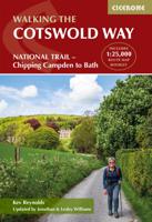
Wandelgids The Cotswold Way | Cicerone
Uitstekende wandelgids van de Cotswolds Way, waarbij naast alle noodzakelijke informatie ook gebruik gemaakt wordt van de echte topografische kaart. inclusief gidsje met routekaarten van 1:25000 (deze is hier ook los te bestellen) Guidebook to walking the 102 mile (163km) Cotswold Way National Trail between Chipping Campden and Bath, across the Cotswolds AONB. The guidebook - which includes both a guide to the route and a separate OS 1:25,000 map booklet - describes the route in both directions.   The route is described over 13 stages, each following the Cotswold escarpment, with dramatic and far-reaching views across the Severn Vale towards the Welsh hills, plunging down to visit honey-coloured villages, old market towns and the elegant and historic city of Bath. The longest of the 13 stages is 10 miles, the shortest 6 miles: these are dictated by the existence of overnight accommodation. For the determined, the trail can be walked in as little as five days.   The Cotswold Way offers …
23,50
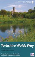
Wandelgids Yorkshire Wolds Way | Aurum Press
Een mooie wandelgids met een goede beschrijving en hele duidelijke kaarten met ingetekende route.   The Yorkshire Wolds were brought to international attention in 2012 by David Hockney’s magnificent Royal Academy exhibition of paintings of the region. Now, Tony Gowers’ completely updated, expanded and re-designed National Trail Guide offers the essential companion to the forgotten but fascinating landscape through which this Trail runs.   The Trail runs from Hessle in the south, by the Humber Bridge, to Filey on the North Yorkshire coast, through the Wolds' secluded and special 'dry valleys', a succession of tranquil villages, and past cel;ebrated locations like Thixendale woods now immortalised in Hockney's vast and dazzling paintings.   As well as comprehensive route descriptions accompanied by OS 1:25,000 maps, the book features a Philip Larkin Trail around Hull, digressions to the handsome town of Beverley with its beautiful Minster, the Holderness region made famous by Winfred Hol…
20,95
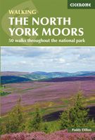
Wandelgids The North York Moors | Cicerone
Uitstekende wandelgids van dit geweldige gebied. Goed beschreven met veel praktische informatie om de routes te kunnen lopen, inclusief redelijke kaarten. Guidebook to 50 walks in the North York Moors National Park. The walks, which range from 4 to 13 miles, are distributed through seven regions within the park, enabling walkers to discover and appreciate the Tabular Hills, Hambleton Hills, Cleveland Hills, Northern Moors, High Moors, Eastern Moors and Cleveland Coast. For those who like a challenge, the course of the classic Lyke Wake Walk, crossing the national park from east to west, is also described.   For each walk (most of which are circular), step-by-step route description is accompanied by extracts of OS mapping. Points of interest are highlighted, and background information provided, detailing the history and industry of the area. The guidebook also includes planning and preparation details such as when to go, where to stay, and how to get around using public transport.   Com…
18,50
Fietskaart 10 Cycling guides North York Moors | Goldeneye
Scheur- en watervast foetskaart van de North York Moors  met ingetekende fietsroutes.   Our maps are double-sided, printed on an A2 sheet with a concertina fold. This allows for easy folding and folding, and an ease of access to the mapping. The material is rain and tear-resistant. Our early maps were designed at the scale of 2 miles to 1 inch/1:126,720. The later designs along with digitalisation are 1: 100,000. We were encouraged by the Cycle Touring Club to convert our cartography toward the cycle market (to replace the out-of-print Bartholomew series). As time and the series progressed we have added more data: The National Cycle Network routes, Regional Routes, and Traffic-Free Family Routes, as and when they are developed. These routes are in addition to the Circular Routes Goldeneye Commissioned at the outset of our publishing schedule. We are also adding to new editions; bike shops, cycle hire, and tea rooms, along with the tourist attractions already featured. Our plan is to ma…
14,95

Klanten-reviews van Wandelgids The Cleveland way and the Yorkshire Wolds way | Cicerone

Er zijn nog geen beoordelingen voor dit productBen jij de eerste die een review plaatst?

Meer over Wandelgids The Cleveland way and the Yorkshire Wolds way | Cicerone

Productomschrijving

Uitstekende wandelgids van de Cotswolds Way, waarbij naast alle noodzakelijke informatie ook gebruik gemaakt wordt van de echte topografische kaart. Inclusief gidsje met routekaarten van 1:25000 Guidebook to the Cleveland Way and Yorkshire Wolds Way National Trails, plus the Tabular Hills Walk link route. The guidebook also contains a 1:25,000 scale OS route map booklet of the Cleveland Way.   The Cleveland Way National Trail, described in seven day stages, is a fine 177km (110 miles) walk around the North York Moors National Park from Helmsley to Filey. The Yorkshire Wolds Way is one of the quietest of Britain's National Trails and wanders for 130km (80 miles) through gentle, cultivated and sparsely populated countryside. Described here in nine day stages, from Hessle near Redcar to Filey, it links end-to-end with the Cleveland Way on the coast. Also described is the three-day, 80km (50 mile) Tabular Hills Walk, a Regional Trail that allows walkers to close the loop of the Cleveland Way and transform it into an enormous circular walk.   The guidebook comes with a separate map booklet of 1:25,000 scale OS maps showing the full route of the Cleveland Way. The clear step-by-step route description links together with the map booklet at each stage along the Way, and the compact format is conveniently sized for slipping into a jacket pocket or the top of a rucksack.   Dorpen en Steden Scarborough, Whitby, Filey, Helmsley, Osmotherley   Inhoudsopgave The Yorkshire Wolds Way National Trail Stage 1 Hessle to South Cave Stage 2 South Cave to Goodmanham or Market Weighton Stage 3 Goodmanham or Market Weighton to Millington Stage 4 Millington to Thixendale Stage 5 Thixendale to Sherburn Stage 6 Sherburn to Filey Stage 7 Filey to Scalby Mills (via the Cleveland Way)   The Tabular Hills Walk Stage 1 Scalby Mills to Levisham Stage 2 Levisham to Hutton-le-Hole Stage 3 Hutton-le-Hole to Helmsley   The Cleveland Way National Trail Stage 1 Helmsley to Sutton Bank Stage 2 Sutton Bank to Osmotherley Stage 3 Osmotherley to Clay Bank Stage 4 Clay Bank to Kildale Stage 5 Kildale to Saltburn-by-the-Sea Stage 6 Saltburn-by-the-Sea to Sandsend Stage 7 Sandsend to Robin Hood’s Bay Stage 8 Robin Hood’s Bay to Scarborough Stage 9 Scarborough to Filey  
Webshop.nl maakt gebruik van cookies. Ga je verder op onze website, ga dan akkoord met het plaatsen van cookies en de verwerking van deze data door ons en vermelde partners.