webshop.nl
Categorieën
  Sluiten

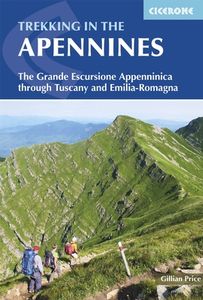
Wandelgids Trekking in the Apennines - Apennijnen | Cicerone

Uitstekende wandelgids die in etappes de route nauwkeurig beschijft; ook de zijtakken en alternatieve routes koman aan bod. Kaarten zijn schetsmatig en in onze ogen onvoldoende bij slechte weersomstandigheden. Wij raden dan ook om er losse kaarten bij te kopen, voor zover verkrijgbaar! Guidebook to the Grand Apennines Trek, or Grande Escursione App...
22,95

Webshops met dit product

Webshop
Bezorging
Prijs

Anderen bekeken ook

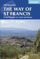
Wandelgids - Pelgrimsroute The Way of St Francis - Via Francigena | Cicerone
This guidebook to the Way of St Francis describes a 550km month-long pilgrim trail through the green heart of Italy. The route begins at Florence and goes through Assisi before its climax in Rome, exploring the mountains of Umbria, Tuscany and Lazio on the way. The route is split into 28 stages, each graded from 'easy' to 'hard'. Some stages include steep climbs and descents, but no special gear is required. Alongside a detailed route description, colour maps and accommodation information, the guidebook contains a concise biography of Francis of Assissi and stories of his life that relate to each location visited. Also included is a walking tour of the Seven Pilgrim Churches of Rome. This book is a trove of information that makes a perfect companion for anyone setting out to walk the Way of St Francis. The Way of St Francis is one of the most popular pilgrim routes in Italy, and it offers a great range of sights: olive groves, vineyards, Renaissance Florence, the Casentino National For…
24,95
Wandelgids Walking in Tuscany - Toscane | Cicerone
Uitstekende wandelgids van Toscane. Goed beschreven met veel praktische informatie om de route te kunnen lopen, inclusief redelijke kaarten. Aanbevolen wandelkaarten De meeste wandelingen (maar lang niet allemaal!) in deze gids worden gedekt door wandelkaart: Wandelkaart - Fietskaart 2440 Toscana | Kompass Voor de andere gebieden staan de kaarten hier onder per gebied genoemd. A guidebook to walks in the Italian region of Tuscany. 43 graded routes range from 2.5 to 18km, and take in the Renaissance splendour of Florence and Siena, the World Heritage scenery of Val d'Orcia and San Gimignano and the stunning island of Elba. Alongside detailed route descriptions and clear mapping there is essential practical information on public transport and food and drink, as well as a comprehensive list of accommodation, and a useful Italian–English glossary. The guide is packed with interesting details about the area’s wildlife, landscape, culture and history, making it a perfect companion to getting…
23,95
Wandelgids The Tour of the Bernina | Cicerone
Uitstekende wandelgids van een meerdaagse tocht in Zwitserland en Italië in het Bernina-gebied. Goede beschrijvingen, veel praktische informatie en redelijke kaarten al zullen deze niet helemaal voldoende zijn.   This guidebook explores two treks in the Bernina region of the Swiss-Italian Alps. The Tour of the Bernina is an 9-stage trek circling the Piz Bernina massif, 119km long and suitable for beginner trekkers. Also included in this guide is the 8-stage Alta Via Valmalenco just to the south of the Bernina. Although shorter, at 94km long, this is a more challenging route suitable for trekkers with more experience.   Whether skirting above St. Moritz and below snow-capped giants on the Tour of the Bernina, or climbing over wild, high passes and through isolated mountains in the Italian Valmalenco by Monte Disgrazia, the treks offer incredible experiences. Both feature spectacular peaks towering over snow fields and perfect alpine pastures, with accommodation in comfortable alpine gue…
24,50
Wandelgids Italy's Sibillini National Park | Cicerone
Walking and trekking guidebook to Italy's Sibillini National Park in the Apennines. 21 day walks and an 8-stage multi-day trek, the 120km Grande Anello dei Sibillini are explored alongside sketch maps and plenty of practical information. Easily reached from airports on the Adriatic coast and Rome, the Sibillini straddles the Marche and Umbria.   Seasons Seasons Refuges open from mid-April to mid-October; August and midsummer weekends very busy; higher ridges may have snow until June; excellent winter walking with snowshoes or touring skis, best with a local guide   Centres Centres Amandola, Balzo, Castelluccio, Norcia, Nursia, Preci, Castelsantangelo, Visso, Ancona, Pescara, Perugia   Difficulty Difficulty Something for all abilities, low-level strolls, ridges and walkers' peaks; the GAS requires no mountaineering expertise   Must See Must See The Grande Anello dei Sibillini 8-day trek, Sibillini National Park, Monte Vettore, Monte Sibilla, Piano Grande, Monte Bove   THE GAS – GRANDE A…
19,95
Wandelkaart 14 Valle dell'Orco, Gran Paradiso | L'Escursionista editore
Voor weinig gebieden in Italië zijn echt goede wandelkaarten beschikbaar. Dit is gelukkig zo'n serie: voor de noordwestelijke Alpen van Italië, Gran Paradiso, Mont Blanc en Aosta en omgeving. Met GPS grid uitgeruste detailkaart, schaal 1:25.000 met alle noodzakelijke wandelinformatie als ingetekende routes, Via Ferrata routes, campings, berghutten en schuilhutten, dat alles met een kaart die veel topografische details kent.    Hoogtelijnen van 25 m. interval, schaduwtekeningen en goed gebruik van kleur voor bijvoorbeeld gletsjers en bossen. Naast ingetekende routes zijn er ook gewone voetpaden op te vinden.    Bijgeleverd wordt (niet bij elke kaart) een kleine brochure met wandelmogelijkheden in dat bepaalde gebied.   Bergen en Dorpen Noasca, Ceresole Reale, Pont, Groscavallo, Gran Paradiso, Mont Taou Blanc, Piccolo Paradiso, Cima di Pertcha, Corno Bianco, Monte Unghiasse, Passo della Losa, Col du Nivolet / Colle del Nivolet, Punta Cissettaz.   With the series "the most beautiful excu…
14,50
Wandelgids Zuid-Toscane | Uitgeverij Elmar
Deze wandelgids is een vertaling van de oorspronkelijke duitse versie. Het zijn klassiekers onder de wandelgidsen. Uitstekende wandelgids met een groot aantal dagtochten in dal en hooggebergte. Met praktische informatie en beperkt kaartmateriaal!  Wandelingen in verschillende zwaarte weergegeven in rood/blauw/zwart.   De Rother wandelgids Zuid-Toscane bevat 50 prachtige wandelingen door het unieke natuurlijke en culturele landschap van het zuiden van Toscane, tussen Florence en de Maremma.   Zoals gebruikelijk zijn er verschillende wandelingen voor beginnende en ervaren wandelaars en is er onmisbare informatie over de streek, de bezienswaardigheden en recreatiemogelijkheden.   De betrouwbare routebeschrijvingen, gedetailleerde kaarten en hoogteprofielen zorgen voor een onvergetelijke wandelervaring.   Door de wijngaarden van de Chianti 1 2.30 uur Badia a Passignano   2 2.00 uur Pontignano   3 3.45 uur Van Volpaia de Monte San Michele, 892 m, op  4 2.00 uur Van Volpaia naar Castelv…
18,99
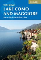
Wandelgids Lake Como and Maggiore | Cicerone
Uitstekende wandelgids van dit geweldige gebied. goed beschreven met veel praktische informatie om de route te kunnen lopen, inclusief redelijke kaarten. This guidebook describes 28 day walks and the Sentiero del Viandante trek around Lakes Como and Maggiore in Northern Italy. The day routes range from 3 to 20km in length are graded 1 to 3. The mini trek up the eastern shore of Lago di Como from Lecco to Colicocan can also be cut into one-day stages if desired.   There is something for everyone, from easy leisurely strolls for first-time walkers to strenuous climbs up panoramic peaks. The clear maps, inspirational photographs and information about accommodation and public transport options help to make this guidebook an ideal companion to exploring the exceptional scenery, views and culture of the Italian Lakes. A basic English-Italian glossary is also included.   Picturesque Lago Maggiore has been working its magic on writers and visitors for centuries. Blessed with a mild climat…
20,95
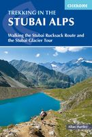
Wandelgids Trekking in the Stubaier Alps | Cicerone
Uitstekende wandelgids van Cicerone over de Stubaier Alpen, waarbij de nadruk ligt op een tweetal meerdaagse routes: Huttentochten voor een gemiddelde en wat meer gevorderde wandelaar. Goede praktische informatie, kaartmateriaal beperkt. Aanbevolen wandelkaarten bij deze gids Schaal 1:25.000 Wandelkaart 31/1 Alpenvereinskarte Stubaier Alpen - Hochstubai Wandelkaart 31/2 Alpenvereinskarte Stubaier Alpen - Sellrain Of schaal 1:50.000 Wandelkaart 83 Stubaier Alpen Kompass Of all the many Alpine areas, few can match the Stubai in the Austrian Tyrol as a venue for a first Alpine season. Shapely peaks, good paths and some of the best huts in the Alps make it ideal for the novice who wants to extend their experience beyond Britain. Of all the many Alpine areas, few can match the Stubai in the Austrian Tyrol as a venue for a first Alpine season. Shapely peaks, good paths and some of the best huts in the Alps make it ideal for the novice who wants to extend their experience beyond Britain. This…
21,95
Wandelgids Trekking in the Alps | Cicerone
All the rich scenic diversity for which the Alps are renowned is celebrated here, while the 20 treks described include well-known classics as well as newly-created multi-day routes. The eight talented writers and photographers brought together to produce this book are among the most experienced of Alpine trekkers. Between them they have explored every corner of Europe’s premier mountain range, written dozens of guides and, in some cases, led trekking holidays there in order to share their enthusiasm for the Alps with other walkers. And that is the prime motivation for Trekking in the Alps – an inspiration and a celebration of the very best of these mountains. Best-known treks Tour of Mont Blanc; Tour of the Matterhorn; Tour of Monte Rosa; Walker’s Haute Route; Tour of the Jungfrau Region; Tour of the Vanoise; Dolomites AV 1 & 2 Longer trans-Alpine treks GR5 (Lake Geneva to Nice); Eastern Alps E5; Italian Alps GTA; Traverse of the Slovenian Alps For the Alpine adventurer Alpine Pass Rou…
25,95
Klimgids - Klettersteiggids - Wandelgids Via Ferratas of the Italian Dolomites: Vol 2 | Cicerone
This guide covers 77 via ferrata routes in the Italian Dolomites. As part of a two-volume set of guides to the Dolomite via ferratas, this volume includes the southern Dolomite regions, in 10 areas including those of Belluno, Brenta, Trento, Lake Garda, the 'Piccole Dolomites' and San Martino di Castrozza. As well as the detailed route descriptions, the guide includes maps, advice on how to climb via ferratas, information on the local area's history and geology, how to travel to and around the Dolomites and and the best places to stay.   Many via ferratas were originally built to aid the movements of alpine military units during the First World War, and now they represent one of the major attractions in the Dolomites. They are a range of protected routes, with fixed cables, ladders and even gorge-spanning bridges, which aid ascent to places normally reserved for expert rock climbers. In recent years, old wartime routes have been restored and many new routes added to give a network of r…
27,95

Klanten-reviews van Wandelgids Trekking in the Apennines - Apennijnen | Cicerone

Er zijn nog geen beoordelingen voor dit productBen jij de eerste die een review plaatst?

Meer over Wandelgids Trekking in the Apennines - Apennijnen | Cicerone

Productomschrijving

Uitstekende wandelgids die in etappes de route nauwkeurig beschijft; ook de zijtakken en alternatieve routes koman aan bod. Kaarten zijn schetsmatig en in onze ogen onvoldoende bij slechte weersomstandigheden. Wij raden dan ook om er losse kaarten bij te kopen, voor zover verkrijgbaar! Guidebook to the Grand Apennines Trek, or Grande Escursione Appenninica (GEA). Through Tuscany and Emilia-Romagna and two National Parks, this 400km, 23 day trail explores the mountains, forests and hills of central Italy. Suitable for a range of walkers, it can be split into shorter sections or day walks if needed. This guidebook describes the Grande Escursione Appenninica (GEA), a nearly 400km long, three week trek crossing the Appenines in 23 stages, from Bocca Trabaria to Passo Due Santi on the edge of Liguria. The route dips in and out of Tuscany and Emilia-Romagna, never dropping below 400 metres. Best walked between spring and autumn, it is suitable for any reasonably fit walker. Highlights include Monte Prado – Tuscany's highest peak – friendly villages and comfortable hotel-style accommodation, memorable meals and yet few walkers, besides the Casentino National Park and Franciscan sanctuaries, the WW2 Gothic line, open ridges on the northern stretch, alpine-style lakes in the Apennines National Park, magnificent beech woods and alpine flowers.   The guidebook provides step-by-step route descriptions, accompanied by detailed mapping. There are transport options for joining and leaving the walk at a number of points, making it perfect for undertaking in small sections or single-day walks. There are suggestions for accommodation en route in comfortable guest houses and alpine-style huts, making it essential reading for anyone undertaking the GEA.   The Apennines are Italy's best-kept secret. Forming the rugged spine of the Italian peninsula, this range provides thousands of kilometres of marked trails over rocky crests and ridges and explores extensive forests and meadows, following routes established long ago by traders, pilgrims and shepherds and little affected by mass tourism. Dotted throughout are historic sanctuaries, national parks and nature reserves, wildlife and wildflowers, incredible roads and passes, and stark memorials to the terrible events of World War II.    Dorpen en steden Abetone, Arezzo, Bibbiena, Bologna, Parma, Pieve Pelago, Pistoia, Pontremoli, Porretta Terme, Prato, Reggio Emilia, Sansepolcro   Etappes Stage 1 Bocca Trabaria to Passo di Viamaggio Stage 2 Passo di Viamaggio to Caprese Michelangelo Stage 3 Caprese Michelangelo to La Verna Stage 4 La Verna to Badia Prataglia Stage 5 Badia Prataglia to Rifugio Città di Forlì Stage 6 Rifugio Città di Forlì to Passo del Muraglione Stage 7 Passo del Muraglione to Colla di Casaglia Stage 8 Colla di Casaglia to Badia Moscheta Stage 9 Badia Moscheta to Passo del Giogo Stage 10 Passo del Giogo to Passo della Futa Stage 11 Passo della Futa to Montepiano Stage 12 Montepiano to Rifugio Pacini Stage 13 Rifugio Pacini to Pracchia Stage 14 Pracchia to Lago Scaffaiolo Stage 15 Lago Scaffaiolo to Boscolungo Stage 16 Boscolungo to Lago Santo Modenese Stage 17 Lago Santo Modenese to Passo delle Radici Stage 18 Passo delle Radici to Passo di Pradarena Stage 19 Passo di Pradarena to Passo del Cerreto Stage 20 Passo del Cerreto to Prato Spilla Stage 21 Prato Spilla to Lago Santo Parmense Stage 22 Lago Santo Parmense to Passo della Cisa Stage 23 Passo della Cisa to Passo Due Santi    
Webshop.nl maakt gebruik van cookies. Ga je verder op onze website, ga dan akkoord met het plaatsen van cookies en de verwerking van deze data door ons en vermelde partners.