webshop.nl
Categorieën
  Sluiten

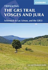
Wandelgids The GR5 Trail Vosges and Jura | Cicerone

Uitstekende wandelgids van dit geweldige gebied. goed beschreven met veel praktische informatie om de route te kunnen lopen, inclusief redelijke kaarten. This guidebook describes a long-distance walking route through the delightful Vosges and Jura. Situated in France near the eastern border, the three regional parks of the Ballons des Vosges, North...
23,95

Webshops met dit product

Webshop
Bezorging
Prijs

Anderen bekeken ook

Wandelgids Switzerland's Jura Crest Trail | Cicerone
Uitstekende wandelgids van de Jura Crest Trail, ook wel bekend als de Jura High Route. Goed beschreven met veel praktische informatie om de route te kunnen lopen, inclusief redelijke kaarten. This guide presents Switzerland's Jura Crest Trail. Also known as the Jura High Route (Swiss national route 5), this 310km long-distance route traverses the sub-alpine mountains of the Swiss Jura from Dielsdorf near Zurich to Nyon on the shores of Lac Léman (Lake Geneva), running roughly parallel to the Swiss-French border. With over 13,500m of ascent, the trail demands a moderate level of fitness and can be comfortably completed in around a fortnight. The Jura Crest Trail is easily accessed from Zurich and Geneva. The region boasts excellent walking infrastructure and facilities, and although the trail crosses the mountains, you are seldom too far from civilisation. The guide contains all the information you need to plan and walk the route. You'll find advice on transport and comprehensive detai…
23,95
Wandelgids The GR5 Trail Benelux and Lorraine | Cicerone
Engelsetalige wandelgids van het noordelijke deel van het beroemde GR 5 pad. Dezse gids beschrijft de gehele route van de GR 5 van Hoek van Holland tot aan Schirmeck in de Vogezen. Goede beschrijvingen en informatie; kaartmateriaal is vrij beperkt. Guidebook to walking the northern section of the GR5 - 1000km starting in Hoek van Holland and passing through the Netherlands, Belgium, Luxembourg and Lorraine to Schirmeck in France. A long-distance route covering a variety of cultures and landscapes. The full GR5 from the North Sea to the Mediterranean is one of the world's greatest trails. Guidebook to the northernmost section of the GR5 - from Hoek van Holland in the Netherlands, through Belgium and Luxembourg, to Schirmeck in the northeast of France. Described over 49 stages, this 1000 kilometre section of the GR5 is relatively easy and ideal for those who don't want to hike up and down steep mountains - or not just yet.   Clear route description is accompanied by 1:100K mapping, toget…
24,95
Wandelgids The GR5 Trail - The Alps | Cicerone
Engelsetalige wandelgids van het beroemde GR 5 pad in de Franse Alpen. Dezse gids beschrijft de gehele route van de GR 5 van het meer van Geneve tot aan Nice en de Middellandse zee. Goede beschrijvingen en informatie; kaartmateriaal is vrij beperkt. An essential guidebook for walking the GR5, one of the world's most spectacular long-distance trails. The GR5 makes its way through the Alps from the shores of Lac Léman at Geneva to the Mediterranean at Nice. A route of 674km (420 miles), it can be trekked in a month, or split over a series of summer trips. The GR5 is well within the reach of fit and moderately experienced walkers and backpackers. There is good signposting and waymarking, and accommodation, food and drink are all available at regular intervals. The paths and tracks are generally well graded, while steep climbs are tackled on zigzag paths, so the overall gradient is not so severe. Every summer, thousands of walkers embark on this trek.   This guidebook also describes some s…
26,95
Wandelgids Walking on Jura, Islay and Colonsay | Cicerone
Uitstekende wandelgids van deze weldadige eilanden. goed beschreven met veel praktische informatie om de route te kunnen lopen, inclusief redelijke kaarten. This guidebook presents a selection of 23 walking routes on the wild and beautiful southern islands of Scotland's Inner Hebrides, with nine walks on Jura, one on neighbouring Scarba, seven on Islay and five on Colonsay, plus a spectacular 5-day trek along Jura's dramatic west coast. The wildest of the southern Hebrides, the walking on Jura is frequently rugged, with many routes crossing remote and often pathless terrain that calls for fitness, self-reliance and navigational competence. The routes on the other islands are somewhat easier, but should still not be underestimated.   In addition to clear route description illustrated with 1:50,000 OS mapping, the guide offers practical advice on the various options for getting to the islands, accommodation and amenities. There are suggestions for linking walks and notes on the islands' …
20,95
Wandelgids Via Francigena Pilgrim Route Part 1 | Cicerone
The 2000km Via Francigena from Canterbury to Rome is one of the world's great pilgrim routes, with a history spanning well over a millennium. This guide describes the first section, from Canterbury to Lausanne on the shores of Lake Geneva, a journey of 1090km passing through England, France and Switzerland. The route is suitable for walkers of all levels of ability, and the section from Canterbury to Besancon is also suitable for cyclists (mountain or hybrid/gravel bike).   There are various options for accommodation, ranging from hotels and B&Bs to camping (although it is not essential to carry a tent), and the French section offers a unique opportunity to lodge with host families in welcoming chambres d'hotes. The guide has all the information you need to plan and prepare for a journey on the Via Francigena. You'll find a wealth of detail about facilities on route and accommodation, as well as tips on training, kit, travel and pilgrim credentials.   The route is presented in 52 stage…
26,50
Wandelgids Walking the John o' Groats Trail | Cicerone
Guide to the John o' Groats Trail, a 233km walking route linking Inverness with John o' Groats on the northeast tip of mainland Britain. Much of the walking is coastal, with the northern half characterised by its spectacular seacliffs; however, there is some inland walking too, and the scenery is varied, ranging from dunes and deserted sandy beaches to beautiful woodland. With rough ground and some exposed clifftop walking, the route is suited to experienced hikers.   It takes around a fortnight to complete. The route is described in 14 stages, each of which includes: an overview map; step-by-step route description illustrated with custom mapping; details of accommodation, facilities and transport links; and information on local points of interest. While the main route description is from south to north, notes are supplied for southbound walkers.   Also included is a bonus route linking the trail with the Great Glen, for the benefit of walkers undertaking the Land's End to John o' Groa…
23,95
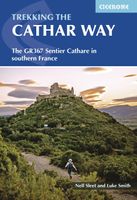
Wandelgids The Cathar Way | Cicerone
Guidebook to the GR367 Cathar Way (Sentier Cathare) in the Languedoc region of southern France. The 260km waymarked trail from Port la Nouvelle on the Mediterranean to Foix traces the history of the Cathars through the Eastern foothills of the Pyrenees. Split into 13 stages and offering a northern variant, the route takes about 2 weeks to complete. Two of the southernmost départements of France, the Pyrénées-Orientales and Ariège are inextricably linked with the history of the Cathars, a heretical Christian sect who were subjected to a crusade in the thirteenth century. Striking castles built on jagged rocky precipices are a highlight of the region and a reminder of those turbulent times. This guidebook describes the 260km Cathar Way (Sentier Cathare or GR367), a long-distance trail from Port-la-Nouvelle on the Mediterranean coast to Ariége's departmental capital Foix linking several of the impressive Cathar castles. The route follows ancient footpaths, jeep tracks and country lanes an…
22,95
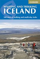
Wandelgids Walking and Trekking in Iceland - IJsland | Cicerone
Wandelgids met beschrijvingen, kaarten en praktische informatie zoals bussen, overnachten, etc. voor meerdaagse wandelroutes en dagwandeltochten op IJsland. A country of extraordinary beauty, Iceland’s incredible variety of volcanic and glacial landscapes makes it a unique destination for walking and trekking holidays. Its three national parks include the mighty Vatnajökull, largest national park in Europe.   The wide range of routes in this book introduce walkers and backpackers to this ‘Land of Ice and Fire’. There are 100 days of walking in this guidebook, stretching over 1722km, split between 49 day walks and 10 multi-stage treks. They climb mountains, cross glaciers, pass lakes and explore coastlines and geothermal areas, and range from easy nature trails to challenging treks. So, there is enough variation to satisfy all kinds of walkers. The routes are spread all around Iceland, grouped into twelve regions. Detailed information is given at the start of each route or trekking stag…
26,95
Wandelgids The Pennine Way | Cicerone
Uitstekende wandelgids van de Pennine Way, waarbij naast alle noodzakelijke informatie ook gebruik gemaakt wordt van de echte topografische kaart. inclusief gidsje met routekaarten van 1:25000  Guidebook to the Pennine Way National Trail with OS map booklet. The 270 mile route from Edale to Kirk Yetholm takes three weeks to walk and is suitable for fit and experienced long distance walkers. The route crosses the Peak District, Yorkshire Dales and North Pennines National Parks. Includes separate OS 1:25,000 map booklet of the route. The Pennine Way is Britain's oldest, toughest long-distance footpath – and arguably its most iconic. Now a National Trail, the 427km (265½ mile) route from Edale in Derbyshire to Kirk Yetholm in the Scottish Borders offers wayfarers the opportunity to immerse themselves in wild beauty of the North. The Pennines boast rolling hills, sweeping moorland and wide glacial valleys, and the Pennine Way has come to embody personal challenge and adventure.    This gui…
23,95
Wandelgids - Fietsgids Hiking and Cycling the California Missions Trail - Californie | Cicerone
Guidebook to hiking or cycling the 800 mile (1289km) California Missions Trail between San Francisco Bay and San Diego. The pilgrimage trail takes in 21 historic Spanish missions and can be completed in 50-60 walking days or 2-3 weeks cycling. With 1:100,000 mapping, route description, and details of accommodation and facilities for each stage. Ancient footpaths became connecting routes between the Spanish missions, pueblos, and presidios in the period 1769 to 1823. Over time these routes became automobile roadways and were marked with bells starting in 1906 to promote and preserve the El Camino Real. Today, the California Missions Trail follows a pedestrian route through urban cities and historic towns, through forest paths and country lanes, to each of the twenty-one historic Spanish missions. The 800-mile California Missions Trail leads walkers and cyclists through some of the most scenic and historic sites of one of America's most beautiful states. The 21 missions, founded 200-250 …
26,50

Klanten-reviews van Wandelgids The GR5 Trail Vosges and Jura | Cicerone

Er zijn nog geen beoordelingen voor dit productBen jij de eerste die een review plaatst?

Meer over Wandelgids The GR5 Trail Vosges and Jura | Cicerone

Productomschrijving

Uitstekende wandelgids van dit geweldige gebied. goed beschreven met veel praktische informatie om de route te kunnen lopen, inclusief redelijke kaarten. This guidebook describes a long-distance walking route through the delightful Vosges and Jura. Situated in France near the eastern border, the three regional parks of the Ballons des Vosges, Northern Vosges and Jura Mountains boast verdant forests, striking rock features and low rounded summits offering spectacular views. Yet, in spite of their extensive network of well-maintained paths, they are not high profile tourist destinations. This walk offers a chance to uncover the hidden secrets of this fascinating area, from its rich wildlife to ancient ruins. Starting in Wissembourg at the northeastern tip of France, the route follows the GR53 southwest to Schirmeck, before picking up the central section of the much-celebrated GR5 (which runs from the Hook of Holland to Nice) between Schirmeck and Nyon on Lake Geneva. The scenery is as varied as it is beautiful, from the tranquil forests of the Northern Vosges to the impressive river gorges of the Jura, from long-forgotten castles to the charming half-timbered villages of old Alsace. Well within the capabilities of any moderately fit walker and clearly waymarked, the entire trek takes five to six weeks, although it could also be walked in stages.    The guide presents the route in 11 chapters, which in turn are broken into short sections of a few hours each, allowing for a flexible itinerary and easy route planning. There are also suggestions for shorter circular routes making use of sections of the GR53/GR5, as well as an overview of other long-distance routes in the region. A summary of local history, plants and wildlife and delicacies can be found in the introduction and appendices offer details of facilities on route and full accommodation listings. With clear route description and a wealth of information to help plan your trip, this comprehensive guide is an ideal companion to discovering this interesting and varied route.   Steden en Dorpen Wissembourg, Saverne, Schirmeck, Ribeauvillé, Villers-le-Lac, Les Rousses, Nyon   GR-5    
Webshop.nl maakt gebruik van cookies. Ga je verder op onze website, ga dan akkoord met het plaatsen van cookies en de verwerking van deze data door ons en vermelde partners.