webshop.nl
Categorieën
  Sluiten

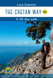
Wandelgids The Cretan Way E4 | Anavasi

De Kretenzische Weg is een 500 km lange wandelroute, die u van oost naar west, over gevarieerde en spectaculaire landschappen van Kreta voert. Het is de ideale manier om de landelijke, bergachtige en kustgebieden van dit ongelooflijke eiland te ontdekken.   Deze gids is de eerste gids voor de route en bevat kaarten, beschrijvingen, een reisversla...
24,95

Webshops met dit product

Webshop
Bezorging
Prijs

Anderen bekeken ook

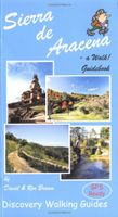
Wandelgids Walk! Sierra de Aracena | Discovery Walking Guides
Introducing you to the beautiful region of Sierra de Aracena, this guidebook has 27 detailed walking routes backed by useful information. Every route has 1:40,000 scale colour mapping from Tour & Trail Map, plus GPS Waypoints for pinpoint navigational accuracy. A hundred kilometres northwest of Seville lies a region of truly unspoilt rural Spain. Once a province of Portugal the Sierra de Aracena encapsulates almost everything that we look for as the idyllic walking destination; rural beauty in flora and fauna, breathtaking landscapes, unspoilt towns and villages linked by old donkey trails. All it lacks are high mountains.   The Spanish have known about this isolated region for sometime and arrive at weekends and in mid-summer, but on weekdays and out of season it returns to peaceful tranquility. Few 'outsiders' know of this delightful region and you can be the first to read about it in English. We first discovered the region five years ago, when we thought it too isolated to justify a…
16,50
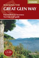
Wandelgids The Great Glen Way | Cicerone
Uitstekende wandelgids van de Great Glen Way, waarbij naast alle noodzakelijke informatie ook gebruik gemaakt wordt van de echte topografische kaart. inclusief gidsje met routekaarten van 1:25000 (deze is hier ook los te bestellen)   Guidebook to walking the Great Glen Way, one of Scotland’s Great Trails that runs along the Great Glen between Fort William and Inverness. The guidebook - which includes both a guide to the route and a separate OS map booklet – describes the route in both directions.   Ideal as an introduction to long-distance walking, the 79-mile Great Glen Way is split into six stages easily walked within a week, with high- and low-level options given for two of these. An alternative route past the northern side of Loch Oich (via Invergarry) is also described.   The guidebook includes practical information, 1:100,000 OS mapping, step-by-step route descriptions for every stage of the walk and lists the facilities found along the way. A separate booklet of 1:25,000 OS mapp…
22,50
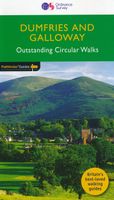
Wandelgids 19 Pathfinder Guides Dumfries & Galloway | Ordnance Survey
Wandelgids van het zuidwestenl van Schotland. Deze gids bevat 28 dagwandelingen, variërend van korte tochten tot pittige dagtochten. De bijbehorende kaarten zijn uitstekend: men heeft de topografische kaarten van Ordnance Survey gebruikt waarop de route is ingetekend. Daarnaast praktische informatie over de wandeling en wat beschrijvingen van het gebied. With 28 circular walks all created by experienced walkers, this Pathfinder walking guidebook for Dumfries and Galloway is ideal for both visitors and locals. The routes range from extended strolls to exhilarating hikes, so there is something for everyone. Each route includes a detailed description, a difficulty rating, the Ordnance Survey map for the route, GPS waypoints and key historical and landscape features to look out for.   Dumfries and Galloway form the south-west of Scotland; a broad wedge of land jutting out into the Irish Sea between the Solway Firth and the Firth of Clyde. The area is also part of Scotland's border country …
18,50
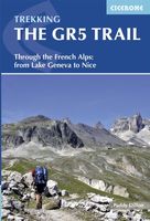
Wandelgids The GR5 Trail - The Alps | Cicerone
Engelsetalige wandelgids van het beroemde GR 5 pad in de Franse Alpen. Dezse gids beschrijft de gehele route van de GR 5 van het meer van Geneve tot aan Nice en de Middellandse zee. Goede beschrijvingen en informatie; kaartmateriaal is vrij beperkt. An essential guidebook for walking the GR5, one of the world's most spectacular long-distance trails. The GR5 makes its way through the Alps from the shores of Lac Léman at Geneva to the Mediterranean at Nice. A route of 674km (420 miles), it can be trekked in a month, or split over a series of summer trips. The GR5 is well within the reach of fit and moderately experienced walkers and backpackers. There is good signposting and waymarking, and accommodation, food and drink are all available at regular intervals. The paths and tracks are generally well graded, while steep climbs are tackled on zigzag paths, so the overall gradient is not so severe. Every summer, thousands of walkers embark on this trek.   This guidebook also describes some s…
26,95
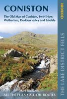
Wandelgids The Lake District Fells Coniston walking guide | Cicerone
Uitstekende uitgebreide wandelgids van een bepaald deel vsn het Lake District, één van de mooiste wandelgebieden van Engeland. De routes zijn goed beschreven, met prima kaartmateriaal. Zolang je niet van de route afwijkt is deze gids voldoende om de wandelroute te lopen.  Part of the Walking the Lake District Fells series, this guidebook covers a wide range of routes to 24 Lakeland summits that can be climbed from Coniston, Torver, the Duddon valley and the Birker Fell road, with highlights including Coniston Old Man, Swirl How, Wetherlam and Black Combe. Suggestions for longer ridge routes are also included. This guide describes ascents of 24 Lake District fells that can be climbed from Coniston and the Duddon and Eskdale valleys, including Coniston Old Man, Swirl How, Wetherlam and Dow Crag. The Coniston Fells - much loved for their classic ridges and wide-reaching views - need little introduction; however, to the west the less-frequented summits of the Birker and Corney Fell massifs…
20,95
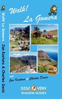
Wandelgids Walk! La Gomera | Discovery Walking Guides
La Gomera is the ultimate get-away-from-it-all island: easy-going, unspoilt, friendly, isolated from the hustle and bustle of modern living, and so laid back it’s virtually supine - even the volcanoes have been dormant for millions of years. The walks, however, are a bit more energetic. For the new 4th edition of Walk! La Gomera Charles Davis has teamed up with Jan Kostura. Jan brings his wide experience and passion for the Canaries, checking, re-walking and revising existing routes, and adding a couple of his own adventures, including a new Top Three Gomeran walk. Two routes have been dropped as having become too dangerous, but the good news is that many of the more harum-scarum walks have been improved through path clearing and the addition of railings to the vertiginous stretches. Other good news is that the devastating forest fires of 2012 have proved not nearly as damaging as we feared, leaving most of our itineraries unscathed. In short, there is every reason to take off and expl…
17,50
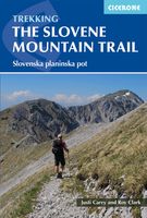
Wandelgids The Slovene Mountain Trail | Cicerone
Uitstekende wandelgids van de Slovenska Planinska Pot. Goed beschreven met veel praktische informatie om de route te kunnen lopen, inclusief redelijke kaarten. A guidebook to trekking the Slovene Mountain Trail, crossing Slovenia from Austria to the Adriatic. The 550km route is presented in a series of 12 3 to 6-day treks of all levels of difficulty, all featuring start and finish points that can be accessed by public transport. They can be completed as single sections or linked to create a longer trip. Each day is graded: low-grade walking is mostly on tracks or lanes with no steep ascents, whereas the most difficult stages may involve steep and technical terrain including fixed protection or sections of via ferrata, for which a helmet, self-belaying equipment and the appropriate experience are required.   In addition to clear route description and mapping, the guide provides all the practical information you will need to plan your trip, covering transport, accommodation and safety…
23,95
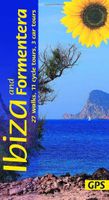
Wandelgids Ibiza and Formentera | Sunflower books
GIds met zowel autotochten, fietstochten en wandelroutes. The go-to Ibiza walking guide for over 30 years. Strap on your boots and discover Ibiza and Formentera on foot with the Sunflower Ibiza travel guide. And on the days when your feet may have had enough, enjoy some spectacular scenery on one of our legendary car or bike tours.   The Sunflower Ibiza guide is indispensable for hiking in Ibiza or seeing Ibiza by car. There's an unending wealth of hidden beauty spots to be discovered, and this book helps you to find the best of Ibiza and Formentera by car, bicycle, or on foot. Routes have been recently checked for this new edition of our guidebook to walking in Ibiza and Formentera and there are two bonuses: firstly, there are GPS tracks for all the treks and cycle tours; secondly, for the adventurous, the author has described a round-the-island hike for which detailed stages and GPS tracks are available.   Inside the Sunflower Ibiza guide book you'll find:27 long and short walks for …
20,95
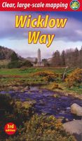
Wandelgids Wicklow Way | Rucksack Readers
Uitgevoerd in de vorm van een klapper, met ringband geeft deze gids een goede beschrijving van de lange afstands route. De kaarten zijn schetsmatig maar wel duidelijk. The Wicklow Way is Ireland’s first and most popular Waymarked Way, running between Marlay Park (Dublin) and Clonegal, 82 miles (132 km) to the south. It offers varied and scenic walking on the flanks of the rugged Wicklow mountains with loughs and waterfalls, passing historic buildings and hospitable villages. Much of the route lies over 1600 feet (500 metres) giving glorious views. Lower sections run through forests and farmland, over a mixture of tracks, roads and pathways rich in wildlife.   Our third edition is based on a research trip made in 2008, further revised in 2011, 2015, 2017 and 2019. It has many route updates, extra photographs and it explains new options for accommodation.   This guidebook contains all you need to plan and enjoy the Wicklow Way:   detailed route description, updated in 2019, with dist…
19,95
Wandelgids Walking in the Yorkshire Dales: South and West | Cicerone
Veelzijdige wandelgids van een deel van de Yorkshire Dales, goede kaarten en beschrijvingen en veel keuze uit een behoorlijk aantal wandelingen. Part of a two-book set, this guidebook describes 44 walks in the southern and western Yorkshire Dales, including the famous 23 mile Three Peaks circuit over Pen-y-Ghent, Whernside and Ingleborough. The other, mostly circular routes of 3½ to 13 miles cover the scenic region between Sedbergh, Kirkby Lonsdale, Settle, Skipton and Grassington. The Yorkshire Dales need little introduction: their picturesque scenery and hundreds of miles of footpaths, tracks and bridleways have been attracting walkers for decades. Part of a two-volume set, this guidebook presents over 40 routes in the south and west of the National Park, with bases including Sedburgh, Malham, Grassington, Skipton, Settle and Kirkby Lonsdale. The walks cover the valleys of Wharfedale, Littondale, Malhamdale, Ribblesdale and Dentdale – each with its own distinctive landscape and chara…
19,95

Klanten-reviews van Wandelgids The Cretan Way E4 | Anavasi

Er zijn nog geen beoordelingen voor dit productBen jij de eerste die een review plaatst?

Meer over Wandelgids The Cretan Way E4 | Anavasi

Productomschrijving

De Kretenzische Weg is een 500 km lange wandelroute, die u van oost naar west, over gevarieerde en spectaculaire landschappen van Kreta voert. Het is de ideale manier om de landelijke, bergachtige en kustgebieden van dit ongelooflijke eiland te ontdekken.   Deze gids is de eerste gids voor de route en bevat kaarten, beschrijvingen, een reisverslag, GPS-tracks, accommodatie info en tips om te wandelen op een van de meest opmerkelijke lange afstand routes in de wereld.   The Cretan Way is a 500 km walking route which takes you from east to west across the varied and spectacular landscapes of Crete. It is the ideal way to discover the rural, mountainous and coastal regions of this incredible island.   This guidebook is the first ever guidebook for the route and includes maps, descriptions, a travelogue, GPS tracks, accommodation info and tips for walking one of the most remarkable long-distance routes in the world.
Webshop.nl maakt gebruik van cookies. Ga je verder op onze website, ga dan akkoord met het plaatsen van cookies en de verwerking van deze data door ons en vermelde partners.