webshop.nl
Categorieën
  Sluiten

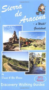
Wandelgids Walk! Sierra de Aracena | Discovery Walking Guides

Introducing you to the beautiful region of Sierra de Aracena, this guidebook has 27 detailed walking routes backed by useful information. Every route has 1:40,000 scale colour mapping from Tour & Trail Map, plus GPS Waypoints for pinpoint navigational accuracy. A hundred kilometres northwest of Seville lies a region of truly unspoilt rural Spain. O...
16,50

Webshops met dit product

Webshop
Bezorging
Prijs

Anderen bekeken ook

Wandelkaart Tour & Trail Sierra de Aracena | Discovery Walking Guides
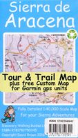
Goede wandelkaart van de Sierra de Aracena in Andalusië. Met gemarkeerde wandelroutes.   1:40,000 scale topographical map covering the Sierra de Aracena region in northern Huelva/Andalucia. All walking routes from Sierra de Aracena - a Walk! Guidebook; are clearly highlighted. Discover the hidden Spain of western Andalucia which is a delight for leisure walkers who appreciate the natural world and 1st class culinary delights; the Jabugo pata negra ham and local setas make for a unique dining experience.   2nd edition includes 1 minute Lat/Long grid, road and development updates and specially highlighted walking trails. Sierra de Aracena Tour & Trail Custom Map is available as a free digital download from Discovery Walking Guides website dwgwalking.co.uk for use in Garmin gps units, Garmin Basecamp and Google Earth; see details on the map for the free digital download. Digital editions of this map are available for use on mobile phone apps from Viewranger and MyTrails.   Produced t…
7,95
Wandelgids Walk! Lanzarote | Discovery Walking Guides
Engelstalige wandelgids Lanzarote, met uitgebreide beschrijvingen van wandelroutes, routekaartjes, praktische informatie zoals bussen en accommodatie. Walk! Lanzarote 5th edition builds on the reputation of our earlier editions with more walks and comprehensive updating so that it caters for the needs of the increasing number of people who would like to combine some walking with a holiday on the Fire island. Walk Lanzarote explodes the myth that there is nowhere worth walking on the island as we range through strolling on coastal promenades, walking across alpine style meadows, striding over the lava sea, dropping into volcanoes, sitting on high mountain seats - quite simply you will be amazed at the wide variety of stunning landscapes the Fire island has to offer the adventurous leisure walker.   new extended coastal route from Arrieta to Los Cocoteros to Costa Teguise, new Playa Blanca to Las Brenas to Yaiza on the GR131, which also updates our Yaiza to Las Brenas circular, newly rev…
18,50
Wandelgids Walk! La Gomera | Discovery Walking Guides
La Gomera is the ultimate get-away-from-it-all island: easy-going, unspoilt, friendly, isolated from the hustle and bustle of modern living, and so laid back it’s virtually supine - even the volcanoes have been dormant for millions of years. The walks, however, are a bit more energetic. For the new 4th edition of Walk! La Gomera Charles Davis has teamed up with Jan Kostura. Jan brings his wide experience and passion for the Canaries, checking, re-walking and revising existing routes, and adding a couple of his own adventures, including a new Top Three Gomeran walk. Two routes have been dropped as having become too dangerous, but the good news is that many of the more harum-scarum walks have been improved through path clearing and the addition of railings to the vertiginous stretches. Other good news is that the devastating forest fires of 2012 have proved not nearly as damaging as we feared, leaving most of our itineraries unscathed. In short, there is every reason to take off and expl…
17,50
Wandelkaart Tour & Trail Costa de Sol - Axarquia | Discovery Walking Guides
Goede wandelkaart van de omgeving Nerja - Competa in het binnenland. For better adventures, use the best map. Costa del Sol (Axarquia) Tour & Trail Super-Durable Map comes with a 2 year adventurous use wear and tear guarantee against splitting or falling apart, see Discovery Walking Guides website for details. From 1 April 2020 a free Custom Map digital edition for Garmin users is available to download from the Discovery Walking Guides website.   Our large 1:40,000 scale, combined with splitting the region into West and East sections with a generous overlap, produces double sided map whose total size is 840mm by 700mm that folds to a pocketable 240mm by 120mm. Costa del Sol (Axarquia) covers the region from Ventas de Zafarraya in the North-West to Almunecar in the South-East; approx 3 42'W to 4 08'W and 36 43'N to 36 58'N. You get the most detailed map of the region that is produced including our 'Tour & Trail' level of detail ranging from major roads to secondary roads to minor roa…
15,95
Wandelgids Walk! Costa del Sol: Axarquia | Discovery Walking Guides
Goede wandelgids van een uitermate geschikt wandelgebied aan de Costa del Sol: het binnenland boven Nerja rond Competa en andere bergdorpen. De beschrijvingen zijn prima, zo ook de praktische informatie en de kaarten. We celebrate a Costa del Sol that does not correspond to the cliches, a Costa del Sol that is all right rather than all wrong, a playground of green valleys and gilded mountain tops, a hidden idyll unknown to most visitors, a haven for dedicated walkers and adventurous tourists alike, a place in which every nook is graced with some gratifying discovery and every outing is a great adventure. The majority of walks are aimed at the adventurous leisure walker, people who will on the whole have some experience of hiking in mountains, are happy to invest a certain amount of effort for a corresponding reward. Covering the best preserved stretch of coastline, the prettiest villages, and most spectacular mountains, Walk! Costa del Sol explores the Axarquia region east of Malaga, a…
18,50
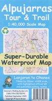
Wandelkaart Tour & Trail Alpujarras | Discovery Walking Guides
Scheur- en watervaste wandelkaart van de Alpujarras met hoogtelijnen en graden. For the best adventures, use the best map. The Moorish white villages of the Alpujarras are well known to day trippers from the Costa del Sol. For walkers this is an idyllic region with stone-laid donkey trails linking the tipico villages and stretching up the southern slopes of the Sierra Nevada to Mulhacen; at 3,483 metres the highest mountain peak on mainland Spain. From Spring to the end of Autumn this is a paradise for hikers, whether you are walking from village to village sampling the local delicacies or tackling the challenging major ascents. One thing you will know is that using the Alpujarras Tour & Trail Map will help you plan, and get the best out of, your adventures.   On a large 960mm by 700mm, double sided, map sheet at 40k scale this map has all the detail you need. 20 and 100 metre contours, combined with altitude shading, giving you a true feel to this impressive landscape.  Stretc…
15,95
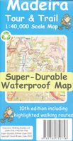
Wandelkaart Tour & Trail Madeira | Discovery Walking Guides
Goed gedetallieerde wandelkaart van Madeira, schaal 1:40.000, scheur en watervast papier. Wandelroutes staan ingetekend. Our large 1:40,000 scale, combined with splitting the island into East and West with a generous overlap, produces double sided map whose total size is 840mm by 600mm and folds to 235mm by 120mm. You get the most detailed map of Madeira that is produced including our 'Tour & Trail' level of detail ranging from major roads to secondary roads to minor roads to streets and camino rural narrow country roads, plus dirt roads and walking trails. Altitude background colouring is designed to clearly show the altitude range when travelling across the island by car or on foot. 100 metre and 50 metre contours are clearly shown on the map along with a large number of individual height points and all of the official 'Trig' points. Tour & Trail attention to detail is legendary as is our useful symbol range including miradors, picnic areas, petrol stations, bar/restaurants and parki…
15,95
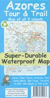
Wandelkaart Tour & Trail Azores - Azoren | Discovery Walking Guides
Gedetailleerde kaart van de Azoren. Met heel veel wandelroutes, al dan niet gemarkeerd. For the best adventures, use the best map. Azores Tour & Trail Super-Durable Map is the most detailed, accurate, toughest, large scale map of these 9 islands that you can buy.    1:60,000 scale for each island, Sao Miguel at 70,000 scale, produces a double sided map sheet of 960mm by 694mm; big enough to show masses of detail but compact enough to use in the car or on the trail. Faial, Pico, Santa Maria and Sao Jorge are on the facing sheet of the map with Corvo, Flores, Graciosa, Sao Miguel and Terceira are on the reverse side. Our special concertina map fold means your map is easy to unfold, and more importantly easy to refold back to its pocket size.   You get the most detailed map of the Azores islands that is produced including our 'Tour & Trail' level of detail ranging from major roads to secondary roads to minor roads to streets and narrow country roads, plus dirt roads and walking trails. We…
15,95
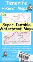
Wandelkaart Tour & Trail Tenerife | Discovery Walking Guides
Uitstekende wandelkaart, met ingetekende wandelroutes, voor specifieke wandelgebieden van Tenerife. Let op: dit is niet een kaart van het hele eiland, maar puur en alleen voor de wandelgebieden > daar is deze kaart de beste in! Our latest hiking research on Tenerife has resulted in new editions of Walk! Tenerife and Tenerife Hikers' Super-Durable Maps. Thanks to Jan Kostura's research we have several new hiking adventures described in detail in Walk! Tenerife. Jan's gps records of his research for new routes and updating of current routes has provided the detailed information to produce our new fourth edition of Tenerife Hiker's Super-Durable Maps. Note that Tenerife Hikers' Super-Durable Maps is a collection of four 30k scale map sections on a double sided sheet of 840mm by 600mm which folds up to 220mm by 120mm. It is not a map of all of Tenerife.  In this edition you will find 30k scale maps covering Valle de Orotava, West, Anaga and Adeje/Arona - Teide printed on a double sided …
17,95
Wandelkaart Tour & Trail Corfu - Korfoe | Discovery Walking Guides
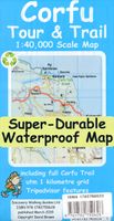
Goede wandelkaart van Korfoe. Scheur- en watervast. Corfu Tour & Trail Super-Durable Map is the most detailed, accurate, toughest, large scale map of the island that you can buy. Super-Durable Maps now come with a 2 year adventurous use wear and tear guarantee, see Discovery Walking Guides website for details. Our large 1:40,000 scale produces a double sided map sheet of 840mm by 680mm; big enough to show masses of detail but compact enough to use in the car or on the trail.   Corfu North is on the facing sheet of the map with Corfu South on the reverse side, including a generous overlap between the two sides. Our special concertina map fold means your map is easy to unfold, and more importantly easy to refold back to its pocket size. You get the most detailed map of Corfu that is produced including our 'Tour & Trail' level of detail ranging from major roads to secondary roads to minor roads to streets and narrow country roads, plus dirt roads and walking trails.   We have a new method…
15,95

Klanten-reviews van Wandelgids Walk! Sierra de Aracena | Discovery Walking Guides

Er zijn nog geen beoordelingen voor dit productBen jij de eerste die een review plaatst?

Meer over Wandelgids Walk! Sierra de Aracena | Discovery Walking Guides

Productomschrijving

Introducing you to the beautiful region of Sierra de Aracena, this guidebook has 27 detailed walking routes backed by useful information. Every route has 1:40,000 scale colour mapping from Tour & Trail Map, plus GPS Waypoints for pinpoint navigational accuracy. A hundred kilometres northwest of Seville lies a region of truly unspoilt rural Spain. Once a province of Portugal the Sierra de Aracena encapsulates almost everything that we look for as the idyllic walking destination; rural beauty in flora and fauna, breathtaking landscapes, unspoilt towns and villages linked by old donkey trails. All it lacks are high mountains.   The Spanish have known about this isolated region for sometime and arrive at weekends and in mid-summer, but on weekdays and out of season it returns to peaceful tranquility. Few 'outsiders' know of this delightful region and you can be the first to read about it in English. We first discovered the region five years ago, when we thought it too isolated to justify a guide.   Since then we have returned regularly, completing our walking research and map surveys in Oct/Nov 2003 and final walking research in May 2004. Now we feel the time is here to introduce you to our secret. Picture sloping meadows dotted with Cork Oaks where herds of inquisitive Iberian black pigs roam at will in a piggy paradise, switch to pollarded Chestnut trees with lively herds of goats, switch to the flock of sheep and lambs that graze outside the apartments at Villa Turistica Fuenteheridos, add in horses and donkeys grazing amongst the trees and meadows and you have the picture of an idyllic bucolic landscape.   The wild life is equally impressive, we saw two black vultures on our first day and another two days later. Wild flowers abound like nowhere else. Botanists arriving in Spring will think they have landed in paradise.   At first we tried keeping notes of the species, but had to give up because there were so many including several we had not seen before. The undergrazed meadows are a carpet of colour from the flowers. Wild Peonies colonise the chestnut orchards west of Castano del Robledo.   Occasionally one species will dominate a meadow or hillside but normally there is a complete mix of species lining our walking routes. Keen plants people should double our walking times just to allow time to marvel at the wild flowers. And the walking, with settlements linked by a rural network of tracks and trails centuries old you will not be seeing much of the quiet tarmac roads in the region.   Tracks and trails range from immaculate cobbling to occasional cobbling to dirt and some are eroded by storm damage. Most of the time we are on clear well-made trails but be ready for some rough stuff. This is not a mountainous region but the steep sided ridges that comprise the Sierra de Aracena have plenty of 'puff and grunt' ascents, most just melt away but Linares de la Sierra to Alajar when we were caught in a downpour was quite hard work.   'Adventurous leisure walker' is how we would catagorise the walking with plenty of ups and downs so a moderate level of fitness is needed. Sierra de Aracena is far from the realms of mass tourism and the nearest you will find to crowds are busloads of Spanish pensioners visiting the Grutas de Maravilla caves in Aracena and the famous ham factories in Jabugo. Horse riding holidays are becoming popular, expect jodhpurs with breakfast at the Sierra de Aracena Hotel and Finca Valbono.   Headwater offer an 'Undiscovered Andalucia' week of guided walking in the region. We flew to Malaga, picked up a pre-booked Peugot 206 and drove the 300 kilometres to stay at Villa Turistica de Fuenteheridos. There are hotels and modern hostels in Aracena, Fuenteheridos, Grazalema, Almonaster and La Posada in the country north of Cartagena; full accommodation information is in the book.   In Oct/Nov 2003 we visited the Feria de Setas in Aracena to marvel at the amazing wild mushrooms collected from the local woodland. This time it was the Feria de Animales like a small county show for cattle, sheep, goats and pigs; but mostly an excuse for the regions farmers to get together for three days of 'Archers' style conversation, eating and not a little drinking. "Sierra de Aracena - a Walk! Guidebook" will introduce you to this beautiful region through our 27 fully detailed walking routes backed by masses of useful information.   Every route has 1:40,000 scale colour mapping from our "Tour & Trail Map", plus GPS Waypoints for pinpoint navigational accuracy
Webshop.nl maakt gebruik van cookies. Ga je verder op onze website, ga dan akkoord met het plaatsen van cookies en de verwerking van deze data door ons en vermelde partners.