webshop.nl
Categorieën
  Sluiten

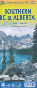
Wegenkaart - landkaart Southern Alberta & Southern British Columbia | ITMB

ITMB, being based in Vancouver, BC, understandably has a local/regional market for our map line. We have a map of Western Canada, as well as an atlas, a very nice map of BC itself, a map of the south half of BC, and a map of part of BC combined with Washington State. What we did not have, until now, was a map covering the most touristically-visited...
13,95

Webshops met dit product

Webshop
Bezorging
Prijs

Anderen bekeken ook

Wegenkaart - landkaart Calgary & Southern Alberta | ITMB
This is a brand new title for ITMB. Calgary is the focus of Canada’s oil industry, the largest city in Alberta, and a major travel hub for international flights. It is the destination of choice for Europeans planning to travel around Western Canada. The city was founded due to the rail line being pushed westward to meet the line being constructed from Vancouver eastward, creating North America’s only trans-continental rail line. The annual Stampede Rodeo held there each July is a highlight of the city’s busy program. The second side of the map covers the southern half of the Province of Alberta and a bit of BC, with an excellent inset map of the town of Banff, and another of the Province’s capital, Edmonton. This map would be perfect for the short-term visitor wishing to explore from the American border to the top of Jasper National Park, and from western Saskatchewan to British Columbia; excellent road coverage, and all attractions noted.   Legend Includes: Port of Entry, University, …
13,95
Wegenkaart - landkaart British Columbia & Alberta Rockies | ITMB
Een degelijke kaart met aanduidingen van o.a. nationale parken, vliegveld, benzinepomp, dirt-roads en kleine plattegrond van hoofdstad. Als overzichtskaart goed te gebruiken.  The Rocky Mountain chain forms the boundary between the Canadian provinces of Alberta and British Columbia. There are only three passes through the mountain chain, which somewhat isolates BC from the rest of Canada (a mixed blessing). The Rockies are also the paramount travel attraction of Canada, nice though our many lakes, waterfalls, and cities happen to be. This double-sided map covers the three national parks of Banff, Jasper, and Yoho, and several provincial parks on both sides of the border, which also forms the continental divide between rivers flowing to the Pacific or to the Atlantic, covering from Calgary to the northern portion of the Fraser Canyon on one side, and the more northerly stretch of the Rockies from Fort St. John to the Yukon. Good inset maps of Calgary, Banff, Jasper, and Lake Louise are …
13,95
Wegenkaart - landkaart Northern British Columbia | ITMB
British Columbia is big! Gargantuan huge, in fact, although it is lightly populated. ITMB published a map of the more densely populated southern half of the province a number of years ago, and we have been asked to give the same emphasis to the northern half ever since. Here it is! Side 1 is of the western portion, including the Alaskan Panhandle, with the route followed by cruise ships heading north and clearly delineates the border between Canada and the USA that nearly erupted into warfare (54 40 or fight). It also shows the Stewart Highway heading north towards the Yukon, with its branch leading to Hyder, Alaska, the only place in the USA that uses Canadian money and does all its banking in Canada. The second side covers the eastern half of BC’s north, with the Alaska Highway starting in Dawson Creek and extending north to Fort Nelson before veering west into the eastern edge of the Rocky Mountains to the Yukon border. This is true wilderness country. It is virtually unpopulated ou…
14,95
Wegenkaart - landkaart Washington State - British Columbia southwest | ITMB
Een degelijke kaart met aanduidingen van o.a. nationale parken, vliegveld, benzinepomp, dirt-roads en campsites. Als overzichtskaart goed te gebruiken. This map hopes to accomplish two goals; first, it is a detailed road and points of interest map for Washington State and adds to our growing range of State covered in detail, and second, it combines that portion of Canada's BC accessible to Americans heading north. The map has two covers so can be marketed either as a USA map title or a Canadian title. The front side covers all of Washington State, with a bit of Oregon and Idaho, and has a decent-sized inset map of downtown Seattle. The reverse side covers much-larger British Columbia - at least a portion of it, including all of Vancouver Island, all the roads from Vancouver eastwards to the Rockies and north to Kamloops, and hundreds of wilderness campsites in the interior. This side also includes insets of Victoria and downtown Vancouver. This map fills a gap in the travel map market …
13,95
Wegenkaart - landkaart 92G Lower Mainland British Columbia - Richmond and New Westminster | ITMB
Goede wegenkaart van British Columbia met topografische uitsnede van Richmond en Westminster. Topographic/Recreation Map 92G&92G2 and G3 - With the 2010 Winter Olympics bearing down on us, this very timely map presents a lovely regional map showing all of the Olympic venues (the Games are being held in Vancouver, Richmond, UBC, Whistler, and the Callaghan Valley – not just in Vancouver). The area of coverage is from Everett (just north of Seattle) in the USA to north of Pemberton, and from Victoria in the west to Chilliwack in the east on the one side, and a detailed 1:50,000 topo map of the Richmond/New Westminster/Surrey/Langley outer urban areas of Metro Vancouver. Both maps are Government of Canada NTS maps, overlaid with touristic and recreational information by ITMB, which holds the copyright on behalf of the Queen (I love being able to say that). The Lower Mainland portion is particularly useful, in that it includes the east coast of Vancouver Island, from Victoria to Nanaimo an…
13,95
Wegenkaart - landkaart Western Canada | ITMB
Een degelijke kaart met aanduidingen van o.a. nationale parken, vliegveld, benzinepomp, dirt-roads. Als overzichtskaart goed te gebruiken. This is actually our second attempt at mapping the western portion of Canada; the first covered everything from northwestern Ontario to the Pacific Ocean and, while it was an excellent map, the scale that such a huge area covered necessitated severe problems. In this version, all of British Columbia, Alberta, and the Yukon have been mapped from fresh digital data and presented at 1:1.4T scale. This would have been impossible when we prepared the first map. The Northwest Territories portion had to be compressed in two ways; first, the scale is 1:2M; second, only the portion with roads is shown. This is still an extremely large area. One has to consider the actual size of Canada when designing a map. Most countries in Europe would fit into this area, which only covers 20% of Canada. The Fort McMurray forest fire of a year ago covered an area larger th…
13,95
Wegenkaart - landkaart Southern Ontario | ITMB
Een degelijke kaart met aanduidingen van o.a. nationale parken, vliegveld, benzinepomp, dirt-roads en kleine plattegrond van hoofdstad. Als overzichtskaart goed te gebruiken. The Canadian province of Ontario is intimidatingly large. It is also mostly tundra with extremely few settlements and few roads; in fact, the geographic centre of Ontario is about 1,500 kms north of the nearest road. The very first map I prepared, at age 10, was of Ontario; and it took me six weeks to trace all the lakes. My point is that the developed portion of the province is a much smaller wedge of fertile ground south of the mineral belt of the Great Canadian Shield. This double-sided map focusses on the area south of Sudbury and North Bay and expands the scale to a much more useful purpose for most users. Imagine Detroit in the southwest corner of the map, with Highway 401 joining it to London and Toronto and a branch motorway cutting across to Buffalo. Add in the Bruce Peninsula and the major routes north t…
13,95
Wegenkaart - landkaart Alberta | ITMB
Een degelijke wegenkaart voor Alberta met aanduidingen van o.a. nationale parken, vliegveld, benzinepomp, dirt-roads. Als overzichtskaart goed te gebruiken. scale 1:1,000,000 Alberta is many different things - a dynamic powerhouse of the Canadian economy, the source of oil in vast quantities, cow country, the Calgary Stampede, the Rockies. Alberta is a real gem in the crown of Canada, and is one of the most popular touristic destinations in North America. This double-sided map shows everything from Head-Smashed-In Buffalo Jump to the dinosaur pits of the badlands around Drumheller, to the foothills resorts close to the national parks of Banff and Jasper, and the gigantic parks themselves. The Province of Alberta is huge in area and exuberant as only a confident entity can be. This is Canada in its glory! A great place to visit, and a great map to explore it with. Printed on paper. Legend Includes: Roads by classification, Airports, Points of Interest, Information Centres, Museums, Camp…
13,95
Wegenkaart - landkaart Idaho, Montana & Wyoming | ITMB
Een degelijke kaart met aanduidingen van o.a. nationale parken, vliegveld, benzinepompen. The northern mountain states of the USA are now the most recent portion of ITMB’s re-mapping of the USA for travel. We had to include a small portion of Washington State and Oregon, due to the shape of Idaho, but the double-sided sheet covers the three states with very little room left over. Side 1 stretches from the Alberta border to Salt Lake City, in Utah, and from west of Spokane to Helena, MT. The 2nd side covers from the Canadian border south to Cheyanne, and is essentially a map of Montana and Wyoming. As such, this is the most detailed map of this region of the USA ever published, and pretty much completes our mapping of the western half of the continental USA. We have also added a new feature – a list of the most popular sites – for those with limited time, showing such well-known features as Glacier National Park and the Buffalo Bill Center of the West. We would be happy to expand this l…
13,95
Wegenkaart - landkaart Laos | ITMB
Een degelijke kaart van Laos met aanduidingen van o.a. nationale parken, vliegveld, benzinepomp, dirt-roads en kleine plattegronden van Vientiane, Luang Prabang we're very pleased to introduce you to this new, double-sided, map at a great scale, with fantastic detail. To me, the north side is the most interesting, covering the portion of Laos from Vientiane, the capital, to the Chinese border. Detailed inset maps of Vientiane and Louang Prabang, the temple city, are included on this side, as are bits of both Thailand and Vietnam. The south portion fills the other side of the sheet, including a goodly portion of Vietnam, showing all border crossings. Much of Thailand has had to be obscured, unfortunately, to make room for the place names index, but the immediate border areas are shown, including the rail line south from Vientiane. In an interesting departure from previous ITMB maps, the back cover consists of a detailed inset map of Vientiane at 1:16,000 scale, making it easy to use in …
13,95

Klanten-reviews van Wegenkaart - landkaart Southern Alberta & Southern British Columbia | ITMB

Er zijn nog geen beoordelingen voor dit productBen jij de eerste die een review plaatst?

Meer over Wegenkaart - landkaart Southern Alberta & Southern British Columbia | ITMB

Productomschrijving

ITMB, being based in Vancouver, BC, understandably has a local/regional market for our map line. We have a map of Western Canada, as well as an atlas, a very nice map of BC itself, a map of the south half of BC, and a map of part of BC combined with Washington State. What we did not have, until now, was a map covering the most touristically-visited part of all of Canada – namely, the southern halves of both British Columbia and its neighbour, Alberta, with a small amount of Washington State, Idaho, and Montana (to assist those heading north and needing to know about border crossings). Therefore, ITMB is pleased to announce the release of Southern BC and Alberta. Side One covers BC from the US border (with a carry-on to Seattle) north to Prince George and east to the Alberta border, with a carry-on to Calgary. All of Vancouver Island, the Okanagan Valley, and the Rock Mountain National Parks of Banff and Jasper, are included. The map is rich with wilderness campsite (almost 1,000 are shown, ski areas, fishing areas, even gas stations in more remote parts of the vast province. Side Two covers Alberta from somewhat north of Edmonton (the provincial capital) to the American border and a bit beyond, and from the Rocky Mountains east to a bit beyond the Saskatchewan border. This side focusses on the movement from the high Rockies to the foothills and plains of the enormous Canadian Prairies The highlights of this side of the map are showcased in our Top Attractions guide and include such world-class features as the Drumheller Dinosaur Museum, the world’s best, to the Columbia Icefield, one of the few in the world easily accessible to walk on. Naturally, the road network, train lines, urban areas, parks, and numerous attractions (who could pass up visiting Head-Smashed-In Buffalo Jump?) are all clearly shown.
Webshop.nl maakt gebruik van cookies. Ga je verder op onze website, ga dan akkoord met het plaatsen van cookies en de verwerking van deze data door ons en vermelde partners.