webshop.nl
Categorieën
  Sluiten

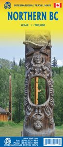
Wegenkaart - landkaart Northern British Columbia | ITMB

British Columbia is big! Gargantuan huge, in fact, although it is lightly populated. ITMB published a map of the more densely populated southern half of the province a number of years ago, and we have been asked to give the same emphasis to the northern half ever since. Here it is! Side 1 is of the western portion, including the Alaskan Panhandle, ...
14,95

Webshops met dit product

Webshop
Bezorging
Prijs

Anderen bekeken ook

Wegenkaart - landkaart Washington State - British Columbia southwest | ITMB
Een degelijke kaart met aanduidingen van o.a. nationale parken, vliegveld, benzinepomp, dirt-roads en campsites. Als overzichtskaart goed te gebruiken. This map hopes to accomplish two goals; first, it is a detailed road and points of interest map for Washington State and adds to our growing range of State covered in detail, and second, it combines that portion of Canada's BC accessible to Americans heading north. The map has two covers so can be marketed either as a USA map title or a Canadian title. The front side covers all of Washington State, with a bit of Oregon and Idaho, and has a decent-sized inset map of downtown Seattle. The reverse side covers much-larger British Columbia - at least a portion of it, including all of Vancouver Island, all the roads from Vancouver eastwards to the Rockies and north to Kamloops, and hundreds of wilderness campsites in the interior. This side also includes insets of Victoria and downtown Vancouver. This map fills a gap in the travel map market …
13,95
Wegenkaart - landkaart Southern Alberta & Southern British Columbia | ITMB
ITMB, being based in Vancouver, BC, understandably has a local/regional market for our map line. We have a map of Western Canada, as well as an atlas, a very nice map of BC itself, a map of the south half of BC, and a map of part of BC combined with Washington State. What we did not have, until now, was a map covering the most touristically-visited part of all of Canada – namely, the southern halves of both British Columbia and its neighbour, Alberta, with a small amount of Washington State, Idaho, and Montana (to assist those heading north and needing to know about border crossings). Therefore, ITMB is pleased to announce the release of Southern BC and Alberta. Side One covers BC from the US border (with a carry-on to Seattle) north to Prince George and east to the Alberta border, with a carry-on to Calgary. All of Vancouver Island, the Okanagan Valley, and the Rock Mountain National Parks of Banff and Jasper, are included. The map is rich with wilderness campsite (almost 1,000 are sh…
13,95
Wegenkaart - landkaart Alaska's Inside Passage | ITMB
Een degelijke kaart met aanduidingen van o.a. nationale parken, vliegveld, benzinepomp, dirt-roads en kleine plattegronden van Anchorage, Seattle, Vancouver en Victoria. Als overzichtskaart goed te gebruiken.    We recently released our USA Pacific Coast Map, covering the segment between San Diego and Vancouver. This map completes the mapping of the Pacific Ocean coastline by mapping the routes followed by cruise ships and Alaska Ferries heading north from Seattle and Vancouver to Alaska. This is a double-sided map, with Vancouver Island and the coastline as far north as Prince Rupert on one side (with inset maps of Seattle, Victoria, and Vancouver)on side 1, and the coastline north to Glacier Bay and an onward inset map to Anchorage (including an inset map of the city) on the second side. As the actual routes followed by the numerous cruise lines vary, we can't show their actual sailing routes, but they generally follow the coastline within viewing distance of either the mainland or c…
13,95
Wegenkaart - landkaart Western Canada | ITMB
Een degelijke kaart met aanduidingen van o.a. nationale parken, vliegveld, benzinepomp, dirt-roads. Als overzichtskaart goed te gebruiken. This is actually our second attempt at mapping the western portion of Canada; the first covered everything from northwestern Ontario to the Pacific Ocean and, while it was an excellent map, the scale that such a huge area covered necessitated severe problems. In this version, all of British Columbia, Alberta, and the Yukon have been mapped from fresh digital data and presented at 1:1.4T scale. This would have been impossible when we prepared the first map. The Northwest Territories portion had to be compressed in two ways; first, the scale is 1:2M; second, only the portion with roads is shown. This is still an extremely large area. One has to consider the actual size of Canada when designing a map. Most countries in Europe would fit into this area, which only covers 20% of Canada. The Fort McMurray forest fire of a year ago covered an area larger th…
13,95
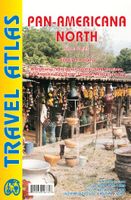
Wegenkaart - landkaart - Wegenatlas Pan-Americana North | ITMB
Wegenatlas - A5 formaat - verschillende schalen - voor de het Noord-Amerikaanse gedeelte van de Pan-Americana ( Pan-American Highway ) van Alaska langs the Pacific kust van British Colombia in Canada, de staten Washington, Oregon en Californie, Mexico, Guatemala tot Panama.   The Pan-American Highway was created by the USA to improve road communications within the Western Hemisphere post-WW2. The highway started at the Mexican border and eventually reached somewhere south of Santiago in Chile. It was a vote-buying gimmick by the Americans to fund allies, but it also created an essential 'spine' road through Central America to the Darien Gap and along the west coast of South America to the then-limits of Chile. Driving the Pan-Am has become a travel experience. More recently, the improvement in more northerly highways, such as the Dalton Highway from Fairbanks to Prudhoe Bay in Alaska, the paving of most of the Stewart Highway through British Columbia, and the tremendous improvement in …
16,50
Wegenkaart - landkaart Nunavut - Northwest Territories | ITMB
The far north of Canada, north of 60 degrees, consists of three territories; the Yukon, the Northwest Territories, and Nunavut. Until now, there has never been a proper map of the territory that was carved off from the NWT a quarter century ago. With only 30,000 people and a scattering of settlements, Nunavut is larger than western Europe in area. This map took us years to prepare, using 1:250,000 government topo maps as a base and tracing thousands of little lakes. The traditional passageway of the fabled Northwest Passage is also shown. The most northerly civilian community in the world is on the map – Grise Bay, as well as Alert, the most remote place on earth. Originally, the NWT covered all of northwestern North America west of the Louisiana Purchase and the Loyalist colonies, and north of the Spanish provinces (essentially north of current day Sactamento). Political changes have reduced its size over the past century and a half to the region of Canada north of the 60th parallel a…
13,95
Wandelkaart 02 Columbia Icefield | Gem Trek Maps
Waterproof and tear-resistant hiking and recreation map for the Columbia Icefield region of the Canadian Rockies.   Updated with the latest satellite imagery of the icefield extent, Gem Trek's Columbia Icefield Map is designed for visitors looking to explore North America s largest icefield south of Alaska. Located beside the Icefields Parkway in Jasper National Park, the icefield is both spectacular and accessible. Whether you are touring along the parkway and taking an Ice Explorer out onto the Athabasca Glacier or heading off to explore the surrounding wilderness on foot, you'll find the waterproof and tear-resistant Columbia Icefield an invaluable tool for making the most of your visit.   The Columbia Icefield Map features detailed cartography, accurate hiking trails with distances, and details such as glacier flow direction and drainage routes. Campgrounds and highway viewpoints are also marked.   In addition to the map, this product is a user-friendly guide to the Columbia Icefie…
14,95
Wegenkaart - landkaart Western Australia | ITMB
The State of Western Australia occupies the western third of the continental country of Australia. The main city is Perth, in the southwest portion, and this is the part of the State with the best land and the most people. Much of the interior is arid desert-like grassland with shallow lakes that often dry out. The road network in the south is generally paved highways and secondary roads, with one road and one rail line heading east to SZ and the rest of the country. Roads in the north tend to be dirt, with the exception of the highway going towards Darwin in NT. There are no roads through the Great Sandy Desert, but the Canning Stock Route crosses the eastern fringe, going north-south. One needs an expensive permit to drive this hazardous track. Most of the attractions of the State are to be found fairly close to the coastline. Most of the larger urban areas tend to have been named after British places, such as Albany, Exmouth, and Port Hedland, but many names have been adopted from a…
13,95
Wegenkaart - landkaart 92G Lower Mainland British Columbia - Richmond and New Westminster | ITMB
Goede wegenkaart van British Columbia met topografische uitsnede van Richmond en Westminster. Topographic/Recreation Map 92G&92G2 and G3 - With the 2010 Winter Olympics bearing down on us, this very timely map presents a lovely regional map showing all of the Olympic venues (the Games are being held in Vancouver, Richmond, UBC, Whistler, and the Callaghan Valley – not just in Vancouver). The area of coverage is from Everett (just north of Seattle) in the USA to north of Pemberton, and from Victoria in the west to Chilliwack in the east on the one side, and a detailed 1:50,000 topo map of the Richmond/New Westminster/Surrey/Langley outer urban areas of Metro Vancouver. Both maps are Government of Canada NTS maps, overlaid with touristic and recreational information by ITMB, which holds the copyright on behalf of the Queen (I love being able to say that). The Lower Mainland portion is particularly useful, in that it includes the east coast of Vancouver Island, from Victoria to Nanaimo an…
13,95
Wegenkaart - landkaart Sunshine Coast - British Columbia | ITMB
Mooi autokaart in overzichtelijke kleur van ITMB. Indexed. English text and legends. The coastline of Canada’s British Columbia is long and varied. The best-known portion is the part just north and west of Vancouver, known as the Sunshine Coast. The rugged Coast Mountain Range makes road-building impractical for much of the interior, so communities such as Gibsons, Sechelt, and Powell River are joined together by Highway 101 and by ferries. Many Fiords take kayakers deep into pristine wilderness areas, and former logging roads are now commonly used for wilderness hikes. The famous Strait of Georgia, used by cruise ships to Alaska, cuts through the middle of the map, with the largely unpopulated and wild Bute Inlet leading TO Waddington Glacier and the vast Homathko Icefield. Side 2 of the map covers southwestern BC, including all of Vancouver Island and the southern interior as far as Nelson and north to 100 Mile House. Insets of downtown Vancouver and Victoria are included.   Legend I…
13,95

Klanten-reviews van Wegenkaart - landkaart Northern British Columbia | ITMB

Er zijn nog geen beoordelingen voor dit productBen jij de eerste die een review plaatst?

Meer over Wegenkaart - landkaart Northern British Columbia | ITMB

Productomschrijving

British Columbia is big! Gargantuan huge, in fact, although it is lightly populated. ITMB published a map of the more densely populated southern half of the province a number of years ago, and we have been asked to give the same emphasis to the northern half ever since. Here it is! Side 1 is of the western portion, including the Alaskan Panhandle, with the route followed by cruise ships heading north and clearly delineates the border between Canada and the USA that nearly erupted into warfare (54 40 or fight). It also shows the Stewart Highway heading north towards the Yukon, with its branch leading to Hyder, Alaska, the only place in the USA that uses Canadian money and does all its banking in Canada. The second side covers the eastern half of BC’s north, with the Alaska Highway starting in Dawson Creek and extending north to Fort Nelson before veering west into the eastern edge of the Rocky Mountains to the Yukon border. This is true wilderness country. It is virtually unpopulated outside of small towns. One can drive for hours and never see another vehicle. It rings with images such as the Chilcoot Trail to the goldfields, or the arduous wartime track created as a land bridge to defend Alaska in case of invasion. It would take a full day to drive from the south to the north of this map. This is a ‘must have’ map for any store considering itself a focal point for adventure travel.  
Webshop.nl maakt gebruik van cookies. Ga je verder op onze website, ga dan akkoord met het plaatsen van cookies en de verwerking van deze data door ons en vermelde partners.