webshop.nl
Categorieën
  Sluiten

Wegenkaart - landkaart Laos | ITMB

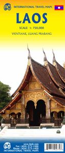
Een degelijke kaart van Laos met aanduidingen van o.a. nationale parken, vliegveld, benzinepomp, dirt-roads en kleine plattegronden van Vientiane, Luang Prabang we're very pleased to introduce you to this new, double-sided, map at a great scale, with fantastic detail. To me, the north side is the most interesting, covering the portion of Laos from ...
13,95

Webshops met dit product

Webshop
Bezorging
Prijs

Anderen bekeken ook

Wegenkaart - landkaart Vietnam - Laos - Cambodia | ITMB
Een degelijke kaart met aanduidingen van o.a. nationale parken, vliegveld, benzinepomp, dirt-roads. Als overzichtskaart goed te gebruiken. The former French-dominated region of Indochina evolved into three separate countries in the early 1950s. Vietnam, Laos, and Cambodia still retain strong ties and it is easy to travel from one country to another. Each has its particular charm, with a Top Attractions list highlighting the most popular attractions. Side 1 concentrates on the southern portion of the region and includes an inset map of Ho Chi Minh City; the second side covers the area from Sien Riep in Cambodia to the Chinese border areas of both Laos and Vietnam. An inset map of Hanoi is one this side. The region is prospering after many years of civil unrest, is friendly, safe, and easy to reach since Covid restrictions were removed last year. The new Chinese-built rail line through northern Laos to Chiang Kong in Thailand, and to Vientiane, Laos, is shown for the first time. This lin…
13,95
Wegenkaart - landkaart Laos - The Mekong River: from source to sea | Odyssey
Laos has been discovered. For centuries this land-locked country in southeast Asia was a sleepy, almost forgotten little principality, sometimes wielding great power but mostly fighting for survival against predatory neighbors. It survived the American Indochina War and emerged as a progressive socialist country. This remote, mountainous country, protected from the ravages of tourism and rapid development, remains pristine and exotic. Laos is still green; its rivers mostly run free. But if you want to see the old Laos you have to move fast. Lovely Laos is located at the heart of romantic Indo-Chine. A precious pearl of a country blessed with natural beauty, exotic flora and rare fauna, Laos also hosts the mighty Mekong river for the larger part of its almost 5,000 kilometre journey from the Tibetan Plateau to the distant sea. Whether you chose to travel Laos by land or by water or both, this illustrated map will enhance your journey both as a pre-trip planner and as a post-trip souveni…
14,95
Reisgids Vietnam, Cambodia, Laos & Northern Thailand | Lonely Planet
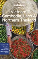
De perfecte reisgids voor zowel de georganiseerde als de zelfstandige reiziger. Naast een algemene inleiding van het land / streek vol met praktische informatie over hoe je er het beste kunt reizen: slapen, eten, vervoer, excursies ... alles kun je er in vinden. De reisgids beschrijft naast Vietnam, Cambodja en Laos ook nog het noorden van Thailand. The Mekong – it’s an exotic name guaranteed to fire up the imagination, with such iconic sights as Angkor Wat, Halong Bay and Luang Prabang. Lonely Planet will get you to the heart of Vietnam, Cambodia, Laos & Northern Thailand, with amazing travel experiences and the best planning advice.   Lonely Planet Vietnam, Cambodia, Laos & Northern Thailand is your passport to the most relevant, up-to-date advice on what to see and skip, and what hidden discoveries await you.   Visit Bangkok, one of Southeast Asia’s most buzzing cities, sail past the limestone peaks of Halong Bay, or experience the transcendent tranquillity of Angkor Wat; all with y…
23,95
Wegenkaart - landkaart South East Asia - Zuid Oost Azië | ITMB
  Een degelijke kaart met aanduidingen van o.a. nationale parken, vliegveld, benzinepomp en dirt-roads. Als overzichtskaart goed te gebruiken. Met Laos, Cambodja, Vietnam, Thailand, Maleisië, Filipijnen en Indonesië.   The part of the world from southern China, through the Indo-Chinese peninsula, and sweeping through the Indonesian archipelago to the hundreds of islands comprising the Philippines, is a fascinating part of the world to map. Countless cultures interact in this vast region - the mountain people along the Vietnamese/Laotian border, the fisherman of coastal regions and islands, the lovely and gentle Balinese, and the business-like Javanese. This is an extremely important part of the world - touristically attractive, economically thriving, and scenically unbeatable. This latest edition will be useful for anyone visiting the region. It is detailed, printed double-sided. This map has proven to be a better seller than expected, necessitating a review. We keep the same cover, sa…
13,95
Wegenkaart - landkaart Cambodia & Mekong Delta | ITMB
Een degelijke kaart met aanduidingen van o.a. nationale parken, vliegveld, benzinepomp, dirt-roads en kleine plattegronden van de hoofdsteden.   Tourism to Cambodia is growing so quickly that we felt it necessary to bring back the country as its own map, instead of being combined with Laos. However, the entire country fits very nicely on one side of a map sheet, so we have combined it with neighboring Vietnam's Mekong Delta map. There are two treasures in Cambodia: the Angkor Wat complex of temples near Siem Riep, and the Capital of Phnom Penh. Cambodia became extremely destabilized by the Vietnam War in the 1960s, leading to a rebellion that placed the murderous Khmer Rouge in charge. This led to massive atrocities and de-populated all towns, killing millions. Siem Riep is a thriving touristic city, and UNESCO manages the Angkor complex very well. The capital has mostly recovered, but still retains the sleepy colonial atmosphere of the French era. River boats ply the Mekong River and …
13,95
Wegenkaart - landkaart Palestine & Jerusalem - Palestina | ITMB
This is a new title for ITMB and the first time a separate map for that portion of the area known as Palestine and controlled by Palestinians has been published. This is essentially an attempt to show a political reality that exists, in that no one denies that both the West Bank and the Gaza Strip exist, albeit as a tightly-controlled entity that is not a country in the traditional sense of the word but is, nonetheless the homeland of millions of people and a self-governing entity. Jerusalem has been shown as an entity, without a border, in order to emphasize its importance as a unifying point of three great religions. Barricades do exist within the city, but these exist mostly to prevent clashes and reduce frictions, and we prefer to concentrate our hopes for Jerusalem as a future symbol of unity. Geographically, to fit both the southerly Gaza Strip area and the northerly West Bank portion together, it has been necessary to include large portions of Israel proper. The border has been …
13,95
Wegenkaart - landkaart Kamchatka Peninsula & Russia Far east | ITMB
Een degelijke kaart met aanduidingen van o.a. nationale parken, vliegveld, benzinepomp, dirt-roads en kleine plattegrond van hoofdstad. Als overzichtskaart goed te gebruiken. Schaal: Kamchatka 1 : 1,700.000 & Eastern Siberia 1 : 3.600.000 This is the most recently released title in our Russia series. In this revised edition, we have expanded the area of coverage to include the portion of Russia known as the Far East Republic and the eastern portions of Siberia (in January, we released Siberia itself). Lets start with the Kamchatka peninsula itself. This is a very interesting adventure travel destination, famous for its geothermal geysers and its isolation from the rest of Russia. There is only one city of any size, Petropavlovsk Kamchatsky (which I genuinely hope is colloquially known as PK), the capital and location of the peninsula only significant airport. We have included an inset map of the city. We also include a map of the famous Valley of Geysers (south of Klyuchi). Interesting…
13,95
Wegenkaart - landkaart Egypt & Cairo | ITMB
Following the so-called Arab spring of a few years ago, northern Africa experienced much turbulence. Egypt experienced the overthrow of the government, the installation of a radical religious-oriented replacement, and the installation of military governance. Tourism plummeted. Most map publishers discontinued their maps of the country. Five years later, Egypt has stabilized and tourism is growing. We feel that the time is right to re-introduce our ITMB map of Egypt. This version focuses on the portions of the country that have been re-opened for tourism, which means from the Mediterranean coastline south to the Aswan Dam. The portion further south remains closed for the moment, as is the border crossing with Sudan. We have also been forced to leave off the Great Sand Sea and the Western Desert portions for the same reason of unrest, as the border areas with Libya remain very unstable. However, we have provided a large inset map of Egypt, covering everything, in the area of desert. We h…
13,95
Wegenkaart - landkaart Washington State - British Columbia southwest | ITMB
Een degelijke kaart met aanduidingen van o.a. nationale parken, vliegveld, benzinepomp, dirt-roads en campsites. Als overzichtskaart goed te gebruiken. This map hopes to accomplish two goals; first, it is a detailed road and points of interest map for Washington State and adds to our growing range of State covered in detail, and second, it combines that portion of Canada's BC accessible to Americans heading north. The map has two covers so can be marketed either as a USA map title or a Canadian title. The front side covers all of Washington State, with a bit of Oregon and Idaho, and has a decent-sized inset map of downtown Seattle. The reverse side covers much-larger British Columbia - at least a portion of it, including all of Vancouver Island, all the roads from Vancouver eastwards to the Rockies and north to Kamloops, and hundreds of wilderness campsites in the interior. This side also includes insets of Victoria and downtown Vancouver. This map fills a gap in the travel map market …
13,95
Wegenkaart - landkaart 770 Vietnam - Laos - Cambodja | Michelin
Zoals je van Michelin mag verwachten is deze kaart zeer overzichtelijk en heeft een duidelijk helder kaartbeeld. De kaart geeft uitgebreide toeristische informatie weer. De perfecte overzichtskaart!   This Vietnam - Laos - Cambodia map from Michelin is part of their red national map series. These are perfect for route planning as well as getting around by car once you're there. They clearly mark out major roads and also show many of the more important minor roads. A street plan of central Lima that highlights the city's mai attractions is included.   The map's simple folding design with durable paper cover, allows it to be read like a book and easily folded back together. Road numbers and intermediate distances are clearly displayed with the more scenic routes highlighted in green.   The map also features:   Political boundaries Regional and National Parks Important sights (points of interest, historic sites, etc.) Driving Times and Distances Road Safety Information A legend in multipl…
12,95

Klanten-reviews van Wegenkaart - landkaart Laos | ITMB

Er zijn nog geen beoordelingen voor dit productBen jij de eerste die een review plaatst?

Meer over Wegenkaart - landkaart Laos | ITMB

Productomschrijving

Een degelijke kaart van Laos met aanduidingen van o.a. nationale parken, vliegveld, benzinepomp, dirt-roads en kleine plattegronden van Vientiane, Luang Prabang we're very pleased to introduce you to this new, double-sided, map at a great scale, with fantastic detail. To me, the north side is the most interesting, covering the portion of Laos from Vientiane, the capital, to the Chinese border. Detailed inset maps of Vientiane and Louang Prabang, the temple city, are included on this side, as are bits of both Thailand and Vietnam. The south portion fills the other side of the sheet, including a goodly portion of Vietnam, showing all border crossings. Much of Thailand has had to be obscured, unfortunately, to make room for the place names index, but the immediate border areas are shown, including the rail line south from Vientiane. In an interesting departure from previous ITMB maps, the back cover consists of a detailed inset map of Vientiane at 1:16,000 scale, making it easy to use in the city without having to unfold the map sheet. Laos, as a country, has an exceptionally rich history, with the exotic Plain of Jars, the enormous temples, and in its involvement in the Vietnam War. This is a country well worth a visit and now it has a map enticing everyone to visit!   Legend Includes: Museum, Place of interest, Cave, Grotto, Pagoda, Temple, World Heritage, Hot Spring, Church, Waterfall, Port, Dock, Ferry, Lighthouse, Beach, Diving, Elephant Santuary etc,.
Webshop.nl maakt gebruik van cookies. Ga je verder op onze website, ga dan akkoord met het plaatsen van cookies en de verwerking van deze data door ons en vermelde partners.