webshop.nl
Categorieën
  Sluiten

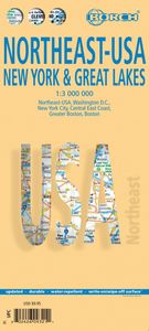
Wegenkaart - landkaart Noordoost USA - Northeast USA | Borch

Mooie geplasticieerde kaart van het Noordoosten van de USA. Deze kaart biedt een goed overzicht van het land met detailkaarten.   Our soft-laminated folded map of Northeast-USA - New York & Great Lakes shows: Northeast USA 1:3 000 000, Greater Boston 1:1 000 000, Central East Coast 1:1 000 000, Boston 1: 14 000, New York City 1:20 000, Washington D...
11,50

Webshops met dit product

Webshop
Bezorging
Prijs

Anderen bekeken ook

Wegenkaart - landkaart USA Northeast - Noordoost USA | ITMB
Een degelijke wegenkaart van het noordoosten van de USA. (1:1.000.000) met aanduidingen van o.a. nationale parken, vliegveld, benzinepomp, dirt-roads. Als overzichtskaart goed te gebruiken. (1:1.000.000 Scale) including adjacent US states and bordering Canada . We started it wanting to do a map of just New England, but that will have to be a future title. By the shape of the USA, the New England States fill most of one side of the map, but New York City and Philadelphia are included as well as a goodly portion of New York State. The second side covers the rest of the state, plus all of New Jersey, Delaware, Maryland, Pennsylvania, and most of Ohio, West Virginia and the northern portion of Virginia. In terms of cities, Cincinnati is at the bottom left of the sheet and Richmond at the bottom right, with Detroit at upper left and Albany at upper right. The value of this map for visitors is that it covers a reasonably comprehensive portion of the USA, stretching as it does from northern M…
13,95
Wegenkaart - landkaart USA Interstate | Borch
Mooie, overzichtelijke wegenkaart van de snelwegen in Amerika. Handig als je grote afstanden in het land moet afleggen.   Our soft-laminated folded map of the USA in the 9th edition shows: USA West, USA East, Hawaiian Islands, Puerto Rico each 1:4 000 000, Alaska 1:8 000 000, USA administrative & time zones. Borch Maps are easy to fold, durable and water-repellent with a wipeable surface. Borch Maps show hotels, museums, monuments, markets, public transport, top sights and points of interest, useful statistics, conversion charts for temperatures, weights and measurements, climate charts showing temperatures, sunshine hours, precipitation and humidity, overview maps, time zones, and much more...   "Get your motor running, head out on the highway"! The Interstate highway system (officially the "Dwight D. Eisenhower National System of Interstate and Defense Highways") authorized by the Federal Aid Highway Act of 1956 and supported by former US President Eisenhower who had been impressed b…
11,50
Wegenkaart - landkaart Southwest-USA - Zuidwest USA | Borch
Mooie geplasticieerde kaart van het Zuidwesten van de USA. Deze kaart biedt een goed overzicht van het land met detailkaarten.   Our soft-laminated folded map of the American Southwest shows: American Southwest 1:3 000 000, Phoenix 1:20 000, San Francisco Bay Area 1:400 000, San Francisco 1:15 000, Greater Los Angeles 1:250 000, San Diego 1:125 000, San Diego Downtown 1:25 000, Las Vegas - The Strip 1:22 000, Grand Canyon National Park 1:250 000, USA administrative & time zones. Borch Maps show hotels, museums, monuments, markets, public transport, top sights and points of interest, useful statistics, conversion charts for temperatures, weights and measurements, climate charts showing temperatures, sunshine hours, precipitation and humidity, overview maps, time zones, and much more...   From the panoramas of San Francisco and the buzz of megametropolis Los Angeles to the charm of San Diego on the Mexican border - the Californian coast boasts sun, beautiful beaches, stunning scenery and…
11,50
Stadsplattegrond New York City | Borch
Borch New York City is een duidelijke, geplastificeerde plattegrond van het centrum van New York (Manhattan) en nog een stukje van Brooklyn en Queens met informatie over openbaar vervoer en bezienswaardigheden. Inclusief straatnamenregister.   Our soft-laminated folded map of New York City shows: Central New York City 1:15 000, Flushing Meadows 1:15 000, Five Boroughs 1:100 000, Public Transport New York City, USA administrative & time zones. Borch Maps are easy to fold, durable and water-repellent with a wipeable surface. Borch Maps show hotels, museums, monuments, markets, public transport, top sights and points of interest, useful statistics, conversion charts for temperatures, weights and measurements, climate charts showing temperatures, sunshine hours, precipitation and humidity, overview maps, time zones, and much more...   Nicknamed "The Big Apple", NYC is the most populous city in the United States. Situated in the state of New York, the city has served as the gateway to the U…
10,25
Stadsplattegrond Manhattan (New York City) | Borch
Borch Manhattan is een duidelijke, geplastificeerde plattegrond met informatie over openbaar vervoer en bezienswaardigheden. Inclusief straatnamenregister.   Our soft-laminated folded map of Manhattan shows: Manhattan (Lower & Midtown) 1:15 000, Manhattan (Upper) 1:15 000, Midtown 1:10 000, Financial District 1:9 000, Public Transport New York City, USA administrative & time zones, Manhattan Zip-Codes, USA administrative & time zones and the Top 30 Sights. Borch Maps are easy to fold, durable and water-repellent with a wipeable surface. Borch Maps show hotels, museums, monuments, markets, public transport, top sights and points of interest, useful statistics, conversion charts for temperatures, weights and measurements, climate charts showing temperatures, sunshine hours, precipitation and humidity, overview maps, time zones, and much more...   Manhattan is one of the five boroughs of New York City (the other four boroughs are the Bronx, Queens, Brooklyn and Staten Island) and on a lan…
10,25
Stadsplattegrond Boston | Borch
Borch Boston is een duidelijke, geplastificeerde plattegrond van het centrum met informatie over openbaar vervoer en bezienswaardigheden. Inclusief straatnamenregister.   Our soft-laminated folded map of Boston shows: Boston Downtown 1:11 000, Eastern Massachusetts 1:600 000, Boston and Region 1:200 000, Logan International Airport 1:33 000, Public Transport Boston, Top 30 Sights and USA administrative and time zones. Borch maps are easy to fold, durable and water-repellent with a wipeable surface. Borch Maps show hotels, museums, monuments, markets, top sights and points of interest, useful statistics, conversion charts for temperatures, weights and measurements, climate charts showing temperatures, sunshine hours, precipitation and humidity, overview maps, time zones, and much more...   Founded in 1630, Boston is often referred to as the cradle of American democracy, due to major events having taken place here during the American Revolution. Boston is an important port and manufactur…
10,25
Wegenkaart - landkaart India Noord | Borch
Mooie geplasticieerde kaart van het noorden van India. Deze kaart biedt een goed overzicht van het land met detailkaarten.   Our soft-laminated folded map of India North shows: India North 1:3 000 000, Delhi 1:30 000, Mumbai 1:30 000, Kolkata 1:30 000, Jaipur 1:30 000, Agra 1:30 000, Varanasi 1:30 000, Amritsar 1:30 000, Jodhpur 1:30 000, Udaipur 1:30 000, Bodhgaya 1:15 000 and India administrative and time zones. Borch maps are easy to fold, durable and water-repellent with a wipeable surface. Borch Maps show hotels, museums, monuments, markets, public transport, top sights and points of interest, useful statistics, conversion charts for temperatures, weights and measurements, climate charts showing temperatures, sunshine hours, precipitation and humidity, overview maps, time zones, and much more...   Northern India is bordered by Pakistan to the west, China, Nepal and Bhutan to the north, and Bangladesh and Myanmar to the east. Hindi and English are the two official languages. After …
11,50
Wegenkaart - landkaart Californië - California | Borch
Mooie geplasticieerde kaart van Californië. Deze kaart biedt een goed overzicht van dit deel van de Verenigde Staten met detailkaarten.   Our soft-laminated folded map of California shows: California North 1:1 200 000, California South 1:1 200 000, Yosemite National Park 1:675 000, USA administrative and time zones. Borch Maps are easy to fold, durable and water-repellent with a wipeable surface. Borch Maps show hotels, museums, monuments, markets, public transport, top sights and points of interest, useful statistics, conversion charts for temperatures, weights and measurements, climate charts showing temperatures, sunshine hours, precipitation and humidity, overview maps, time zones, and much more...   Mountains, ocean, forest, desert - California has everything to offer the visitor. And in Los Angeles, anything is possible: lying on Venice Beach in the morning, skiing in the nearby San Gabriel Mountains in the afternoon, a visit to Disneyland, an exciting tour through Universal Stud…
11,50
Wegenkaart - landkaart Hawaiian Islands - Hawaiï | Borch
Mooie geplasticieerde kaart van Hawaiï. Deze kaart biedt een goed overzicht van deze eilanden met detailkaarten.   Our soft-laminated folded map of Hawaii shows: Hawaii (Big Island) 1:400 000, Kilauea Caldera 1:150 000, Hilo 1:70 000, Maui, Molokai / Lanai / Kahoolawe 1:200 000, Wailuku & Kahului 1:35 000, Hawaiian Islands 1:4 000 000, Niihau 1:400 000, Kauai / Oahu 1:200 000, Honolulu & Pearl Harbour 1:26 000, Honolulu Downtown 1:15 500, USA administrative & time zones. Borch Maps are easy to fold, durable and water-repellent with a wipeable surface. Borch Maps show hotels, museums, monuments, markets, public transport, top sights and points of interest, useful statistics, conversion charts for temperatures, weights and measurements, climate charts showing temperatures, sunshine hours, precipitation and humidity, overview maps, time zones, and much more...   Borne of fire and water barely 300 million years ago, the eight islands of the Hawaiian Archipelago together form the 50th US st…
11,50
Wegenkaart - landkaart 04 New England & Atlantic Noordoost USA | Hallwag
Uitstekende wegenkaart waarbij de Europese kleurstelling de kaart zeer prettig leesbaar maken i.v.m. met Amerikaanse kaartenmakers. Deze kaart is eenzijdig bedrukt. Op de kaart is informatie te vinden waar allerlei voorzieningen te vinden zijn (d.m.v. symbolen), zoals campings, picknickplaatsen, informatiecentra, luchthavens enz. Bij de kaart zit een apart boekje met een aantal kleine stadsplattegronden, informatie over Nationale Parken en overige informatie voor toeristen. Met Maine, New Hampshire, Vermont, New York, Massachusetts, Rhode Island, Connecticut, Pennsylvania, New Jersey and large Maryland and Delaware. These new, region by region "USA Road Guides", on a scale of 1 : 1 mio, provide up-to-date, detailed road maps with lots of tourist information. Transit and city maps, as well as detailed maps of national parks, are included in the map layout. The map package also includes a mileage chart with travelling times between major cities, and a brochure with an index of places, tr…
14,50

Klanten-reviews van Wegenkaart - landkaart Noordoost USA - Northeast USA | Borch

Er zijn nog geen beoordelingen voor dit productBen jij de eerste die een review plaatst?

Meer over Wegenkaart - landkaart Noordoost USA - Northeast USA | Borch

Productomschrijving

Mooie geplasticieerde kaart van het Noordoosten van de USA. Deze kaart biedt een goed overzicht van het land met detailkaarten.   Our soft-laminated folded map of Northeast-USA - New York & Great Lakes shows: Northeast USA 1:3 000 000, Greater Boston 1:1 000 000, Central East Coast 1:1 000 000, Boston 1: 14 000, New York City 1:20 000, Washington DC 1:15 000, USA administrative & time zones. Borch maps are easy to fold, durable and water-repellent with a wipeable surface. Borch Maps show hotels, museums, monuments, markets, public transport, top sights and points of interest, useful statistics, conversion charts for temperatures, weights and measurements, climate charts showing temperatures, sunshine hours, precipitation and humidity, overview maps, time zones, and much more...   From Philadelphia's Independence Park to Boston's Freedom Trail, New York's Federal Hall to Washington's Capitol Hill, from the Potomac to the "honeymooners' paradise" of Niagara Falls, New England and the mid-Atlantic States are brimming with history and tantalising beauty. Those who want to escape the frenetic pace of New York and Boston will be delighted by New England's old charm: the timeless beauty of "America's Rhine" (Hudson River Valley north of New York); the wildlife refuges of Long Island; the unique flavour of Cape Cod; the historic cities of Worcester and Providence. Washington D.C., the nation's magnificent capital, provides opportunity for fascinating excursions into the beautiful history-laden hinterland, including Manassas and Fredericksburg - former battlefields of the Civil War, Pennsylvania Dutch Country, the intriguing Appalachian ridges where the first Irish and German settlers established their roots and the enchanting scenery around Virginia's Tidewater region.  
Webshop.nl maakt gebruik van cookies. Ga je verder op onze website, ga dan akkoord met het plaatsen van cookies en de verwerking van deze data door ons en vermelde partners.