webshop.nl
Categorieën
  Sluiten

Wegenkaart - landkaart Southwest-USA - Zuidwest USA | Borch

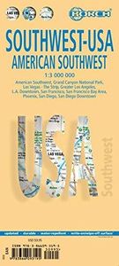
Mooie geplasticieerde kaart van het Zuidwesten van de USA. Deze kaart biedt een goed overzicht van het land met detailkaarten.   Our soft-laminated folded map of the American Southwest shows: American Southwest 1:3 000 000, Phoenix 1:20 000, San Francisco Bay Area 1:400 000, San Francisco 1:15 000, Greater Los Angeles 1:250 000, San Diego 1:125 000...
11,50

Webshops met dit product

Webshop
Bezorging
Prijs

Anderen bekeken ook

Wegenkaart - landkaart Noordwest USA - Northwest USA | Borch
Mooie geplasticieerde kaart van het Noordwesten van de USA. Deze kaart biedt een goed overzicht van het land met detailkaarten. Our soft-laminated map of USA Northwest - USA 1 includes: Pacific Northwest 1:3 000 000, San Francisco 1:15 000, San Francisco Bay Area 1:400 000, San Francisco & Region 1:1 000 000, Seattle 1:13 000 and Greater Seattle 1:350 000, Seattle & Region 1:1 000 000,  Portland 1:20 000, Denver & Region 1:1 000 000, Salt Lake City & Region 1:1 000 000, Yellowstone National Park 1:1 000 000, USA administrative & time zones, interesting statistics, conversion chart for temperatures, weights and measures, climate chart with temperatures, sunshine hours, precipitation and humidity and much more.   The beautiful landscape of Oregon and Washington includes rugged coastline, mountain ranges, lakes, rivers, rich farmland and burgeoning wine country, as well as the magnificent cities of Portland and Seattle with their bustling cosmopolitan flair. While Seattle is renowned as t…
11,50
Wegenkaart - landkaart Californië - California | Borch
Mooie geplasticieerde kaart van Californië. Deze kaart biedt een goed overzicht van dit deel van de Verenigde Staten met detailkaarten.   Our soft-laminated folded map of California shows: California North 1:1 200 000, California South 1:1 200 000, Yosemite National Park 1:675 000, USA administrative and time zones. Borch Maps are easy to fold, durable and water-repellent with a wipeable surface. Borch Maps show hotels, museums, monuments, markets, public transport, top sights and points of interest, useful statistics, conversion charts for temperatures, weights and measurements, climate charts showing temperatures, sunshine hours, precipitation and humidity, overview maps, time zones, and much more...   Mountains, ocean, forest, desert - California has everything to offer the visitor. And in Los Angeles, anything is possible: lying on Venice Beach in the morning, skiing in the nearby San Gabriel Mountains in the afternoon, a visit to Disneyland, an exciting tour through Universal Stud…
11,50
Wegenkaart - landkaart USA Interstate | Borch
Mooie, overzichtelijke wegenkaart van de snelwegen in Amerika. Handig als je grote afstanden in het land moet afleggen.   Our soft-laminated folded map of the USA in the 9th edition shows: USA West, USA East, Hawaiian Islands, Puerto Rico each 1:4 000 000, Alaska 1:8 000 000, USA administrative & time zones. Borch Maps are easy to fold, durable and water-repellent with a wipeable surface. Borch Maps show hotels, museums, monuments, markets, public transport, top sights and points of interest, useful statistics, conversion charts for temperatures, weights and measurements, climate charts showing temperatures, sunshine hours, precipitation and humidity, overview maps, time zones, and much more...   "Get your motor running, head out on the highway"! The Interstate highway system (officially the "Dwight D. Eisenhower National System of Interstate and Defense Highways") authorized by the Federal Aid Highway Act of 1956 and supported by former US President Eisenhower who had been impressed b…
11,50
Wegenkaart - landkaart 174 California - Californie - Nevada | Michelin
Bijzonder goed leesbare kaart van een deel van de Verenigde Staten - USA, in dit geval het gebied van de staten Californie en Nevada.   Op deze kaart zijn de Nationale Parken goed zichtbaar ingetekend met een heldere achtergrondkleur. Wegnummers, register, afstanden tussen steden en bijvoorbeeld de beroemde groene wegenaanduiding van Michelin ontbreken niet.    Met stadsplattegronden (alleen het centrum)  van Las Vegas, Los Angeles, Phoenix, Salt Lake City, San Diego en San Francisco   Michelin USA California, Nevada Map 174 (scale: 1:1,267,000)—part of Michelin's brand-new US regional map series with bright green covers—zooms in close for comprehensive coverage of California and Nevada, as well as western Utah and Arizona. It contains city maps for easy driving in Las Vegas, Los Angeles, Phoenix, Salt Lake City, San Diego and San Francisco. Michelin star-rated sights and a selection of not-to-be-missed annual events and festivals serve as inspiration for future road trips. Outdoor ent…
9,95
Wegenkaart - landkaart USA Southwest - zuidwest | ITMB
Een degelijke kaart met aanduidingen van o.a. nationale parken, vliegveld, benzinepomp, dirt-roads. Als overzichtskaart goed te gebruiken   We're introducing a map of the US Southwest States, notably most of California and Nevada, Arizona, most of Utah, and the western third of New Mexico and Colorado. Our regional series is at 1:1M scale. This results in instances where the name of the map may differ from the common perception. In US parlance, the 'Southwest' is often thought to be Arizona and New Mexico, whereas in reality it is southern California, Nevada, and Arizona. If one includes New Mexico, the square sheet of paper has to go so far north that one ends up including Denver. This is our compromise and we'll figure out how to deal with Texas, New Mexico, Louisiana, and Oklahoma a bit further down the line. This double-sided map covers from Reno and Sacramento in the north to Tijuana and Deming NM in the south, and from the Pacific coastline in the west to Gallop NM and Grand Junc…
13,95
Reisgids USA West Coast | Insight Guides
Een rijk geillustreerde reisgids met diepgaande teksten: één van de beste reisgidsen die er bestaan. Eerste deel bestaat uit een beschrijving van de unieke aspecten van de regio, daarna een deel echte reisgids en als afsluiting een deel met praktische informatie. De uitstekende informatie wordt vergezeld van prachtige foto's en heldere kaarten. Niet alleen om mee te nemen, maar ook om vooraf en zelfs achteraf weer in de stemming te komen. This Insight Guide is a lavishly illustrated inspirational travel guide to the USA West Coast and a beautiful souvenir of your trip. Perfect for travellers looking for a deeper dive into the destination's history and culture, it's ideal to inspire and help you plan your travels. With its great selection of places to see and colourful magazine-style layout, this USA West Coast guidebook is just the tool you need to accompany you before or during your trip. Whether it's deciding when to go, choosing what to see or creating a travel plan to cover key pla…
24,95
Wegenkaart - landkaart Zuidoost USA - Southeast USA | Borch
Mooie geplasticieerde kaart van het Zuidoosten van de USA. Deze kaart biedt een goed overzicht van het land met detailkaarten. Our soft-laminated map of the southeast of the USA - USA 6 includes: The South & Florida 1:3 000 000, Central Florida 1:1 350 000, Atlanta & Region 1:1 000 000, Atlanta Downtown 1:15 000, Miami & Florida Keys 1:1 000 000, Miami Downtown 1:20 000, South Miami Beach 1:20 000, New Orleans & Region 1:1 000 000, New Orleans French Quarter 1:13 000, USA administrative & time zones, interesting statistics, conversion chart for temperatures, weights and measures, climate chart with temperatures, sunshine hours, precipitation and humidity and much more.   From Washington D.C. along the Atlantic coast to Florida and west to Louisiana and Arkansas, this is original plantation country, which has long since "gone with the wind". Yet traces of the charming Old South can still be found in the historic cities of Alexandria, Williamsburg, Charleston, and Savannah, and along the…
11,50
Wegenkaart - landkaart Noordoost USA - Northeast USA | Borch
Mooie geplasticieerde kaart van het Noordoosten van de USA. Deze kaart biedt een goed overzicht van het land met detailkaarten.   Our soft-laminated folded map of Northeast-USA - New York & Great Lakes shows: Northeast USA 1:3 000 000, Greater Boston 1:1 000 000, Central East Coast 1:1 000 000, Boston 1: 14 000, New York City 1:20 000, Washington DC 1:15 000, USA administrative & time zones. Borch maps are easy to fold, durable and water-repellent with a wipeable surface. Borch Maps show hotels, museums, monuments, markets, public transport, top sights and points of interest, useful statistics, conversion charts for temperatures, weights and measurements, climate charts showing temperatures, sunshine hours, precipitation and humidity, overview maps, time zones, and much more...   From Philadelphia's Independence Park to Boston's Freedom Trail, New York's Federal Hall to Washington's Capitol Hill, from the Potomac to the "honeymooners' paradise" of Niagara Falls, New England and the mid…
11,50
Reisgids California - Californië | Rough Guides
Zeer goede reisgids voor zowel de georganiseerde maar vooral voor de zelfstandige reiziger. Boordevol informatie over reizen, slapen, eten, maar ook musea en cultuur. Voor veel landen meestal completer en beter dan de Lonely Planet ! The Rough Guide to CaliforniaMake the most of your time on Earth with the ultimate travel guides. World-renowned 'tell it like it is' travel guide, now with free eBook. Discover California with this comprehensive and entertaining travel guide, packed with practical information and honest recommendations by our independent experts.   Whether you plan to hit the surf and seaside rollercoasters of Santa Cruz, hike in the Sierra Nevada, roam the Napa Valley's wineland, or embark on a Route 66 road trip, the Rough Guide to California will help you discover the best places to explore, eat, drink, shop and sleep along the way. Features of this travel guide to California:- Detailed regional coverage: provides practical information for every kind of trip, from o…
26,50
Stadsplattegrond San Francisco | Borch
Borch San Francisco is een duidelijke, geplastificeerde plattegrond van het centrum met informatie over openbaar vervoer en bezienswaardigheden. Inclusief straatnamenregister.   Our soft-laminated folded map of San Francisco shows: San Francisco Downtown 1:13 000, Alcatraz Island 1: 15 000, Golden Gate Park 1:13 000, San Francisco and Region 1:150 000, San Francisco Bay Area 1:400 000, Public Transport San Francisco, Top 30 Sights and USA administrative and time zones. Borch maps are easy to fold, durable and water-repellent with a wipeable surface. Borch Maps show hotels, museums, monuments, markets, top sights and points of interest, useful statistics, conversion charts for temperatures, weights and measurements, climate charts showing temperatures, sunshine hours, precipitation and humidity, overview maps, time zones, and much more...   The 14th most populous city in the U.S. and the 4th most populous in California is best known for its Golden Gate bridge, cable cars, steep hills li…
10,25

Klanten-reviews van Wegenkaart - landkaart Southwest-USA - Zuidwest USA | Borch

Er zijn nog geen beoordelingen voor dit productBen jij de eerste die een review plaatst?

Meer over Wegenkaart - landkaart Southwest-USA - Zuidwest USA | Borch

Productomschrijving

Mooie geplasticieerde kaart van het Zuidwesten van de USA. Deze kaart biedt een goed overzicht van het land met detailkaarten.   Our soft-laminated folded map of the American Southwest shows: American Southwest 1:3 000 000, Phoenix 1:20 000, San Francisco Bay Area 1:400 000, San Francisco 1:15 000, Greater Los Angeles 1:250 000, San Diego 1:125 000, San Diego Downtown 1:25 000, Las Vegas - The Strip 1:22 000, Grand Canyon National Park 1:250 000, USA administrative & time zones. Borch Maps show hotels, museums, monuments, markets, public transport, top sights and points of interest, useful statistics, conversion charts for temperatures, weights and measurements, climate charts showing temperatures, sunshine hours, precipitation and humidity, overview maps, time zones, and much more...   From the panoramas of San Francisco and the buzz of megametropolis Los Angeles to the charm of San Diego on the Mexican border - the Californian coast boasts sun, beautiful beaches, stunning scenery and reflects all the images associated with the famously laid-back Californian lifestyle. Attractions inland include Death Valley's awesome lunar landscape, the ancient giant forests of Sequoia National Park and the magnificent waterfalls of Yosemite National Park. In nearby Nevada's gambling capital Las Vegas more than 60,000 marriages are witnessed annually. Further east, the splendid desert city of Phoenix serves as a base for excursions to the meandering gorges of the Colorado River - otherwise known as the Grand Canyon. New Mexico reflects images of the old west: forest-clad mountains, vast prairies, ancient Indian pueblos and ruins and historic Spanish towns. Of course all of the above are depicted on our map of Southwest USA.  
Webshop.nl maakt gebruik van cookies. Ga je verder op onze website, ga dan akkoord met het plaatsen van cookies en de verwerking van deze data door ons en vermelde partners.