webshop.nl
Categorieën
  Sluiten

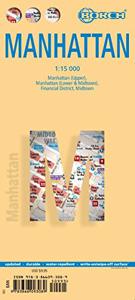
Stadsplattegrond Manhattan (New York City) | Borch

Borch Manhattan is een duidelijke, geplastificeerde plattegrond met informatie over openbaar vervoer en bezienswaardigheden. Inclusief straatnamenregister.   Our soft-laminated folded map of Manhattan shows: Manhattan (Lower & Midtown) 1:15 000, Manhattan (Upper) 1:15 000, Midtown 1:10 000, Financial District 1:9 000, Public Transport New York City...
10,25

Webshops met dit product

Webshop
Bezorging
Prijs

Anderen bekeken ook

Stadsplattegrond New York City | Borch
Borch New York City is een duidelijke, geplastificeerde plattegrond van het centrum van New York (Manhattan) en nog een stukje van Brooklyn en Queens met informatie over openbaar vervoer en bezienswaardigheden. Inclusief straatnamenregister.   Our soft-laminated folded map of New York City shows: Central New York City 1:15 000, Flushing Meadows 1:15 000, Five Boroughs 1:100 000, Public Transport New York City, USA administrative & time zones. Borch Maps are easy to fold, durable and water-repellent with a wipeable surface. Borch Maps show hotels, museums, monuments, markets, public transport, top sights and points of interest, useful statistics, conversion charts for temperatures, weights and measurements, climate charts showing temperatures, sunshine hours, precipitation and humidity, overview maps, time zones, and much more...   Nicknamed "The Big Apple", NYC is the most populous city in the United States. Situated in the state of New York, the city has served as the gateway to the U…
10,25
Reisgids New York City | Eyewitness
Whether you want to visit the iconic Empire State Building, take a leisurely stroll through Central Park, or sample the sublime cocktails in East Village, your DK Eyewitness travel guide makes sure you experience all that New York City has to offer. Dynamic and diverse, New York City is bursting at the seams with unmissable sights, mouth-watering cuisines, and truly unique experiences. From the soaring skyscrapers of Manhattan to the trendy bars of Brooklyn, the vibrant jazz clubs of Harlem to the cobblestoned streets of Soho, the city offers everything in abundance.   Our updated guide brings New York City to life, transporting you there like no other travel guide does with expert-led insights, trusted travel advice, detailed breakdowns of all the must-see sights, photographs on practically every page, and our hand-drawn illustrations which place you inside the city's iconic buildings and neighbourhoods. Our updated 2023 travel guide brings to life. DK Eyewitness New York City is your…
20,95
Stadsplattegrond Tokyo - Tokio | Borch
Borch Tokio is een duidelijke, geplastificeerde plattegrond van het centrum met informatie over openbaar vervoer en bezienswaardigheden. Inclusief straatnamenregister.   Our soft-laminated folded map of Tokyo shows: Tokyo 1:17 000, Tokyo Bay & Shinagawa 1:19 000, Tokyo & Region 1:1 300 000, Tokyo Subway Route Map, Japan administrative and time zones, Top 30 Sights. Borch Maps are easy to fold, durable and water-repellent with a wipeable surface. Borch Maps show hotels, museums, monuments, markets, public transport, top sights and points of interest, useful statistics, conversion charts for temperatures, weights and measurements, climate charts showing temperatures, sunshine hours, precipitation and humidity, overview maps, time zones, and much more...   Tokyo, the vast capital city of Japan, is also one of the 47 Japanese prefectures. Tokyo means "Eastern Capital", is located in the Kanto region on the southeastern tip of Honshu (the main island of Japan), is home to the Japanese gover…
10,25
Wegenkaart - landkaart Noordoost USA - Northeast USA | Borch
Mooie geplasticieerde kaart van het Noordoosten van de USA. Deze kaart biedt een goed overzicht van het land met detailkaarten.   Our soft-laminated folded map of Northeast-USA - New York & Great Lakes shows: Northeast USA 1:3 000 000, Greater Boston 1:1 000 000, Central East Coast 1:1 000 000, Boston 1: 14 000, New York City 1:20 000, Washington DC 1:15 000, USA administrative & time zones. Borch maps are easy to fold, durable and water-repellent with a wipeable surface. Borch Maps show hotels, museums, monuments, markets, public transport, top sights and points of interest, useful statistics, conversion charts for temperatures, weights and measurements, climate charts showing temperatures, sunshine hours, precipitation and humidity, overview maps, time zones, and much more...   From Philadelphia's Independence Park to Boston's Freedom Trail, New York's Federal Hall to Washington's Capitol Hill, from the Potomac to the "honeymooners' paradise" of Niagara Falls, New England and the mid…
11,50
Stadsplattegrond Dublin | Borch
Borch Dublin is een duidelijke, geplastificeerde plattegrond van het centrum met informatie over openbaar vervoer en bezienswaardigheden. Inclusief straatnamenregister. Our soft-laminated folded map of Dublin shows: Central Dublin 1:12 000, Phoenix Park 1:25 000, Temple Bar & Grafton Street 1:10 000, Dublin & Environs 1:125 000, East Coast 1:700 000, Public Transport Dublin, Ireland administrative & time zones, Top 30 Sights. Borch Maps are easy to fold, durable and water-repellent with a wipeable surface. Borch Maps show hotels, museums, moanuments, markets, public transport, top sights and points of interest, useful statistics, conversion charts for temperatures, weights and measurements, climate charts showing temperatures, sunshine hours, precipitation and humidity, overview maps, time zones, and much more...   The bustling Irish capital has much to offer the visitor, especially with regard to literary history. Once home to Oscar Wilde, James Joyce, W.B. Yeats, G.B. Shaw, Samuel Be…
10,25
Stadsplattegrond City map New York | Lonely Planet
De stadsplattegronden van Lonely Planet zijn uitgevoerd op scheur- en watervast papier, zijn lichtgewicht en kennen een handig formaat. Het centrum van de stad is in heldere kleuren in beeld gebracht met straatnamen, bezienswaardigheden en symbolen voor openbaar vervoer. Op de achterzijde staat informatie over de toeristische hoogtepunten en in de meeste gevallen een schematische plattegrond van het openbaar vervoer. Met een register. Durable and waterproof, with a handy slipcase and an easy-fold format, Lonely Planet's New York City Map is your conveniently sized passport to traveling with ease. Get more from your map and your trip with images and information about top city attractions, walking tour routes, transport maps, itinerary suggestions, an extensive street and site index, and practical travel tips and directory. With this easy-to-use, full-color navigation tool in your back pocket, you can truly get to the heart of New York, so begin your journey now! Durable and waterproof …
9,95
Stadsplattegrond Bangkok | Borch
Borch Bangkok is een duidelijke, geplastificeerde plattegrond van het centrum met informatie over openbaar vervoer en bezienswaardigheden. Inclusief straatnamenregister. Our soft-laminated folded map of Bangkok shows: Bangkok City 1:14 000, Wat Phra Kaeo & Royal Grand Palace 1:6 000, Bangkok & Region 1:100 000, Public Transport Bangkok, Top 30 Sights, Thailand administrative and time zones. Borch Maps are easy to fold, durable and water-repellent with a wipeable surface. Borch Maps show hotels, museums, monuments, markets, public transport, top sights and points of interest, useful statistics, conversion charts for temperatures, weights and measurements, climate charts showing temperatures, sunshine hours, precipitation and humidity, overview maps, time zones, and much more...   Krung Thep Maha Nakhon (Bangkok) on the Chao Phraya river is the capital city of Thailand and the country's economic center. It is one of the most populous cities in the world with its number of inhabitants ver…
10,25
Stadsplattegrond Vancouver | Borch
Borch Vancouver is een duidelijke, geplastificeerde plattegrond van het centrum met informatie over openbaar vervoer en bezienswaardigheden. Inclusief straatnamenregister.   Our soft-laminated folded map of Vancouver shows: Vancouver Downtown 1:15 000, Greater Vancouver 1:125 000, Vancouver - Seattle Area 1:1 800 000, Granville Island 1:5 500, Victoria 1:30 000, Public Transport Vancouver, Canada administrative & time zones, Top 30 Sights. Borch Maps are easy to fold, durable and water-repellent with a wipeable surface. Borch Maps show hotels, museums, monuments, markets, public transport, top sights and points of interest, useful statistics, conversion charts for temperatures, weights and measurements, climate charts showing temperatures, sunshine hours, precipitation and humidity, overview maps, time zones, and much more...   Vancouver on the Pacific Rim, a major seaport city with an imposing skyline, ranked in 2012 as being the third most livable of all cities worldwide, after Melbo…
10,25
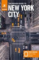
Reisgids New York City | Rough Guides
Als stadsgids zo mogelijk nog beter en completer dan de Lonely Planet. Net als de planet vol met praktische informatie over overnachting, eten en drinken, vervoer, uitgaan en bezienswaardigheden. Ook uitgebreid aandacht voor cultuur en geschiedenis van de stad. Engelstalig. Voor de Zwervers de topper onder de gidsen voor de stad. This New York City guidebook is perfect for independent travellers planning a longer trip. It features all of the must-see sights and a wide range of off-the-beaten-track places. It also provides detailed practical information on preparing for a trip and what to do on the ground. And this New York City travel guidebook is printed on paper from responsible sources, and verified to meet the FSC’s strict environmental and social standards.    This New York City guidebook covers: the Harbor Islands; the Financial District; Tribeca; Soho; Chinatown; Little Italy; Nolita; Lower East Side; the East Village; the West Village; Chelsea; the Meatpacking District; Unio…
24,95
Stadsplattegrond Rio de Janeiro | Borch
Geplastificeerde wegenkaart van Rio de Janeiro voor toeristisch gebruik. Met stadsplattegrond en inclusief index. Met kaarten van de omgeving van Rio, 30 bezienswaardigheden en openbaar vervoer in Rio de Janeiro.   Our soft-laminated folded map of Rio de Janeiro shows: Rio de Janeiro Centre 1:13 000, Quinta da Boa Vista 1:13 000, Corcovado 1:13 000, Ipanema, Leblon 1:13 000, Greater Rio de Janeiro 1: 175 000, Rio de Janeiro and Sao Paulo 1:4 000 000, Public Transport Rio de Janeiro, Brazil administrative and time zones and Top 30 sights. Borch maps are easy to fold, durable and water-repellent with a wipeable surface. Borch Maps show hotels, museums, monuments, markets, public transport, top sights and points of interest, useful statistics, conversion charts for temperatures, weights and measurements, climate charts showing temperatures, sunshine hours, precipitation and humidity, overview maps, time zones, and much more...   The city of Rio de Janeiro ("January River") is located in t…
10,25

Klanten-reviews van Stadsplattegrond Manhattan (New York City) | Borch

Er zijn nog geen beoordelingen voor dit productBen jij de eerste die een review plaatst?

Meer over Stadsplattegrond Manhattan (New York City) | Borch

Productomschrijving

Borch Manhattan is een duidelijke, geplastificeerde plattegrond met informatie over openbaar vervoer en bezienswaardigheden. Inclusief straatnamenregister.   Our soft-laminated folded map of Manhattan shows: Manhattan (Lower & Midtown) 1:15 000, Manhattan (Upper) 1:15 000, Midtown 1:10 000, Financial District 1:9 000, Public Transport New York City, USA administrative & time zones, Manhattan Zip-Codes, USA administrative & time zones and the Top 30 Sights. Borch Maps are easy to fold, durable and water-repellent with a wipeable surface. Borch Maps show hotels, museums, monuments, markets, public transport, top sights and points of interest, useful statistics, conversion charts for temperatures, weights and measurements, climate charts showing temperatures, sunshine hours, precipitation and humidity, overview maps, time zones, and much more...   Manhattan is one of the five boroughs of New York City (the other four boroughs are the Bronx, Queens, Brooklyn and Staten Island) and on a land area of only 22.7 square miles, it is the most densely-populated county in the United States with more than 34,756.7 persons per square mile. Of slightly more than 8.2 million people residing in all five boroughs, almost 1.6 million live on the island of Manhattan. The borough of Manhattan includes a few much smaller islands and a piece of mainland next to the Bronx. New York City is the world's most important financial center and countless corporate headquarters of internationally-renowned firms are situated here, as are the New York Stock Exchange and NASDAQ. Besides its status as a commercial, publishing, fashion and arts center, Manhattan has many superb museums, world-famous landmarks, universities and a plethora of cultural attractions for visitors. Manhattan is a great destination any time of year.  
Webshop.nl maakt gebruik van cookies. Ga je verder op onze website, ga dan akkoord met het plaatsen van cookies en de verwerking van deze data door ons en vermelde partners.