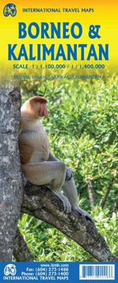

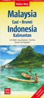
Wegenkaart - landkaart Borneo - Kalimantan | ITMB

0
The Island of Borneo is shared by three countries: Malaysia and Brunei have the northern portion, with the balance forming Kalimantan Province of Indonesia. This double-sided map shows both northern and southern portions to good advantage; printed on paper. Legend Includes: International and state boundaries, roads by classifications, distances be...

Alle aanbiedingen van dit product

Verkoper
Bezorging
Prijs
DeZwerver.nl logo
DeZwerver.nl
2,95
14,95

Anderen bekeken ook

Wegenkaart - landkaart Borneo - Kalimantan | ITMB
The Island of Borneo is shared by three countries: Malaysia and Brunei have the northern portion, with the balance forming Kalimantan Province of Indonesia. This double-sided map shows both northern and southern portions to good advantage; printed on paper. Legend Includes: International and state boundaries, roads by classifications, distances between points, rivers, lakes, national parks, beaches, hotels, lighthouses, airports, place of interests and other information
14,95
Wegenkaart - landkaart Ontario | ITMB
Een degelijke kaart voor Ontario met aanduidingen van o.a. nationale parken, vliegveld, benzinepomp, dirt-roads en kleine plattegrond van Toronto, Sault Ste. Marie. Als overzichtskaart goed te gebruiken. Ontario and Quebec form the portion of Canada known as Central Canada. Ontario is the industrial heartland of the country, and the southern portion is the most densely-populated and urbanized part of Canada. Toronto is a city of 2.8M people and the heartland of an economic region serving 100,000,000 people in two countries. Southern Ontario is also home for six million residents, some of the most historic sites in the country, and major recreational land masses (Algonquin Park, Bruce Trail, Muskoka/Haliburton). Northern Ontario, on the other side of the map, occupies the bulk of the land area of the province, and is dominated by the Canadian Shield (a pre-Cambrian rock formation that is the oldest land on earth, rich in mineral wealth). The North is dominated by recreational activitie…
14,95
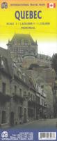
Wegenkaart - landkaart Québec | ITMB
Een degelijke kaart met aanduidingen van o.a. nationale parken, vliegvelden en grote wegen. Als overzichtskaart goed te gebruiken. Tweezijdig. La Belle Province is historically rich, linguistically unique in North America, and attractive for tourism. It is a very large area of land, forcing us to portray the northern portion at a different scale than the more populated southern portion. The map extends to Ottawa in the west and includes most of New Brunswick in the east, as well as all the border areas with the USA to the south. Due to the size of Quebec, the focus of this map is concentrated on providing road information to get around, parks and geographic features, and symbols portraying ski resort areas, urban areas, and road numbers. A basic inset showing the major routes around Montreal is an added feature.   Legend Includes: Roads by classification, Points of Interest, Mines, Museums, Airports, National Parks, Rivers, Lakes, Mountain Peaks, Waterfalls, Border Crossings, Rest Are…
14,95
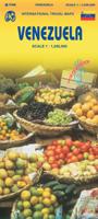
Wegenkaart - landkaart Venezuela | ITMB
Wegenkaart met tevens aanduidingen van Nationale Parken en reservaten. Stadsplattegrond van Caracas 1:25.000 en kaart 1:500.000 van omgeving Caracas. This is another one of our brand new maps. The artwork has been digitally-prepared, and this time printed double-sided to achieve a MUCH better scale. We have included a regional inset map of the Caracas area, and insets of the Roraima Mountains region, but the size of Venezuela is such that the rest of the paper consists solely of the country itself. The southern portion remains relatively unexplored and undeveloped, with few roads and only the occasional settlement, and the northern coastal region shows the road network very well. This is the first new map of Venezuela in many years. Legend Includes: Roads by classification, Railways, Rivers, Rapids, Lakes, Swamps, Points of Interest, Airports, Harbours, Archaeological Sites, Museums, Churches, Car Ferries, Oilfields, Heights in meters, Beaches, Hospitals, Hotels, Universities, Gas Sta…
14,95
Wegenkaart - landkaart Somalië & Hoorn van Afrika | ITMB
Een degelijke kaart met aanduidingen van o.a. nationale parken, vliegveld, benzinepomp, dirt-roads en kleine plattegrond van hoofdstad. Als overzichtskaart goed te gebruiken. Met aan de ene zijde een kaart van Somalië, schaal 1:1.700.000, en op de andere zijde een overzichtskaart van de Hoorn van Afrika, schaal 1:3.400.000 Somalia is one of the more interesting off-the-beaten-path countries. The area around Mogadishu prefers to call itself Somalia, but controls only a portion of the overall country area. Then there is Jubaland, on the Kenyan border, aligned very closely to the former Italian colony boundaries of the same name. Truly, an amazing juxtaposition of countries within countries! The reverse side of the sheet presents a very interesting regional perspective of the area between the northern border of Ethiopia, a small portion of Sudan and a reasonable portion of South Sudan, all of Uganda, most of Kenya, all of Djibouti, and a fair portion of Eritrea, as well as the former Ade…
14,95
Wegenkaart - landkaart Bahrain & Qatar | ITMB
Een degelijke kaart met aanduidingen van o.a. nationale parken, vliegveld, benzinepomp, dirt-roads en kleine plattegrond van hoofdstad. Als overzichtskaart goed te gebruiken.  Schaal: - Bahrein 1:115.000 - Qatar 1:300.000 The northern portion of the United Arab Emirates consists of a small peninsula (Qatar) and an island (Bahrain). Although these countries are not geographically significant in relation to their neighbours, they are enormously wealthy, thanks to oil, and have aspirations of grandeur. Qatar hosted the FIFA World Cup of soccer in November 2022. This is significant. Qatar, as a destination country, is now 'on the map'. Its capital, Doha, is quite well developed, with three Metro subway lines, motorways, and a sophisticated city centre dominated by superb high-rise architecture. Just to the west, the island of Bahrain is just as wealthy, and just as likely to have ornate architecture, luxurious shopping arcades, and an extravagant lifestyle. Its capital, Manama, is growing…
14,95
Wegenkaart - landkaart Indonesië - Indonesia | ITMB
Een degelijke landkaart van Indonesië met aanduidingen van o.a. nationale parken, vliegvelden en grote wegen. Als overzichtskaart goed te gebruiken. De nadruk ligt echter vooral op de natuurkundige aspecten. Scheur- en watervast! Met een kleine kaart van Jakarta. The hundreds of islands making up the island nation of Indonesia make a double-sided map inevitable in order to show any significant amount of detail. Side 1 shows the western half, starting with Sumatra in the upper left and including Java and most of the island of Borneo (Kalimantan Province to the Indonesians). This side also includes a large inset map of central Jakarta (for better detail see our separate map of the city); ditto for Sumatra, Java, and Borneo. Bali, Lombok, and Sumbawa islands are in the lower right portion of the map, and most of Malaysia and all of Singapore are included, simply because they are there. The infamous volcanic island of Krakatoa is located just to the west of Java. The other side of the map…
14,95
Wegenkaart - landkaart Mexico Sonora & Chihuahua | ITMB
The border states between the USA and Mexico are of significant economic and travel importance, being some of the most traversed border crossings in the world. Touristically, northwestern Mexico appeals to desert lovers, with resort towns along the coast and arid ranch areas inland. The rail trip through the Copper Canyon is one of Mexico’s highlights and, yes, the hairless miniature shivering dog actually originates from Chihuahua. Printed double-sided on paper. Legend Includes: International and provincial borders, airports, roads by classifications, distances between points, gas stations, point of interests, archaeological sites, beaches, lighthouses, hotels, parks, museums, caves and other information.
14,95
Wegenkaart - landkaart Mexico North East | ITMB
Mexico is one of our favourite places to visit, and is also very popular with American travelers. The five states that border Texas – Coahuila, Nuevo Leon, Tamaulipas, Zacatecas, and San Luis Potosi may not be well-known internationally, but Monterrey (the third largest city in Mexico), Nuevo Laredo, Matamoros, Torreon, Tampico, Aguascalientes, and Ciudad Victoria evoke images of the Mexico of ranches and vast distances. This is actually a fertile and economically developing part of the country, bordered by the Gulf of Mexico on the east, Texas on the north, and ITMB’s maps of Central Mexico on the south and our new map of Sonora and Chihuahua States on the west. This is an excellent map for cross-border expeditions; printed single-sided, on paper, showing main and secondary road connections, rail lines, gas stations in smaller towns, and whatever tourist attractions we were able to locate. Legend Includes: Airports, roads by classifications, distances between points, gas station, poi…
14,95

Klanten-reviews van Wegenkaart - landkaart Borneo - Kalimantan | ITMB

Er zijn nog geen beoordelingen voor dit productBen jij de eerste die een review plaatst?

Meer over Wegenkaart - landkaart Borneo - Kalimantan | ITMB

Productomschrijving

The Island of Borneo is shared by three countries: Malaysia and Brunei have the northern portion, with the balance forming Kalimantan Province of Indonesia. This double-sided map shows both northern and southern portions to good advantage; printed on paper.

Legend Includes:
International and state boundaries, roads by classifications, distances between points, rivers, lakes, national parks, beaches, hotels, lighthouses, airports, place of interests and other information

Productinformatie

    Verken gerelateerde categorieën

    Webshop.nl maakt gebruik van cookies. Ga je verder op onze website, ga dan akkoord met het plaatsen van cookies en de verwerking van deze data door ons en vermelde partners.