webshop.nl
Categorieën
  Sluiten

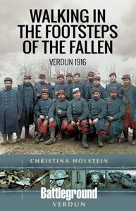
Wandelgids Walking in the Footsteps of the Fallen - Verdun 1916 | Pen and Sword publications

A visit to the battlefield of Verdun is usually dominated by the forts of Douamont and Vaux, the museum at Fleury and the striking, huge Ossuary, Although this gives a flavour of the horrific fighting that took place in the area, particularly in 1916, the visitor will be hard pressed to get much more than an impression from such places.This book se...
20,95

Webshops met dit product

Webshop
Bezorging
Prijs

Anderen bekeken ook

Wandelgids Walking Waterloo: A Guide | Pen and Sword publications
Wandelgids over de Slag bij Waterloo   Charles Esdaile’s new guide to the Battle of Waterloo presents the experience of the soldiers who took part in the battle in the most graphic and direct way possible – through their own words. In a series of walks he describes in vivid detail what happened in each location on 18 June 1815 and he quotes at length from eyewitness accounts of the men who were there.   Each phase of the action during that momentous day is covered, from the initial French attacks and the intense fighting at Hougoumont and La Haye Sainte to the charges of the French cavalry against the British squares and the final, doomed attack of Napoleon’s Imperial Guard.   This innovative guide to this historic site is fully illustrated with a selection of archive images from the War Heritage Institute in Brussels, modern colour photographs of the battlefield as it appears today and specially commissioned maps which allow the visitor to follow the course of the battle on the ground…
24,95
Historische Kaart 14 - 18 Map of Verdun (Battlefield map) | Eerste Wereld Oorlog | Pen and Sword publications
Comprehensive mapping for the Battle of Verdun 1916 and a sizable part of the early days of the Meuse-Argonne Offensive 1918. Clearly produced in full color, with different types of feature in different colors, all supported by two comprehensive keys. For many years the Holts have provided tourers to the battlefields with excellent mapping for the Ypres Salient and the Somme. This map of the Verdun/Meuse area fills one of the many gaps in the coverage of the Western Front. This map of the Verdun battlefield is in the same style, using a color coded system to distinguish the different types of features. It includes some 300 locations of memorials, cemeteries, significant remnants of the battle terrain, remaining fortifications, trenches, the destroyed villages and other vestiges of the war. On the reverse there is a cut out and enlarged section of the Verdun battlefield in particular - the most visited part of the area, which provides greater detail. This section includes the Ossuary …
7,95
Wandelgids Walking in the Forest of Bowland and Pendle | Cicerone
This handy guidebook contains 40 diverse circular day walks suitable for walkers with navigational skills. There is a variety of terrain covered in the Forest of Bowland and Pendle which makes it perfect for those who wish to explore an AONB. Some of the routes covered include: Ward's Stone, Pendle Hill, Longridge Fell and Fair Snape Fell. The Forest of Bowland and Pendle provide vastly differing terrain – from the lush farmlands of the Ribble valley to the more rugged rough pastures of the Forest of Bowland uplands and the huge boggy uplifts of the main Bowland massif itself.   The walks in this guidebook are suitable for those who already have good navigational skills and range from 3 miles to 12.5. For walkers who like to ‘collect’ summits, there are six Marilyns within the area of the Forest of Bowland and Pendle, only two of which (White Hill and Easington Fell) are not included in any of the walks. However, this guidebook does offer information on how to access both for those who…
7,50
Reisgids The Battles of Arras - north | Pen and Sword publications
The First World War battlefields to the north of Arras - including Vimy Ridge - are among the most famous and most visited sites on the Western Front, rivalled only by those around Ypres and the Somme, and this clearly written, highly illustrated guide is the ideal introduction to them. Visitors can trace for themselves the course of each battle across the modern landscape and gain a fascinating insight into the nature of the fighting in the area - and the wider conflict across the Western Front - throughout the war. The book covers the key battles fought in the northern sector of the Arras front, including the 1917 Battle of Vimy Ridge and battles at Villers au Bois, Oppy Wood and Gavrelle. Expert guides Jon Cooksey and Jerry Murland have devised a series of routes that can be walked, biked or driven, explaining the fighting that occurred at each place in vivid detail. They record what happened, where it happened and why, and point out the sights that remain for the visitor to see. Th…
20,50
Wandelgids Walking in the Thames Valley | Cicerone
Walking in the Thames Valley offers 25 challenging circular walks around the River Thames and River Kennet in the south of England, taking in the Southern Chilterns, the Berkshire and North Hampshire Downs, Southern Oxfordshire and the eastern edge of Wiltshire. All routes are within easy reach of Reading, Newbury, Abingdon and London. While some walks visit Iron Age hill forts, others pass more modern features such as Wilton Windmill and the Kennet and Avon Canal. Some follow sections of the Ridgeway, while others meander along the banks of the Thames. What they all have in common is that they take the keen rambler to some of the best parts of the Thames Valley – a patchwork of open chalk grassland, broadleaved woodland and farmland and home to two Areas of Outstanding Natural Beauty. • walks from 10 to 18 miles, including one 2-day route • shorter, less strenuous alternatives for many of the walks • detailed route descriptions with information on local points of interest, OS mapping …
18,50
Wandelgids Walking in the Auvergne | Cicerone
Uitgebreide wandelgids van de Auvergne: goede beschrijvingen, veel keuze, kaarten wat minder goed. This handy guidebook offers the finest day walks in five different areas of the Auvergne, an often-forgotten region in central France perfect for accessible day walking in a unique and spectacular landscape. Towns such as Vichy, Clermont-Ferrand and Puy-en-Velay also offer delightful places to base yourself for that perfect walking holiday. The ridges, rocky peaks and verdant valleys of the Cantal supervolcano dominate south-western Auvergne. The centre of the region hosts the unique chain of 'puys' with their pudding bowl forms and the pristine crater lakes of the Sancy massif. In the north, the Montagne Bourbonnaise preserves a pastoral way of life which is quintessentially French while the Haute Loire's rivers and medieval abbeys reward those venturing further off the beaten track. Notes on the geology and history of points of interest passed en route help you to get the most out of yo…
19,95
Wandelgids Karawanken - Slovenie - Walking in the Karavanke | Cicerone
Goede wandelgids met veel dagtochten; redelijk kaartmateriaal en goede praktische informatie. This guidebook offers 23 walking routes set across the magnificent 120km-long Karavanke mountain range, which forms a natural border between Austria and Slovenia. Commonly known as 'the way the Alps used to be', as it is yet to experience the extent of commercial development known by the Western Alps, it is one of the longest ranges in Western Europe but it remains genuinely unspoilt and relatively unvisited by English-speaking hillwalkers. The guide's walks begin in pretty towns and villages, and most of them access the peaks from the relatively more gentle Slovenian side of the range, where forest-clad slopes lead to grassy summits where spectacular views can be enjoyed. Arranged by peak from west to east along the range, most of the summits can be reached by waymarked paths and trails. The guide gives all the practical details you need on transport, accessing the routes, accommodation and a…
20,95
Wandelgids Ullswater and the Eastern Lakes | Hallewell Publications
Rewalked and updated in 2016, Walks Ullswater & the Eastern Lakes features walks in The Lake District - the famous area of spectacular peaks and lakes in the north-west of England. This guide covers the eastern part of the district, with most of the routes clustered around Ullswater. The routes included are largely hill climbs, plus some lower lakeside routes. The 25 walks featured range from 1.5 miles to 8 miles (2.5-13km). Routes include: Brothers Water, Angle Tarn and walks from Patterdale and Glenridding. Part of a popular series of A6 pocket walking guides that describe routes which are suitable for walkers of all abilities and to suit all tastes. Route descriptions are accompanied by 2-colour sketch maps. The guides are illustrated with line illustrations, and will provide walkers with a good introduction to what each area covered has to offer.  
5,95
Wandelgids Keswick and the Northern Lakes | Hallewell Publications
Rewalked and updated in 2021 - Walks Keswick & the Northern Lakes features walks in The Lake District - the famous area of spectacular peaks and lakes in the north-west of England. This guide covers the northern part of the area. Many of the walks included are near the town of Keswick, with others in Borrowdale and by Buttermere and Crummock Water. They range in nature from serious hill climbs to gentler, lower-level routes. The 26 walks featured range from 2 miles to 10 miles (3-16km). Routes include: Skiddaw, Cat Bells & Derwent Water, Hay Stacks and a circuit of Buttermere. Now in its 4th edition, Walks Keswick is part of a popular series of A6 pocket walking guides which describe routes which are suitable for walkers of all abilities and to suit all tastes. Route descriptions are accompanied by 2-colour sketch maps. The guides are illustrated with line illustrations, and will provide walkers with a good introduction to what each area covered has to offer.  
5,95
Wandelgids Landscapes of the Tatra Mountains (Polen en Slowakije) | Sunflower books
Wandelgids: vele dagtochten worden degelijk beschreven met openbaar vervoer informatie, goede routebeschrijvingen en kaartmateriaal. Tevens enkele autotochten. (Engelstalig) The go-to Tatra Mountains travel guide for discovering the best walks and car tours. Strap on your boots and discover Tatra Mountains on foot with the Sunflower Tatra Mountains travel guide. And on the days when your feet may have had enough, enjoy some spectacular scenery on one of our legendary car tours.   The Sunflower Tatra Mountains guide is indispensable for hiking in the Tatra Mountains or seeing Tatra Mountains by car. For those who love mountain walks, there can be few places where hikers are better catered for than in the Polish Tatras and the Slovakian Tatras. Skilfully constructed paths make hiking in very rough terrain comparatively easy; signposting and waymarking are almost universally excellent.   Hillwalkers will be in their element here, but there are often shorter, easy suggestions for the less …
23,50

Klanten-reviews van Wandelgids Walking in the Footsteps of the Fallen - Verdun 1916 | Pen and Sword publications

Er zijn nog geen beoordelingen voor dit productBen jij de eerste die een review plaatst?

Meer over Wandelgids Walking in the Footsteps of the Fallen - Verdun 1916 | Pen and Sword publications

Productomschrijving

A visit to the battlefield of Verdun is usually dominated by the forts of Douamont and Vaux, the museum at Fleury and the striking, huge Ossuary, Although this gives a flavour of the horrific fighting that took place in the area, particularly in 1916, the visitor will be hard pressed to get much more than an impression from such places.This book seeks to guide the battlefield pilgrim into parts of the battlefield that get rarely visited by means of a series of walks, a number of which include the major sites.The four tours have been carefully walked. All are practicable for a reasonably healthy adult; the tours vary in length, most taking a half day to complete and the longest (the last) a day.In a twist to the usual walks to be found in the Battleground series,. Christina makes full use of the numerous field graves and isolated memorials that are to be found on the Verdun battlefield, a number of which will bring visitors to the most visited sites. In the course of these walks many physical remnants will be found, such as gun positions, bunkers and trench systems, the significance of which is fully explained. The walks have not been chosen at random: by following these the tourer will get a far greater understanding of why the fighting at Verdun developed as it did and why such places as Fort Vaux were so significant to both sides.The field graves and memorials to the combatants, very often of individuals, provide an opportunity to give their story and the unit action in which they were fighting when they were killed. Verdun is a battlefield where the story of units and individuals can easily become lost in the horror of the incessant fighting that raged over ten months; and over ground which is extremely difficult to read because of the post war forestation programme. Profusely illustrated and with excellent mapping, a hallmark of Christina Holstein's books, a visitor who follows the walks in this book will be left with a far clearer idea of the men who fought and died here and of the features of the battlefield and their significance in this battle that so challenged the endurance of the armies of two nations. 1e wereldoorlog eerste wereld oorlog WW1  
Webshop.nl maakt gebruik van cookies. Ga je verder op onze website, ga dan akkoord met het plaatsen van cookies en de verwerking van deze data door ons en vermelde partners.