webshop.nl
Categorieën
  Sluiten

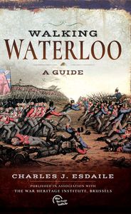
Wandelgids Walking Waterloo: A Guide | Pen and Sword publications

Wandelgids over de Slag bij Waterloo   Charles Esdaile’s new guide to the Battle of Waterloo presents the experience of the soldiers who took part in the battle in the most graphic and direct way possible – through their own words. In a series of walks he describes in vivid detail what happened in each location on 18 June 1815 and he quotes at leng...
24,95

Webshops met dit product

Webshop
Bezorging
Prijs

Anderen bekeken ook

Reisgids The Battles of Arras - north | Pen and Sword publications
The First World War battlefields to the north of Arras - including Vimy Ridge - are among the most famous and most visited sites on the Western Front, rivalled only by those around Ypres and the Somme, and this clearly written, highly illustrated guide is the ideal introduction to them. Visitors can trace for themselves the course of each battle across the modern landscape and gain a fascinating insight into the nature of the fighting in the area - and the wider conflict across the Western Front - throughout the war. The book covers the key battles fought in the northern sector of the Arras front, including the 1917 Battle of Vimy Ridge and battles at Villers au Bois, Oppy Wood and Gavrelle. Expert guides Jon Cooksey and Jerry Murland have devised a series of routes that can be walked, biked or driven, explaining the fighting that occurred at each place in vivid detail. They record what happened, where it happened and why, and point out the sights that remain for the visitor to see. Th…
20,50
Wandelgids Walking in the Footsteps of the Fallen - Verdun 1916 | Pen and Sword publications
A visit to the battlefield of Verdun is usually dominated by the forts of Douamont and Vaux, the museum at Fleury and the striking, huge Ossuary, Although this gives a flavour of the horrific fighting that took place in the area, particularly in 1916, the visitor will be hard pressed to get much more than an impression from such places.This book seeks to guide the battlefield pilgrim into parts of the battlefield that get rarely visited by means of a series of walks, a number of which include the major sites.The four tours have been carefully walked. All are practicable for a reasonably healthy adult; the tours vary in length, most taking a half day to complete and the longest (the last) a day.In a twist to the usual walks to be found in the Battleground series,. Christina makes full use of the numerous field graves and isolated memorials that are to be found on the Verdun battlefield, a number of which will bring visitors to the most visited sites. In the course of these walks many ph…
20,95
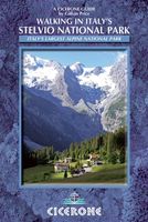
Wandelgids Walking in Italy's Stelvio National Park | Cicerone
Wandelgids voor de Stelvio Nationaal Park in de Rätische Alpen ( Alpi Retiche ) ten zuiden van de Splügenpas op de grens met het Zwitserse Graubünden. Engelstalige beschrijving van 38 dagwandelingen.   Aanbevolen wandelkaarten 1:25.000 voor deze gids Wandelkaart 008 Ortles - Cevedale - Ortlergebiet | Tabacco Editrice   Wandelkaart 045 Latsch - Martell - Schlanders- Laces - Val Martello - Silandro | Tabacco Editrice   Wandelkaart 048 Val di Peio - Val di Rabbi - Val di Sole | Tabacco Editrice   The wide range of 38 summer day walks in this guide explore the renowned Stelvio National Park in the Italian Rhaetian Alps. Bordering the Dolomites to the east, and Switzerland to the west, the Stelvio is one of the largest protected areas in all of the Alps. Its unspoilt landscape ranges from valley farmland to forested hillsides and alpine meadows, and up to a wilderness of rugged glaciated summits and ridges, the highest of which is Ortler, at 3905m.   The walks, a selection of routes from ea…
20,95
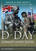
Reisgids Major & Mrs Holt's Definitive Battlefield Guide to the D-Day Normandy Landing Beaches | Pen and Sword publications
Already the best-selling English-language guide to the area, universally known as THE BIBLE, this is the 75th anniversary, completely revised, up-to-date, much expanded edition of the DEFINITIVE GUIDE TO THE D-DAY NORMANDY LANDING BEACHES. The third in the Holts' important series of Battlefield Guides (following the Somme and the Ypres Salient) it employs the same, highly acclaimed formula. Once again the cold facts are interlaced with anecdotes of bravery, humour, sadness and humanity. This new edition now contains: All the landing Beaches: JUNO, SWORD, GOLD, OMAHA, UTAH All the Airborne Operations: British and American Two Approach Routes; Six timed and measured Itineraries 21 in-text Itinerary maps, Battle maps & Diagrams Approx 400 recommended sites within the D-Day planned area of advance, all with photos, each with Latitude & Longitude references (New for this Edition) Over 400 coloured pictures, 352 pages Memorials / Museums / Batteries / Bunkers / Landing fields Allied and G…
23,95
Accommodatiegids - Campergids - Campinggids Botswana Self-Drive Guide | Tracks4Africa
De Self Drive Guide Botswana van Tracks4Africa is een uitgebreide gids met alle informatie voor mensen die zelf met een eigen of gehuurde auto door Botswana willen reizen. De gids bevat informatie over parken en routes, over overnachtingsmogelijkheden en campings, maar ook over de veiligheid, de beste reistijd, de planning, de keuze van welk vervoermiddel en de hulpmiddelen die vereist zijn. Zo vindt u bijvoorbeeld ook informatie over het huren van een 4x4 met tent op het dak en campingspullen, over de techniek van de auto, over voorbereiding, over navigatie, communicatie en vereiste documenten. De gids ziet er aantrekkelijk en overzichtelijk uit en bevat veel kaarten met routes en ook kleurenfoto's. De gids is groot van formaat : A4 !   This guide is specifically aimed at self-drive travellers. If you are a self-drive tourist, there are five things that you need to know when you are on the road:  1. Where to sleep.  2. Where to get fuel.  3. What to see and do.  4. Where to buy suppli…
52,50
Accommodatiegids Namibia Self-Drive Guide | Tracks4Africa
So, what is so special about the Tracks4Africa guide books? These are not guides written by armchair travellers or the personal experience of one person, but the combined experiences of a whole community of travellers. The T4A community travel far and wide – not by luxury bus or safari vehicle but on their own wheels. Sometimes they travel in groups and sometimes as lone rangers, but they always travel by motorbike, sedan or 4WD, therefore this guide is specifically aimed at self-drive travellers.   If you are a self-drive tourist, there are five things that you need to know when you are on the road: 1. Where to sleep. 2. Where to get fuel. 3. What to see and do. 4. Where to buy supplies. 5. Where to go in case of an emergency.   If you have the Tracks4Africa Self-Drive Guide as your travel companion, the answers to all these and many more questions will be at hand. If you are well prepared and well informed, you can really enjoy the unspoilt beauty of Africa! The Tracks4Afric…
52,50
Wandelgids Walking in Torridon, Fisherfield, Fannichs and An Teallach | Cicerone
Guide to 50 walks and easy scrambles in north-western Scotland, covering Southern Torridon, Northern Torridon, Letterewe and Fisherfield, and the Fannichs. Ascents of 27 Munros, 20 Corbetts and 14 Grahams are included, with highlights including Liathach, Beinn Eighe, Beinn Alligin, An Teallach and Slioch. The walks are suitable for those with good navigation skills who are competent in a mountain environment.   All the walks in the guide are graded, with summary statistics provided, and each includes clear route description and mapping. There's also a route summary table to help with choosing appropriate walks. Background information on local geology, wildlife and history, and planning details on when to go, where to stay and what to take are included to make the most out of any trip to Torridon.   The region boasts spectacular and distinctive landscapes and breathtaking views. Steep-sided rocky mountains rise above long winding lochs, both freshwater and sea. From the hills there are …
23,95
Fietsgids Bikeline Cycling guide Provence | Esterbauer
Provence – The name alone sounds inviting to every traveller. The region’s wonderfully mild climate and many quiet paved roads makes it an ideal destination for bicycle tourists year round. Let yourself be enchanted by ancient towns and historic monasteries, by the scent from fields of rich lavender, the charm of tiny villages and French joie de vivre. Enjoy the contrasts presented by the peaceful expanses of the Camargue, with its glittering blue bays and herds of Camargue horses grazing in a landscape dotted with brilliantly white farmsteads. A refreshing plunge into the Mediterranean is just one of the many highlights of this bicycle tour. This Cycling Guide includes detailed maps of the countryside and of many cities and towns, precise route descriptions, information about historic and cultural sites as well as background information and a comprehensive list of overnight accommodations. The only thing this guide cannot provide is fine cycling weather, but we hope you find nothing b…
13,50
Vogelgids Birds of Aruba, Bonaire, and Curaçao: A Site and Field Guide | Zona Tropical
Birds of Aruba, Bonaire, and Curaçao is the essential guide for anyone traveling to those islands. It showcases the more than 280 species seen on Aruba, Bonaire, and Curaçao and provides descriptions of and directions to the best places to bird, from the famous white sand beaches to hidden watering holes to the majestic national parks.   Aruba, Bonaire, and Curaçao – the "ABCs" – located in the southwestern Caribbean, not far from Venezuela, share fascinating ecological features with the West Indies as well as the South American mainland, making birding on the islands unique. The identification portion of Birds of Aruba, Bonaire, and Curaçao features endemic subspecies such as the Brown-throated Parakeet; a wide variety of wintering North American migrants; spectacular restricted-range northern South American species such as the Yellow-shouldered Parrot, Bare-eyed Pigeon, Troupial, Ruby-topaz Hummingbird, and Yellow Oriole; and West Indian species including the Pearly-eyed Thrasher and…
42,50
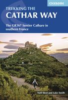
Wandelgids The Cathar Way | Cicerone
Guidebook to the GR367 Cathar Way (Sentier Cathare) in the Languedoc region of southern France. The 260km waymarked trail from Port la Nouvelle on the Mediterranean to Foix traces the history of the Cathars through the Eastern foothills of the Pyrenees. Split into 13 stages and offering a northern variant, the route takes about 2 weeks to complete. Two of the southernmost départements of France, the Pyrénées-Orientales and Ariège are inextricably linked with the history of the Cathars, a heretical Christian sect who were subjected to a crusade in the thirteenth century. Striking castles built on jagged rocky precipices are a highlight of the region and a reminder of those turbulent times. This guidebook describes the 260km Cathar Way (Sentier Cathare or GR367), a long-distance trail from Port-la-Nouvelle on the Mediterranean coast to Ariége's departmental capital Foix linking several of the impressive Cathar castles. The route follows ancient footpaths, jeep tracks and country lanes an…
22,95

Klanten-reviews van Wandelgids Walking Waterloo: A Guide | Pen and Sword publications

Er zijn nog geen beoordelingen voor dit productBen jij de eerste die een review plaatst?

Meer over Wandelgids Walking Waterloo: A Guide | Pen and Sword publications

Productomschrijving

Wandelgids over de Slag bij Waterloo   Charles Esdaile’s new guide to the Battle of Waterloo presents the experience of the soldiers who took part in the battle in the most graphic and direct way possible – through their own words. In a series of walks he describes in vivid detail what happened in each location on 18 June 1815 and he quotes at length from eyewitness accounts of the men who were there.   Each phase of the action during that momentous day is covered, from the initial French attacks and the intense fighting at Hougoumont and La Haye Sainte to the charges of the French cavalry against the British squares and the final, doomed attack of Napoleon’s Imperial Guard.   This innovative guide to this historic site is fully illustrated with a selection of archive images from the War Heritage Institute in Brussels, modern colour photographs of the battlefield as it appears today and specially commissioned maps which allow the visitor to follow the course of the battle on the ground.
Webshop.nl maakt gebruik van cookies. Ga je verder op onze website, ga dan akkoord met het plaatsen van cookies en de verwerking van deze data door ons en vermelde partners.