webshop.nl
Categorieën
  Sluiten

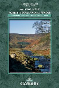
Wandelgids Walking in the Forest of Bowland and Pendle | Cicerone

This handy guidebook contains 40 diverse circular day walks suitable for walkers with navigational skills. There is a variety of terrain covered in the Forest of Bowland and Pendle which makes it perfect for those who wish to explore an AONB. Some of the routes covered include: Ward's Stone, Pendle Hill, Longridge Fell and Fair Snape Fell. The Fore...
7,50

Webshops met dit product

Webshop
Bezorging
Prijs

Anderen bekeken ook

Wandelgids Walking in Cornwall | Cicerone
40 half to full day rambles on the coasts and inland hills of Cornwall are explored in this guidebook.  Routes range from short, 2 mile strolls to long, wild walks of over 8 miles. With plenty of opportunities to combine routes together, this guide provides a wealth of variety for walkers of all abilities.   The guidebook is divided into 6 sections, including walks on Bodmin Moor (for which good navigational skills are required), the North Coast, Penwith and West Cornwall, the Inland Mining Districts, Land's End and the Lizard and Roseland Peninsulas.    Cornwall has a lot to offer walkers; stunning coastal scenery and long stretches of wild moorland, with quiet estuaries cutting through high and rocky headlands. Birdlife and wildlife, from choughs to falcons to seals are found throughout the county, as are historical sites from the neolithic, to Iron Age hill forts and a long history of mining. The towns and villages of Cornwall, from the popular spots such as St Ives, Newquay and Pad…
19,95
Wandelgids Walking Loch Lomond and The Trossachs | Cicerone
Uitstekende wandelgids, sommige meerdaags, voor dit uitdagende wandelgebied in Schotland. Guidebook to over 70 walking routes in the hills of Loch Lomond and the Trossachs National Park in Scotland's Southern Highlands. Including 21 Munros on less-popular routes, as well as plenty of Corbetts and Grahams. Hill summits of Ben Lomond, the Cobbler, Ben Lui and the Arrochar Alps have plenty of routes to explore. The routes in this guide range from 1 to 17 miles, and are clearly graded for distance and difficulty, as well as dividing between low-level, mid-level and mountain walks. From short, loch-side strolls suitable for all walkers, to long, challenging mountain routes with rocky scrambling, the Loch Lomond and Trossachs hills have plenty to offer.    The glens and mountains walks in this guide are divided into area: the Trossachs, Callander and Loch Lubnaig, Balquhidder and Lochearnhead, Crianlarich to Inveraran, Tyndrum, Ben Lomond, Loch Lomond West, Arrochar Alps and Glen Croe to Loc…
20,95
Wandelgids Walking in the New Forest | Cicerone
Goede wandelgids met veel dagtochten, geschikt voor iedereen.   A guidebook to 30 walks of between 3 and 10 miles set throughout the New Forest National Park in Hampshire and Wiltshire. Routes explore ancient woodland, heather-clad heath and dramatic coastline, all within easy reach of Southampton, Bournemouth and Salisbury. Walks for all abilities, easily combined to create longer challenges.   This guidebook presents 30 walks in the New Forest in Hampshire and Wiltshire, Britain's smallest National Park. Easily accessible from Southampton, Bournemouth, Salisbury and Winchester, the New Forest encompasses varied landscapes, from ancient woodlands to open heaths, rivers and coastline. Routes of between 5 and 16km (3 and 10 miles) explore the Forest, mainly on fairly flat terrain, often on well-defined tracks and paths. Most walks are suitable for all the family and many can be combined to make longer outings. Each walk is described in detail, highlighting the many points of interest …
18,50
Wandelgids Walking in the Thames Valley | Cicerone
Walking in the Thames Valley offers 25 challenging circular walks around the River Thames and River Kennet in the south of England, taking in the Southern Chilterns, the Berkshire and North Hampshire Downs, Southern Oxfordshire and the eastern edge of Wiltshire. All routes are within easy reach of Reading, Newbury, Abingdon and London. While some walks visit Iron Age hill forts, others pass more modern features such as Wilton Windmill and the Kennet and Avon Canal. Some follow sections of the Ridgeway, while others meander along the banks of the Thames. What they all have in common is that they take the keen rambler to some of the best parts of the Thames Valley – a patchwork of open chalk grassland, broadleaved woodland and farmland and home to two Areas of Outstanding Natural Beauty. • walks from 10 to 18 miles, including one 2-day route • shorter, less strenuous alternatives for many of the walks • detailed route descriptions with information on local points of interest, OS mapping …
18,50
Wandelgids Walking in the Briançonnais | Cicerone
Handige duidelijke wandelgids van een mooi wandelgebied. De routes zijn accuraat beschreven met praktische informatie erbij. Kaartmateriaal is redelijk, soms wat schetsmatig. In berggebieden zijn wandelkaarten wel belangrijk! Bij de routes worden de juiste kaartnummers gegeven.    This guidebook presents 40 walks exploring the area around Briançon in France. The walks are divided into 6 sections covering the valleys of Clarée, Cerveyrette, Ayes, Durance and Guisane, as well as the area around Vallouise and Montgenèvre. The walks are circular and range in distance from 4 to 21 km. Graded easy to very hard, there is a walk to suit all abilities.    Dominated on all sides by jagged peaks, and perched on a rocky spur at the nucleus of five beautiful valleys, the city of Briançon lies almost at the southernmost tip of the main Alpine range. The Briançonnais, the surrounding region to which it gives its name, is a stunning mountain wilderness packed with everything one would expect from a hi…
23,95
Wandelgids The Yorkshire Dales - Walking in the North and East | Cicerone
This guidebook contains 43 circular day walks in the north and east Yorkshire Dales. It explores the dales, hills and moors between Kirkby Stephen and Pateley Bridge. Walking ranges from gentle three-mile strolls to more strenuous day-long rambles across the Howgills, Wensleydale, Swaledale, Nidderdale, Mallerstang and Coverdale   In this guidebook, 43 circular walks, ranging from 3-mile strolls to full-day adventures are explored in the northern and eastern Dales. Few areas in England are as appealing as the Yorkshire Dales and this volume of a two-part guide provides walkers with a comprehensive walking guide to the whole of the region.     Each valley has a character and history of its own and this guide covers the varied fell and dale landscapes of the Howgills, Mallerstang, Swaledale, Wensleydale, Coverdale and Nidderdale. Spectacular waterfalls, dramatic gorges, expansive heather moors, rich woodlands and colourful flower meadows are just some of the natural delights encountered …
19,95
Wandelgids 71 Pathfinder Guides The High Fells of Lakeland | Ordnance Survey
Are you planning a holiday to the Lake District? Do you enjoy a hill-walking challenge with impressive mountain-top views? Inside Pathfinder (R) Guide to the High Fells of Lakeland are 20 majestic and challenging fell walks amid the glorious scenery of the Lake District mountains with clear and easy-to-follow route directions compiled from the author's 40 years' experience of Lakeland walking. For adventurous ramblers and walkers wanting a hill-walking challenge, this brand new Pathfinder (R) walking guide features 20 demanding day-walks in the mountains of the Lake District, from Scafell Pike (highest mountain in the Lake District), to Helvellyn, Skiddaw, Great End and Bowfell - all over 900m (nearly 3000 feet) high. Giving a detailed guide to 20 inspiring expeditions on the high fells of Lakeland, Pathfinder (R) Guide to the High Fells of Lakeland explores some of the best fell walking country in the Lake District. With views over to Buttermere, Derwentwater and Grasmere, the Lakelan…
18,50
Wandelgids Walking on Arran | Cicerone
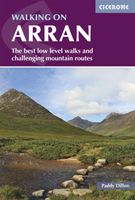
Uitstekende wandelgids voor dit uitdagende wandelgebied in Schotland. Dagtochten. The 45 walking routes in this Isle of Arran guidebook range from easy 3km (2 miles) nature trails to long arduous mountain routes with scrambles (up to 32km) providing thorough coverage of Arran, including the ascent of Goatfell and nearby Holy Isle. Most routes are 10km to 15km long but many give opportunities to create longer cross island walks. This guidebook presents a selection of 45 day walks on the popular and accessible Isle of Arran. The routes are between 2 miles (3km) and 20 miles (32km) in length, from easy waymarked forest trails to more arduous mountain walks, exposed ridge routes and scrambles. There are linear and circular walks to choose from, and opportunities to link routes together and create longer walks across the length and breadth of the island. With highlights including Goatfell, Beinn Tarsuinn, the Sannox Horseshoe, Glen Rosa and the Cock of Arran, there's something here to suit …
23,95
Wandelgids Walking in the Isles of Scilly | Cicerone
Uitstekende wandelgids van dit geweldige gebied. goed beschreven met veel praktische informatie om de route te kunnen lopen, inclusief redelijke kaarten. This guidebook to walking on the Scilly Isles at the south-western edge of Britain includes 11 day walks and 4 boat trips, perfect for a fortnight away from it all. The walks are between 2 and 16km long, and explore the larger islands such as Tresco, St Martin's, St Mary's, St Agnes and Bryher as well as smaller islands in the archipelago. Alongside the walks, which are suitable for walkers of all abilities, are 4 Boat Trips which explore Annet and the Western Rocks, the Norrard Rocks, St Helens and Teän as well as the Eastern Isles.   With their mild climate and relaxing atmosphere, the Isles make an ideal destination for a retreat, with stunning scenery, rich bird life and myriad wildflowers. Basking in sunshine, rising green and pleasant from the blue Atlantic Ocean, fringed by rugged cliffs and sandy beaches, they reveal their cha…
12,95
Wandelgids The Hebrides - De Hebriden Schotland | Cicerone
This inspirational guide offers 50 varied hiking and backpacking routes on the Scottish Hebrides islands, set out in a large guidebook to be savoured. The hikes highlight all the very best landscapes and scenery to be found on the spectacular islands of the Hebrides, a wonderland for adventurous walkers to return to time and time again. Inspirational guidebook to walking in Scotland's Hebrides islands. 50 adventurous walks on well-known and remote islands; from Syke, Mull, Rum, the Uists and Barra, Ulva, Iona, Eigg and Muck and more besides. Most of the walks provide a full day for experienced walkers, with a few multi-day adventures as well as some shorter routes. The terrain is often rough, rugged and pathless, while waymarking and public transport can, in many places, be hard to find. The challenge of wild walking, and the self-reliance needed to discover the best of the Hebrides, make the islands all the more appealing for adventurous walkers.   The walks also include Hebrides clas…
28,50

Klanten-reviews van Wandelgids Walking in the Forest of Bowland and Pendle | Cicerone

Er zijn nog geen beoordelingen voor dit productBen jij de eerste die een review plaatst?

Meer over Wandelgids Walking in the Forest of Bowland and Pendle | Cicerone

Productomschrijving

This handy guidebook contains 40 diverse circular day walks suitable for walkers with navigational skills. There is a variety of terrain covered in the Forest of Bowland and Pendle which makes it perfect for those who wish to explore an AONB. Some of the routes covered include: Ward's Stone, Pendle Hill, Longridge Fell and Fair Snape Fell. The Forest of Bowland and Pendle provide vastly differing terrain – from the lush farmlands of the Ribble valley to the more rugged rough pastures of the Forest of Bowland uplands and the huge boggy uplifts of the main Bowland massif itself.   The walks in this guidebook are suitable for those who already have good navigational skills and range from 3 miles to 12.5. For walkers who like to ‘collect’ summits, there are six Marilyns within the area of the Forest of Bowland and Pendle, only two of which (White Hill and Easington Fell) are not included in any of the walks. However, this guidebook does offer information on how to access both for those who wish to access them by elongating one of the existing routes. The other Marilyns that are included in the walks are Ward’s Stone, Pendle Hill, Longridge Fell and Fair Snape Fell.   None of the walks in this book present technical problems in good weather conditions, especially in summer, and the vast majority may also be tackled in winter by competent walkers. However, some of the walks transverse bleak and featureless moorland where mist becomes a major hazard, and others involve a measure of road walking where you will need to take care against approaching traffic (although road stretches have been kept to a minimum).   At the start of each walk there is a box that provides information on the start/finish point (including details of refreshment and toilet facilities), distance, height gain, the terrain along the route and relevant Ordnance Survey maps.  
Webshop.nl maakt gebruik van cookies. Ga je verder op onze website, ga dan akkoord met het plaatsen van cookies en de verwerking van deze data door ons en vermelde partners.