webshop.nl
Categorieën
  Sluiten

Historische Kaart 14 - 18 Map of Verdun (Battlefield map) | Eerste Wereld Oorlog | Pen and Sword publications

Comprehensive mapping for the Battle of Verdun 1916 and a sizable part of the early days of the Meuse-Argonne Offensive 1918. Clearly produced in full color, with different types of feature in different colors, all supported by two comprehensive keys. For many years the Holts have provided tourers to the battlefields with excellent mapping for the...
7,95

Webshops met dit product

Webshop
Bezorging
Prijs

Anderen bekeken ook

Historische Kaart Verdun - Eerste Wereldoorlog | War travel
Themakaart over de geschiedenis van de Eerste Wereldoorlog in en rond Verdun. Met gedetailleerde inzetten van Verdun, Argonne en Saint-Michel. Aandacht voor monumenten, musea, vestingen, loopgraven en kerkhoven.  Mooi kleurgebruik, veel detail en heel gedetailleerd. Gedrukt op stone-paper, dat gaat echt veel langer mee.   Van de uitgever Discover Verdun and its surroundings. This double-sided printed map shows the locations of cemeteries, monuments, forts, trenches and museums in and around Verdun. The map is printed on Stone Paper, 100% water-repellent, very durable in use and paper-free. Folded size 12.5 * 25 cm, unfolded 70 * 100 cm.   Discover 10 destroyed villages, 66 World War I cemeteries (37 French, 28 German and 1 American), 30 fortresses, 40 monuments, 16 trenches and 10 World War I museums using this highly detailed map.   The map is divided into 4 sections:   The city of Verdun. Visit the underground Citadelle, the beautiful Victory Monument, the old town in Vauban style an…
15,-
Wandelgids Walking in the Footsteps of the Fallen - Verdun 1916 | Pen and Sword publications
A visit to the battlefield of Verdun is usually dominated by the forts of Douamont and Vaux, the museum at Fleury and the striking, huge Ossuary, Although this gives a flavour of the horrific fighting that took place in the area, particularly in 1916, the visitor will be hard pressed to get much more than an impression from such places.This book seeks to guide the battlefield pilgrim into parts of the battlefield that get rarely visited by means of a series of walks, a number of which include the major sites.The four tours have been carefully walked. All are practicable for a reasonably healthy adult; the tours vary in length, most taking a half day to complete and the longest (the last) a day.In a twist to the usual walks to be found in the Battleground series,. Christina makes full use of the numerous field graves and isolated memorials that are to be found on the Verdun battlefield, a number of which will bring visitors to the most visited sites. In the course of these walks many ph…
20,95
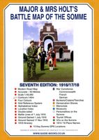
Historische Kaart Major & Mrs Holt's Battle Map of The Somme | Pen and Sword publications
This is the only map available that shows the exact locations of 300 memorials and places of interest on the battlefields of the Somme   This Sixth Edition also covers the American and Canadian areas between Amiens and Montdidier.    It is double sided in four colours with an overall view on one side and a detailed view on the other, both showing battle lines and ORBAT information   There are detailed alphabetical and thematic indexes to all 300 points.   Size - The map measures 19.5 inches (49cm) by 28 inches (71cm). It is printed in four colours and is double sided on firm glossy paper.   On one side at a scale of 1:70,000 is shown the whole of the Somme battle area from Bullecourt in the north to Amiens in the south and from Doullens in the west to Pyronne in the east. Also on this side are the colour coded indexes and the map of the 1918 sector from Villers Bretonneux to Cantigny.   On the other side at a scale of 1:40,000 the battle area mostly, but not exclusively, associate…
9,95
Historische Kaart Major & Mrs Holt's Battle Map of Market Garden | Pen and Sword publications
This is the only map of its kind devised and created by Major and Mrs Holt and is used by many guides   It shows the locations of 300 memorials and war cemeteries over THE WHOLE OPERATION MARKET-GARDEN AREA   It shows the progress of the battle from Leopoldsburg to  Eindhoven, Nijmegen, Arnhem and Oosterbeek overlaid on modern roads   In four colours, double sided and with 10 inset maps it shows all drop and landing zones   Suitable for navigation by car, bicycle or foot   Size - The map measures 19.5 inches (49cm) by 28 inches (71cm). It is printed in four colours and is on firm glossy paper.   On one side at a scale of 1:180,000 is shown the whole of the Market Garden corridor of operations from Arnhem in the north to Leopoldsburg in the south and from Vught in the west to Overloon in the east. See below for details of the other side.   What is Marked on the Map   This map is quite unique and no other exists that shows the Market Garden Corridor in such detail. Over 230 memori…
9,95
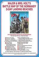
Historische Kaart Major & Mrs Holt's Battle Map of The Normandy D-Day Landing Beaches | Pen and Sword publications
This is the only detailed battle map of the D-Day Beaches area that shows the locations of 400 memorials   The map is double sided showing the US beaches on one side and the British and Canadian on the other   It is in full colour with detailed thematic and alphabetical indexes making it easy to find what you are looking for.   Landing force details and battle lines are overlaid onto a grid of modern roads.   Size - The map measures 19.5 inches (49cm) by 28 inches (71cm).  It is printed in four colours and is on firm glossy paper.   On one side at a scale of 1:116,000 are shown The British Landing Beaches from Bayeux in the west to Ouistreham (covering GOLD,JUNO and SWORD) plus the 6th BR AB DZs from Pegasus Bridge to Dives.   On the other side at a scale of 1:116,000 are shown the US AE DZs around Ste Mere Eglise and Ste Marie du Mont and the US Landing Beaches, UTAH and OMAHA.   The Falaise Gap   There is also a small boxed section showing the area of Falaise and the locatio…
9,95
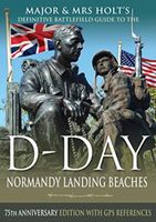
Reisgids Major & Mrs Holt's Definitive Battlefield Guide to the D-Day Normandy Landing Beaches | Pen and Sword publications
Already the best-selling English-language guide to the area, universally known as THE BIBLE, this is the 75th anniversary, completely revised, up-to-date, much expanded edition of the DEFINITIVE GUIDE TO THE D-DAY NORMANDY LANDING BEACHES. The third in the Holts' important series of Battlefield Guides (following the Somme and the Ypres Salient) it employs the same, highly acclaimed formula. Once again the cold facts are interlaced with anecdotes of bravery, humour, sadness and humanity. This new edition now contains: All the landing Beaches: JUNO, SWORD, GOLD, OMAHA, UTAH All the Airborne Operations: British and American Two Approach Routes; Six timed and measured Itineraries 21 in-text Itinerary maps, Battle maps & Diagrams Approx 400 recommended sites within the D-Day planned area of advance, all with photos, each with Latitude & Longitude references (New for this Edition) Over 400 coloured pictures, 352 pages Memorials / Museums / Batteries / Bunkers / Landing fields Allied and G…
23,95
Reisgids The Battles of Arras - north | Pen and Sword publications
The First World War battlefields to the north of Arras - including Vimy Ridge - are among the most famous and most visited sites on the Western Front, rivalled only by those around Ypres and the Somme, and this clearly written, highly illustrated guide is the ideal introduction to them. Visitors can trace for themselves the course of each battle across the modern landscape and gain a fascinating insight into the nature of the fighting in the area - and the wider conflict across the Western Front - throughout the war. The book covers the key battles fought in the northern sector of the Arras front, including the 1917 Battle of Vimy Ridge and battles at Villers au Bois, Oppy Wood and Gavrelle. Expert guides Jon Cooksey and Jerry Murland have devised a series of routes that can be walked, biked or driven, explaining the fighting that occurred at each place in vivid detail. They record what happened, where it happened and why, and point out the sights that remain for the visitor to see. Th…
20,50
Wandelgids Walking Waterloo: A Guide | Pen and Sword publications
Wandelgids over de Slag bij Waterloo   Charles Esdaile’s new guide to the Battle of Waterloo presents the experience of the soldiers who took part in the battle in the most graphic and direct way possible – through their own words. In a series of walks he describes in vivid detail what happened in each location on 18 June 1815 and he quotes at length from eyewitness accounts of the men who were there.   Each phase of the action during that momentous day is covered, from the initial French attacks and the intense fighting at Hougoumont and La Haye Sainte to the charges of the French cavalry against the British squares and the final, doomed attack of Napoleon’s Imperial Guard.   This innovative guide to this historic site is fully illustrated with a selection of archive images from the War Heritage Institute in Brussels, modern colour photographs of the battlefield as it appears today and specially commissioned maps which allow the visitor to follow the course of the battle on the ground…
24,95
Reisgids 1e Wereldoorlog - World War I Battlefields | Bradt Travel Guides
Thoroughly updated for this new 3rd edition, Bradt's World War I Battlefields remains the only compact practical travel guide to cover both French and Belgian battlefield sites involved in one of the deadliest conflicts in human history, which changed the face of foreign policy and European geography forever. The 2014-18 centenary of the First World War was a huge catalyst for battlefield tourism, leading to a proliferation of innovative new museums, memorials, commemorative trails, statues and more - which are comprehensively covered in this update. Co-authored by two award-winning travel writers, this lightweight and pocket-friendly guidebook is perfect for visitors. It covers all the main sites, memorials and museums of the entire Western Front alongside practical information such as travelling there and getting around, and how to book the best guided tours.   In the Belgian section of the book, chapters cover Ypres and the Ypres Salient; Poperinge and Heuvelland; Diksmuide, Veurne …
13,95
Historische Kaart Bataille de Verdun 1916 - Slag om Verdun | IGN - Institut Géographique National
Speciale themakaart over de slag bij Verdun in de 1e Wereldoorlog. Veel details over slagvelden, troepenbewegingen en andere locaties. Gedetailleerd genoeg om alle plekken in het veld terug te vinden. The Great War, World War I commemorative map published by IGN France which presents an overview of the Verdun   Includes three maps. An overview map at a scale of 1:75,000 A more detailed inset map of the battle area A reproduction of a contemporary map showing the area around the Fort de Douaumont at 1:5,000   WW1, 1e wereldoorlog, Eerste wereldoorlog
10,50

Klanten-reviews van Historische Kaart 14 - 18 Map of Verdun (Battlefield map) | Eerste Wereld Oorlog | Pen and Sword publications

Er zijn nog geen beoordelingen voor dit productBen jij de eerste die een review plaatst?

Meer over Historische Kaart 14 - 18 Map of Verdun (Battlefield map) | Eerste Wereld Oorlog | Pen and Sword publications

Productomschrijving

Comprehensive mapping for the Battle of Verdun 1916 and a sizable part of the early days of the Meuse-Argonne Offensive 1918. Clearly produced in full color, with different types of feature in different colors, all supported by two comprehensive keys. For many years the Holts have provided tourers to the battlefields with excellent mapping for the Ypres Salient and the Somme. This map of the Verdun/Meuse area fills one of the many gaps in the coverage of the Western Front. This map of the Verdun battlefield is in the same style, using a color coded system to distinguish the different types of features. It includes some 300 locations of memorials, cemeteries, significant remnants of the battle terrain, remaining fortifications, trenches, the destroyed villages and other vestiges of the war. On the reverse there is a cut out and enlarged section of the Verdun battlefield in particular - the most visited part of the area, which provides greater detail. This section includes the Ossuary at Douamont, Forts Douamont, Vaux and Souville and many more features. The front line at key stages of the battle in 1916 is clearly indicated. GPS references are given for the more significant sites. Roads and major tracks are shown, with restrictions in access as known at the date of publication. The map extends from the eastern fringes of the Argonne Forest to the west and encompasses the whole of the 1916 Verdun battlefield to the east. This means that several places of interest to the student of the American army's offensive in late 1918 are shown. The map is trilingual - in English, French and German - so far as is practicable given the constraints of space. The map is of a manageable size, both in a vehicle and when being used outside.
Webshop.nl maakt gebruik van cookies. Ga je verder op onze website, ga dan akkoord met het plaatsen van cookies en de verwerking van deze data door ons en vermelde partners.