webshop.nl
Categorieën
  Sluiten

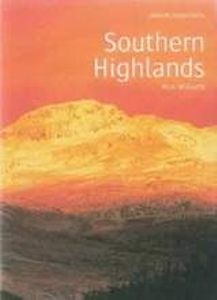
Wandelgids Southern Highlands | Pocket Mountains

Mooi uitgevoerde wandelgids in een handzaam formaat: 15 x 10 cm. De wandelingen zijn duidelijk beschreven, soms een beetje summier. This Pocket Mountains guide to the Southern Highlands of Scotland covers Glenlyon to Rannoch, Kinross to Callander, The Arrochar Alps, The Trossachs to the Mamlorn Hills, Hills of Crianlarich and Tyndrum -40 circular r...
10,95

Webshops met dit product

Webshop
Bezorging
Prijs

Anderen bekeken ook

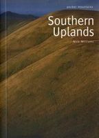
Wandelgids Southern Uplands | Pocket Mountains
Mooi uitgevoerde wandelgids in een handzaam formaat: 15 x 10 cm. De wandelingen zijn duidelijk beschreven, soms een beetje summier. This Pocket Mountains guide to the Southern Uplands of Scotland contains 40 hill walks, trademark photography and inventive circular routes. Each route is accompanied by a full colour photograph, contoured map and additional facts about the history, geology and wildlife. Coverage of The Galloway Hills, Lowther and Moffat Hills, Clyde and Tweed, Edinburgh and Lothian, Cheviot and Langholm Hills.  
10,95
Wandelgids Cheshire | Pocket Mountains
Handige compacte wandelgids met 40 dagwandelingen. Deze gids bevat kleine kaartjes en leuke uitgebreide informatie over wat er langs de route te zien is. Goede wandelkaarten zijn echter we noodzakelijk voor deze tochten: de Ordnance Survey explorer maps of Landanger maps zijn zeer geschikt.   Full of surprises and infused with history, Cheshire is a wonderful place to go for a walk! From the wild and open hills of the Peaks to the low-lying pastures of the Plain, Cheshire is covered in a spider's web of footpaths, bridleways, towpaths and trails and is well served by welcoming pubs and cosy cafes. There is so much to see in this corner of England and there is no better way to explore it than by lacing up your boots and setting off on foot - armed of course with this selection of 40 circular walks.
10,95
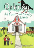
Wandelgids Orkney | Pocket Mountains
Handige compacte wandelgids met 40 dagwandelingen. Deze gids bevat kleine kaartjes en leuke uitgebreide informatie over wat er langs de route te zien is. Goede wandelkaarten zijn echter we noodzakelijk voor deze tochten: de Ordnance Survey explorer maps of Landanger maps zijn zeer geschikt.   The 40 walks in this guide range from a short stroll to hikes of several hours, but most can be completed in half a day or less. The majority are circular, several are lollipop-shaped and some require you to return by the same route. They all, however, end up back where they started, so you will not find yourself miles from your car. Each route is prefaced by an indication of the distance involved and the time it is likely to take. The latter is estimated on the time it took the author to walk the route (averaging around 3.5km per hour) before adding a little for tea, toilet and tourism stops. The timings should be regarded as a rough guide, and if you have to catch a bus or boat at the end of the…
10,95
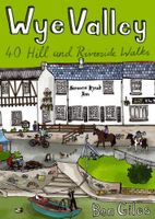
Wandelgids Wye Valley | Pocket Mountains
This guide contains forty circular routes, covering an area somewhat broader than the AONB but within similar north-south boundaries. This collection of walks is split into five areas: Hereford Lowlands and the Woolhope Dome; Archenfield and the Monnow and Trothy Valleys; The Wye Gorge; The Forest of Dean; The Trellech to Chepstow Plateau. In part, the areas reflect the diverse geology and ecology of the landscape, but they are in no way essentially distinct or separate. Each has its own particular attractions and character, but there is much that is shared between all five areas.   Most of the routes are intended as comfortable walks or strolls, manageable by all willing to put one foot in front of another, at most requiring half a day to complete. Occasionally, the cumulative ascent may leave unseasoned legs a little stiffer, but in general the walking is on well-worn paths, lanes and tracks, which should require minimal time and effort for route-finding. However, the sketch maps serve an…
10,95
Wandelgids Walking in the Yorkshire Dales: South and West | Cicerone
Veelzijdige wandelgids van een deel van de Yorkshire Dales, goede kaarten en beschrijvingen en veel keuze uit een behoorlijk aantal wandelingen. Part of a two-book set, this guidebook describes 44 walks in the southern and western Yorkshire Dales, including the famous 23 mile Three Peaks circuit over Pen-y-Ghent, Whernside and Ingleborough. The other, mostly circular routes of 3½ to 13 miles cover the scenic region between Sedbergh, Kirkby Lonsdale, Settle, Skipton and Grassington. The Yorkshire Dales need little introduction: their picturesque scenery and hundreds of miles of footpaths, tracks and bridleways have been attracting walkers for decades. Part of a two-volume set, this guidebook presents over 40 routes in the south and west of the National Park, with bases including Sedburgh, Malham, Grassington, Skipton, Settle and Kirkby Lonsdale. The walks cover the valleys of Wharfedale, Littondale, Malhamdale, Ribblesdale and Dentdale – each with its own distinctive landscape and chara…
19,95
Wandelgids Walking in the Auvergne | Cicerone
Uitgebreide wandelgids van de Auvergne: goede beschrijvingen, veel keuze, kaarten wat minder goed. This handy guidebook offers the finest day walks in five different areas of the Auvergne, an often-forgotten region in central France perfect for accessible day walking in a unique and spectacular landscape. Towns such as Vichy, Clermont-Ferrand and Puy-en-Velay also offer delightful places to base yourself for that perfect walking holiday. The ridges, rocky peaks and verdant valleys of the Cantal supervolcano dominate south-western Auvergne. The centre of the region hosts the unique chain of 'puys' with their pudding bowl forms and the pristine crater lakes of the Sancy massif. In the north, the Montagne Bourbonnaise preserves a pastoral way of life which is quintessentially French while the Haute Loire's rivers and medieval abbeys reward those venturing further off the beaten track. Notes on the geology and history of points of interest passed en route help you to get the most out of yo…
19,95
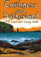
Wandelgids Caithness and Sutherland | Pocket Mountains
Handige compacte wandelgids met 40 dagwandelingen. Deze gids bevat kleine kaartjes en leuke uitgebreide informatie over wat er langs de route te zien is. Goede wandelkaarten zijn echter we noodzakelijk voor deze tochten: de Ordnance Survey explorer maps of Landanger maps zijn zeer geschikt. The county of Ayrshire is located on the Firth of Clyde on the beautiful West Coast of Scotland and is known as one of the most fertile areas of the country, famed for its cattle and crops. Although more industrial to the north, it is in the main a landscape made for walking with an abundance of open countryside and rugged little hills, golden sandy beaches and beautiful sunsets. This guide features 40 mostly moderate walks full of interest which explore all aspects of the region, from craggy cliffs and caves to historic castles, ancient forests to sandy shorelines. Sutherland and Caithness are the most northerly parts of mainland Britain. Northwest Sutherland is a landscape of sandy beaches and sw…
10,95
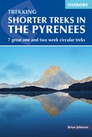
Wandelgids Shorter Treks in the Pyrenees | Cicerone
Uitstekende wandelgids van dit geweldige gebied. Goed beschreven met veel praktische informatie om de route te kunnen lopen, inclusief redelijke kaarten. A guidebook to seven circular treks exploring the Pyrenees of France and Spain. Seven 1 or 2 week routes in dramatic mountain scenery, including the Pic du Midi d'Ossau, Vignemale, Ordesa Canyon, Gavernie, Puigmal and Canigou. Using mostly waymarked mountain paths, with some boulderfield or easy scrambling, the treks are designed with accommodation in mountain refuges or mountain villages at the end of each stage, though there are plenty of options to camp for those who prefer to backpack. Detailed descriptions for each stage of the route are accompanied by sketch maps and elevation profiles, and there are notes on planning, equipment and access. The Pyrenees stretch 400km from Atlantic to Mediterranean, forming a barrier rising to over 3000m between France and Spain. The steep rolling hills of the Basque Country give way to the spe…
23,95
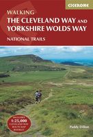
Wandelgids The Cleveland way and the Yorkshire Wolds way | Cicerone
Uitstekende wandelgids van de Cotswolds Way, waarbij naast alle noodzakelijke informatie ook gebruik gemaakt wordt van de echte topografische kaart. Inclusief gidsje met routekaarten van 1:25000 Guidebook to the Cleveland Way and Yorkshire Wolds Way National Trails, plus the Tabular Hills Walk link route. The guidebook also contains a 1:25,000 scale OS route map booklet of the Cleveland Way.   The Cleveland Way National Trail, described in seven day stages, is a fine 177km (110 miles) walk around the North York Moors National Park from Helmsley to Filey. The Yorkshire Wolds Way is one of the quietest of Britain's National Trails and wanders for 130km (80 miles) through gentle, cultivated and sparsely populated countryside. Described here in nine day stages, from Hessle near Redcar to Filey, it links end-to-end with the Cleveland Way on the coast. Also described is the three-day, 80km (50 mile) Tabular Hills Walk, a Regional Trail that allows walkers to close the loop of the Cleveland W…
25,95
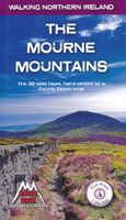
Wandelgids The Mourne Mountains | Knife Edge Outdoor
The only guidebook for the Mourne Mountains written by a County Down local hiker: 30 handpicked routes. The only guidebook for the Mourne Mountains with Real 1:25,000 Maps: this makes navigation easy and saves you money: no need to carry additional maps. Also includes: -Game of Thrones film locations -Numbered waypoints linking maps to text -Quick Reference Route List: enabling you to plan an itinerary to match your ability and schedule. All difficult calculations of time, distance and altitude gain are done for you -Everything the hiker needs to know to plan routes: route descriptions, difficulty, weather, how to get there, and more -Accommodation section -Information on Wildlife, Plants & Geology -History of the Mourne Wall -List of Irish Place Names -Edge to edge colour: the most modern and beautiful Mournes guidebook The Mourne range comprises the highest mountains in Northern Ireland. It is a stunning wilderness which is popular with local walkers but is relatively unknown to thos…
19,50

Klanten-reviews van Wandelgids Southern Highlands | Pocket Mountains

Er zijn nog geen beoordelingen voor dit productBen jij de eerste die een review plaatst?

Meer over Wandelgids Southern Highlands | Pocket Mountains

Productomschrijving

Mooi uitgevoerde wandelgids in een handzaam formaat: 15 x 10 cm. De wandelingen zijn duidelijk beschreven, soms een beetje summier. This Pocket Mountains guide to the Southern Highlands of Scotland covers Glenlyon to Rannoch, Kinross to Callander, The Arrochar Alps, The Trossachs to the Mamlorn Hills, Hills of Crianlarich and Tyndrum -40 circular routes with 45 full colour maps -Each route is circular and takes into account the environmental impact of the walker -The routes vary in difficulty from easy half-day walks to longer, more challenging hikes -Original full colour maps for each route -Stunning colour photography throughout - Covers all the Munros (peaks over 3000 feet) and the best Corbetts (peaks over 2500 feet) in the area) - Designed in durable pocket format to take into the hills - Notes on history, geology and wildlife accompany each section of the book  
Webshop.nl maakt gebruik van cookies. Ga je verder op onze website, ga dan akkoord met het plaatsen van cookies en de verwerking van deze data door ons en vermelde partners.