webshop.nl
Categorieën
  Sluiten

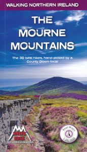
Wandelgids The Mourne Mountains | Knife Edge Outdoor

The only guidebook for the Mourne Mountains written by a County Down local hiker: 30 handpicked routes. The only guidebook for the Mourne Mountains with Real 1:25,000 Maps: this makes navigation easy and saves you money: no need to carry additional maps. Also includes: -Game of Thrones film locations -Numbered waypoints linking maps to text -Quick ...
19,50

Webshops met dit product

Webshop
Bezorging
Prijs

Anderen bekeken ook

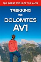
Wandelgids Trekking the Dolomites Av1 | Knife Edge Outdoor
Superhandige wandelgids voor de Alta Via 1 in de Dolomieten. Met deze gids heb je verder niks nodig: alle benodigde Tabacco wandelkaarten zitten in deze gids! The only guidebook exclusively for the AV1.Everything you need to know to plan and walk Italy's most popular long distance route.Real maps inside (Tabacco 1:25,000): the finest maps available for the Dolomites. This makes navigation easy and there is no need to carry additional maps. Also includes:* Numbered waypoints linking maps to text* Unique Itinerary Planner: plan a bespoke itinerary to match your ability and vacation schedule. All difficult calculations of time, distance and altitude gain are done for you* 7 Proposed Itineraries of between 6 and 11 days* Everything the trekker needs to know to plan the route: route descriptions, costs, budget, difficulty, weather, how to get there, and more* Full accommodation listings: spectacularly situated mountain huts* Section on Camping* Exciting variants to the main route* Informati…
19,95
Wandelgids Walking Brittany - Bretagne | Knife Edge Outdoor
Wild coastline: endless towering cliffs, remote rocky headlands, almost forgotten islands and stunning beaches which would not be out of place on a Caribbean island.   Explore a region packed with beauty and historical interest: megalithic sites, World War 2 fortifications, ancient villages and much more. Real IGN Maps inside: 1:25,000.   Also includes:   ▶ Numbered waypoints linking the Real Maps to our clear descriptions ▶ Graded routes to suit all abilities ▶ Everything the hiker needs to know: route descriptions,  difficulty, weather, how to get there, and more ▶ Information on Wildlife and Plants ▶ Carnac and other Megalithic sites  ▶ Section on World War 2 and the 'Atlantic Wall'   France is a large country with a huge and varied coastline. This coastline is very wild and very beautiful but rarely is it both wilder and more beautiful than in Brittany. This stunning part of the world's most visited country has around 3,000 km of sea frontage so you could spend a lifetime here wal…
19,50
Wandelgids The Mourne and Cooley Mountains | The Collins Press
The Mourne and Cooley Mountains are quite simply a hiker’s paradise.   These exhilarating walks will take you to the highest point in Northern Ireland, to scenic Slieve Foye and the ancient summit of Slieve Gullion.    On routes steeped in the legend of the Táin Bó Cúailgne, trek through picturesque woodlands. Discover the highest passage tomb in Ireland, use an old smugglers’ route and walk alongside tranquil reservoirs. The more ambitious will relish the Mourne Wall and Mourne Seven Sevens challenges, and some summits include optional scrambles to the top of dramatic granite tors or rocky outcrops.  Each graded route is illustrated with photographs and specially drawn maps. Snippets on the rich flora, fauna, geology, history, heritage and folklore of each area are included throughout.  So, get your walking boots on and discover the impressive landscape that inspired C.S. Lewis’ magical world of Narnia and served as the backdrop for Game of Thrones.
22,50
Wandelgids Northern Ireland : The Unmissable Hikes | Knife Edge Outdoor
The definitive guidebook for walking in Northern Ireland: 36 epic walks hand-picked by a County Down local. The only guidebook for Northern Ireland with real OSNI maps inside: this makes navigation easy. The Causeway Coast, the Glens of Antrim, the Mourne Mountains, the Sperrins and much more.   Also includes: New walks in the Mournes which were not included in our previous Mourne Mountain book: including the Mournes Grand Traverse, our newly designed 55km challenge circuit which has been divided into two stages. Game of Thrones film locations List of Irish place names Numbered waypoints linking maps to text
21,50
Wandelgids The high mountains of Crete - Kreta | Cicerone
Guidebook to walking and trekking the high mountains of Crete. The largest of the Greek Islands, Crete's mountains provide breathtaking walking and wilderness to this popular island. The routes in this guidebook are graded for difficulty and range from short, easy strolls to challenging, multi-day treks and summit climbs, so there are options for walkers of all abilities.    All the mountain ranges of Crete feature high plains, gorges and ravines, but in the heart of the Lefka Ori there is something else. High above the treeline snow thaws by July to reveal a great circle of massive barren peaks, interspersed with ‘moonscape’ outcrops, or depressions, of sinkholes in black, grey or red rock. This high desert wilderness is seldom visited but covers some 960sqkm.   In central Crete, where the island is at its widest, the huge mass of Psiloritis (Mount Ida) dominates the whole region. Covering about 560sqkm this massif is different in that a single huge, partly scree-surfaced summit ridge…
26,50
Wandelgids Walking in the Auvergne | Cicerone
Uitgebreide wandelgids van de Auvergne: goede beschrijvingen, veel keuze, kaarten wat minder goed. This handy guidebook offers the finest day walks in five different areas of the Auvergne, an often-forgotten region in central France perfect for accessible day walking in a unique and spectacular landscape. Towns such as Vichy, Clermont-Ferrand and Puy-en-Velay also offer delightful places to base yourself for that perfect walking holiday. The ridges, rocky peaks and verdant valleys of the Cantal supervolcano dominate south-western Auvergne. The centre of the region hosts the unique chain of 'puys' with their pudding bowl forms and the pristine crater lakes of the Sancy massif. In the north, the Montagne Bourbonnaise preserves a pastoral way of life which is quintessentially French while the Haute Loire's rivers and medieval abbeys reward those venturing further off the beaten track. Notes on the geology and history of points of interest passed en route help you to get the most out of yo…
19,95
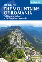
Wandelgids The Mountains of Romania - Roemenië | Cicerone
Guidebook to walks and multi-day treks in the Carpathian mountains of Romania. Includes routes in the Maramures and Bucovina regions, Piatra Craiului ridge, and the Retezat and Fagaras mountains. This guide describes 27 short treks of 2-6 days and 10 day walks in the mountains of Romania. Although there is a slight focus on Transylvania, most of the main massifs are included, with chapters covering the Mountains of Maramures, the Eastern Carpathians, the mountains around Brasov, the Fagara?, the region between the Olt and the Jiu, the Retezat, the mountains of Banat and the Apuseni. Also included is an ascent of Moldoveanu, Romania's highest peak at 2544m.   There is a wealth of advice to help you plan your trip and organise the logistics of your walk or trek. Some routes avail of the network of mountain huts; others offer opportunities to camp in attractive wild locations. Overviews and a route summary table make it easy to choose an appropriate excursion. Each route includes clear de…
26,50
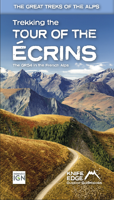
Wandelgids Tour of the Ecrins National Park GR54 | Knife Edge Outdoor
Overzichtelijke routegids van deze prachtige wandelroute. Per etappe vind je een hoogteprofiel, goede beschrijvingen van de wandelroute, een topografische kaart op gedetailleerde schaal. Voor en achterin de gids staat aanvullende praktische informatie zoals adressen van campings, andere accommodaties en bijvoorbeeld een paar pagina's over de flora en fauna.  The Tour of the Ecrins National Park is also known as the GR54. It is arguably the best trek in the Alps. It is an incredible walk of 193km (120 miles) around the incomparable Ecrins National Park in the Southern French Alps. It takes  9-12 days. On the way, 14 magnificent mountain passes are crossed. It is almost certainly the finest trek that you have never heard of! The Ecrins Massif is the second highest range of mountains in the French Alps: the Mont Blanc Massif is of course the highest.   Unspoilt and remote high mountain terrain: snow frosted summits, beautiful valleys and pastures, sparkling azure lakes, carpets of wild…
26,95
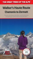
Wandelgids Walker's Haute Route: Chamonix to Zermatt | Knife Edge Outdoor
Overzichtelijke routegids van deze prachtige wandelroute. Per etappe vind je een hoogteprofiel, goede beschrijvingen van de wandelroute, een topografische kaart op gedetailleerde schaal. Voor en achterin de gids staat aanvullende praktische informatie zoals adressen van campings, andere accommodaties en bijvoorbeeld een paar pagina's over de flora en fauna.  The only guidebook for the Walker's Haute Route with Real Maps: 1:25,000/1:50,000 mapping included for each stage. This makes navigation easy and saves you money: no need to buy additional maps. Also includes:* Unique Itinerary Planner: plan a bespoke itinerary to match your ability and vacation schedule. All difficult calculations of time, distance and altitude gain are done for you* 6 Proposed Itineraries of between 10 and 14 days* Everything the trekker needs to know to plan the route: route descriptions, costs, budget, difficulty, weather, how to get there, and more* Full accommodation listings: spectacularly situated mountain …
20,95
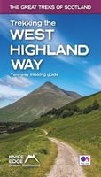
Wandelgids Trekking the West Highland Way: Two-Way Trekking Guide | Knife Edge Outdoor
The definitive two-way guide to the West Highland Way: both northbound and southbound routes are described in full. Real Maps: Full Ordnance Survey Explorer mapping inside (1:25,000). All accommodation is numbered and marked on the maps. 17 different itineraries: schedules of 3, 4, 5, 6, 7, 8, 9, 10 and 11 days for hikers and runners. Includes both southbound and northbound itineraries. Difficult calculations of time, distance and altitude gain are done for you. Also includes: - Detailed information on equipment and travelling light - Everything the trekker needs to know: route, costs, difficulty, weather, travel, and more - Full accommodation listings: the best inns, B&Bs and hotels - Detailed section on camping - Essential info for both self-guided and guided trekkers - Information on geology, history, plants and wildlife - Numbered waypoints linking the Real Maps to our clear descriptions The West Highland Way, which is one of 'Scotland's Great Trails', travels 96 miles through …
19,50

Klanten-reviews van Wandelgids The Mourne Mountains | Knife Edge Outdoor

Er zijn nog geen beoordelingen voor dit productBen jij de eerste die een review plaatst?

Meer over Wandelgids The Mourne Mountains | Knife Edge Outdoor

Productomschrijving

The only guidebook for the Mourne Mountains written by a County Down local hiker: 30 handpicked routes. The only guidebook for the Mourne Mountains with Real 1:25,000 Maps: this makes navigation easy and saves you money: no need to carry additional maps. Also includes: -Game of Thrones film locations -Numbered waypoints linking maps to text -Quick Reference Route List: enabling you to plan an itinerary to match your ability and schedule. All difficult calculations of time, distance and altitude gain are done for you -Everything the hiker needs to know to plan routes: route descriptions, difficulty, weather, how to get there, and more -Accommodation section -Information on Wildlife, Plants & Geology -History of the Mourne Wall -List of Irish Place Names -Edge to edge colour: the most modern and beautiful Mournes guidebook The Mourne range comprises the highest mountains in Northern Ireland. It is a stunning wilderness which is popular with local walkers but is relatively unknown to those outside of Ireland. The highest mountain in the range is Slieve Donard (849m), Northern Ireland's highest point, which sweeps majestically down into the Irish Sea at the pretty seaside town of Newcastle. This proximity to the sea is a characteristic of the Mournes, often creating a mysterious atmosphere, as frequently the high peaks can be seen rising dramatically out of a blanket of sea mist. The Mournes have everything you would expect from a mountain region on the Emerald Isle: beautifully long ridges, magnificent summits and vibrant heather and gorse covered slopes. However, there is one key thing which sets it apart: uniquely, the whale-backed slopes of the highest peaks are completely encircled by the lovely dry-stone 'Mourne Wall'.
Webshop.nl maakt gebruik van cookies. Ga je verder op onze website, ga dan akkoord met het plaatsen van cookies en de verwerking van deze data door ons en vermelde partners.