webshop.nl
Categorieën
  Sluiten

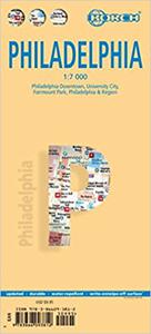
Stadsplattegrond Philadelphia | Borch

Borch Philadelphia is een duidelijke, geplastificeerde plattegrond van het centrum met informatie over openbaar vervoer en bezienswaardigheden. Inclusief straatnamenregister.   Our soft-laminated folded map of Philadelphia shows: Philadelphia Downtown 1:7 000, Philadelphia & Region 1:125 000, University City 1:12 000, Fairmount Park 1:15 000, Publi...
11,50

Webshops met dit product

Webshop
Bezorging
Prijs

Anderen bekeken ook

Stadsplattegrond Praag | Borch
Borch Praag is een duidelijke, geplastificeerde plattegrond van het centrum met informatie over openbaar vervoer en bezienswaardigheden. Inclusief straatnamenregister. Our soft-laminated folded map of Prague shows: Old Town & Lesser Quarter 1:10 000, Prague 1:15 000, Prague Castle 1:5 000, Prague & Region 1:100 000, Czech Republic (West) 1:1 200 000, Public Transport Prague, Czech Republic administrative. Borch Maps are easy to fold, durable and water-repellent with a wipeable surface. Borch Maps show hotels, museums, monuments, markets, public transport, top sights and points of interest, useful statistics, conversion charts for temperatures, weights and measurements, climate charts showing temperatures, sunshine hours, precipitation and humidity, overview maps, time zones, and much more...   Prague, also known as "the Golden City" or "the City of a Hundred Spires" is the capital and largest city in the Czech Republic. Situated in the center of Bohemia it is set romantically on the ba…
10,25
Stadsplattegrond Boston | Borch
Borch Boston is een duidelijke, geplastificeerde plattegrond van het centrum met informatie over openbaar vervoer en bezienswaardigheden. Inclusief straatnamenregister.   Our soft-laminated folded map of Boston shows: Boston Downtown 1:11 000, Eastern Massachusetts 1:600 000, Boston and Region 1:200 000, Logan International Airport 1:33 000, Public Transport Boston, Top 30 Sights and USA administrative and time zones. Borch maps are easy to fold, durable and water-repellent with a wipeable surface. Borch Maps show hotels, museums, monuments, markets, top sights and points of interest, useful statistics, conversion charts for temperatures, weights and measurements, climate charts showing temperatures, sunshine hours, precipitation and humidity, overview maps, time zones, and much more...   Founded in 1630, Boston is often referred to as the cradle of American democracy, due to major events having taken place here during the American Revolution. Boston is an important port and manufactur…
10,25
Stadsplattegrond New York City | Borch
Borch New York City is een duidelijke, geplastificeerde plattegrond van het centrum van New York (Manhattan) en nog een stukje van Brooklyn en Queens met informatie over openbaar vervoer en bezienswaardigheden. Inclusief straatnamenregister.   Our soft-laminated folded map of New York City shows: Central New York City 1:15 000, Flushing Meadows 1:15 000, Five Boroughs 1:100 000, Public Transport New York City, USA administrative & time zones. Borch Maps are easy to fold, durable and water-repellent with a wipeable surface. Borch Maps show hotels, museums, monuments, markets, public transport, top sights and points of interest, useful statistics, conversion charts for temperatures, weights and measurements, climate charts showing temperatures, sunshine hours, precipitation and humidity, overview maps, time zones, and much more...   Nicknamed "The Big Apple", NYC is the most populous city in the United States. Situated in the state of New York, the city has served as the gateway to the U…
10,25
Stadsplattegrond Oslo | Borch
Borch Oslo is een duidelijke, geplastificeerde plattegrond van het centrum met informatie over openbaar vervoer en bezienswaardigheden. Inclusief straatnamenregister. Our soft-laminated folded map of Oslo shows: Oslo Centre 1:11 000, Holmenkollen & Tryvannshogda 1:25 000, Oslo & Region 1:200 000, Western Norway 1:800 000, Public Transport Oslo, Norway administrative & time zones, Top 30 Sights. Borch Maps show hotels, museums, monuments, markets, public transport, top sights and points of interest, useful statistics, conversion charts for temperatures, weights and measurements, climate charts showing temperatures, sunshine hours, precipitation and humidity, overview maps, time zones, and much more...   The capital city of Norway was founded by King Harald III around 1048 and is located at the northern end of the Oslofjord. Today Oslo, home of the Nobel Peace Center Foundation, is the commercial, maritime, financial, governmental and cultural center of the country. It has a population o…
10,25
Stadsplattegrond Singapore | Borch
Borch Singapore is een duidelijke, geplastificeerde plattegrond van het centrum met informatie over openbaar vervoer en bezienswaardigheden. Inclusief straatnamenregister. Our soft-laminated folded map of Singapore shows: Singapore City 1:14 000, Singapore 1:120 000, Sentosa Island 1:25 000, Changi Airport 1:4 000 and the Public Transportation SMRT schematic map. Borch Maps are easy to fold, durable and water-repellent with a wipeable surface. Borch Maps show hotels, museums, monuments, markets, public transport, top sights and points of interest, useful statistics, conversion charts for temperatures, weights and measurements, climate charts showing temperatures, sunshine hours, precipitation and sea temperatures, overview maps and much more...   The Republic of Singapore (also known as "Lion City", although history tells us Singapore's founder probably meant "tigers") is a very clean and orderly city-state located on the southern tip of the Malay Peninsula, with Changi airport usually…
10,25
Stadsplattegrond Montréal | Borch
Borch Montréal is een duidelijke, geplastificeerde plattegrond van het centrum met informatie over openbaar vervoer en bezienswaardigheden. Inclusief straatnamenregister.   Our soft-laminated folded map of Montreal shows: Montreal Center 1:15 000, Olympic Park 1:15 000, Old Montreal 1:6500, Montreal & Region 1:250 000, Public Transport Montreal, Underground City Montreal, Top 30 Sights, Canada administrative & time zones. Borch Maps are easy to fold, durable and water-repellent with a wipeable surface. Borch Maps show hotels, museums, monuments, markets, public transport, top sights and points of interest, useful statistics, conversion charts for temperatures, weights and measurements, climate charts showing temperatures, sunshine hours, precipitation and humidity, overview maps, time zones, and much more...   Named for Mont Royal in the center of downtown, which provides some interesting vistas, Canada's third-largest city is the largest in Quebec province. Montreal, the cultural cent…
10,25
Stadsplattegrond Istanbul | Borch
Borch Istanbul is een duidelijke, geplastificeerde plattegrond van het centrum met informatie over openbaar vervoer en bezienswaardigheden. Inclusief straatnamenregister.   Our soft-laminated folded map of Istanbul shows: Istanbul 1:11 000, Topkapi Palace 1:4 000, Grand Bazaar 1:3 000, Üsküdar 1:13 000, Greater Istanbul 1:150 000, Northwestern Turkey 1:2 000 000, Public Transport Istanbul, Turkey administrative & time zones, Top 30 sights. Borch Maps are easy to fold, durable and water-repellent with a wipeable surface. Borch Maps show hotels, museums, monuments, markets, public transport, top sights and points of interest, useful statistics, conversion charts for temperatures, weights and measurements, climate charts showing temperatures, sunshine hours, precipitation and humidity, overview maps, time zones, and much more...   Istanbul (formerly known as Byzantium and Constantinople) is Europe's most populous city (circa 13 million inhabitants) and is located on the Bosphorus Strait. …
10,25
Stadsplattegrond Rio de Janeiro | Borch
Geplastificeerde wegenkaart van Rio de Janeiro voor toeristisch gebruik. Met stadsplattegrond en inclusief index. Met kaarten van de omgeving van Rio, 30 bezienswaardigheden en openbaar vervoer in Rio de Janeiro.   Our soft-laminated folded map of Rio de Janeiro shows: Rio de Janeiro Centre 1:13 000, Quinta da Boa Vista 1:13 000, Corcovado 1:13 000, Ipanema, Leblon 1:13 000, Greater Rio de Janeiro 1: 175 000, Rio de Janeiro and Sao Paulo 1:4 000 000, Public Transport Rio de Janeiro, Brazil administrative and time zones and Top 30 sights. Borch maps are easy to fold, durable and water-repellent with a wipeable surface. Borch Maps show hotels, museums, monuments, markets, public transport, top sights and points of interest, useful statistics, conversion charts for temperatures, weights and measurements, climate charts showing temperatures, sunshine hours, precipitation and humidity, overview maps, time zones, and much more...   The city of Rio de Janeiro ("January River") is located in t…
10,25
Stadsplattegrond Tokyo - Tokio | Borch
Borch Tokio is een duidelijke, geplastificeerde plattegrond van het centrum met informatie over openbaar vervoer en bezienswaardigheden. Inclusief straatnamenregister.   Our soft-laminated folded map of Tokyo shows: Tokyo 1:17 000, Tokyo Bay & Shinagawa 1:19 000, Tokyo & Region 1:1 300 000, Tokyo Subway Route Map, Japan administrative and time zones, Top 30 Sights. Borch Maps are easy to fold, durable and water-repellent with a wipeable surface. Borch Maps show hotels, museums, monuments, markets, public transport, top sights and points of interest, useful statistics, conversion charts for temperatures, weights and measurements, climate charts showing temperatures, sunshine hours, precipitation and humidity, overview maps, time zones, and much more...   Tokyo, the vast capital city of Japan, is also one of the 47 Japanese prefectures. Tokyo means "Eastern Capital", is located in the Kanto region on the southeastern tip of Honshu (the main island of Japan), is home to the Japanese gover…
10,25
Stadsplattegrond Budapest - Boedapest | Borch
Borch Budapest is een duidelijke, geplastificeerde plattegrond van het centrum met informatie over openbaar vervoer en bezienswaardigheden. Inclusief straatnamenregister.   Our soft-laminated folded map of Budapest shows: Budapest 1:11 000, Budapest & Region 1:400 000, Margaret Island 1:11 000, Public Transportation Budapest, Top 30 Sights, Hungary administrative and time zones. Borch Maps are easy to fold, durable and water-repellent with a wipeable surface. Borch Maps show hotels, museums, monuments, markets, public transport, top sights and points of interest, useful statistics, conversion charts for temperatures, weights and measurements, climate charts showing temperatures, sunshine hours, precipitation and humidity, overview maps, time zones, and much more...   Budapest is the capital and largest city of Hungary and its commercial, transport and cultural center. Located on the famous Danube river, the Buda half of the city lies on the western bank while Pest is located on the eas…
10,25

Klanten-reviews van Stadsplattegrond Philadelphia | Borch

Er zijn nog geen beoordelingen voor dit productBen jij de eerste die een review plaatst?

Meer over Stadsplattegrond Philadelphia | Borch

Productomschrijving

Borch Philadelphia is een duidelijke, geplastificeerde plattegrond van het centrum met informatie over openbaar vervoer en bezienswaardigheden. Inclusief straatnamenregister.   Our soft-laminated folded map of Philadelphia shows: Philadelphia Downtown 1:7 000, Philadelphia & Region 1:125 000, University City 1:12 000, Fairmount Park 1:15 000, Public Transport Philadelphia, Top 30 Sights, USA administrative & time zones. Borch Maps are easy to fold, durable and water-repellent with a wipeable surface. Borch Maps show hotels, museums, monuments, markets, public transport, top sights and points of interest, useful statistics, conversion charts for temperatures, weights and measurements, climate charts showing temperatures, sunshine hours, precipitation and humidity, overview maps, time zones, and much more...   Thanks to Benjamin Franklin, one of the founding fathers of the United States, the ideas and actions leading to the American Revolution were formed in Philadelphia and for this reason the city is known as "The Birthplace of America". Philadelphia was the center of the original 13 American colonies and is today the largest city in Pennsylvania. Affectionately called "Philly", Philadelphia is an important commercial, educational and cultural center. The most impressive sight of historical importance is Independence Hall, where the Declaration of Independence was signed and the Liberty Bell can be seen in the nearby Liberty Bell Center. Apart from its many historical museums the city has several art museums, science museums and museums for natural history, archaeology and anthropology. Philly's vibrant night life can be experienced on South Street and in the Old City, and music fans shouldn't miss the Avenue of the Arts in City Center, home to the Philadelphia Opera and Orchestra as well as many excellent restaurants.  
Webshop.nl maakt gebruik van cookies. Ga je verder op onze website, ga dan akkoord met het plaatsen van cookies en de verwerking van deze data door ons en vermelde partners.