webshop.nl
Categorieën
  Sluiten

Stadsplattegrond Budapest - Boedapest | Borch

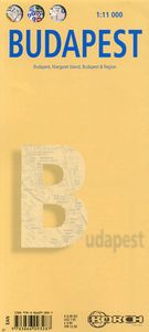
Borch Budapest is een duidelijke, geplastificeerde plattegrond van het centrum met informatie over openbaar vervoer en bezienswaardigheden. Inclusief straatnamenregister.   Our soft-laminated folded map of Budapest shows: Budapest 1:11 000, Budapest & Region 1:400 000, Margaret Island 1:11 000, Public Transportation Budapest, Top 30 Sights, Hungary...
10,25

Webshops met dit product

Webshop
Bezorging
Prijs

Anderen bekeken ook

Stadsplattegrond Wenen | Borch
Borch Wenen is een duidelijke, geplastificeerde plattegrond van het centrum met informatie over openbaar vervoer en bezienswaardigheden. Inclusief straatnamenregister.   Our soft-laminated folded map of Vienna shows: Vienna Centre 1:11 000, UNO-City 1:11 000, Schönbrunn 1:11 000, Hofburg 1: 7 000, Vienna & Region 1:100 000, Public Transport Vienna, Austria administrative and Top 30 sights. Borch Maps are easy to fold, durable and water-repellent with a wipeable surface. Borch Maps show hotels, museums, monuments, markets, public transport, top sights and points of interest, useful statistics, conversion charts for temperatures, weights and measurements, climate charts showing temperatures, sunshine hours, precipitation and humidity, overview maps, time zones, and much more...   Vienna, situated in the east of Austria, is not only its largest city but also its capital in cultural, economic and political terms. Vienna boasts a high standard of living and was designated a UNESCO World Her…
10,25
Stadsplattegrond Montréal | Borch
Borch Montréal is een duidelijke, geplastificeerde plattegrond van het centrum met informatie over openbaar vervoer en bezienswaardigheden. Inclusief straatnamenregister.   Our soft-laminated folded map of Montreal shows: Montreal Center 1:15 000, Olympic Park 1:15 000, Old Montreal 1:6500, Montreal & Region 1:250 000, Public Transport Montreal, Underground City Montreal, Top 30 Sights, Canada administrative & time zones. Borch Maps are easy to fold, durable and water-repellent with a wipeable surface. Borch Maps show hotels, museums, monuments, markets, public transport, top sights and points of interest, useful statistics, conversion charts for temperatures, weights and measurements, climate charts showing temperatures, sunshine hours, precipitation and humidity, overview maps, time zones, and much more...   Named for Mont Royal in the center of downtown, which provides some interesting vistas, Canada's third-largest city is the largest in Quebec province. Montreal, the cultural cent…
10,25
Stadsplattegrond Praag | Borch
Borch Praag is een duidelijke, geplastificeerde plattegrond van het centrum met informatie over openbaar vervoer en bezienswaardigheden. Inclusief straatnamenregister. Our soft-laminated folded map of Prague shows: Old Town & Lesser Quarter 1:10 000, Prague 1:15 000, Prague Castle 1:5 000, Prague & Region 1:100 000, Czech Republic (West) 1:1 200 000, Public Transport Prague, Czech Republic administrative. Borch Maps are easy to fold, durable and water-repellent with a wipeable surface. Borch Maps show hotels, museums, monuments, markets, public transport, top sights and points of interest, useful statistics, conversion charts for temperatures, weights and measurements, climate charts showing temperatures, sunshine hours, precipitation and humidity, overview maps, time zones, and much more...   Prague, also known as "the Golden City" or "the City of a Hundred Spires" is the capital and largest city in the Czech Republic. Situated in the center of Bohemia it is set romantically on the ba…
10,25
Stadsplattegrond Hamburg | Borch
Borch Hamburg is een duidelijke, geplastificeerde plattegrond van het centrum met informatie over openbaar vervoer en bezienswaardigheden. Inclusief straatnamenregister.   Our soft-laminated folded map of Hamburg shows: Hamburg 1:22 000, Hamburg Centre 1:10 500, Blankenese 1:22 000, Hamburg Airport 1:22 000, Hamburg Harbour 1:25 000, Greater Hamburg 1:130 000, public transport, Top 30 sights, Germany administrative & time zone. Borch Maps are easy to fold, durable and water-repellent with a wipeable surface. Borch Maps show hotels, museums, monuments, markets, public transport, top sights and points of interest, useful statistics, conversion charts for temperatures, weights and measurements, climate charts showing temperatures, sunshine hours, precipitation and humidity, overview maps, time zones, and much more...   Located on the southern tip of the Jutland peninsula between continental Europe, Scandinavia, the North and the Baltic Sea, the Hanseatic City of Hamburg is Germany's secon…
10,25
Stadsplattegrond Toronto | Borch
Borch Toronto is een duidelijke, geplastificeerde plattegrond van het centrum met informatie over openbaar vervoer en bezienswaardigheden. Inclusief straatnamenregister.   Our soft-laminated folded map of Toronto shows: Toronto City 1:17 500, The Beaches 1:17 500, Toronto Islands 1:20 000, Toronto & Region 1:500 000, Niagara Falls 1:25 000, Public Transport Toronto, Canada administrative & time zones and Top 30 Sights. Borch Maps are easy to fold, durable and water-repellent with a wipeable surface. Borch Maps show hotels, museums, monuments, markets, public transport, top sights and points of interest, useful statistics, conversion charts for temperatures, weights and measurements, climate charts showing temperatures, sunshine hours, precipitation and humidity, overview maps, time zones, and much more...   Toronto, Canada’s largest city and commercial capital, is the capital of the province of Ontario. Telecommunication, transportation, aerospace, business services, finance, media, fi…
10,25
Stadsplattegrond Chicago | Borch
Borch Chicago is een duidelijke, geplastificeerde plattegrond van het centrum met informatie over openbaar vervoer en bezienswaardigheden. Inclusief straatnamenregister.   Our soft-laminated folded map of Chicago shows: Chicago Downtown 1:8 000, Lincoln Park 1:16 000, Hyde Park 1:20 000, Chicago & Region 1:250 000, O'Hare Airport 1: 22 500, Public Transportation CTA, Top 30 Sights and USA administrative & time zones. Borch Maps are easy to fold, durable and water-repellent with a wipeable surface. Borch Maps show hotels, museums, monuments, markets, public transport, top sights and points of interest, useful statistics, conversion charts for temperatures, weights and measurements, climate charts showing temperatures, sunshine hours, precipitation and humidity, overview maps, time zones, and much more...   Not only famous for Barack Obama and Al Capone, Chicago is also called "America's second city" or the "Windy City". Chicago is the largest city in the state of Illinois, is located on…
10,25
Stadsplattegrond Barcelona | Borch
Borch Barcelona is een duidelijke, geplastificeerde plattegrond van het centrum met informatie over openbaar vervoer en bezienswaardigheden. Inclusief straatnamenregister.   Our soft-laminated folded map of Barcelona shows: Barcelona Centre 1:11 000, Royal Palace 1: 11 000, Parc Güell 1:11 000, Old Town 1:5 500, Barcelona and Region 1:150 000, Public Transport Barcelona, Top 30 Sights and Spain administrative. Borch maps are easy to fold, durable and water-repellent with a wipeable surface. Borch Maps show hotels, museums, monuments, markets, top sights and points of interest, useful statistics, conversion charts for temperatures, weights and measurements, climate charts showing temperatures, sunshine hours, precipitation and humidity, overview maps, time zones, and much more...   The city of Barcelona is situated on the beautiful Mediterranean coast and is bordered by the Serra de Collserola mountain ridge and the estuaries of the Llobregat and Besòs rivers. The capital city of "Catal…
10,25
Stadsplattegrond Rome | Borch
Borch Rome is een duidelijke, geplastificeerde plattegrond van het centrum met informatie over openbaar vervoer en bezienswaardigheden. Inclusief straatnamenregister.   Our soft-laminated folded map of Rome shows: Rome 1:15 000, Rome Centre 1:11 000, Vatican 1:7 000, Rome & Region 1:250 000, Roman Forum 1:7 000, Public Transport Rome, Italy administrative and Top 30 Sights. Borch Maps are easy to fold, durable and water-repellent with a wipeable surface. Borch Maps show hotels, museums, monuments, markets, public transport, top sights and points of interest, useful statistics, conversion charts for temperatures, weights and measurements, climate charts showing temperatures, sunshine hours, precipitation and humidity, overview maps, time zones, and much more...   According to legend the Roman Empire's capital city was founded by Romulus and Remus, two brothers reared by a she-wolf. Rome was built on seven hills and was the centre of the ancient world. Classical masonic ruins bear witnes…
10,25
Stadsplattegrond Streetwise Budapest | Michelin
REVISED 2023Streetwise Budapest Map is a laminated city center map of Budapest, Hungary. The accordion-fold pocket size travel map has an integrated metro map including lines & stations. Coverage includes:Main Budapest Map Front 1: 17,000Main Budapest Map Back 1:11,000Budapest City Center Map 1:11,000Millennium City Center Map 1:17,000Budapest Metro MapDimensions: 4" x 8.5" folded, 8.5" x 27" unfoldedPeople say Budapest is the Paris of Central Europe.   Maybe that statement is true because it combines a combination of western luxuries, architectural beauty, and cosmopolitan European traditions. But this baroque city is still connected to its Eastern European heritage with the steaming baths, incredibly complex language and lusty cuisine. Budapest straddles a curve in the river Danube which bisects two distinct parts.   The east side is known as Pest and the west side is known as Buda, hence Budapest. It's a very logical, well laid out city. Castle Hill is the premier destination for vi…
9,95
Stadsplattegrond Philadelphia | Borch
Borch Philadelphia is een duidelijke, geplastificeerde plattegrond van het centrum met informatie over openbaar vervoer en bezienswaardigheden. Inclusief straatnamenregister.   Our soft-laminated folded map of Philadelphia shows: Philadelphia Downtown 1:7 000, Philadelphia & Region 1:125 000, University City 1:12 000, Fairmount Park 1:15 000, Public Transport Philadelphia, Top 30 Sights, USA administrative & time zones. Borch Maps are easy to fold, durable and water-repellent with a wipeable surface. Borch Maps show hotels, museums, monuments, markets, public transport, top sights and points of interest, useful statistics, conversion charts for temperatures, weights and measurements, climate charts showing temperatures, sunshine hours, precipitation and humidity, overview maps, time zones, and much more...   Thanks to Benjamin Franklin, one of the founding fathers of the United States, the ideas and actions leading to the American Revolution were formed in Philadelphia and for this rea…
11,50

Klanten-reviews van Stadsplattegrond Budapest - Boedapest | Borch

Er zijn nog geen beoordelingen voor dit productBen jij de eerste die een review plaatst?

Meer over Stadsplattegrond Budapest - Boedapest | Borch

Productomschrijving

Borch Budapest is een duidelijke, geplastificeerde plattegrond van het centrum met informatie over openbaar vervoer en bezienswaardigheden. Inclusief straatnamenregister.   Our soft-laminated folded map of Budapest shows: Budapest 1:11 000, Budapest & Region 1:400 000, Margaret Island 1:11 000, Public Transportation Budapest, Top 30 Sights, Hungary administrative and time zones. Borch Maps are easy to fold, durable and water-repellent with a wipeable surface. Borch Maps show hotels, museums, monuments, markets, public transport, top sights and points of interest, useful statistics, conversion charts for temperatures, weights and measurements, climate charts showing temperatures, sunshine hours, precipitation and humidity, overview maps, time zones, and much more...   Budapest is the capital and largest city of Hungary and its commercial, transport and cultural center. Located on the famous Danube river, the Buda half of the city lies on the western bank while Pest is located on the eastern bank. Once the second most important city in the Austro-Hungarian Empire, with a settlement history including Celts, Romans and Ottoman Turks, Budapest's landmarks bear testimony to its dramatically rich history. Sights that must be seen include the largest synagogue in Europe, the second largest baroque castle in the world, the third largest parliament building in the world, the third largest church in Europe and innumerable museums and beautiful palaces which can all be accessed via a reliable public transport system. Budapest is a great place to shop, so look out for the antiques and flea markets and make sure to visit the Great Market Hall and bring home some of the famous Hungarian paprika. April to October are the best months to visit!  
Webshop.nl maakt gebruik van cookies. Ga je verder op onze website, ga dan akkoord met het plaatsen van cookies en de verwerking van deze data door ons en vermelde partners.