webshop.nl
Categorieën
  Sluiten

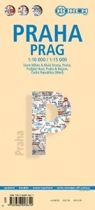
Stadsplattegrond Praag | Borch

Borch Praag is een duidelijke, geplastificeerde plattegrond van het centrum met informatie over openbaar vervoer en bezienswaardigheden. Inclusief straatnamenregister. Our soft-laminated folded map of Prague shows: Old Town & Lesser Quarter 1:10 000, Prague 1:15 000, Prague Castle 1:5 000, Prague & Region 1:100 000, Czech Republic (West) 1:1 200 00...
10,25

Webshops met dit product

Webshop
Bezorging
Prijs

Anderen bekeken ook

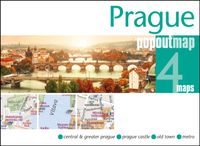
Stadsplattegrond Popout Map Praag Prague | Compass Maps
Handig ( borstzak- ) formaat stadsplattegrond met voldoende detail, zodat je ook de kleinere straatjes erop aantreft. Van veel wereldsteden inmidddels leverbaar en dat is mooi, want juist in dit soort steden wil je je handen liever vrij houden en niet teveel hoeven stoeien met het uitvouwen van een grote plattegrond, en/of teveel als "toerist" opvallen. Door het unieke vouwsysteem blijft alles zeer compact en biedt het kaartje een razendvlugge manier van orientatie. Wel is dit product alleen geschikt voor het ( grote ) centrum van de stad.Verder geven de kaartjes uit deze reeks ook de meeste highlights van de stad aan en ( indien van toepassing ) een overzichtskaartje van de metro. Discover the Czech capital of Prague in all its historic beautywith the help of this genuinely pocket-sized, pop-up map. Small in size yet bigon detail, this compact, dependable, Prague city map will ensure you don't missa thing. Includes 2 PopOut maps - a detailed street map of Prague city centre as well a…
7,95
Stadsplattegrond Hamburg | Borch
Borch Hamburg is een duidelijke, geplastificeerde plattegrond van het centrum met informatie over openbaar vervoer en bezienswaardigheden. Inclusief straatnamenregister.   Our soft-laminated folded map of Hamburg shows: Hamburg 1:22 000, Hamburg Centre 1:10 500, Blankenese 1:22 000, Hamburg Airport 1:22 000, Hamburg Harbour 1:25 000, Greater Hamburg 1:130 000, public transport, Top 30 sights, Germany administrative & time zone. Borch Maps are easy to fold, durable and water-repellent with a wipeable surface. Borch Maps show hotels, museums, monuments, markets, public transport, top sights and points of interest, useful statistics, conversion charts for temperatures, weights and measurements, climate charts showing temperatures, sunshine hours, precipitation and humidity, overview maps, time zones, and much more...   Located on the southern tip of the Jutland peninsula between continental Europe, Scandinavia, the North and the Baltic Sea, the Hanseatic City of Hamburg is Germany's secon…
10,25
Stadsplattegrond Singapore | Borch
Borch Singapore is een duidelijke, geplastificeerde plattegrond van het centrum met informatie over openbaar vervoer en bezienswaardigheden. Inclusief straatnamenregister. Our soft-laminated folded map of Singapore shows: Singapore City 1:14 000, Singapore 1:120 000, Sentosa Island 1:25 000, Changi Airport 1:4 000 and the Public Transportation SMRT schematic map. Borch Maps are easy to fold, durable and water-repellent with a wipeable surface. Borch Maps show hotels, museums, monuments, markets, public transport, top sights and points of interest, useful statistics, conversion charts for temperatures, weights and measurements, climate charts showing temperatures, sunshine hours, precipitation and sea temperatures, overview maps and much more...   The Republic of Singapore (also known as "Lion City", although history tells us Singapore's founder probably meant "tigers") is a very clean and orderly city-state located on the southern tip of the Malay Peninsula, with Changi airport usually…
10,25
Stadsplattegrond Beijing - Peking | Borch
Borch Beijing is een duidelijke, geplastificeerde plattegrond van het centrum met informatie over openbaar vervoer en bezienswaardigheden. Inclusief straatnamenregister.   Our soft-laminated folded map of Beijing shows: Beijing 1:75 000, Central Beijing 1:24 000, Beijing and Region 1:1 200 000, Forbidden City 1:6000, Summer Palace 1:6000, Chengde 1:30 000, Fragrant Hills Park 1:13 000, Badaling 1:18 000, Public Transport Beijing, Top 30 sights, Beijing Shi administrative and China administrative and time zones. Borch maps are easy to fold, durable and water-repellent with a wipeable surface. Borch Maps show hotels, museums, monuments, markets, top sights and points of interest, useful statistics, conversion charts for temperatures, weights and measurements, climate charts showing temperatures, sunshine hours, precipitation and humidity, overview maps, time zones, and much more...   Beijing, formerly known as Peking, is the capital and second most populous city of the People's Republic …
10,25
Reisgids Pocket Prague - Praag | Lonely Planet
Klein compact stadgidsje voor Praag met alle essentiele informatie voor een paar dagen. Eten & drinken, Accomodaties en bezienswaardigheden. Met stadsplattegrond. Lonely Planet's Pocket Prague is your guide to the city's best experiences and local life - neighbourhood by neighbourhood; Grab a coffee in the Old Town Square, admire Prague Castle from Charles Bridge and wander through the old Jewish Cemetery; all with your trusted travel companion. Uncover the best of Prague and make the most of your trip!Inside Lonely Planet's Pocket Prague: Full-colour maps and travel photography throughoutHighlights and itineraries help you tailor a trip to your personal needs and interestsInsider tips to save time and money and get around like a local, avoiding crowds and trouble spotsEssential info at your fingertips - hours of operation, phone numbers, websites, transit tips, pricesHonest reviews for all budgets - eating, sightseeing, going out, shopping, hidden gems that most guidebooks missConven…
12,95
Stadsplattegrond Budapest - Boedapest | Borch
Borch Budapest is een duidelijke, geplastificeerde plattegrond van het centrum met informatie over openbaar vervoer en bezienswaardigheden. Inclusief straatnamenregister.   Our soft-laminated folded map of Budapest shows: Budapest 1:11 000, Budapest & Region 1:400 000, Margaret Island 1:11 000, Public Transportation Budapest, Top 30 Sights, Hungary administrative and time zones. Borch Maps are easy to fold, durable and water-repellent with a wipeable surface. Borch Maps show hotels, museums, monuments, markets, public transport, top sights and points of interest, useful statistics, conversion charts for temperatures, weights and measurements, climate charts showing temperatures, sunshine hours, precipitation and humidity, overview maps, time zones, and much more...   Budapest is the capital and largest city of Hungary and its commercial, transport and cultural center. Located on the famous Danube river, the Buda half of the city lies on the western bank while Pest is located on the eas…
10,25
Stadsplattegrond Sint Petersburg | Borch
Borch Sint Petersburg is een duidelijke, geplastificeerde plattegrond van het centrum met informatie over openbaar vervoer en bezienswaardigheden. Inclusief straatnamenregister.   Our soft-laminated folded map of St. Petersburg shows: St. Petersburg 1:11 000, St. Petersburg Northwest 1:15 000, St. Petersburg & Region 1:325 000, Moskovsky Prospekt 1:20 000, Peterhof 1:10 000, Pushkin 1:10 000, Public Transport St. Petersburg, Top 30 Sights. Borch maps are eay to fold, durable and water-repellent with a wipeable surface. Borch Maps show hotels, museums, monuments, markets, public transport, top sights and points of interest, useful statistics, conversion charts for temperatures, weights and measurements, climate charts showing temperatures, sunshine hours, precipitation and humidity and much more...   St. Petersburg, situated on the Neva River on the Gulf of Finland (formerly known as Petrograd, then Leningrad) was founded by Tsar Peter the Great in 1703 and today enjoys the image of bei…
10,25
Stadsplattegrond - Wegenkaart - landkaart Fleximap Prague - Praag | Insight Guides
Geplastificeerde kaart van Praag, met register. Voor de 'gewone' toerist een handige kaart, geen groot formaat, overzichtelijk met alle belangrijke plaatsen goed weergegeven.   Flexi Map Prague is a laminated, tear-resistant map which includes 3 maps, each accompanied by separate indexes. The main map depicts Prague at a scale of 1:12 500, the index has been categorized for ease of use. Streets are named along with public buildings and selected hotels.   A Prague Environs map can be found on the reverse and this shows the various routes into the city. A detailed Metro plan is located on the back cover for easy reference.   Also included is a map of western Czech Republic which is depicted at a scale of 1:900 000, in addition to the road and rail networks, this map provides a detailed picture of the topography through the use of relief shading with gradients given for steep ascents.    Flexi Map Prague also gives a list - with descriptions and some photographs - of 21 recommended sight…
9,95
Stadsplattegrond Berlin - Berlijn | Borch
Geplastificeerde stadsplattegrond van Berlijn voor toeristisch gebruik. Met metrokaart en omgevingskaart. Inclusief index.   Our soft-laminated folded map of Berlin shows: Berlin 1:18 000, Berlin Mitte 1:11 500, Greater Berlin 1:130 000, Public Transport Berlin, Berlin Wall, Germany administrative and Top 30 sights. Borch Maps are easy to fold, durable and water-repellent with a wipeable surface. Borch Maps show hotels, museums, monuments, markets, public transport, top sights and points of interest, useful statistics, conversion charts for temperatures, weights and measurements, climate charts showing temperatures, sunshine hours, precipitation and humidity, overview maps, time zones, and much more...   The second most populous city in the EU, Berlin is influential in European politics, culture and science. Due to its location directly in the center of Europe, Berlin is a major transport hub. Renowned universities, high-profile sports and social events and famous orchestras and museum…
10,25
Stadsplattegrond Wenen | Borch
Borch Wenen is een duidelijke, geplastificeerde plattegrond van het centrum met informatie over openbaar vervoer en bezienswaardigheden. Inclusief straatnamenregister.   Our soft-laminated folded map of Vienna shows: Vienna Centre 1:11 000, UNO-City 1:11 000, Schönbrunn 1:11 000, Hofburg 1: 7 000, Vienna & Region 1:100 000, Public Transport Vienna, Austria administrative and Top 30 sights. Borch Maps are easy to fold, durable and water-repellent with a wipeable surface. Borch Maps show hotels, museums, monuments, markets, public transport, top sights and points of interest, useful statistics, conversion charts for temperatures, weights and measurements, climate charts showing temperatures, sunshine hours, precipitation and humidity, overview maps, time zones, and much more...   Vienna, situated in the east of Austria, is not only its largest city but also its capital in cultural, economic and political terms. Vienna boasts a high standard of living and was designated a UNESCO World Her…
10,25

Klanten-reviews van Stadsplattegrond Praag | Borch

Er zijn nog geen beoordelingen voor dit productBen jij de eerste die een review plaatst?

Meer over Stadsplattegrond Praag | Borch

Productomschrijving

Borch Praag is een duidelijke, geplastificeerde plattegrond van het centrum met informatie over openbaar vervoer en bezienswaardigheden. Inclusief straatnamenregister. Our soft-laminated folded map of Prague shows: Old Town & Lesser Quarter 1:10 000, Prague 1:15 000, Prague Castle 1:5 000, Prague & Region 1:100 000, Czech Republic (West) 1:1 200 000, Public Transport Prague, Czech Republic administrative. Borch Maps are easy to fold, durable and water-repellent with a wipeable surface. Borch Maps show hotels, museums, monuments, markets, public transport, top sights and points of interest, useful statistics, conversion charts for temperatures, weights and measurements, climate charts showing temperatures, sunshine hours, precipitation and humidity, overview maps, time zones, and much more...   Prague, also known as "the Golden City" or "the City of a Hundred Spires" is the capital and largest city in the Czech Republic. Situated in the center of Bohemia it is set romantically on the banks of the Vltava River. Prague is home to 1.2 million people with an additional estimated 300,000 commuters. Due to Prague's multifold architectural palette - from ultra modern to Gothic, from Renaissance to Art Nouveau, Baroque, Cubist and Neoclassical - this city has become one of the most popular tourist destinations in Europe since the fall of the iron curtain. Prague Castle, the largest ancient castle in the world, is just one of many sights in this fascinating city. Fortunately, Prague's original architectural structures were not greatly damaged in World War II, the entire historic center of the city has been well preserved and since 1992 listed as a World Heritage Site. Prague is a truly splendid city with a fascinating history and it is well worth a visit - not just for the architecturally inclined.  
Webshop.nl maakt gebruik van cookies. Ga je verder op onze website, ga dan akkoord met het plaatsen van cookies en de verwerking van deze data door ons en vermelde partners.