webshop.nl
Categorieën
  Sluiten

Stadsplattegrond Hamburg | Borch

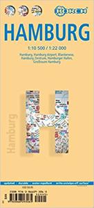
Borch Hamburg is een duidelijke, geplastificeerde plattegrond van het centrum met informatie over openbaar vervoer en bezienswaardigheden. Inclusief straatnamenregister.   Our soft-laminated folded map of Hamburg shows: Hamburg 1:22 000, Hamburg Centre 1:10 500, Blankenese 1:22 000, Hamburg Airport 1:22 000, Hamburg Harbour 1:25 000, Greater Hambur...
10,25

Webshops met dit product

Webshop
Bezorging
Prijs

Anderen bekeken ook

Stadsplattegrond Los Angeles | Borch
Borch Los Angeles is een duidelijke, geplastificeerde plattegrond van het centrum met informatie over openbaar vervoer en bezienswaardigheden. Inclusief straatnamenregister.   Our soft-laminated folded map of Los Angeles shows: Los Angeles 1:60 000, L.A. Downtown 1:17 000, Santa Monica & Venice 1:20 000, Hollywood 1:15 000, L.A. & Region 1:225 000, L.A. Airport 1:20 000, Public Transport Los Angeles, USA administrative and time zones, Top 30 Sights. Borch maps are easy to fold, durable and water-repellent with a wipeable surface. Borch Maps show hotels, museums, monuments, markets, public transport, top sights and points of interest, useful statistics, conversion charts for temperatures, weights and measurements, climate charts showing temperatures, sunshine hours, precipitation and humidity, overview maps, time zones, and much more...   Abbreviated L.A., Los Angeles is the most populous city in California and the 2nd largest English-speaking city in the world. It is best known for bei…
11,50
Stadsplattegrond Budapest - Boedapest | Borch
Borch Budapest is een duidelijke, geplastificeerde plattegrond van het centrum met informatie over openbaar vervoer en bezienswaardigheden. Inclusief straatnamenregister.   Our soft-laminated folded map of Budapest shows: Budapest 1:11 000, Budapest & Region 1:400 000, Margaret Island 1:11 000, Public Transportation Budapest, Top 30 Sights, Hungary administrative and time zones. Borch Maps are easy to fold, durable and water-repellent with a wipeable surface. Borch Maps show hotels, museums, monuments, markets, public transport, top sights and points of interest, useful statistics, conversion charts for temperatures, weights and measurements, climate charts showing temperatures, sunshine hours, precipitation and humidity, overview maps, time zones, and much more...   Budapest is the capital and largest city of Hungary and its commercial, transport and cultural center. Located on the famous Danube river, the Buda half of the city lies on the western bank while Pest is located on the eas…
10,25
Stadsplattegrond Praag | Borch
Borch Praag is een duidelijke, geplastificeerde plattegrond van het centrum met informatie over openbaar vervoer en bezienswaardigheden. Inclusief straatnamenregister. Our soft-laminated folded map of Prague shows: Old Town & Lesser Quarter 1:10 000, Prague 1:15 000, Prague Castle 1:5 000, Prague & Region 1:100 000, Czech Republic (West) 1:1 200 000, Public Transport Prague, Czech Republic administrative. Borch Maps are easy to fold, durable and water-repellent with a wipeable surface. Borch Maps show hotels, museums, monuments, markets, public transport, top sights and points of interest, useful statistics, conversion charts for temperatures, weights and measurements, climate charts showing temperatures, sunshine hours, precipitation and humidity, overview maps, time zones, and much more...   Prague, also known as "the Golden City" or "the City of a Hundred Spires" is the capital and largest city in the Czech Republic. Situated in the center of Bohemia it is set romantically on the ba…
10,25
Stadsplattegrond Las Vegas | Borch
Borch Las Vegas is een duidelijke, geplastificeerde plattegrond van het centrum met informatie over openbaar vervoer en bezienswaardigheden. Inclusief straatnamenregister.   Our soft-laminated folded map of Las Vegas shows: Las Vegas 1:20 000, Las Vegas & Region 1:150 000, Las Vegas & National Parks 1:3 000 000, Grand Canyon National Park 1:225 000, Grand Canyon Village 1:40 000, USA administrative & time zones, Top 30 Sights. Borch Maps are easy to fold, durable and water-repellent with a wipeable surface. Borch Maps show hotels, museums, monuments, markets, public transport, top sights and points of interest, useful statistics, conversion charts for temperatures, weights and measurements, climate charts showing temperatures, sunshine hours, precipitation and humidity, overview maps, time zones, and much more...   Las Vegas, literally translated as "The Meadows", is also known as "Sin City" and is the most populous city in the state of Nevada, with the largest number of hotel rooms in…
10,25
Stadsplattegrond Toronto | Borch
Borch Toronto is een duidelijke, geplastificeerde plattegrond van het centrum met informatie over openbaar vervoer en bezienswaardigheden. Inclusief straatnamenregister.   Our soft-laminated folded map of Toronto shows: Toronto City 1:17 500, The Beaches 1:17 500, Toronto Islands 1:20 000, Toronto & Region 1:500 000, Niagara Falls 1:25 000, Public Transport Toronto, Canada administrative & time zones and Top 30 Sights. Borch Maps are easy to fold, durable and water-repellent with a wipeable surface. Borch Maps show hotels, museums, monuments, markets, public transport, top sights and points of interest, useful statistics, conversion charts for temperatures, weights and measurements, climate charts showing temperatures, sunshine hours, precipitation and humidity, overview maps, time zones, and much more...   Toronto, Canada’s largest city and commercial capital, is the capital of the province of Ontario. Telecommunication, transportation, aerospace, business services, finance, media, fi…
10,25
Stadsplattegrond Berlin - Berlijn | Borch
Geplastificeerde stadsplattegrond van Berlijn voor toeristisch gebruik. Met metrokaart en omgevingskaart. Inclusief index.   Our soft-laminated folded map of Berlin shows: Berlin 1:18 000, Berlin Mitte 1:11 500, Greater Berlin 1:130 000, Public Transport Berlin, Berlin Wall, Germany administrative and Top 30 sights. Borch Maps are easy to fold, durable and water-repellent with a wipeable surface. Borch Maps show hotels, museums, monuments, markets, public transport, top sights and points of interest, useful statistics, conversion charts for temperatures, weights and measurements, climate charts showing temperatures, sunshine hours, precipitation and humidity, overview maps, time zones, and much more...   The second most populous city in the EU, Berlin is influential in European politics, culture and science. Due to its location directly in the center of Europe, Berlin is a major transport hub. Renowned universities, high-profile sports and social events and famous orchestras and museum…
10,25
Stadsplattegrond Sydney | Borch
Borch Sydney is een duidelijke, geplastificeerde plattegrond van het centrum met informatie over openbaar vervoer en bezienswaardigheden. Inclusief straatnamenregister. Our soft-laminated folded map of Sydney shows: Inner Sydney 1:15 000, Sydney CBD 1:7 500, Sydney 1:120 000, Sydney & Region 1:450 000, Homebush Bay Olympic Park 1:15 000, Airport Sydney 1:25 000, Public Transport Sydney, Australia administrative & time zones, Top 30 Sights. Borch Maps show hotels, museums, monuments, markets, public transport, top sights and points of interest, useful statistics, conversion charts for temperatures, weights and measurements, climate charts showing temperatures, sunshine hours, precipitation and humidity, overview maps, time zones, and much more...   Sydney, the capital city of the state New South Wales, is Australia's most populous city with an estimated 4.2 million inhabitants in its metropolitan area. Located on the southeastern coast, Sydney is built around Port Jackson, a section of …
10,25
Stadsplattegrond Madrid | Borch
Borch Madrid is een duidelijke, geplastificeerde plattegrond van het centrum met informatie over openbaar vervoer en bezienswaardigheden. Inclusief straatnamenregister.   Our soft-laminated folded map of Madrid shows: Central Madrid 1:10 000, Madrid & Region 1:200 000, Province of Madrid 1:700 000, Toledo 1:9 000, Segovia 1:8 500, Public Transport Madrid, Spain administrative. Borch maps are easy to fold, durable and water-repellent with a wipeable surface. Borch Maps show hotels, museums, monuments, markets, public transport, top sights and points of interest, useful statistics, conversion charts for temperatures, weights and measurements, climate charts showing temperatures, sunshine hours, precipitation and humidity, overview maps, time zones, and much more...   Madrid, located on the Manzanares River, is the capital and largest city of Spain and also its political and geographic center. Local residents are called Madrileños. Not only is Madrid one of the main financial centers of t…
10,25
Stadsplattegrond Boston | Borch
Borch Boston is een duidelijke, geplastificeerde plattegrond van het centrum met informatie over openbaar vervoer en bezienswaardigheden. Inclusief straatnamenregister.   Our soft-laminated folded map of Boston shows: Boston Downtown 1:11 000, Eastern Massachusetts 1:600 000, Boston and Region 1:200 000, Logan International Airport 1:33 000, Public Transport Boston, Top 30 Sights and USA administrative and time zones. Borch maps are easy to fold, durable and water-repellent with a wipeable surface. Borch Maps show hotels, museums, monuments, markets, top sights and points of interest, useful statistics, conversion charts for temperatures, weights and measurements, climate charts showing temperatures, sunshine hours, precipitation and humidity, overview maps, time zones, and much more...   Founded in 1630, Boston is often referred to as the cradle of American democracy, due to major events having taken place here during the American Revolution. Boston is an important port and manufactur…
10,25
Stadsplattegrond Philadelphia | Borch
Borch Philadelphia is een duidelijke, geplastificeerde plattegrond van het centrum met informatie over openbaar vervoer en bezienswaardigheden. Inclusief straatnamenregister.   Our soft-laminated folded map of Philadelphia shows: Philadelphia Downtown 1:7 000, Philadelphia & Region 1:125 000, University City 1:12 000, Fairmount Park 1:15 000, Public Transport Philadelphia, Top 30 Sights, USA administrative & time zones. Borch Maps are easy to fold, durable and water-repellent with a wipeable surface. Borch Maps show hotels, museums, monuments, markets, public transport, top sights and points of interest, useful statistics, conversion charts for temperatures, weights and measurements, climate charts showing temperatures, sunshine hours, precipitation and humidity, overview maps, time zones, and much more...   Thanks to Benjamin Franklin, one of the founding fathers of the United States, the ideas and actions leading to the American Revolution were formed in Philadelphia and for this rea…
11,50

Klanten-reviews van Stadsplattegrond Hamburg | Borch

Er zijn nog geen beoordelingen voor dit productBen jij de eerste die een review plaatst?

Meer over Stadsplattegrond Hamburg | Borch

Productomschrijving

Borch Hamburg is een duidelijke, geplastificeerde plattegrond van het centrum met informatie over openbaar vervoer en bezienswaardigheden. Inclusief straatnamenregister.   Our soft-laminated folded map of Hamburg shows: Hamburg 1:22 000, Hamburg Centre 1:10 500, Blankenese 1:22 000, Hamburg Airport 1:22 000, Hamburg Harbour 1:25 000, Greater Hamburg 1:130 000, public transport, Top 30 sights, Germany administrative & time zone. Borch Maps are easy to fold, durable and water-repellent with a wipeable surface. Borch Maps show hotels, museums, monuments, markets, public transport, top sights and points of interest, useful statistics, conversion charts for temperatures, weights and measurements, climate charts showing temperatures, sunshine hours, precipitation and humidity, overview maps, time zones, and much more...   Located on the southern tip of the Jutland peninsula between continental Europe, Scandinavia, the North and the Baltic Sea, the Hanseatic City of Hamburg is Germany's second largest and has the world's eleventh largest port and one the world's most important transatlantic shipping hubs. Largely devastated by World War II air raids, modern Hamburg is the commercial and cultural center of northern Germany. Hamburg is the country's sports capital, home to Europe's tallest town hall, one of its largest planetariums, at least 79 museums, and is also a major theater hub and venue for many famous shows. Hamburg's most famous street, the "Reeperbahn" where the Beatles began their career, is the city's red-light district. Tourism plays a significant role in the city's economy, Hamburg's port and the Reeperbahn being the two most visited tourist sites in Germany. Sistered with Chicago, Marseille, Shanghai, Prague and others, the beautiful German maritime city of Hamburg is best visited in the spring or summer months.  
Webshop.nl maakt gebruik van cookies. Ga je verder op onze website, ga dan akkoord met het plaatsen van cookies en de verwerking van deze data door ons en vermelde partners.