webshop.nl
Categorieën
  Sluiten

Wegenkaart - landkaart Zuidoost USA - Southeast USA | Borch

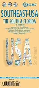
Mooie geplasticieerde kaart van het Zuidoosten van de USA. Deze kaart biedt een goed overzicht van het land met detailkaarten. Our soft-laminated map of the southeast of the USA - USA 6 includes: The South & Florida 1:3 000 000, Central Florida 1:1 350 000, Atlanta & Region 1:1 000 000, Atlanta Downtown 1:15 000, Miami & Florida Keys 1:1 000 000, M...
11,50

Webshops met dit product

Webshop
Bezorging
Prijs

Anderen bekeken ook

Wegenkaart - landkaart 08 Southeast USA zuidoost | Hallwag
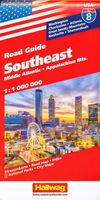
Uitstekende wegenkaart waarbij de Europese kleurstelling de kaart zeer prettig leesbaar maken i.v.m. met Amerikaanse kaartenmakers. Deze kaart is eenzijdig bedrukt. Op de kaart is informatie te vinden waar allerlei voorzieningen te vinden zijn (d.m.v. symbolen), zoals campings, picknickplaatsen, informatiecentra, luchthavens enz. Bij de kaart zit een apart boekje met een aantal kleine stadsplattegronden, informatie over Nationale Parken en overige informatie voor toeristen. Middle Atlantic & Appalachen, Indiana, South Illinois,  Ohio, Pennsylvania, New Jersey, Virginia, North & South Carolina These new, region by region "USA Road Guides", on a scale of 1 : 1 mio, provide up-to-date, detailed road maps with lots of tourist information. Transit and city maps, as well as detailed maps of national parks, are included in the map layout. The map package also includes a mileage chart with travelling times between major cities, and a brochure with an index of places, travel information from A …
14,50
Wegenkaart - landkaart Noordoost USA - Northeast USA | Borch
Mooie geplasticieerde kaart van het Noordoosten van de USA. Deze kaart biedt een goed overzicht van het land met detailkaarten.   Our soft-laminated folded map of Northeast-USA - New York & Great Lakes shows: Northeast USA 1:3 000 000, Greater Boston 1:1 000 000, Central East Coast 1:1 000 000, Boston 1: 14 000, New York City 1:20 000, Washington DC 1:15 000, USA administrative & time zones. Borch maps are easy to fold, durable and water-repellent with a wipeable surface. Borch Maps show hotels, museums, monuments, markets, public transport, top sights and points of interest, useful statistics, conversion charts for temperatures, weights and measurements, climate charts showing temperatures, sunshine hours, precipitation and humidity, overview maps, time zones, and much more...   From Philadelphia's Independence Park to Boston's Freedom Trail, New York's Federal Hall to Washington's Capitol Hill, from the Potomac to the "honeymooners' paradise" of Niagara Falls, New England and the mid…
11,50
Wegenkaart - landkaart Southwest-USA - Zuidwest USA | Borch
Mooie geplasticieerde kaart van het Zuidwesten van de USA. Deze kaart biedt een goed overzicht van het land met detailkaarten.   Our soft-laminated folded map of the American Southwest shows: American Southwest 1:3 000 000, Phoenix 1:20 000, San Francisco Bay Area 1:400 000, San Francisco 1:15 000, Greater Los Angeles 1:250 000, San Diego 1:125 000, San Diego Downtown 1:25 000, Las Vegas - The Strip 1:22 000, Grand Canyon National Park 1:250 000, USA administrative & time zones. Borch Maps show hotels, museums, monuments, markets, public transport, top sights and points of interest, useful statistics, conversion charts for temperatures, weights and measurements, climate charts showing temperatures, sunshine hours, precipitation and humidity, overview maps, time zones, and much more...   From the panoramas of San Francisco and the buzz of megametropolis Los Angeles to the charm of San Diego on the Mexican border - the Californian coast boasts sun, beautiful beaches, stunning scenery and…
11,50
Stadsplattegrond Miami | Borch
Borch Miami is een duidelijke, geplastificeerde plattegrond van het centrum met informatie over openbaar vervoer en bezienswaardigheden. Inclusief straatnamenregister.   Miami Downtown 1:15 000, Miami Beach 1:15 000, Coconut Grove 1:15 000, Greater Miami 1:350 000, Southern Florida 1:500 000, Public Transportation   Our soft-laminated folded map of Miami shows: Miami Downtown 1:15 000, Miami Beach 1:15 000, Coconut Grove 1:15 000, Greater Miami 1:350 000, Southern Florida 1:500 000, Coral Gables 1:30 000, Public Transportation Miami, Top 30 Sights, USA administrative & time zones. Borch Maps are easy to fold, durable and water-repellent with a wipeable surface. Borch Maps show hotels, museums, monuments, markets, public transport, top sights and points of interest, useful statistics, conversion charts for temperatures, weights and measurements, climate charts showing temperatures, sunshine hours, precipitation and humidity, overview maps, time zones, and much more...   Exotic Miami is …
10,25
Wegenkaart - landkaart Nieuw - Zeeland | Borch
Mooie geplasticieerde kaart van Nieuw - Zeeland. Deze kaart biedt een goed overzicht van het land met detailkaarten.   Our soft-laminated map of New Zealand includes: North Island 1:1 300 000, South Island 1:1 300 000, Auckland 1:20 000, Christchurch 1:20 000, Dunedin 1:15 000,  Nelson 1:15 000, Rotorua 1:15 000, Queenstown 1:15 000, Wellington 1:20 000, New Zealand administrative & time zones, interesting statistics, conversion chart for temperatures, weights and measures, climate chart with temperatures, sunshine hours, precipitation and humidity and much more.   "4 million inhabitants and 60 million sheep" does not do justice to the charm and natural diversity of this beautiful country. Lush meadows and fertile soils are only some of the natural resources with which New Zealand is endowed, the real natural wealth of this island state in the middle of the South Pacific lies in its incredibly diverse landscape: snow-covered mountains, dense forests, lush green lowlands, crystal-clear …
11,50
Wegenkaart - landkaart Noordwest USA - Northwest USA | Borch
Mooie geplasticieerde kaart van het Noordwesten van de USA. Deze kaart biedt een goed overzicht van het land met detailkaarten. Our soft-laminated map of USA Northwest - USA 1 includes: Pacific Northwest 1:3 000 000, San Francisco 1:15 000, San Francisco Bay Area 1:400 000, San Francisco & Region 1:1 000 000, Seattle 1:13 000 and Greater Seattle 1:350 000, Seattle & Region 1:1 000 000,  Portland 1:20 000, Denver & Region 1:1 000 000, Salt Lake City & Region 1:1 000 000, Yellowstone National Park 1:1 000 000, USA administrative & time zones, interesting statistics, conversion chart for temperatures, weights and measures, climate chart with temperatures, sunshine hours, precipitation and humidity and much more.   The beautiful landscape of Oregon and Washington includes rugged coastline, mountain ranges, lakes, rivers, rich farmland and burgeoning wine country, as well as the magnificent cities of Portland and Seattle with their bustling cosmopolitan flair. While Seattle is renowned as t…
11,50
Wegenkaart - landkaart 3126 Southeast United States | National Geographic
Mooie kaart van de bekende kaartenmaker National Geographic. Veel details door kleurgebruik. De wegen zijn met kleuren verdeeld in drukke en minder drukke, de wegnummers zijn goed terug te vinden. De kaart onderscheidt zich van andere series door de hoeveelheid topografische details als counties, plaatsnamen en waterwegen en het bevat een register waarin het eenvoudig zoeken is. Daarnaast is de kaart gedrukt op scheur- en watervast papier. The United States Southeast Adventure Map will guide you through the diverse landscapes of this remarkable region, from the white sand beaches of Florida, to the barrier islands of North Carolina, through the coastal plains and rolling piedmont regions, and into the stunning Blue Ridge Mountains of Virginia, West Virginia, North Carolina, Tennessee and Georgia. Great Smoky Mountains and Shenandoah National Parks straddle the ridge of the Appalachian Mountains and stand in dramatic contrast to the sawgrass marshlands of Everglades National Park and th…
17,50
Wegenkaart - landkaart USA Interstate | Borch
Mooie, overzichtelijke wegenkaart van de snelwegen in Amerika. Handig als je grote afstanden in het land moet afleggen.   Our soft-laminated folded map of the USA in the 9th edition shows: USA West, USA East, Hawaiian Islands, Puerto Rico each 1:4 000 000, Alaska 1:8 000 000, USA administrative & time zones. Borch Maps are easy to fold, durable and water-repellent with a wipeable surface. Borch Maps show hotels, museums, monuments, markets, public transport, top sights and points of interest, useful statistics, conversion charts for temperatures, weights and measurements, climate charts showing temperatures, sunshine hours, precipitation and humidity, overview maps, time zones, and much more...   "Get your motor running, head out on the highway"! The Interstate highway system (officially the "Dwight D. Eisenhower National System of Interstate and Defense Highways") authorized by the Federal Aid Highway Act of 1956 and supported by former US President Eisenhower who had been impressed b…
11,50
Wegenkaart - landkaart USA Florida & Deep South | ITMB
Florida has been unavailable for far too long! We wanted to improve the area of coverage while converting the artwork to a GIS-based digital data base, so the area of coverage now includes Georgia, Alabama, part of Mississippi, and most of the Carolinas. This would be an excellent map to use on the way south (or north) along I-95 or I-85 through Atlanta or Augusta and south to the Gulf Coast. The Panhandle of Florida is on the same side of the sheet, with the second side being devoted to Florida south to the Keys. There isn't enough space to show many insets; just the Orlando area and a Florida map showing population by counties. Another innovation we have introduced is to print the map on waterproof paper, for durability as well as for use as an umbrella during sudden downpours! Legend Includes: Road by classification, motorway, two land road, railway with station, waterway and much more...   Deep South, schaal 1: 1000000 Florida schaal 1: 720000
13,95
Wegenkaart - landkaart Southeast Asia - Zuidoost Azië | Nelles Verlag
Goede kaart van Zuidoost Azië. Aan beide kanten bedrukt. Met veel toeristische aanduidingen als nationale parken en culturele bezienswaardigheden. Prima leesbare kaart. South East Asia at 1:4,500,000 from Nelles Verlag, with its smaller size, double-sided map offering a convenient format for use when travelling. The map divides the region north/south, with coverage on the northern side including the Philippines and Taiwan. On the reverse is the whole of Malaysia and Indonesia. ----- This is a clear, double-sided folded road map of Southeast Asia, including Taiwan, at 1:4 500 000 scale. Places of interest, national parks and beaches are all highlighted and shaded-relief colouring clearly depicts the topography.   The map includes insets showing Papua New Guinea and Taiwan, covering the area from Burma, Vietnam, Thailand, Hong Kong, the Phillipines to Indonesia. The legend is in three languages, including English.   A good map must be hard-wearing and allow itself to be folded up simply …
11,95

Klanten-reviews van Wegenkaart - landkaart Zuidoost USA - Southeast USA | Borch

Er zijn nog geen beoordelingen voor dit productBen jij de eerste die een review plaatst?

Meer over Wegenkaart - landkaart Zuidoost USA - Southeast USA | Borch

Productomschrijving

Mooie geplasticieerde kaart van het Zuidoosten van de USA. Deze kaart biedt een goed overzicht van het land met detailkaarten. Our soft-laminated map of the southeast of the USA - USA 6 includes: The South & Florida 1:3 000 000, Central Florida 1:1 350 000, Atlanta & Region 1:1 000 000, Atlanta Downtown 1:15 000, Miami & Florida Keys 1:1 000 000, Miami Downtown 1:20 000, South Miami Beach 1:20 000, New Orleans & Region 1:1 000 000, New Orleans French Quarter 1:13 000, USA administrative & time zones, interesting statistics, conversion chart for temperatures, weights and measures, climate chart with temperatures, sunshine hours, precipitation and humidity and much more.   From Washington D.C. along the Atlantic coast to Florida and west to Louisiana and Arkansas, this is original plantation country, which has long since "gone with the wind". Yet traces of the charming Old South can still be found in the historic cities of Alexandria, Williamsburg, Charleston, and Savannah, and along the Mississippi River in Louisiana and Mississippi. However, the impressive cities of Atlanta, New Orleans and Miami have shaped the face of the progressive New South with their multicultural vitality and fascinating mix of old and new architecture. Florida, the "Sunshine State", offers perfect beaches for relaxing holidays, very friendly locals, and the magnificent reefs of the Florida Keys are renowned among snorkellers and divers.
Webshop.nl maakt gebruik van cookies. Ga je verder op onze website, ga dan akkoord met het plaatsen van cookies en de verwerking van deze data door ons en vermelde partners.