webshop.nl
Categorieën
  Sluiten

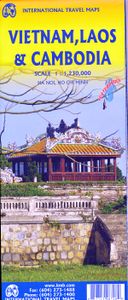
Wegenkaart - landkaart Vietnam - Laos - Cambodia | ITMB

Een degelijke kaart met aanduidingen van o.a. nationale parken, vliegveld, benzinepomp, dirt-roads. Als overzichtskaart goed te gebruiken. The former French-dominated region of Indochina evolved into three separate countries in the early 1950s. Vietnam, Laos, and Cambodia still retain strong ties and it is easy to travel from one country to another...
13,95

Webshops met dit product

Webshop
Bezorging
Prijs

Anderen bekeken ook

Wegenkaart - landkaart Laos | ITMB
Een degelijke kaart van Laos met aanduidingen van o.a. nationale parken, vliegveld, benzinepomp, dirt-roads en kleine plattegronden van Vientiane, Luang Prabang we're very pleased to introduce you to this new, double-sided, map at a great scale, with fantastic detail. To me, the north side is the most interesting, covering the portion of Laos from Vientiane, the capital, to the Chinese border. Detailed inset maps of Vientiane and Louang Prabang, the temple city, are included on this side, as are bits of both Thailand and Vietnam. The south portion fills the other side of the sheet, including a goodly portion of Vietnam, showing all border crossings. Much of Thailand has had to be obscured, unfortunately, to make room for the place names index, but the immediate border areas are shown, including the rail line south from Vientiane. In an interesting departure from previous ITMB maps, the back cover consists of a detailed inset map of Vientiane at 1:16,000 scale, making it easy to use in …
13,95
Wegenkaart - landkaart 770 Vietnam - Laos - Cambodja | Michelin
Zoals je van Michelin mag verwachten is deze kaart zeer overzichtelijk en heeft een duidelijk helder kaartbeeld. De kaart geeft uitgebreide toeristische informatie weer. De perfecte overzichtskaart!   This Vietnam - Laos - Cambodia map from Michelin is part of their red national map series. These are perfect for route planning as well as getting around by car once you're there. They clearly mark out major roads and also show many of the more important minor roads. A street plan of central Lima that highlights the city's mai attractions is included.   The map's simple folding design with durable paper cover, allows it to be read like a book and easily folded back together. Road numbers and intermediate distances are clearly displayed with the more scenic routes highlighted in green.   The map also features:   Political boundaries Regional and National Parks Important sights (points of interest, historic sites, etc.) Driving Times and Distances Road Safety Information A legend in multipl…
12,95
Wegenkaart - landkaart 3016 Adventure Map Vietnam south - Zuid | National Geographic
Mooie, heldere kaart van het zuidelijk deel van Vietnam, gedrukt op scheurvast en watervast papier.   National Geographic's Vietnam, South AdventureMap is designed to meet the unique needs of adventure travelers with its durability and accurate information. Each folded map provides global travelers with the perfect combination of detail and perspective, highlighting the area s terrain and best locations for adventure activities like snorkeling, surfing, fishing, and more.    AdventureMaps include hundreds of points of interest that highlight diverse and unique destinations within the region. The map includes the locations of thousands of cities and towns with a user-friendly index, plus a clearly marked road network complete with distances and designations for major highways, main roads, and tracks and trails for those seeking to explore more remote regions.    The front side of the Vietnam South map details the lower central region of the country, from its border with Laos and Cambodi…
17,50
Wegenkaart - landkaart Cambodia & Mekong Delta | ITMB
Een degelijke kaart met aanduidingen van o.a. nationale parken, vliegveld, benzinepomp, dirt-roads en kleine plattegronden van de hoofdsteden.   Tourism to Cambodia is growing so quickly that we felt it necessary to bring back the country as its own map, instead of being combined with Laos. However, the entire country fits very nicely on one side of a map sheet, so we have combined it with neighboring Vietnam's Mekong Delta map. There are two treasures in Cambodia: the Angkor Wat complex of temples near Siem Riep, and the Capital of Phnom Penh. Cambodia became extremely destabilized by the Vietnam War in the 1960s, leading to a rebellion that placed the murderous Khmer Rouge in charge. This led to massive atrocities and de-populated all towns, killing millions. Siem Riep is a thriving touristic city, and UNESCO manages the Angkor complex very well. The capital has mostly recovered, but still retains the sleepy colonial atmosphere of the French era. River boats ply the Mekong River and …
13,95
Wegenkaart - landkaart 3024 Adventure Map Cambodia - Cambodja | National Geographic
Mooie, heldere kaart van Cambodja,  gedrukt op scheurvast en watervast papier. National Geographic's Cambodia Adventure Map is designed to meet the needs of adventure travelers with its durability and detailed, accurate information. This map includes the locations of cities and towns with a user-friendly index, a clearly marked road network complete with distances and designations for roads/highways, plus secondary routes for those seeking to explore off the beaten path. Adventure Maps differ from a traditional road map because of the specialty content they include. Each map contains hundreds of diverse and unique recreational, ecological, cultural, and historic destinations — outside of the major tourist hubs. National Geographic Adventure Maps are the perfect companion to a guidebook, yet far easier to pack!   Cambodia is perhaps best know to international travelers as the home of the Angkor empire for six hundred years. Angkor Wat and Angkor Thom are part of the vast temple complex …
17,50
Reisgids Eyewitness Travel Cambodia and Laos | Dorling Kindersley
De Engelstalige Capitool : Prachtig geillustreerde reisgids met o.a. 3D tekeningen, fraaie kaarten en geweldige foto’s. Daarnaast uitgebreide achtergrondbeschrijvingen. Echt om in de stemming te komen! Groot formaat gids. Engelstalig. Whether you want to be awed by Angkor Wat, cruise along the mighty Mekong, or sip on a coffee in a chic Vientiane café, your DK Eyewitness travel guide makes sure you experience all that Cambodia and Laos has to offer. Cambodia and Laos evoke images of ancient temples, saffron-robed monks and mpenetrable jungle. But these two neighbouring countries offer so much more – from gilded palaces to vibrant nightlife, sandy national parks to mountain hikes. Our updated 2022 travel guide brings Cambodia & Laos to life, transporting you there like no other travel guide does with expert-led insights, trusted travel advice, detailed breakdowns of all the must-see sights, photographs on practically every page, and our hand-drawn illustrations which place you inside …
22,50
Wegenatlas Travel Atlas Thailand, Vietnam, Laos & Cambodia | ITMB
  Atlas, gebonden, A5 formaat The Indochina Region consists of five countries, including that portion of Burma that sweeps down the western part of the Malay Peninsula. The four other countries form a cohesive entity for travel, especially now that border and visa requirements for travel have been reduced. Thailand itself is definitely the Number One reason for visiting the region. The first portion of the atlas is devoted to Thailand, including detailed page-size maps of Bangkok, Chiang Mai, and Pattaya. Vietnam is the next most-popular destination and is shown in great detail, with inset maps of Hanoi, Hoi An, Hue, Da Nang, Da Lat, Can Tho, and the central Saigon portion of Ho Chi Minh City. Laos and Cambodia are shown with the same degree of attention to detail, including insets of Vientiane, Phnom Penh, and two maps concentrating on Angkor Wat. This is a compact and convenient way for visitors to the region to have everything they need in one format - easy to catty, easy to use Leg…
16,50
Wegenkaart - landkaart Vietnam - Laos - Cambodia (Cambodja) | Freytag & Berndt
Zeer goede overzichtskaart van het hele gebied van Vietnam, Laos en Cambodja. Zeker als je meerdere landen gaat combineren is dit een prima kaart waar nog veel op staat. Veel plaatsen, maar ook allerlei toeristisch interessante plekken die met symbolen zijn aangegeven. Detailed, double-sided road map Vietnam, Cambodia, and Laos, ideal for route-planning. Clearly shows the national road network and selected provincial and local roads, with each class of road clearly indicated and road numbers shown. Intermediate driving distances between locations are shown in kilometres alongside the road, motorway filling stations are shown and motorway junctions are indicated. Topography is shown with relief shading and some spot heights. International and provincial boundaries are clearly marked, as are National Parks, nature reserves and restricted military areas. Symbols indicate various sights & locations of tourist interest, such as churches, leisure & sports destinations, panoramas & viewing po…
14,95
Wegenkaart - landkaart Cambodja - Cambodia the Khmer Legacy | Odyssey
This is a double sided and illustrated, folded map of Cambodia (on one side) and the Greater Mekong Sub-region (on the other side). The former shows essential sites and architectural treasures, including 22 colour photographs plus comprehensive notes with historical and cultural information. The map sheet is more than just a map - heavily illustrated, it includes useful information for the traveller, both before and during a visit to Cambodia. The map of Cambodia is at a scale of 1:1,000,000 with accompanying photos and essays written by John Sanday covering cultural and historical information on key places and people. The map of the Greater Mekong Sub-region covers the reverse of the sheet at a scale of 1:3,150,000 incorporating Cambodia, Vietnam, Thailand, Myanmar (Burma), Laos and part of South China. It is centred on the Mekong River.
14,95
Wegenkaart - landkaart South East Asia - Zuid Oost Azië | ITMB
  Een degelijke kaart met aanduidingen van o.a. nationale parken, vliegveld, benzinepomp en dirt-roads. Als overzichtskaart goed te gebruiken. Met Laos, Cambodja, Vietnam, Thailand, Maleisië, Filipijnen en Indonesië.   The part of the world from southern China, through the Indo-Chinese peninsula, and sweeping through the Indonesian archipelago to the hundreds of islands comprising the Philippines, is a fascinating part of the world to map. Countless cultures interact in this vast region - the mountain people along the Vietnamese/Laotian border, the fisherman of coastal regions and islands, the lovely and gentle Balinese, and the business-like Javanese. This is an extremely important part of the world - touristically attractive, economically thriving, and scenically unbeatable. This latest edition will be useful for anyone visiting the region. It is detailed, printed double-sided. This map has proven to be a better seller than expected, necessitating a review. We keep the same cover, sa…
13,95

Klanten-reviews van Wegenkaart - landkaart Vietnam - Laos - Cambodia | ITMB

Er zijn nog geen beoordelingen voor dit productBen jij de eerste die een review plaatst?

Meer over Wegenkaart - landkaart Vietnam - Laos - Cambodia | ITMB

Productomschrijving

Een degelijke kaart met aanduidingen van o.a. nationale parken, vliegveld, benzinepomp, dirt-roads. Als overzichtskaart goed te gebruiken. The former French-dominated region of Indochina evolved into three separate countries in the early 1950s. Vietnam, Laos, and Cambodia still retain strong ties and it is easy to travel from one country to another. Each has its particular charm, with a Top Attractions list highlighting the most popular attractions. Side 1 concentrates on the southern portion of the region and includes an inset map of Ho Chi Minh City; the second side covers the area from Sien Riep in Cambodia to the Chinese border areas of both Laos and Vietnam. An inset map of Hanoi is one this side. The region is prospering after many years of civil unrest, is friendly, safe, and easy to reach since Covid restrictions were removed last year. The new Chinese-built rail line through northern Laos to Chiang Kong in Thailand, and to Vientiane, Laos, is shown for the first time. This line connects with the Chinese rail system leading to Yunnan, but is not shown as the route is still regarded as a military secret by China. At the moment, its purpose is to move freight from China to ports, but it is probable that passenger service is also possible. The map is printed on waterproof stone paper for durability and to hold up in extremely humid conditions.   Map size: 27*39"   Legend Includes: Roads by classification, Rivers and Lakes, National Park, Airports, Points of Interests, Highways, Main Roads, Zoos, Fishing, and much more...
Webshop.nl maakt gebruik van cookies. Ga je verder op onze website, ga dan akkoord met het plaatsen van cookies en de verwerking van deze data door ons en vermelde partners.