webshop.nl
Categorieën
  Sluiten

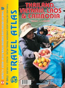
Wegenatlas Travel Atlas Thailand, Vietnam, Laos & Cambodia | ITMB

  Atlas, gebonden, A5 formaat The Indochina Region consists of five countries, including that portion of Burma that sweeps down the western part of the Malay Peninsula. The four other countries form a cohesive entity for travel, especially now that border and visa requirements for travel have been reduced. Thailand itself is definitely the Number O...
16,50

Webshops met dit product

Webshop
Bezorging
Prijs

Anderen bekeken ook

Wegenkaart - landkaart Vietnam - Laos - Cambodia | ITMB
Een degelijke kaart met aanduidingen van o.a. nationale parken, vliegveld, benzinepomp, dirt-roads. Als overzichtskaart goed te gebruiken. The former French-dominated region of Indochina evolved into three separate countries in the early 1950s. Vietnam, Laos, and Cambodia still retain strong ties and it is easy to travel from one country to another. Each has its particular charm, with a Top Attractions list highlighting the most popular attractions. Side 1 concentrates on the southern portion of the region and includes an inset map of Ho Chi Minh City; the second side covers the area from Sien Riep in Cambodia to the Chinese border areas of both Laos and Vietnam. An inset map of Hanoi is one this side. The region is prospering after many years of civil unrest, is friendly, safe, and easy to reach since Covid restrictions were removed last year. The new Chinese-built rail line through northern Laos to Chiang Kong in Thailand, and to Vientiane, Laos, is shown for the first time. This lin…
13,95
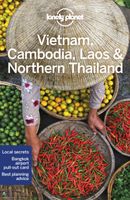
Reisgids Vietnam, Cambodia, Laos & Northern Thailand | Lonely Planet
De perfecte reisgids voor zowel de georganiseerde als de zelfstandige reiziger. Naast een algemene inleiding van het land / streek vol met praktische informatie over hoe je er het beste kunt reizen: slapen, eten, vervoer, excursies ... alles kun je er in vinden. De reisgids beschrijft naast Vietnam, Cambodja en Laos ook nog het noorden van Thailand. The Mekong – it’s an exotic name guaranteed to fire up the imagination, with such iconic sights as Angkor Wat, Halong Bay and Luang Prabang. Lonely Planet will get you to the heart of Vietnam, Cambodia, Laos & Northern Thailand, with amazing travel experiences and the best planning advice.   Lonely Planet Vietnam, Cambodia, Laos & Northern Thailand is your passport to the most relevant, up-to-date advice on what to see and skip, and what hidden discoveries await you.   Visit Bangkok, one of Southeast Asia’s most buzzing cities, sail past the limestone peaks of Halong Bay, or experience the transcendent tranquillity of Angkor Wat; all with y…
23,95
Wegenkaart - landkaart Laos | ITMB
Een degelijke kaart van Laos met aanduidingen van o.a. nationale parken, vliegveld, benzinepomp, dirt-roads en kleine plattegronden van Vientiane, Luang Prabang we're very pleased to introduce you to this new, double-sided, map at a great scale, with fantastic detail. To me, the north side is the most interesting, covering the portion of Laos from Vientiane, the capital, to the Chinese border. Detailed inset maps of Vientiane and Louang Prabang, the temple city, are included on this side, as are bits of both Thailand and Vietnam. The south portion fills the other side of the sheet, including a goodly portion of Vietnam, showing all border crossings. Much of Thailand has had to be obscured, unfortunately, to make room for the place names index, but the immediate border areas are shown, including the rail line south from Vientiane. In an interesting departure from previous ITMB maps, the back cover consists of a detailed inset map of Vientiane at 1:16,000 scale, making it easy to use in …
13,95
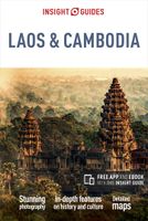
Reisgids Laos & Cambodia - Cambodja | Insight Guides
Dé gids als het gaat om achtergrondinformatie en prachtige foto’s. Door het formaat en gewicht niet zo zeer om mee te nemen, als wel om thuis voor en na de reis uitgebreid te lezen. Kwalitatief van een hoog niveau! Engels. Laos and Cambodia maintain a formidable allure for travellers - thoughts of paradise beaches and ancient temples are enough to set feet itching. Be inspired to visit by the new edition of Insight Guide Laos and Cambodia, a comprehensive full-colour guide to this fascinating and dramatically beautiful country, home to eight of the world's ten highest mountains. Inside Insight Guide Laos and Cambodia:   · A fully-overhauled edition by our expert South East Asia author.   · Stunning, specially-commissioned new photography that brings this breath-taking area and its people to life.    · Highlights of both country's top attractions, including Cambodia's Angkor Wat temples and the French colonial city of Luang Prabang in Laos.   · Descriptive region-by-region accounts cove…
23,95
Wegenkaart - landkaart 3006 Adventure Map Thailand | National Geographic
Wegenkaart van Thailand met vermelding van veel bezienswaardigheden, nationale parken en attrakties. Watervast en scheurvast. National Geographic's Thailand Adventure Map is designed to meet the unique needs of adventure travelers—detailed, durable, and accurate. Thailand includes the locations of thousands of major cities and towns with an index for easily locating them, plus a clearly marked road network complete with distances and designations for major highways, limited access highways, and more.   What sets National Geographic Adventure Maps apart from traditional road maps are the hundreds of points of interest that highlight the diverse, unique, and exotic destinations within Thailand including national parks, nature reserves, World Heritage sites, archeological sites, scenic viewpoints, Buddhist temples of interest, mosques, zoos, and monuments.     The front side of the Thailand map shows the northern half of the country and extends south to the capital city of Bangkok. Border…
17,50
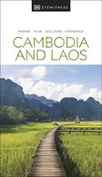
Reisgids Eyewitness Travel Cambodia and Laos | Dorling Kindersley
De Engelstalige Capitool : Prachtig geillustreerde reisgids met o.a. 3D tekeningen, fraaie kaarten en geweldige foto’s. Daarnaast uitgebreide achtergrondbeschrijvingen. Echt om in de stemming te komen! Groot formaat gids. Engelstalig. Whether you want to be awed by Angkor Wat, cruise along the mighty Mekong, or sip on a coffee in a chic Vientiane café, your DK Eyewitness travel guide makes sure you experience all that Cambodia and Laos has to offer. Cambodia and Laos evoke images of ancient temples, saffron-robed monks and mpenetrable jungle. But these two neighbouring countries offer so much more – from gilded palaces to vibrant nightlife, sandy national parks to mountain hikes. Our updated 2022 travel guide brings Cambodia & Laos to life, transporting you there like no other travel guide does with expert-led insights, trusted travel advice, detailed breakdowns of all the must-see sights, photographs on practically every page, and our hand-drawn illustrations which place you inside …
22,50
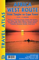
Wegenatlas Travel Atlas Africa West Route: from Tangier to Cape Town | ITMB
Handzame wegenatlas, formaat A5, van de hele route van Tanger naar Kaapstad langs de westelijke kant van Afrika. Naast de wegenkaarten bevat deze atlas ook een aantal centrumkaarten van de belangrijkste steden die je onderweg tegenkomt.  There are three routes one can follow on an overland expedition from Europe to Cape Town (or the reverse). Last year, ITMB published the eastern route, via Cairo and Sudan to Ethiopia and Kenya. This year, we are pleased to announce the publication of a more practical route to follow, via Tangier, Morocco, Mauritania, Senegal, Mali and Ghana, through the Congo to Uganda, and then south over a variety of options to Namibia and South Africa. The advantage of this route is that it avoids the conflict-ridden countries closest to infection from the extremist Islam movement. It also avoids the current difficulties of the central route through Algeria (the Hoggar route) and Niger. We do have to caution that all routes through Africa contain risks. Routes are …
16,50
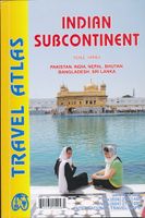
Wegenatlas Travel Atlas Indian Subcontinent | ITMB
Handzame wegenatlas op A5 formaat, helaas geen spiraalbinding. Maar voor deze regio is er op dit moment geen andere atlas beschikbaar.   This is our biggest atlas ever, with 152 pages of maps and 51 pages of place names indexing. The Indian Sub-Continent consists of Pakistan, India, Nepal, Bhutan, Bangladesh, Sri Lanka and Kashmir. Each country (Kashmir being considered shared) is presented as an entity, so Pakistan occupies 30 pages at 1:1,200,000 scale, and Nepal occupies 32 pages at 1:530,000 scale. In short, each country is shown in detail, but at scales appropriate for each country. The amount of detail on each page is impressive; equal to buying six maps at $12.95 each. The market is the traveller to the region, visiting several of these areas and wanting a compact way to have detailed mapping without having to carry half a dozen maps or spend a large amount of money on maps. Eleven city inset maps are included, as well as basic insets for the Andaman and Nicobar island chains. T…
16,50
Wegenkaart - landkaart USA Northeast - Noordoost USA | ITMB
Een degelijke wegenkaart van het noordoosten van de USA. (1:1.000.000) met aanduidingen van o.a. nationale parken, vliegveld, benzinepomp, dirt-roads. Als overzichtskaart goed te gebruiken. (1:1.000.000 Scale) including adjacent US states and bordering Canada . We started it wanting to do a map of just New England, but that will have to be a future title. By the shape of the USA, the New England States fill most of one side of the map, but New York City and Philadelphia are included as well as a goodly portion of New York State. The second side covers the rest of the state, plus all of New Jersey, Delaware, Maryland, Pennsylvania, and most of Ohio, West Virginia and the northern portion of Virginia. In terms of cities, Cincinnati is at the bottom left of the sheet and Richmond at the bottom right, with Detroit at upper left and Albany at upper right. The value of this map for visitors is that it covers a reasonably comprehensive portion of the USA, stretching as it does from northern M…
13,95
Reisgids Thailand | Rough Guides
Zeer goede reisgids voor zowel de georganiseerde maar vooral voor de zelfstandige reiziger. Boordevol informatie over reizen, slapen, eten, maar ook musea en cultuur. Uitputtende bron van informatie, veelal nog completer dan de Lonely Planet. Inleidende informatie over land en cultuur is zeer goed. This practical travel guide to Thailand features detailed factual travel tips and points-of-interest structured lists of all iconic must-see sights as well as some off-the-beaten-track treasures. Our itinerary suggestions and expert author picks of things to see and do will make it a perfect companion both, ahead of your trip and on the ground. This Thailand guide book is packed full of details on how to get there and around, pre-departure information and top time-saving tips, including a visual list of things not to miss.   Our colour-coded maps make Thailand easier to navigate while you're there. This guide book to Thailand has been fully updated post-COVID-19 and it comes with a free…
26,50

Klanten-reviews van Wegenatlas Travel Atlas Thailand, Vietnam, Laos & Cambodia | ITMB

Er zijn nog geen beoordelingen voor dit productBen jij de eerste die een review plaatst?

Meer over Wegenatlas Travel Atlas Thailand, Vietnam, Laos & Cambodia | ITMB

Productomschrijving

  Atlas, gebonden, A5 formaat The Indochina Region consists of five countries, including that portion of Burma that sweeps down the western part of the Malay Peninsula. The four other countries form a cohesive entity for travel, especially now that border and visa requirements for travel have been reduced. Thailand itself is definitely the Number One reason for visiting the region. The first portion of the atlas is devoted to Thailand, including detailed page-size maps of Bangkok, Chiang Mai, and Pattaya. Vietnam is the next most-popular destination and is shown in great detail, with inset maps of Hanoi, Hoi An, Hue, Da Nang, Da Lat, Can Tho, and the central Saigon portion of Ho Chi Minh City. Laos and Cambodia are shown with the same degree of attention to detail, including insets of Vientiane, Phnom Penh, and two maps concentrating on Angkor Wat. This is a compact and convenient way for visitors to the region to have everything they need in one format - easy to catty, easy to use Legend Includes: Roads by classification, Airports, Point of Interest, Hospitals, Hotels, Mines, World Heritage, Temples, Wildlife Reserve, Turtle Area, Port, Border Crossing, Ferries, Beaches, and much more.
Webshop.nl maakt gebruik van cookies. Ga je verder op onze website, ga dan akkoord met het plaatsen van cookies en de verwerking van deze data door ons en vermelde partners.