webshop.nl
Categorieën
  Sluiten

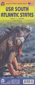
Wegenkaart - landkaart USA South - Atlantic States | ITMB

Een degelijke kaart met aanduidingen van o.a. nationale parken, vliegveld, benzinepomp, dirt-roads van de Oosttkust van de USA van Philadelphia tot Florida  . Als overzichtskaart goed te gebruiken. We call the map the Atlantic States guardedly for obvious reasons. First, the northeastern Atlantic States are missing and second, Florida's Caribbean c...
13,95

Webshops met dit product

Webshop
Bezorging
Prijs

Anderen bekeken ook

Wegenkaart - landkaart USA Northeast - Noordoost USA | ITMB
Een degelijke wegenkaart van het noordoosten van de USA. (1:1.000.000) met aanduidingen van o.a. nationale parken, vliegveld, benzinepomp, dirt-roads. Als overzichtskaart goed te gebruiken. (1:1.000.000 Scale) including adjacent US states and bordering Canada . We started it wanting to do a map of just New England, but that will have to be a future title. By the shape of the USA, the New England States fill most of one side of the map, but New York City and Philadelphia are included as well as a goodly portion of New York State. The second side covers the rest of the state, plus all of New Jersey, Delaware, Maryland, Pennsylvania, and most of Ohio, West Virginia and the northern portion of Virginia. In terms of cities, Cincinnati is at the bottom left of the sheet and Richmond at the bottom right, with Detroit at upper left and Albany at upper right. The value of this map for visitors is that it covers a reasonably comprehensive portion of the USA, stretching as it does from northern M…
13,95
Wegenkaart - landkaart USA: east half | ITMB
Goede overzichtskaart van het oosten de USA. Deze uitgever heeft ook het westen van de USA op kaart uitgebracht. Beide kaarten geven zodoende een compleet beeld van de Verenigde Staten. The United States of America is a humongous travel attraction. Whether one is thinking of NYC or Disneyland, Hollywood or longhorn cattle, America is a fascinating place. ITMB specializes in mapping exotic travel destinations and in making even well-known places exotic. This is the first of a series of maps that we hope to publish on the USA in the years to come. We decided to start with two maps, East Half and West Half, because the size of the country and its complexity mitigated against doing one map for the entire half-continent. Even at the scale chosen, it was extremely difficult to portray all the parks, national monuments, battlefields, and touristic attractions that this fascinating country offers. One side covers the Atlantic seaboard from Maine to Florida, with insets of Washington, the Flori…
13,95
Wegenkaart - landkaart - Stadsplattegrond Washington D.C. & eastern corridor | ITMB
Stadsplattegrond van Washington D.C., 1:12.500, met een overzichtskaart van het gebied van Boston tot aan Washington DC, 1:1.000.000   This is one of the most-visited cities in the USA and one really NEEDS a map to uncover all the statues, memorials, and buildings of interest. Of course, hotels, shopping areas, transportation hubs, parks, etc are also included. With this edition, we also have added a full-sheet map of the Eastern Corridor of the USA to the reverse side of the map. Starting with Boston in the north, through NYC and Philadelphia to Baltimore and on past DC to Richmond and Raleigh, the Eastern Corridor encompasses one-third of the population of the United States and a dozen States. The map shows road and rail connections, with motorways noted in blue and toll roads in green, and includes major historic and touristic sites within the area of coverage.   Legend Includes: Roads by classification, State Boundaries,State Highways, Main Roads, Secondary and other Roads,Hot spri…
13,95
Wegenkaart - landkaart 3127 United States Northeast | National Geographic
Mooie kaart van de bekende kaartenmaker National Geographic. Veel details door kleurgebruik. De wegen zijn met kleuren verdeeld in drukke en minder drukke, de wegnummers zijn goed terug te vinden. De kaart onderscheidt zich van andere series door de hoeveelheid topografische details als counties, plaatsnamen en waterwegen en het bevat een register waarin het eenvoudig zoeken is. Daarnaast is de kaart gedrukt op scheur- en watervast papier. The United States Northeast Adventure Map will guide you through the states of the Mid Atlantic region (Virginia, West Virginia, Maryland, Delaware and Pennsylvania, New York and New Jersey) and New England (Connecticut, Rhode Island, Massachusetts, Vermont, New Hampshire, and Maine). Each of these states is rich in history and nature and has its own distinct character, from the dramatic rocky shoreline of Maine's Acadia National Park and the beaches and dunes of Cape Cod Massachusetts, through the Adirondack Mountains of New York, the White and Gree…
17,50
Wegenkaart - landkaart Queensland | ITMB
Een degelijke wegenkaart van Queensland met aanduidingen van o.a. nationale parken, vliegveld, benzinepomp, dirt-roads en kleine plattegrond van hoofdstad. Als overzichtskaart goed te gebruiken. We complete our series of regional maps covering Australia with this map of Queensland, which nicely fills a double-sided sheet with only small portions of adjoining states showing. The map also includes a large inset map of central Brisbane. At this scale, the road/rail network of this part of Australia becomes very clear. The first side concentrates on the northern portion of the state, and the other side, the more densely-developed southern half. The map includes a listing of the state’s top attractions, and notes al major touristic attractions. Although gas/petrol stations are commonly found, we have included some gas symbols in remoter parts of Queensland to encourage drivers to venture into roads less travelled. All states and territories of Australia are now available from ITMB as separa…
13,95
Wegenkaart - landkaart Australia South & Northern Territory | ITMB
Australia was one of the first countries ITMB published, back in the 1980s, albeit a licensed version. Our own original artwork was completed in the mid-1990s, but until recently, we have not focused on sectional maps of the country based on individual states. In 2019, we published Brisbane and Queensland, and Sydney and New South Wales. Now, we are issuing the ‘middle’ states of South Australia and Northern Territory to provide better coverage of these important parts of Australia at a better scale than a country map could provide. South Australia can be thought of as having two parts; the fertile farming economy surrounding Adelaide in the south and the much more arid northern portion. The road network in the south tends to be well developed, with paved roads going more or less east-west to NSW and WA. Northerly roads tend to be gravel or dirt, such as the Birdville Track, and the north-westerly roads tend to pass through land ceded to aboriginals and require permits. Northern Territ…
13,95
Wegenkaart - landkaart 3014 Adventure Map India South - Zuid | National Geographic
Wegenkaart van Zuid India met vermelding van veel bezienswaardigheden, nationale parken en attrakties. Watervast en scheurvast. National Geographic's India South Adventure Map is designed to meet the unique needs of adventure travelers with its durability and detailed, accurate information. The map includes the locations of thousands of cities and towns with a user-friendly index, as well as a clearly marked road network complete with distances and designations for highways, major routes and secondary roads.   The India South Adventure Map differs from a traditional road map for it includes hundreds of points of interest that highlight the diverse and unique destinations found in this region. The map features UNESCO World Heritage sites, archaeological sites, wildlife sanctuaries, Hindu and Buddhist temples, sacred sites, forts, palaces, ruins, waterfalls, caves and other points of interest, making it an invaluable resource to travelers hoping to experience all the history and culture …
17,50
Wegenkaart - landkaart Paraguay & Bolivia South | ITMB
Een degelijke kaart met aanduidingen van o.a. nationale parken, vliegveld, benzinepomp, dirt-roads en kleine plattegrond van hoofdstad. Als overzichtskaart goed te gebruiken. Technically, this is a new title for ITMB, in that it is not merely an updating of a previous edition, but it is still a map of Paraguay, basically, so we count it as an updated edition with part of Bolivia included. Expanding the area of coverage benefits visitors combining Paraguay and Bolivia into one trip. The first side covers Bolivia from La Paz south to the Paraguayan border, with inset maps of Potosi and Santa Cruz. The second side concentrates on Paraguay itself, with inset maps of Asuncion, the Asuncion region, and northern Paraguay. Small bits of bordering countries also are included. Road connections within Paraguay have been shown to good advantage. Both countries, being land-locked, are somewhat isolated, making travel to them something more adventuresome than visits to neighbouring countries. Howeve…
13,95
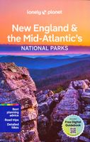
Reisgids New England - Mid-Atlantic States National Parks | Lonely Planet
Lonely Planet's New England and the Mid-Atlantic States' National Parks is your passport to the most up-to-date advice on what to see and skip. Cycle carriage roads, hike ladder trails and zip down Skyline Drive; all with your trusted travel companion. Get to the heart of New England and the Mid-Atlantic's National Parks and begin your journey now! Inside Lonely Planet'sNew England and the Mid-Atlantic States' National Parks Travel Guide: Up-to-date information - all businesses were rechecked before publication to ensure they are still open after 2020's COVID-19 outbreak User-friendly highlightsand itinerarieshelp you tailor your trip to your personal needs and interests Insider tipsto save time and money and get around like a local, avoiding crowds and trouble spots Essential infoat your fingertips- hours of operation, phone numbers, websites, transit tips, prices, emergency information, park seasonality, hiking trail junctions, viewpoints, landscapes, elevations, distances, difficul…
18,50
Wegenkaart - landkaart Oklahoma & Texas | ITMB
Een degelijke wegenkaart met aanduidingen van o.a. nationale parken, vliegveld, benzinepomp, dirt-roads. Als overzichtskaart goed te gebruiken. ITMB is pleased to announce the newest addition to our range of titles on the USA. Increasingly, we are developing our artwork to cover the larger states attractively and comprehensively, but also, we hope sensibly. Texas and Oklahoma share a common heritage of having been formed out of land taken from others through the long-held policy of Manifest Destiny. Today, Texas is the second largest State in the union (after Alaska), and is the only State to have previously been an independent country. It also includes the oldest urban area in the USA, Presidio, founded by the Spaniards to guard the ford over the Rio Grande. Because of its shape, and the natural proximity of the State of Oklahoma along its northern edge, combining the two States just made sense. The map is presented double-sided (top half/bottom half) on waterproof paper that is durab…
13,95

Klanten-reviews van Wegenkaart - landkaart USA South - Atlantic States | ITMB

Er zijn nog geen beoordelingen voor dit productBen jij de eerste die een review plaatst?

Meer over Wegenkaart - landkaart USA South - Atlantic States | ITMB

Productomschrijving

Een degelijke kaart met aanduidingen van o.a. nationale parken, vliegveld, benzinepomp, dirt-roads van de Oosttkust van de USA van Philadelphia tot Florida  . Als overzichtskaart goed te gebruiken. We call the map the Atlantic States guardedly for obvious reasons. First, the northeastern Atlantic States are missing and second, Florida's Caribbean coastline is included. Also, to cover an area so long, we had to go further inland than 'just' the coast, so all of Pennsylvania and West Virginia are included. The area of coverage of side A is Philadelphia/Pittsburg south to Augusta and Charleston. Side B continues south to the southernmost portion of Florida and west to Panama City. Inset maps of Orlando and Miami are included on this side as well. Both road and rail connections are shown, and distances between communities shown. Places of touristic interest are included, albeit suitable to the scale. An extensive place name index is included.  Legend Includes: Roads by classification, Rivers and Lakes, National Park, Airports, Points of Interests, Mining, Highways, Main Roads, Zoos, Fishing, , and much more...
Webshop.nl maakt gebruik van cookies. Ga je verder op onze website, ga dan akkoord met het plaatsen van cookies en de verwerking van deze data door ons en vermelde partners.