webshop.nl
Categorieën
  Sluiten

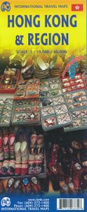
Wegenkaart - landkaart - Stadsplattegrond Hong Kong & Region | ITMB

Plattegrond van Hong Kong met aan de ene kant Hong Kong op een schaal van 1:10.000 en op de achterkant de omgeving op een schaal van 1:60.000. De kaart is uitgevoerd met register en metrokaart. De kaart beslaat Hongkong tot aan Sham Shui Po, Ngau Tai Kok, Vitoria Peak  en Quarry Bay. De regiokaart gaat tot aan Shenzhen. Op deze kaart staan diverse ...
13,95

Webshops met dit product

Webshop
Bezorging
Prijs

Anderen bekeken ook

Wegenkaart - landkaart - Stadsplattegrond Fleximap Hong Kong | Insight Guides
Geplastificeerde stadskaart van Hong Kong. Goede overzichtelijke kaart met een grof overzicht van de hele stad en een gedetailleerde kaart van het centrumdeel. Flexi Map Hong Kong is much more than just a laminated map. The Tourist Information section includes detailed descriptions and some stunning photographs of a carefully selected number of recommended sights, these sights are linked to the mapping by easy to find numbered markers. There is also an abundance of helpful information on getting around, tipping, opening times, public holidays, emergency telephone numbers and much more.    The comprehensive index has been divided into different categories to make locatin...g places as easy as possible. The laminated, tear-resistant finish is tough, weatherproof and can be written on using a non-permanent marker.   The main map shows Hong Kong at a scale of 1:130 000 (1cm = 1.3km) and clearly shows the region's road network and ferry routes.    On the reverse is a map of the New T…
9,95
Hong Kong
Hong Kong
Capitool Top 10 Hong Kong - Top 10 van onder andere de beste restaurants, de mooiste bezienswaardigheden en de leukste winkels- Met de uitneembare kaart vind je gemakkelijk de weg- De schitterende foto’s brengen Hong Kong tot leven- Compact formaat, ideaal om mee te nemen- Diverse wandelroutes leiden je langs alle hoogtepunten van de stad Top 10 Hong Kong De reisgids is opgebouwd uit top 10-lijsten die het beste van alles wat er in Hong Kong te zien en te doen is, behandelen. De stad heeft van alles te bieden, van futuristische wolkenkrabbers tot traditionele Chinese tempels en van grote menigtes tot afgelegen stranden op de schiereilanden. Top 10 Hong Kong bevat tips en praktische informatie voor tijdens het verblijf, zoals wat voor weer je kunt verwachten, waar je lekker kunt eten, gratis uitjes, welk hotel het beste is en gemakkelijk te volgen voorbeeldroutes zodat je in korte tijd zoveel mogelijk kunt zien. Of je nu een weekend of een hele week komt, dankzij de handige lijstjes heb…
14,99
Wegenkaart - landkaart 83D Wells Gray - Murtle Lake | ITMB
Gedetailleerde kaart van een bepaald gebied in Canada, in dit geval een wegenkaart van Wells Gray national park (schaal 1:250.000) en een wandelkaart / topografische kaart  van Murtle lake (schaal 1:50.000).  Helder en duidelijk kleurgebruik, goed leesbaar en op de Wells Gray kaart met symbolen onder andere campsites, trails, benzinepompen etc.  Double sided, very detailed hiking map, with recreational information, based on the government topographic cartography. Scale 1:50,000. Legend includes points of interest, airports/airstrips, Forest Service offices, RV/camping/ recreation sites, wilderness camps. shelters, campsites/trailer parks, picnic areas, accommodations, parking, waterfalls, horseback riding, mountain biking, cross country skiing, canoeing, hiking, viewpoints, mountain climbing, golf courses, fishing, boat launches, gas stations, restaurants, gates, national/provincial parks. Printed on durable synthetic paper suitable for outdoor use.  
13,95
Wegenkaart - landkaart - Stadsplattegrond China South - Zuid | ITMB
Een degelijke wegenkaart met aanduidingen van o.a. nationale parken, vliegveld, benzinepomp, dirt-roads. Als overzichtskaart goed te gebruiken.   China is a very large country. While our map of the entire country is fine for general travel and sells well, China is too large to show areas in detail. This map concentrates on the part of China from Shanghai south and all the way west to Lhasa and includes Taiwan and Hainan Island. We are not trying to make any sort of political comment here, but geographically, both Tibet and Taiwan fall within the area of coverage and are both included for this reason alone. The map also includes insets of Hong Kong, Guangzhou and Shanghai   Legend Includes: Roads by classification, Points of Interest, National Parks, Airports, Golf Courses, Beaches, Campsites, Waterfalls, Viewpoints, Churches, Surfing/Scuba Diving Spots, Fishing Spots, Hospitals, harbours/Ports, Lighthouses, Museums, Monuments, Caves, Mosques, Mountain Peaks, Botanic Gardens, Wildlife S…
13,95
Stadsplattegrond - Wegenkaart - landkaart Cardiff & Wales | ITMB
Een dubbelzijdige kaart met aan de ene zijde een plattegrond van Cardiff, schaal 1:8.000 en op de andere zijde een wegenkaart, schaal 1:300.000, met aanduidingen van o.a. nationale parken, vliegveld, benzinepompen. ITMB finds the UK to be a never-ending source of maps needing to be prepared, such as this one of Cardiff and Wales. Cardiff is the capital of Wales, and is also an international access point to the UK; a map seems desirable. The city is based at the mouth of the River Taff, with most touristic points being concentrated in the harbour area, the city centre, and a concentration of eateries along Albany Road. Cardiff is shaped by two parallel motorways; the A4232close to the waterfront, and the A48 near the northern extremities. Both are included in our map, which also shows historic sites, hotels, and tourist amenities. The reverse side shows all of Wales as an entity, showing roads, rail lines, ferry crossing points, and access routes to England. It also shows historic sites…
13,95
Wegenkaart - landkaart Peru | ITMB
Een degelijke kaart met aanduidingen van o.a. nationale parken, vliegveld, dirt-roads en kleine plattegrond van hoofdstad. Als overzichtskaart goed te gebruiken. Peru at 1:1,500,000 on a double-sided, waterproof and tear-resistant, indexed map from ITMB, with large, clear street plans of central Lima and Cusco, highlighting accommodation, places of interest and various facilities. The map divides the country north/south, approximately along the line between the Cordillera Blanca and Cordillera Huyahuash, with very little overlap between the two sides. Topography is very effectively presented by altitude colouring, with spot heights and additional graphics for swamps and marshland, glaciers and volcanos. The map shows the country’s road network distinguishing between all-weather and seasonable roads and indicates driving distances on main routes. Railway lines, including the popular routes linking Cusco with Puno and Arequipa, are very clearly shown. The map also shows local airports an…
13,95
Wegenkaart - landkaart Malawi - Mozambique | ITMB
Een degelijke kaart met aanduidingen van o.a. nationale parken, vliegveld, benzinepomp, dirt-roads en kleine plattegrond van de belangrijkste steden. Er was zelfs nog plek voor interessante informatie over beide landen. Als overzichtskaart goed te gebruiken. Eén zijde van de kaart omvat Mozambique in zijn geheel, met ten dele de omringende landen (schaal 1:1.900.000) De andere zijde omvat Malawi, schaal 1:900.000.   Both of these countries are unique ITMB titles. Malawi sells quite well, and always has. Mozambique is an interesting country that I explored several times while living in then-Rhodesia. Its infrastructure has suffered since independence, but Beira and the parks east of Malawi are quite good. The northern part of the country is largely undeveloped, unlike Malawi, where one of the treats of the country is Livingstonia, on a plateau overlooking Lake Malawi, where David Livingstone founded his mission and built a town of Scottish stone buildings. It has to be seen to be believ…
13,95
Reisgids Pocket Hong Kong | Lonely Planet
Pocket reisgidsen van Lonely Planet zijn een kleinere versie dan de 'echte' Planets. Vaak echter van bijzondere bestemmingen binnen een bepaald land waardoor er meer aandacht is en uitgebreidere tips zijn voor die bepaalde streek i.v.m. de grote Planets. Handzaam formaat, makkelijk in de binnenzak! Toch ook deze vol met praktische informatie. Lonely Planet's Pocket Hong Kong is your guide to the city's best experiences and local life - neighbourhood by neighbourhood. Behold Victoria Peak vista, explore the famous night market and feast on dim sum; all with your trusted travel companion. Uncover the best of Hong Kong and make the most of your trip! Inside Lonely Planet's Pocket Hong Kong: Up-to-date information - all businesses were rechecked before publication to ensure they are still open after 2020's COVID-19 outbreak Full-colour maps and travel photography throughout Highlightsand itineraries help you tailor your trip to your personal needs and interests Insider tips to save time a…
12,95
Stadsplattegrond City map Hong Kong | Lonely Planet
De stadsplattegronden van Lonely Planet zijn uitgevoerd op scheur- en watervast papier, zijn lichtgewicht en kennen een handig formaat. Het centrum van de stad is in heldere kleuren in beeld gebracht met straatnamen, bezienswaardigheden en symbolen voor openbaar vervoer. Op de achterzijde staat informatie over de toeristische hoogtepunten en in de meeste gevallen een schematische plattegrond van het openbaar vervoer. Met een register. Durable and waterproof, with a handy slipcase and an easy-fold format, Lonely Planet Hong Kong City Map is your conveniently-sized passport to traveling with ease. Get more from your map and your trip with images and information about top city attractions, transport maps, itinerary suggestions, extensive street and site index, and practical travel tips and directory. With this easy-to-use, full colour navigation tool in your back pocket, you can truly get to the heart of Hong Kong, so begin your journey now!   Easy-fold format and convenient size Handy sl…
9,95

Klanten-reviews van Wegenkaart - landkaart - Stadsplattegrond Hong Kong & Region | ITMB

Er zijn nog geen beoordelingen voor dit productBen jij de eerste die een review plaatst?

Meer over Wegenkaart - landkaart - Stadsplattegrond Hong Kong & Region | ITMB

Productomschrijving

Plattegrond van Hong Kong met aan de ene kant Hong Kong op een schaal van 1:10.000 en op de achterkant de omgeving op een schaal van 1:60.000. De kaart is uitgevoerd met register en metrokaart. De kaart beslaat Hongkong tot aan Sham Shui Po, Ngau Tai Kok, Vitoria Peak  en Quarry Bay. De regiokaart gaat tot aan Shenzhen. Op deze kaart staan diverse campings en ook bushaltes, treinlijnen en de ferry's.   Legend Includes: Roads by classification, Points of Interest, Castles, Museums, Cathedrals, Churches, Abbeys, Theme Parks, Airports, Airstrips, Caravan Camps, Motorway Service Stations, Caves, Viewpoints, Zoos, Golf Courses, Lighthouses, National Parks, Rivers, Lakes, Waterfalls, Mountain Peaks, Ruins, Camping Sites, Tourist Information Centres, Skiing, Wildlife Reservation, and much more.
Webshop.nl maakt gebruik van cookies. Ga je verder op onze website, ga dan akkoord met het plaatsen van cookies en de verwerking van deze data door ons en vermelde partners.