webshop.nl
Categorieën
  Sluiten

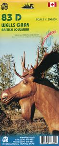
Wegenkaart - landkaart 83D Wells Gray - Murtle Lake | ITMB

Gedetailleerde kaart van een bepaald gebied in Canada, in dit geval een wegenkaart van Wells Gray national park (schaal 1:250.000) en een wandelkaart / topografische kaart  van Murtle lake (schaal 1:50.000).  Helder en duidelijk kleurgebruik, goed leesbaar en op de Wells Gray kaart met symbolen onder andere campsites, trails, benzinepompen etc.  Do...
13,95

Webshops met dit product

Webshop
Bezorging
Prijs

Anderen bekeken ook

Wegenkaart - landkaart Pyrenees - Andorra (Pyreneeën) | ITMB
Overzichtskaart van de Pyreneeën (schaal 1:450.000)  op de ene kant en op de andere zijde een gedetailleerde kaart van Andorra (1:40.000) The Pyrenees mountain chain straddling the border between France and Spain on one side, with historic Andorra on other side. As is normal with ITMB maps combining two areas at different scales, the map has two covers, so can be marketed equally well as Andorra or as Pyrenees. Our coverage of Pyrenees goes from the Atlantic to the Mediterranean coastlines Legend includes: roads by classification, international airports, domestic airports, ports, ruins, historic/archeological, hot springs, forts, lighthouses, national parks, world heritages, mountain peaks, spot heights, universities, oil fields, point of interests, beaches, camping sites, churches, viewpoints, mosques, passes, caves, border crossings, mines, hospitals and much more. Detailed travel map of Andorra shows roads from national highways to unpaved tracks; pedestrian paths and trails; railwa…
13,95
Wandelkaart - Topografische kaart 318 Mount Rogers High Country - Grayson Highlands State Park | National Geographic
Prachtige geplastificeerde kaart van het bekende nationaal park. Met alle recreatieve voorzieningen als campsites, maar ook met topografische details en wandelroutes ed. Door uitgekiend kleurgebruik zeer prettig in gebruik. Scheur en watervast!   National Geographic's Trails Illustrated map of Mount Rogers High Country and Grayson Highlands State Park, Southwest Virginia, is a two-sided, waterproof, topographic trail map designed to meet the needs of outdoor enthusiasts with unmatched durability and detail. This map was created in cooperation with local land management agencies and is loaded with valuable recreation information for exploring the area's large rock formations, spruce-fir forests, and the highest peak in Virginia. Trails and major roads, including the Appalachian Trail, the Virginia Creeper Trail, and the Virginia Highland Horse Trail, are clearly distinguished. Places of interest include areas for camping, picnicking, fishing, hiking, mountain biking, horseback riding, a…
17,95
Wegenkaart - landkaart - Stadsplattegrond Hong Kong & Region | ITMB
Plattegrond van Hong Kong met aan de ene kant Hong Kong op een schaal van 1:10.000 en op de achterkant de omgeving op een schaal van 1:60.000. De kaart is uitgevoerd met register en metrokaart. De kaart beslaat Hongkong tot aan Sham Shui Po, Ngau Tai Kok, Vitoria Peak  en Quarry Bay. De regiokaart gaat tot aan Shenzhen. Op deze kaart staan diverse campings en ook bushaltes, treinlijnen en de ferry's.   Legend Includes: Roads by classification, Points of Interest, Castles, Museums, Cathedrals, Churches, Abbeys, Theme Parks, Airports, Airstrips, Caravan Camps, Motorway Service Stations, Caves, Viewpoints, Zoos, Golf Courses, Lighthouses, National Parks, Rivers, Lakes, Waterfalls, Mountain Peaks, Ruins, Camping Sites, Tourist Information Centres, Skiing, Wildlife Reservation, and much more.
13,95
Wandelkaart - Topografische kaart 744 Adirondack Park - Northville - Raquette Lake | National Geographic
Prachtige geplastificeerde kaart van het bekende nationaal park. Met alle recreatieve voorzieningen als campsites, maar ook met topografische details en wandelroutes ed. Door uitgekiend kleurgebruik zeer prettig in gebruik. Scheur en watervast! National Geographic's Trails Illustrated map of Adirondack Park Northville/Raquette Lake is a two-sided, waterproof, topographic trail map designed to meet the needs of outdoor enthusiasts with unmatched durability and detail. This map was created in cooperation with the Adirondack Mountain Club and is loaded with valuable recreation information for boating, hiking, fishing, sailing, cycling, ice fishing, skiing, and snowmobiling. Trails and major roads are clearly distinguished, from the picturesque foothills to the northern peaks and around lakes of all sizes. Campgrounds, climbing areas, marinas, and museums are labeled and easy to find and boundaries for park lands, wilderness, primitive, forest, and protected areas are clearly marked. Disco…
17,95
Wegenkaart - landkaart Alaska's Inside Passage | ITMB
Een degelijke kaart met aanduidingen van o.a. nationale parken, vliegveld, benzinepomp, dirt-roads en kleine plattegronden van Anchorage, Seattle, Vancouver en Victoria. Als overzichtskaart goed te gebruiken.    We recently released our USA Pacific Coast Map, covering the segment between San Diego and Vancouver. This map completes the mapping of the Pacific Ocean coastline by mapping the routes followed by cruise ships and Alaska Ferries heading north from Seattle and Vancouver to Alaska. This is a double-sided map, with Vancouver Island and the coastline as far north as Prince Rupert on one side (with inset maps of Seattle, Victoria, and Vancouver)on side 1, and the coastline north to Glacier Bay and an onward inset map to Anchorage (including an inset map of the city) on the second side. As the actual routes followed by the numerous cruise lines vary, we can't show their actual sailing routes, but they generally follow the coastline within viewing distance of either the mainland or c…
13,95
Wegenkaart - landkaart Peru | ITMB
Een degelijke kaart met aanduidingen van o.a. nationale parken, vliegveld, dirt-roads en kleine plattegrond van hoofdstad. Als overzichtskaart goed te gebruiken. Peru at 1:1,500,000 on a double-sided, waterproof and tear-resistant, indexed map from ITMB, with large, clear street plans of central Lima and Cusco, highlighting accommodation, places of interest and various facilities. The map divides the country north/south, approximately along the line between the Cordillera Blanca and Cordillera Huyahuash, with very little overlap between the two sides. Topography is very effectively presented by altitude colouring, with spot heights and additional graphics for swamps and marshland, glaciers and volcanos. The map shows the country’s road network distinguishing between all-weather and seasonable roads and indicates driving distances on main routes. Railway lines, including the popular routes linking Cusco with Puno and Arequipa, are very clearly shown. The map also shows local airports an…
13,95
Wegenkaart - landkaart British Columbia South (Canada) | ITMB
Deze wegenkaart van British Columbia bestrijkt het gebied tussen Vancouver en Calgary, en is de perfecte toeristische kaart voor het verkennen van de regio Rocky Mountain. Alle wegen en spoorlijnen tussen de twee steden worden getoond, evenals campings en parken.   This map covers the area between Vancouver and Calgary, and is the perfect tourist map for exploring the Rocky Mountain region. All roads and rail lines between the two cities are shown, as well as camp grounds, parks. Legend Includes: Points of interests, airports, RV and camping sites, wilderness camps, picnic areas, waterfalls, tourist information, museums, golf courses, gas stations, outdoor activities and other information. Folded paper, road and travel map in color. Scale 1:900,000. Distinguishes roads ranging from divided highways to other roads-4WD/dry weather. Legend includes railways, trails, ferry routes, glaciers, points of interest, international airports, domestic airports, museums, mountain peaks, camping/recr…
13,95
Wandelkaart - Wegenkaart - landkaart 902 Jasper South National Park | National Geographic
Goede kaart van een deel van Jasper National Park. Geschikt voor overzicht maar ook voor de langere trails: campsites, rivieren, paden, alles kun je er op terug vinden.   National Geographic's Trails Illustrated map of Jasper South is a two-sided, waterproof map designed to meet the needs of outdoor enthusiasts with unmatched durability and detail. This map was created in conjunction with local land management agencies and is loaded with valuable recreation information.   The front side of the Jasper South map details the east side of the national park, from Whitehorse Wildland Provincial Park to the north, to White Goat Wilderness Area to the south. The reverse side of the map details the west side of the park, extending from Cummins Lakes Provincial Park to the south, to Victoria Cross Ranges to the North. Insets show survival tips, safe travel in Bear Country, and all the recreation the park has to offer with backpacking, camping, biking, hiking and horseback riding.   Trails I…
17,50
Wegenkaart - landkaart Ontario | ITMB
Een degelijke kaart voor Ontario met aanduidingen van o.a. nationale parken, vliegveld, benzinepomp, dirt-roads en kleine plattegrond van Toronto, Sault Ste. Marie. Als overzichtskaart goed te gebruiken. Ontario and Quebec form the portion of Canada known as Central Canada. Ontario is the industrial heartland of the country, and the southern portion is the most densely-populated and urbanized part of Canada. Toronto is a city of 2.8M people and the heartland of an economic region serving 100,000,000 people in two countries. Southern Ontario is also home for six million residents, some of the most historic sites in the country, and major recreational land masses (Algonquin Park, Bruce Trail, Muskoka/Haliburton). Northern Ontario, on the other side of the map, occupies the bulk of the land area of the province, and is dominated by the Canadian Shield (a pre-Cambrian rock formation that is the oldest land on earth, rich in mineral wealth). The North is dominated by recreational activities…
13,95
Wegenkaart - landkaart Jasper National Park & Northern Alberta | ITMB
  Jasper National Park kaart, zeer gedetailleerd (schaal 1:250.000) plus op de anderekant van de kaart staat Noord Alberta, schaal 1:1.000.000. Natuurkundige overzichtskaart met veel plaatsen en wegen, spoorlijnen en rivieren, hoogten, lengte- en breedtegraden.   Two words immediately come to my mind if I were to describe Northern Alberta: Oil and Cold. Oil sands could be found relatively easily within the Northern Alberta region. This pushes the Canadian economy forward as gasoline and other petroleum products are becoming higher in demand. Northern Alberta is also about the subzero temperature. The region of Northern Alberta mostly contains very cold, long winters and warm, short summers. Fort McMurray, for example, one of the famous urban communities located in the Wood buffalo municipality, has only a yearly mean temperature of 0.7 degrees Celsius. Nonetheless, Northern Alberta is also a land of recreation activities and wild adventures. On the other side of the Northern Alberta m…
13,95

Klanten-reviews van Wegenkaart - landkaart 83D Wells Gray - Murtle Lake | ITMB

Er zijn nog geen beoordelingen voor dit productBen jij de eerste die een review plaatst?

Meer over Wegenkaart - landkaart 83D Wells Gray - Murtle Lake | ITMB

Productomschrijving

Gedetailleerde kaart van een bepaald gebied in Canada, in dit geval een wegenkaart van Wells Gray national park (schaal 1:250.000) en een wandelkaart / topografische kaart  van Murtle lake (schaal 1:50.000).  Helder en duidelijk kleurgebruik, goed leesbaar en op de Wells Gray kaart met symbolen onder andere campsites, trails, benzinepompen etc.  Double sided, very detailed hiking map, with recreational information, based on the government topographic cartography. Scale 1:50,000. Legend includes points of interest, airports/airstrips, Forest Service offices, RV/camping/ recreation sites, wilderness camps. shelters, campsites/trailer parks, picnic areas, accommodations, parking, waterfalls, horseback riding, mountain biking, cross country skiing, canoeing, hiking, viewpoints, mountain climbing, golf courses, fishing, boat launches, gas stations, restaurants, gates, national/provincial parks. Printed on durable synthetic paper suitable for outdoor use.  
Webshop.nl maakt gebruik van cookies. Ga je verder op onze website, ga dan akkoord met het plaatsen van cookies en de verwerking van deze data door ons en vermelde partners.