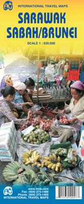
Wegenkaart - landkaart Sabah - Sarawak - Brunei | ITMB

0
Een degelijke kaart met aanduidingen van o.a. nationale parken, vliegveld, benzinepomp, dirt-roads en kleine plattegrond van hoofdstad. Als overzichtskaart goed te gebruiken. At last! This is the 'new' artwork covering northern Borneo in detail. We used to have two maps for this area, but have combined the artwork into one double-sided map coverin...

Verkopers met dit product

Verkoper
Bezorging
Prijs
DeZwerver.nl logo
DeZwerver.nl
2,95
13,95

Anderen bekeken ook

Wegenkaart - landkaart Sabah - Sarawak - Brunei | ITMB
Een degelijke kaart met aanduidingen van o.a. nationale parken, vliegveld, benzinepomp, dirt-roads en kleine plattegrond van hoofdstad. Als overzichtskaart goed te gebruiken. At last! This is the 'new' artwork covering northern Borneo in detail. We used to have two maps for this area, but have combined the artwork into one double-sided map covering the same area as formerly, but as one map, and with greater consistency in colouring and style. The base artwork has been updated and readability improved. This is a 'new' map, in that ITMB has never had a title exactly like this, but it is an 'update' in that we have had this artwork available before, which justifies the 2nd Edition label.   Legend Includes: Motorway, Major Highway,Airport,Car Ferry route and many more
13,95
Wegenkaart - landkaart Scotland - Schotland | ITMB
Anyone who has been in this business for a few years remembers Ordnance Survey and their brilliantly detailed artwork. They should also remember that OS guarded this artwork religiously. That all changed when the then head of government in the UK, one soon-forgotten Gordon Brown, decreed that commercial OS artwork had to be discontinued and artwork had to be made more freely available to users. I expected an outpouring of new artwork by private UK firms. It did not happen; in fact, the range of travel maps decreased dramatically. However, OS artwork is still an excellent source of mapping artwork. This is a wonderful double-sided, detailed map of Scotland. It is both extremely detailed and accurate. We have added symbols for parks, historic sites, battlefields, country hotels, and anything else that we think would interest visitors. In order to portray Scotland to best scale advantage, the only inset included with this map are those of outlying islands, such as the Shetlands. ITMB als…
13,95
Wegenkaart - landkaart South Pacific Cruising & Samoa | ITMB
Een overzichtskaart van de zuidelijke Stille Oceaan met de cruise routes tussen de verschillende eilanden aangegeven. Op de achterzijde een overzichtskaart van Samoa This is a new venture for ITMB. Cruising is a rapidly-growing segment of the travel industry, experiencing double-digit growth rates annually. Obviously, this is a thriving market. In conjunction with several cruise ship lines, we have prepared a map of the South Pacific Ocean, which extends southwards from Hawai'i to the southern tip of New Zealand and eastwards from central Australia/Papua New Guinea to the Pitcairn Islands. Thus, it does not include the popular South East Asia and China coast routes. We think this has to change at a time when 25,000,000 people are travelling by cruise ships. At the same time, we must keep coverage area relevant for those end users of the artwork. Even at 1:12M, most of the area covered is water, with island countries such as Fiji, Tonga, Kiribati, Tahiti, and the Cook Islands being vis…
13,95
Wegenkaart - landkaart Venezuela | ITMB
Wegenkaart met tevens aanduidingen van Nationale Parken en reservaten. Stadsplattegrond van Caracas 1:25.000 en kaart 1:500.000 van omgeving Caracas. This is another one of our brand new maps. The artwork has been digitally-prepared, and this time printed double-sided to achieve a MUCH better scale. We have included a regional inset map of the Caracas area, and insets of the Roraima Mountains region, but the size of Venezuela is such that the rest of the paper consists solely of the country itself. The southern portion remains relatively unexplored and undeveloped, with few roads and only the occasional settlement, and the northern coastal region shows the road network very well. This is the first new map of Venezuela in many years. Legend Includes: Roads by classification, Railways, Rivers, Rapids, Lakes, Swamps, Points of Interest, Airports, Harbours, Archaeological Sites, Museums, Churches, Car Ferries, Oilfields, Heights in meters, Beaches, Hospitals, Hotels, Universities, Gas Sta…
13,95
Wegenkaart - landkaart Jersey - Guernsey - Sark - Alderney (Kanaaleilanden) | ITMB
Goede detailkaart van alle kanaaleilanden. Het is zo gedetailleerd dat zelfs straatnamen er op staan. De kaart is ook nog eens geplastificeerd en daarmee scheur- en watervast.  ITMB is pleased to re-introduce the Channel Islands map area after a lengthy hiatus of preparing new artwork. The first version of this part of Europe was licensed artwork by a local firm in Jersey, and upon running out of copies of the printed map, we opted to prepare fresh artwork of our own to continue this interesting corner of the continent to continue to be available. The islands, collectively known in English as the Channel Islands, are one of those anomalies that make Europe so attractive. They are part of Great Britain, but not part of the UK; hence, they are not part of the EU. They are self-governing entities ‘owned’ by the Queen in her role of being Duchess of Normandy. This is, of course, merely a hereditary situation, but the islands were the personal possessions of William the Conqueror in 1066, …
14,50
Wegenkaart - landkaart Dominicaanse Republiek - Haiti | ITMB
Een degelijke kaart met aanduidingen van o.a. nationale parken, vliegveld, benzinepomp, dirt-roads en kleine plattegrond van hoofdstad. Als overzichtskaart goed te gebruiken. This map has been a difficult update, coming in the midst of the turmoil in Haiti caused by the earthquake in the spring of 2010. This is actually two separate maps sharing a single sheet of paper. The Dom Rep side was fairly straight-forward to update, as there has been little change, but the Haiti side needed a lot of time and energy. The earthquake revealed a previously unrealized reality – nobody had any information on Haiti. Our map was the only one in existence, and it proved to be too weak to meet the needs of humanitarian groups. They, however, provided a wealth of useful information as they reached out to isolated villages about road conditions, spelling of place names, and actual locations, which we have added to our artwork. This is a work in progress, so don’t expect perfection, but this map is far be…
13,95
Wegenkaart - landkaart England & Wales - Engeland | ITMB
Een degelijke kaart met aanduidingen van o.a. nationale parken, vliegveld, benzinepompen. ITMB publishes a map of Great Britain, but each portion of GB needs its own map to show roads and attractions in more detail. This is a brilliant map of both England and Wales, showing the entire 'country' in a double-sided format. The place names index is formidable, but England in particular is a series of little villages, so it has been very difficult to decide what to include and what to leave out. This map is showing motorways, divided carriageways, all A & B highways, railway lines, airports, historic sites and touristic attractions, parks and gardens, and just about everything that we could fit on to the page to provide users with a detailed, usable map. We have been able to fit all of southern England/Wales as far north as Chester/Lincoln on side A and with a little overlap, from those cities north to the well over the Scottish border, up to Perth/Dundee filling side B. The Isle of Man an…
13,95
Wegenkaart - landkaart Scandinavia - Scandinavië | ITMB
Een degelijke wegenkaart met aanduidingen van o.a. nationale parken, vliegveld. Als overzichtskaart goed te gebruiken. This is a new title for ITMB, providing detailed coverage of almost all of what most of us consider to be the Scandinavian countries. Only the southernmost portions of Denmark had to be left off. The map is double-sided, with Denmark and most of Norway and Sweden on one side and their balances and Finland on the reverse side. The road network, particularly the motorways and A-type roads shown up very well. Secondary roads show well and also are easy to see. Rail lines are present as well as ferry routes, of which there are many. The area of Scandinavia is so large in the European context that little attention has been paid to the region. When mapping a large area such as this is, it is difficult to show every detail. We have done our best and included all world heritage sites, major churches, castles, some campsites, and as many touristic attractions as could be fitte…
13,95
Wegenkaart - landkaart Atlantic Canada | ITMB
The first edition was published in 2000 using artwork under licence. This edition uses original ITMB artwork. Side 1 covers Nova Scotia, New Brunswick, and Prince Edward Island as well as Quebec s Magdalen Islands at a scale of 1:800,000. This side also includes the Top 10 Attractions of the three provinces. The second side is devoted to the Canadian Province of Newfoundland and Labrador, with the much smaller island portion being a half-page inset at 1:150,000 scale and the larger mainland portion being at 1:1,700,000. The northernmost tip of Quebec/Labrador belongs to Nunavut. St. Pierre et Miquelon, a French overseas possession just south of Newfoundland Island, is also included, as well as the map s only urban inset, historic St. John s, one of North America s oldest cities. The map also includes a listing of 9 Top Attractions. ITMB also publishes maps of the individual provinces, but the advantage of this regional map is that it combines together four interesting parts of Canada …
13,95
Wegenkaart - landkaart Oklahoma & Texas | ITMB
Een degelijke wegenkaart met aanduidingen van o.a. nationale parken, vliegveld, benzinepomp, dirt-roads. Als overzichtskaart goed te gebruiken. ITMB is pleased to announce the newest addition to our range of titles on the USA. Increasingly, we are developing our artwork to cover the larger states attractively and comprehensively, but also, we hope sensibly. Texas and Oklahoma share a common heritage of having been formed out of land taken from others through the long-held policy of Manifest Destiny. Today, Texas is the second largest State in the union (after Alaska), and is the only State to have previously been an independent country. It also includes the oldest urban area in the USA, Presidio, founded by the Spaniards to guard the ford over the Rio Grande. Because of its shape, and the natural proximity of the State of Oklahoma along its northern edge, combining the two States just made sense. The map is presented double-sided (top half/bottom half) on waterproof paper that is dura…
13,95

Klanten-reviews van Wegenkaart - landkaart Sabah - Sarawak - Brunei | ITMB

Er zijn nog geen beoordelingen voor dit productBen jij de eerste die een review plaatst?

Meer over Wegenkaart - landkaart Sabah - Sarawak - Brunei | ITMB

Productomschrijving

Een degelijke kaart met aanduidingen van o.a. nationale parken, vliegveld, benzinepomp, dirt-roads en kleine plattegrond van hoofdstad. Als overzichtskaart goed te gebruiken.

At last! This is the 'new' artwork covering northern Borneo in detail. We used to have two maps for this area, but have combined the artwork into one double-sided map covering the same area as formerly, but as one map, and with greater consistency in colouring and style. The base artwork has been updated and readability improved. This is a 'new' map, in that ITMB has never had a title exactly like this, but it is an 'update' in that we have had this artwork available before, which justifies the 2nd Edition label.   Legend Includes: Motorway, Major Highway,Airport,Car Ferry route and many more

Productinformatie

    Verken gerelateerde categorieën

    Webshop.nl maakt gebruik van cookies. Ga je verder op onze website, ga dan akkoord met het plaatsen van cookies en de verwerking van deze data door ons en vermelde partners.