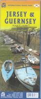
Wegenkaart - landkaart Jersey - Guernsey - Sark - Alderney (Kanaaleilanden) | ITMB

0
Goede detailkaart van alle kanaaleilanden. Het is zo gedetailleerd dat zelfs straatnamen er op staan. De kaart is ook nog eens geplastificeerd en daarmee scheur- en watervast.  ITMB is pleased to re-introduce the Channel Islands map area after a lengthy hiatus of preparing new artwork. The first version of this part of Europe was licensed artwork ...

Alle aanbiedingen van dit product

Verkoper
Bezorging
Prijs
DeZwerver.nl logo
DeZwerver.nl
2,95
14,95

Anderen bekeken ook

Wegenkaart - landkaart Jersey - Guernsey - Sark - Alderney (Kanaaleilanden) | ITMB
Goede detailkaart van alle kanaaleilanden. Het is zo gedetailleerd dat zelfs straatnamen er op staan. De kaart is ook nog eens geplastificeerd en daarmee scheur- en watervast.  ITMB is pleased to re-introduce the Channel Islands map area after a lengthy hiatus of preparing new artwork. The first version of this part of Europe was licensed artwork by a local firm in Jersey, and upon running out of copies of the printed map, we opted to prepare fresh artwork of our own to continue this interesting corner of the continent to continue to be available. The islands, collectively known in English as the Channel Islands, are one of those anomalies that make Europe so attractive. They are part of Great Britain, but not part of the UK; hence, they are not part of the EU. They are self-governing entities ‘owned’ by the Queen in her role of being Duchess of Normandy. This is, of course, merely a hereditary situation, but the islands were the personal possessions of William the Conqueror in 1066, …
14,95
Reisgids Dominicus Kanaaleilanden: Guernsey - Jersey - Sark - Herm | Gottmer
Om de Kanaaleilanden -Jersey, Guernsey, Herm, Sark en Alderney- is eeuwenlang gestreden door Frankrijk en Engeland en dat maakt ze tot een bijzonder gevarieerd reisdoel voor de vakantieganger - van magnifieke forten en vestingen tot een exquise Franse keuken naast een degelijke Britse. De reisgids Kanaaleilanden beschrijft welk landschappelijk schoon er te vinden is: er zijn kilometers lange kusten met grillige rotsformaties, steile klippen en gevaarlijke riffen, maar ook rustige baaien en stranden. Talloze bloemen en planten kleuren er in de lente en zomer de hellingen. In de reisgids Kanaaleilanden vindt u alle culturele en historische achtergronden, maar ook zeker de praktische informatie die nodig is voor een bezoek aan dit gebied.
21,99
Wandelgids Walking on Guernsey, Alderney, Sark and Herm | Cicerone
Guidebook to 24 easy day walks on the Channel Islands of Guernsey, Alderney, Sark and Herm, and the 3-day Guernsey Coastal Walk. Making up part of the Channel Islands Way, the routes follow paths, tracks and quiet roads and total around 240km (150 miles). Uses detailed 1:15,000 scale States of Guernsey maps, with notes on travel, accommodation, plants and wildlife and the islands' fascinating history.   Seasons all year round, but particularly good in spring when the wild flowers are at their most colourful; busy during the summer, with long, sunny days; quieter in autumn; sometimes bleak in the winter   Centres St Peter Port; St Sampson   Difficulty good paths and tracks are used, along with quiet country roads, avoiding main roads wherever possible; gradients are often gentle, but there are some rugged cliff paths and occasional steep slopes and flights of steps; short walks can be combined to make longer ones   Must See excellent cliff coastline, rocky and sandy beaches; nature res…
21,95
Kanaaleilanden
Kanaaleilanden
ANWB Extra reisgids Kanaaleilanden Ontdek de Kanaaleilanden met de compacte reisgids ANWB Extra Kanaaleilanden!De Kanaaleilanden lijken wel gemáákt om te wandelen en fietsen. Kustpaden ontsluiten de prachtigste landschappen die Jersey en Guernsey te bieden hebben. Maar ook op de kleinere eilanden kun je heerlijk wandelen. De ANWB Extra reisgids Kanaaleilanden biedt naast veel praktische tips over campings, vakantiehuizen, hotels en vervoer ook 15 inspirerende bezienswaardigheden die je niet mag missen. Ontdek alles over het scheepsverleden van de eilanden in het Maritime Museum op Jersey, bezoek het huis van schrijver Victor Hugo op Guernsey of bezoek de weelderige tuinen van La Seigneurie op het eiland Sark.Deze kleine reisgids past gemakkelijk in de handtas en heeft een handige uitneembare kaart met daarop de beste tips voor overnachten, winkelen, eten en drinken en uitgaan.ANWB Extra is de succesvolste reisgidsenserie van Nederland! Met al meer dan 5 miljoen gidsen verkocht over 108…
10,95
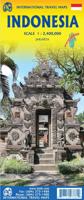
Wegenkaart - landkaart Indonesië - Indonesia | ITMB
Een degelijke landkaart van Indonesië met aanduidingen van o.a. nationale parken, vliegvelden en grote wegen. Als overzichtskaart goed te gebruiken. De nadruk ligt echter vooral op de natuurkundige aspecten. Scheur- en watervast! Met een kleine kaart van Jakarta. The hundreds of islands making up the island nation of Indonesia make a double-sided map inevitable in order to show any significant amount of detail. Side 1 shows the western half, starting with Sumatra in the upper left and including Java and most of the island of Borneo (Kalimantan Province to the Indonesians). This side also includes a large inset map of central Jakarta (for better detail see our separate map of the city); ditto for Sumatra, Java, and Borneo. Bali, Lombok, and Sumbawa islands are in the lower right portion of the map, and most of Malaysia and all of Singapore are included, simply because they are there. The infamous volcanic island of Krakatoa is located just to the west of Java. The other side of the map…
14,95
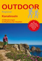
Wandelgids 403 Kanalinseln - Kanaal Eilanden Alderney, Guernsey, Herm, Jersey, Sark, | Conrad Stein Verlag
Handzaam boekje met routebeschrijvingen inclusief een heleboel praktische informatie. De beschrijving is uitstekend, maar kaarten zijn beperkt en schetsmatig aanwezig. Duits Die fünf Kanalinseln vor der Küste Frankreichs sind ein wahres Wanderparadies: Beeindruckende Küstenpfade, traumhafte Sandstrände und das Spiel der Gezeiten sorgen für ein spektakuläres Naturerlebnis. Aber auch die historischen Sehenswürdigkeiten und die fantastische Küche wissen zu begeistern. Der Wanderführer beschreibt die 32 schönsten Touren auf Jersey, Guernsey, Herm, Sark und  Alderney. Zu jeder Route gibt es Tipps für Wanderer mit Kind und Hund. Karten und Höhenprofile ergänzen die genauen Wegbeschreibungen, GPS-Tracks können kostenlos heruntergeladen werden. Infos zu Anreise, Einkehrmöglichkeiten, Rastplätzen sowie Besonderheiten an den Wegen runden den Wanderführer ab.  Alderney, Guernsey, Herm, Jersey, Sark, 
14,95
Wegenkaart - landkaart Madagascar | ITMB
Een degelijke kaart met aanduidingen van o.a. nationale parken, vliegveld, benzinepomp, dirt-roads en kleine plattegrond van hoofdstad. Als overzichtskaart goed te gebruiken. Tweezijdig! IThe large island off the east coast of Africa is Madagascar. The actual name of the country is the Malagasy Republic, but the public is much more likely to know the country by its island name, so we call our map by the island’s name, rather than using the country name. Makes sense to us! Regardless, this is a major touristic destination. The double-sided map covers the island in great detail, with an inset map of the capital city, Antananarivo. As with other ITMB maps, this one includes a listing of ‘must see’ attractions, such as Tsingy National Park and the famous Lemur’s Park. The island also has a regular surface route to the Comoro Islands, which are also included on this map. Legend Includes: Railroads, Forest, Mational Park, International Airport, Domestic Airport, Fort, holtel, Cave, Museum, …
14,95
Wegenkaart - landkaart Bahamas | ITMB
Een degelijke kaart met aanduidingen van o.a. nationale parken, vliegveld, benzinepomp, dirt-roads en kleine plattegrond van hoofdstad. As overzichtskaart goed te gebruiken. The Bahamas is one of the most touristic Caribbean island countries, with huge resort complexes in Nassau and in Freeport. We visited Grand Bahama Island earlier this month and can attest to the friendliness of the people and the attractiveness of the island. This map shows all of the many islands that comprise The Bahamas. There isn’t a lot of contouring, as the country’s highest point is only 36 feet above sea level. An inset map expanding the island of New Providence, and separate inset maps of Nassau and of Freeport, are included. The map is double-sided, east half-west half, printed on waterproof paper for durability.
14,95
Wegenkaart - landkaart 107 Serifos | Road Editions
Gedetailleerde wegenkaart met aanduiding van de wandelwegen, lijst van hotels en toeristische informatie. Voor alle doeleinden een zeer geschikte kaart. The features that make this and every other ROAD island map unique are: *The coastline, hydrography and precision geophysical background based on data provided by the Hellenic Military Geographic Service and electronically processed by us for clarity and legibility. We have highlighted the mountain masses in shades of brown between the contour lines (at 20m intervals on this map) to outline clearly the relief of the island. *The beaches are indicated by a special symbol next to which we have noted their names, as well as all the roads and footpaths leading to them (since most people primarily visit the islands for the beaches!). We have even included a short text in which the island’s best beaches are concisely referred to, to save you going on a wild goose hunt in search of them. *The road network is mapped out with impressive and ex…
9,95
Wegenkaart - landkaart Gulf Islands & Nanaimo (Canada) | ITMB
This is completely new artwork and a new approach to ITMB’s mapping of the islands in the Gulf of Georgia, between the mainland and Vancouver Island. This double-sided map incorporates two NTS topographical maps into its artwork, with points of interest, hiking trails, boat launching spots, and B&Bs included. It also covers a wider area than previously, so we have decided to call this map a 1st Edition; printed on durable ITM plastic paper. Legend Includes: Roads by classification, Ferry terminal, camping sites, museums, canoeing, fishing, tourist information sites, hiking roads, lighthouse, picnic areas, parks, and point of interest.
14,95

Klanten-reviews van Wegenkaart - landkaart Jersey - Guernsey - Sark - Alderney (Kanaaleilanden) | ITMB

Er zijn nog geen beoordelingen voor dit productBen jij de eerste die een review plaatst?

Meer over Wegenkaart - landkaart Jersey - Guernsey - Sark - Alderney (Kanaaleilanden) | ITMB

Productomschrijving

Goede detailkaart van alle kanaaleilanden. Het is zo gedetailleerd dat zelfs straatnamen er op staan. De kaart is ook nog eens geplastificeerd en daarmee scheur- en watervast. 

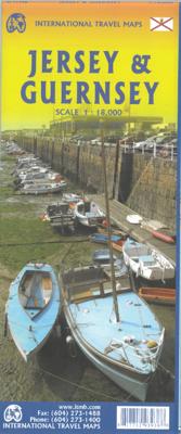
ITMB is pleased to re-introduce the Channel Islands map area after a lengthy hiatus of preparing new artwork. The first version of this part of Europe was licensed artwork by a local firm in Jersey, and upon running out of copies of the printed map, we opted to prepare fresh artwork of our own to continue this interesting corner of the continent to continue to be available. The islands, collectively known in English as the Channel Islands, are one of those anomalies that make Europe so attractive. They are part of Great Britain, but not part of the UK; hence, they are not part of the EU. They are self-governing entities ‘owned’ by the Queen in her role of being Duchess of Normandy. This is, of course, merely a hereditary situation, but the islands were the personal possessions of William the Conqueror in 1066, at the time he led Norman forces into Britain and won the Battle of Hastings. They remained his personal possessions and have been passed on from monarch to monarch for more than 950 years. Located just off the French coast, not too far from St. Malo, the islands were occupied by German forces during WW2, and are now readily available by ferry or airplane from both France and Britain. There are actually, five inhabited islands, of which Jersey and Guernsey are the largest. Alderney, Sark, and Herm make up the others. Ferries link the islands, and tourism is a major activity of the islands, along with banking. Most visitors arrive on Jersey, which on our map occupies an entire side. The airport is located near the western end of the island. Ferries arrive at St. Helier I’m very pleased that it is once again available.. Accommodations are plentiful and car rentals the best way to explore the island. The map shows all touristic attractions, roads, and rural restaurants/pubs. The reverse side is dominated by Guernsey, naturally, and its historic main town of St. Pete Port, but the shape of the island allowed us to include generous inset maps of Alderney and Sark, while including tiny Herm in the main map. This map has two covers: one showing Jersey and Guernsey, and the other noting Guernsey and Jersey, with two different pictures. And in the upper right corner, the flags of each island. This is one of those ‘must see before death’ touristic destinations and is well worth the visit.   Legend Includes: Ferry route, Highway, Main Road, Secondary Road, Hotel, Restaurant, Port, Point of interest, Ruins / Ancient sites, Pub, Domestic Airport etc.

Productinformatie

    Verken gerelateerde categorieën

    Webshop.nl maakt gebruik van cookies. Ga je verder op onze website, ga dan akkoord met het plaatsen van cookies en de verwerking van deze data door ons en vermelde partners.