webshop.nl
Categorieën
  Sluiten

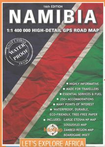
Wegenkaart - landkaart Namibië | Infomap

Another InfoMap classic – now in its 13th edition and highly recommended!   Famous for its Namib desert, the oldest desert in the world, which straddle the western shore along the Atlantic, Namibia is country of intense beauty and seemingly unlimited space. It is a photographer’s paradise. Watch the afternoon shadows add drama to the dunes at Sossu...
15,95

Webshops met dit product

Webshop
Bezorging
Prijs

Anderen bekeken ook

Wegenkaart - landkaart Botswana | Infomap
Goede betrouwbare kaart van Botswana. Met GPS coordinaten. Easy to read in a vehicle Practical, user-friendly scale Extensive countrywide accommodation listing and contact details Experienced-based tips and route comments Includes many off-road tracks GPS co-ordinates of intersections Border post information Many points of interest Distances, fuel points, airports Booking details for national parks Roads and tracks in the national park and reserves Inset of Tuli Block A classic. Our Botswana map, now in its 14th edition, is one of our top sellers. From more frequented destinations such as the country’s famous game parks to other lesser known ones like Tsodilo Hills – Botswana’s World Heritage site with over 4000 rock paintings – this map is a one-stop resource for both self-drive travellers and fly-in tourists alike. Use it to navigate your way from Gaborone to Maun, from Kasane down the Hunters Road to Khubu Island, from Twee Rivieren to the Kalahari, or simply use it as a…
15,95
Accommodatiegids Namibia Self-Drive Guide | Tracks4Africa
So, what is so special about the Tracks4Africa guide books? These are not guides written by armchair travellers or the personal experience of one person, but the combined experiences of a whole community of travellers. The T4A community travel far and wide – not by luxury bus or safari vehicle but on their own wheels. Sometimes they travel in groups and sometimes as lone rangers, but they always travel by motorbike, sedan or 4WD, therefore this guide is specifically aimed at self-drive travellers.   If you are a self-drive tourist, there are five things that you need to know when you are on the road: 1. Where to sleep. 2. Where to get fuel. 3. What to see and do. 4. Where to buy supplies. 5. Where to go in case of an emergency.   If you have the Tracks4Africa Self-Drive Guide as your travel companion, the answers to all these and many more questions will be at hand. If you are well prepared and well informed, you can really enjoy the unspoilt beauty of Africa! The Tracks4Afric…
52,50
Wegenkaart - landkaart Namibia - Namibië | Tracks4Africa
Uitstekende dubbelzijdige wegenkaart van Namibië, gemaakt door gerenommeerde kaartenmaker Track4Africa in Afrika. Met afstanden en reistijden tussen steden en op alle wegen vermeld. GPS via hun website te downloaden. De kaart wordt door vrijwel elke reisorganisatie geadviseerd als je met een eigen auto in Namibië rond gaat rijden. The Tracks4Africa Namibia paper map is designed to be used in conjunction with the T4A GPS Map of Namibia. It is the largest available Namibia map at 1:1,000,000 scale, offering you the perfect trip planning tool for your next Namibian holiday.  This T4A paper map series are probably the first comprehensive country maps in the world, offering travel time information for the entire road network, be it on tar, gravel or sand!    Key features:    Large 1:1,000,000 scale  Travel times and distances included on the map  What you see on the paper map is exactly what you get on T4A GPS Maps  Comprehensive set of roads and tracks in nature reserves  Detailed inf…
27,50
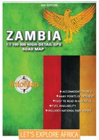
Wegenkaart - landkaart Zambia | Infomap
Zambia boasts some of the most beautiful, wild and pristine wilderness in Southern Africa. With 19 national parks including the world famous Kafue and South Luangwa National Parks, Zambia is an exciting wildlife and touring destination. Despite the fact that around 30% of the country being protected for wildlife conservation or management, it is still in many ways under-the-radar in terms of its tourist potential. Largely tropical and subtropical in climate, Zambia is characterized by woodland savannahs, grasslands and forests. Malaria is a concern and visitors are advised to take precautions.   Walking tours through one of the country’s national parks are a truly unforgettable experience. South Luangwa National Park is one of the best places for this, and an excellent destination for game viewing. Other sites such as the Bangweulu wetlands offer visitors a chance to see enormous herds of black lechwe. With so many wilderness areas to choose from though such as Kasanka, Lochinvar, Lowe…
15,95
Wegenkaart - landkaart Botswana - Zimbabwe | ITMB
Een degelijke kaart met aanduidingen van o.a. nationale parken, vliegveld, benzinepomp, dirt-roads en kleine plattegrond van hoofdstad. Als overzichtskaart goed te gebruiken. 7th Edition 1:1,600,000/11:1,000,000 on waterproof stone paper Both Botswana and its neighbour, Zimbabwe, form a common entity and a British heritage in Central Southern Africa, but there the resemblance ends. The Bechuana formed an alliance of sorts with the Pritish to protect them from the Boers in the then-nearby Transvaal. Upon a peaceful transition to independence as Botswana, it has evolved into a democratic and peaceful country. Zimbabwe, formerly Rhodeisa, is a failed state, although potentially, Zimbabwe could dominate tourism if governmental affairs were orderly. This map focuses on Botswana simply because that country is a beacon of orderly pleasantness in the continent; well run, routistacally well developed, with good infrastructure, and close to the game preserves of both South Africa and Zimbabwe. T…
13,95
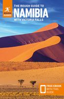
Reisgids Namibia - Namibië | Rough Guides
Zeer goede reisgids voor zowel de georganiseerde maar vooral voor de zelfstandige reiziger. Boordevol informatie over reizen, slapen, eten, maar ook musea en cultuur. Voor  de meeste  landen meestal completer en beter dan de Lonely Planet ! This Namibia with Victoria Falls guidebook is perfect for independent travellers planning a longer trip. It features all of the must-see sights and a wide range of off-the-beaten-track places. It also provides detailed practical information on preparing for a trip and what to do on the ground. And this Namibia with Victoria Falls travel guidebook is printed on paper from responsible sources, and verified to meet the FSC's strict environmental and social standards.   This Namibia with Victoria Falls guidebook covers: Windhoek and around, The southwest, The southern Kalahari and the far south, Central-northern Namibia, Central coast, Etosha and the far north, The northeast, Victoria Falls.   Inside this Namibia with Victoria Falls travel book, you'll …
23,95
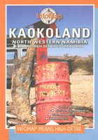
Wegenkaart - landkaart Kaokoland and northern Damaraland - Namibië | Infomap
Goede betrouwbare kaart van het noordwesten van Namibië: Damaraland en Kaokoland. Met GPS coordinaten. Engels Colour folding Map, 52x73 cm, scale 1:620.000. The first scale road map of this area to be produced with GPS co-ordinates. 100 GPS Co-ordinates of major intersections, refuelling points and accommodation information. Map range 11°45’ to 15°00’ East and 17° to 20°00’ South. Detailed road map Kaokoland / Kaokoveld (Namibia) includes GPS co-ordinates of major intersections, refuelling points and accomodation information.   This map covers North-Western Namibia on the one side and BUSHMANLAND and CAPRIVI in North-Eastern Namibia on the reverse side. This map is very much recommended for travelers to these regions as an addition to our bigger scaled Namibia map. Here you get a nice amplified look at the regions with loads of GPS coordinates, accommodation and petrol points. Furthermore we included extensive route and travel ideas and general information on Kaokoland. Sold in a plast…
15,95
Wegenkaart - landkaart Swaziland | Infomap
De Zuid-Afrikaanse producent InfoMap slaagt er in om voor de zuidelijke staten van Afrika uitstekende kaarten te maken. Met een heldere cartografie en een keur aan topografische informatie zijn deze kaarten goed geschikt en aan te bevelen voor diegene die zelfstandig gaat reizen in een van de zuidelijke staten van Afrika. De kaarten bevatten ook aanduidingen voor tankstations, afstanden en andere praktische reisinformatie. This 3rd edition has been completely re-designed and updated making a visit to this tiny, yet exciting country, so much easier. Ruled by Africa’s last absolute monarch, King Mswati III, Swaziland is an often over-looked Southern African travel destination. Laid back, safe, with much of its traditional Swazi culture intact, Swaziland offers a different kind of holiday experience.   At around 17 000 square kilometres in size Swaziland is a landlocked country bordered by South Africa and Mozambique. Geographically the country is composed of savannah, hills and mountains…
15,95
Wegenkaart - landkaart Brazilië | ITMB
Een degelijke kaart met aanduidingen van o.a. nationale parken, vliegveld, benzinepomp, dirt-roads en kleine plattegrond van hoofdstad. Als overzichtskaart goed te gebruiken. Brazil, or more properly, Brasil, is a difficult country to map as a country, in that most of the developed areas are in the relatively small extreme south of the country. The vast region of the Amazon Basin is lightly populated and is not easy to access. Our solution has been to portray the south portion on one side at a detailed scale, to enable such locations as Rio and Sao Paulo a better scale to help travellers, while mapping the north at a respectable but more limited scale on the That said, one still needs both sides of the map, as Brasilia, the capital, falls on the north side other side of the sheet. I should also note that roads north of Brasilia tend to be less well-paved than those in the south. The  shape of the country also presents mapping difficulties, in that little room is available for inset map…
13,95
Wegenkaart - landkaart Wales & southwest England | ITMB
Een degelijke kaart met aanduidingen van o.a. nationale parken, vliegveld, benzinepompen. Finally, we have been able to create our own map of the lovely country of Wales. I use the word ‘country’ in its truest sense, as Wales was invaded and taken over by the English centuries ago. Regardless, the Welsh language and Welsh culture continue to flourish, although English is commonly spoken. We have visited Wales on several occasions and find that the attractions are so numerous that we could never see them all. There are too many castles to count, but some of the best preserved in the British Isles are in Wales, notable Caernarfon, but nearby Harlech is a World Heritage Site. St, David’s must be one of the smallest and loveliest cathedrals in the world, and Tintern Abbey ruins among the most poignant anywhere. We took Johnny to Abergavenny for lunch in March, not that it made any difference; he just pined for a McDonalds. This map is double-sided, with Wales on one side and the West Count…
13,95

Klanten-reviews van Wegenkaart - landkaart Namibië | Infomap

Er zijn nog geen beoordelingen voor dit productBen jij de eerste die een review plaatst?

Meer over Wegenkaart - landkaart Namibië | Infomap

Productomschrijving

Another InfoMap classic – now in its 13th edition and highly recommended!   Famous for its Namib desert, the oldest desert in the world, which straddle the western shore along the Atlantic, Namibia is country of intense beauty and seemingly unlimited space. It is a photographer’s paradise. Watch the afternoon shadows add drama to the dunes at Sossusvlei, walk through the ghost town of Kolmanskop, hike the Fish River Canyon, see the lunar landscape and Quiver trees near Keetmanshoop, experience a world transformed when the Etosha pan fills with water, or look out for the endangered cheetah of which Namibia has the highest population left in Africa.   The country is a hugely popular tourist destination that offers endless possibilities to travellers throughout all budgets and travel requirements. Tourism is one of the country’s main economic activities, with around one million tourists visiting Namibia each year. Given that the country’s population currently sits somewhere around 2 million, this is a significant number. German tourists make up one of the largest tourist groups due in part to Namibia’s history with that country. In fact German is still spoken by many people in the country, although less now than in times past.   For self-drive travellers the road networks are extensive and generally well maintained. In fact, Namibia is one of the best places for self-drive travel in Southern Africa. Urban centers such as Windhoek, Walvis Bay and Swakopmund have all the facilities required by travellers, the country is stable, infrastructure good, and the country boasts some of the finest game viewing in Southern Africa. It also has a wide and well-established range of accommodation option ranging from basic campsite to luxury lodges.   Our Namibia map is well researched, very thorough and is an important planning tool for any upcoming Namibia trip. It includes all national, major and minor roads as well as many 4×4 tracks. Roads are named, with distances between points and it shows GPS co-ordinates of major intersections. Also included are fuel availability, accommodation options, border posts, airstrips and points of interest. The map includes information in areas that are not so popular, and are often overlooked, such as Bushmanland, a remote area in the northeast. Also included is the area next to the dry Nossob riverbed between Gobabis and the entrance gate of the Kgalagadi Transfrontier Park.
Webshop.nl maakt gebruik van cookies. Ga je verder op onze website, ga dan akkoord met het plaatsen van cookies en de verwerking van deze data door ons en vermelde partners.