webshop.nl
Categorieën
  Sluiten

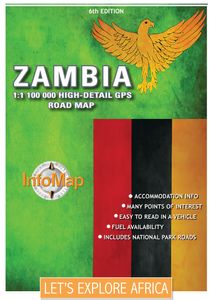
Wegenkaart - landkaart Zambia | Infomap

Zambia boasts some of the most beautiful, wild and pristine wilderness in Southern Africa. With 19 national parks including the world famous Kafue and South Luangwa National Parks, Zambia is an exciting wildlife and touring destination. Despite the fact that around 30% of the country being protected for wildlife conservation or management, it is st...
15,95

Webshops met dit product

Webshop
Bezorging
Prijs

Anderen bekeken ook

Wegenkaart - landkaart Botswana | Infomap
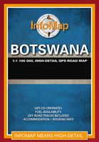
Goede betrouwbare kaart van Botswana. Met GPS coordinaten. Easy to read in a vehicle Practical, user-friendly scale Extensive countrywide accommodation listing and contact details Experienced-based tips and route comments Includes many off-road tracks GPS co-ordinates of intersections Border post information Many points of interest Distances, fuel points, airports Booking details for national parks Roads and tracks in the national park and reserves Inset of Tuli Block A classic. Our Botswana map, now in its 14th edition, is one of our top sellers. From more frequented destinations such as the country’s famous game parks to other lesser known ones like Tsodilo Hills – Botswana’s World Heritage site with over 4000 rock paintings – this map is a one-stop resource for both self-drive travellers and fly-in tourists alike. Use it to navigate your way from Gaborone to Maun, from Kasane down the Hunters Road to Khubu Island, from Twee Rivieren to the Kalahari, or simply use it as a…
15,95
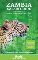
Reisgids Zambia Safari Guide: Luangwa Valley • Lower Zambezi • Victoria Falls | Bradt Travel Guides
Zeer goede gids voor Zambia en betrouwbaar alternatief voor de Lonely Planet. Nog completer! Zelfde soort informatie als de Lonely Planet: vol met praktische feiten en achtergronden. Voor Afrikaanse landen zijn de Bradt guides veruit de meest complete reisgidsen. For over 25 years Bradt's Zambia Safari Guide has been widely acknowledged as the best guidebook to this African country, and it is now the only dedicated guide to Zambia's world-renowned safari destinations. Combining in-depth reviews of lodges, camps and other accommodation (from a stately home to a contemporary woven treehouse), detailed descriptions of safari locations and operators, extensive practical details, local insights, a brand new 48-page colour wildlife guide and curated coverage of the main access points of Lusaka and Livingstone, this is the ‘must-have' guidebook to travel planning and exploring the country's wildlife-rich safari regions.   Lying in the heart of the continent, Zambia is deepest, darkest Africa …
27,95
Wegenkaart - landkaart Zimbabwe | Infomap
Easy to read in a vehicle Various accommodation options with contact details Major and secondary roads with many off-road tracks Roads in the national parks and reserves Distances between points on major roads Border post information Points of interest   While Zimbabwe has for many years now made headlines for its economic hardships, it’s worth remembering that for a long time this country was the ‘’breadbasket of Africa’ and one of the premier wildlife destinations on the continent. A changing political landscape in the late 90’s however, virtually caused a complete collapse in the tourism industry – a vital bloodline to the economy.   Those troubled times seem to be coming to a close and Zimbabwe is back on the tourist map. Foreign visitors are slowly rising and recently the country was voted the World’s Best Tourism Destination by the World Tourism Organisation. With a wealth of tourist-sites, activities and wildlife reserves, any trip to this country will be memorable. From …
15,95
Accommodatiegids Namibia Self-Drive Guide | Tracks4Africa
So, what is so special about the Tracks4Africa guide books? These are not guides written by armchair travellers or the personal experience of one person, but the combined experiences of a whole community of travellers. The T4A community travel far and wide – not by luxury bus or safari vehicle but on their own wheels. Sometimes they travel in groups and sometimes as lone rangers, but they always travel by motorbike, sedan or 4WD, therefore this guide is specifically aimed at self-drive travellers.   If you are a self-drive tourist, there are five things that you need to know when you are on the road: 1. Where to sleep. 2. Where to get fuel. 3. What to see and do. 4. Where to buy supplies. 5. Where to go in case of an emergency.   If you have the Tracks4Africa Self-Drive Guide as your travel companion, the answers to all these and many more questions will be at hand. If you are well prepared and well informed, you can really enjoy the unspoilt beauty of Africa! The Tracks4Afric…
52,50
Wegenkaart - landkaart South West Western Australia | Hema Maps
Hema's South West Western Australia Map features unequalled road and track information for this picturesque corner in Australia's largest state. A regional map for discovering South West Western Australia (WA). On the reverse side of the map are detailed inset maps of Nambung National Park, Avon Valley National Park, Lane Poole Reservation, the South West Corner, Stirling Range National Park, D, Entrecastreaux National Park and Albany Coast. Also included is tourist information for the Coral Coast, Perth, Avon Valley, the Great Southern Region, Peel, Blackwood River Valley, the Southern Forests, the Margaret River region and the Southern Coast.   The southwestern portion of Western Australia has a spectacular coastline, great surfing beaches, flowing rivers, tall forests, wineries, farms, quaint towns, bustling cities and numerous other attractions. While forest communities remain quiet, the coastal area from Bunbury to Margaret River and Augusta bursts at the seams on long weekends…
15,95
Wegenkaart - landkaart Swaziland | Infomap
De Zuid-Afrikaanse producent InfoMap slaagt er in om voor de zuidelijke staten van Afrika uitstekende kaarten te maken. Met een heldere cartografie en een keur aan topografische informatie zijn deze kaarten goed geschikt en aan te bevelen voor diegene die zelfstandig gaat reizen in een van de zuidelijke staten van Afrika. De kaarten bevatten ook aanduidingen voor tankstations, afstanden en andere praktische reisinformatie. This 3rd edition has been completely re-designed and updated making a visit to this tiny, yet exciting country, so much easier. Ruled by Africa’s last absolute monarch, King Mswati III, Swaziland is an often over-looked Southern African travel destination. Laid back, safe, with much of its traditional Swazi culture intact, Swaziland offers a different kind of holiday experience.   At around 17 000 square kilometres in size Swaziland is a landlocked country bordered by South Africa and Mozambique. Geographically the country is composed of savannah, hills and mountains…
15,95
Wegenkaart - landkaart Melbourne and Region Map | Hema Maps
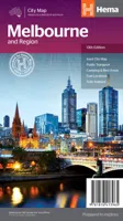
Handige kaart van zowel de stad Melbourne als het omliggende gebied. Description Melbourne & Region The Melbourne and Region map features a primary map of Greater Melbourne (1:115,000) that includes highways, major roads and local streets, as well as 24-hour fuel, parks and caravan parks. On the reverse is a Melbourne CBD map with accommodation, shopping and other places of interest pinpointed, along with train and tram network maps and a Melbourne Region map. Key Features Highways, major roads and local streets Points of interest Accommodation Travel Information Parks Caravan Parks 24 Hour Fuel Tram lines Railway stations Suburbs Suburbs Index Shopping centres Theatres/Cinemas Sporting venues Tram and Train network maps The cosmopolitan capital of Victoria, Melbourne is a city of distinct districts: each with its own particular appeal. For a different view of the city head to the observation deck at the Eureka Skydeck for 360° views. A cruise along the Yarra River provides yet another…
11,50
Wegenkaart - landkaart 790 New Zealand - Nieuw Zeeland | Michelin
Zoals je van Michelin mag verwachten is deze kaart zeer overzichtelijk en heeft een duidelijk helder kaartbeeld. De kaart geeft uitgebreide toeristische informatie weer. De perfecte overzichtskaart!   This New Zealand map from Michelin is part of their red national map series. These are perfect for route planning as well as getting around by car once you're there. They clearly mark out major roads and also show many of the more important minor roads.    The map's simple folding design with durable paper cover, allows it to be read like a book and easily folded back together. Road numbers and intermediate distances are clearly displayed with the more scenic routes highlighted in green.   The map also features:   Political boundaries Regional and National Parks Important sights (points of interest, historic sites, etc.) Driving Times and Distances Road Safety Information A legend in multiple languages (Dutch, English, French, German and Spanish) Michelin New Zealand Map 790 is a new addi…
12,95
Reisgids Culture Smart! Zambia | Kuperard
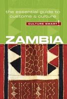
De Cultuur Bewust!-gids geeft toeristen en zakenlieden belangrijke informatie met betrekking tot de cultuur van alledag in het land van bestemming. Anders dan in de gebruikelijke reisgidsen wordt de lezer in deze reeks bijgespijkerd op het gebied van omgangsvormen, normen en waarden, hoe zich te gedragen en wat verwacht mag worden op zakelijk en sociaal gebied. Het zijn beknopte zakformaatgidsen met interessante wetenswaardigheden over het dagelijks leven. Een must voor iedereen die naar het buitenland gaat voor vakantie, studie of werk.   Culture Smart! Zambia is a unique introduction to life there today. Most of what is written about the country comes from the perspective of one or other tribe. There is nothing quite like this concise description of its major cultural traditions. The people most visitors will meet are well-educated, sophisticated, and well-versed in Western ways. Nonetheless, foreign businesspeople cannot hope to be successful without understanding the ancient and co…
14,95
Wegenkaart - landkaart 770 Vietnam - Laos - Cambodja | Michelin
Zoals je van Michelin mag verwachten is deze kaart zeer overzichtelijk en heeft een duidelijk helder kaartbeeld. De kaart geeft uitgebreide toeristische informatie weer. De perfecte overzichtskaart!   This Vietnam - Laos - Cambodia map from Michelin is part of their red national map series. These are perfect for route planning as well as getting around by car once you're there. They clearly mark out major roads and also show many of the more important minor roads. A street plan of central Lima that highlights the city's mai attractions is included.   The map's simple folding design with durable paper cover, allows it to be read like a book and easily folded back together. Road numbers and intermediate distances are clearly displayed with the more scenic routes highlighted in green.   The map also features:   Political boundaries Regional and National Parks Important sights (points of interest, historic sites, etc.) Driving Times and Distances Road Safety Information A legend in multipl…
12,95

Klanten-reviews van Wegenkaart - landkaart Zambia | Infomap

Er zijn nog geen beoordelingen voor dit productBen jij de eerste die een review plaatst?

Meer over Wegenkaart - landkaart Zambia | Infomap

Productomschrijving

Zambia boasts some of the most beautiful, wild and pristine wilderness in Southern Africa. With 19 national parks including the world famous Kafue and South Luangwa National Parks, Zambia is an exciting wildlife and touring destination. Despite the fact that around 30% of the country being protected for wildlife conservation or management, it is still in many ways under-the-radar in terms of its tourist potential. Largely tropical and subtropical in climate, Zambia is characterized by woodland savannahs, grasslands and forests. Malaria is a concern and visitors are advised to take precautions.   Walking tours through one of the country’s national parks are a truly unforgettable experience. South Luangwa National Park is one of the best places for this, and an excellent destination for game viewing. Other sites such as the Bangweulu wetlands offer visitors a chance to see enormous herds of black lechwe. With so many wilderness areas to choose from though such as Kasanka, Lochinvar, Lower Zambezi, North Luangwa, Liuwa and Nsumbu National Parks, visitors can undoubtedly find themselves feeling sometimes like the only travellers for miles around. Then of course there is adventure tourism. From river rafting and riding elephants near the mighty Zambezi, to swinging in the Bokota Gorge or bush camping under the wide African sky.   Our map is highly detailed and a great planning tool for any self-drive or tourist holiday to the country. With infrastructure development happening fairly rapidly in Zambia, many more roads being tarred and upgraded and new bridges being built, it is important to be up-to-date. It is becoming both quicker and easier to now to get to the country’s national parks. Our map shows primary and secondary routes and off-road tracks, and has been thoroughly edited, updated and improved upon. We have also included many points of interest, campsites, camp GPS co-ordinates, accommodation, national park contacts, park gates and fuel points.  
Webshop.nl maakt gebruik van cookies. Ga je verder op onze website, ga dan akkoord met het plaatsen van cookies en de verwerking van deze data door ons en vermelde partners.