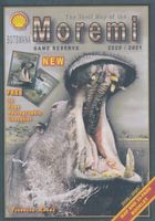
Wegenkaart - landkaart Moremi - Tourist Map of Moremi Game Reserve Botswana | Shell

0
Zeer bijzondere landkaart van Moreni Game Reserve in Botswana. Uitermate handig zijn de GPS coördinaten van de meest belangrijke punten als campings of uitzichtspunten. De kaart is gebaseerd op een luchtfoto, waarbij alle details zijn ingetekend. The map: The Moremi map is based on satellite photos. The front of the map consists of a map of the en...

Verkopers met dit product

Verkoper
Bezorging
Prijs
DeZwerver.nl logo
DeZwerver.nl
2,95
17,50

Anderen bekeken ook

Wegenkaart - landkaart Kgalagadi - Tourist Map of Kgalagadi Transfrontier Park Botswana | Shell
Zeer bijzondere landkaart van het grensgebied van Botswana en Zuid Afrika. Uitermate handig zijn de GPS coordinaten van de meest belangrijke punten als campings of uitzichtpunten. De kaart is gebaseerd op een luchtfoto, waarbij alle details zijn ingetekend. The map: The map consists of a large map of the entire Park on the front of the map. On the back is enlargements of six maps - the South African side, Mabuasehube, Swart Pan area, Gemsbok Wilderness Trail, Mabuasehube Wilderness Trail and of the Kaa Kalahari Concession. Satellite images were used and the roads were tracked by GPS. There are 168 GPS coordinates on this map. Establishment of a Transfrontier Park: On the 7 th of April 1999 Botswana and South Africa signed a bilateral agreement in which they agreed to manage their adjacent national parks, Gemsbok National Park in Botswana and Kalahari Gemsbok National Park in South Africa, as a single ecological unit – the Kgalagadi Transfrontier Park. It is the first formally declared…
17,50
Wegenkaart - landkaart Okavango Delta - Tourist Map of the Okavango Delta and Linyanti Botswana - Veronica Roodt | Shell
Zeer bijzondere landkaart van de Okavango Delta en Linyanti. Uitermate handig zijn de GPS coördinaten van de meest belangrijke punten als campings of uitzichtpunten. De kaart is gebaseerd op een luchtfoto, waarbij alle details zijn ingetekend. The map: The map of the Okavango and Linyanti was compiled by using LANDSAT satellite images. The main reason for a tourist map of the area is to indicate the localities of the lodges as well as the wildlife management areas in which they occur. Tourists to the Okavango often visit more than one lodge and this will give them a good idea of where they have been. On the back of the map are enlargements of the different tourist areas, which shows more detail of the landscape. There are no GPS co-ordinates on the Okavango map as all the Wildlife areas consist of private concessions, which are not open to the general public. The roads in the private concessions have also not been indicated as this may mislead the self-driving public, making them thin…
17,50
Wegenkaart - landkaart Chobe | Shell
Zeer bijzondere goede landkaart van Chobe National Park in Botswana. Uitermate handig zijn de GPS coordinaten van de meest belangrijke punten als campings of uitzichtpunten. De kaart is gebaseerd op een luchtfoto, waarbij alle details zijn ingetekend. The map: The Chobe map consists of a complete map of Chobe on the front of the map and there are 5 individual maps of the major tourist areas on the back of the map. These are Chobe river front east, Chobe river front west, Nogatsaa, Savute and a small orientation map. The map was compiled by using satellite images, giving one a birds eye-view of the area. The roads were tracked by means of a GPS and then super-imposed on the photographs. Detailed GPS co-ordinates are supplied for game-drive areas. The Chobe map contains 126 GPS co-ordinates. The four main tourist areas: The Chobe National Park consists of a variety of vegetation types and geological features, offering extreme contrasts and a wide range of wildlife experiences within the…
17,50
Wegenkaart - landkaart Botswana - Zimbabwe | ITMB
Een degelijke kaart met aanduidingen van o.a. nationale parken, vliegveld, benzinepomp, dirt-roads en kleine plattegrond van hoofdstad. Als overzichtskaart goed te gebruiken. 7th Edition 1:1,600,000/11:1,000,000 on waterproof stone paper Both Botswana and its neighbour, Zimbabwe, form a common entity and a British heritage in Central Southern Africa, but there the resemblance ends. The Bechuana formed an alliance of sorts with the Pritish to protect them from the Boers in the then-nearby Transvaal. Upon a peaceful transition to independence as Botswana, it has evolved into a democratic and peaceful country. Zimbabwe, formerly Rhodeisa, is a failed state, although potentially, Zimbabwe could dominate tourism if governmental affairs were orderly. This map focuses on Botswana simply because that country is a beacon of orderly pleasantness in the continent; well run, routistacally well developed, with good infrastructure, and close to the game preserves of both South Africa and Zimbabwe. …
13,95
Accommodatiegids - Campergids - Campinggids Botswana Self-Drive Guide | Tracks4Africa
De Self Drive Guide Botswana van Tracks4Africa is een uitgebreide gids met alle informatie voor mensen die zelf met een eigen of gehuurde auto door Botswana willen reizen. De gids bevat informatie over parken en routes, over overnachtingsmogelijkheden en campings, maar ook over de veiligheid, de beste reistijd, de planning, de keuze van welk vervoermiddel en de hulpmiddelen die vereist zijn. Zo vindt u bijvoorbeeld ook informatie over het huren van een 4x4 met tent op het dak en campingspullen, over de techniek van de auto, over voorbereiding, over navigatie, communicatie en vereiste documenten. De gids ziet er aantrekkelijk en overzichtelijk uit en bevat veel kaarten met routes en ook kleurenfoto's. De gids is groot van formaat : A4 !   This guide is specifically aimed at self-drive travellers. If you are a self-drive tourist, there are five things that you need to know when you are on the road:  1. Where to sleep.  2. Where to get fuel.  3. What to see and do.  4. Where to buy suppl…
52,50
Wegenkaart - landkaart 3207 Adventure Map Botswana | National Geographic
Wegenkaart van Botswana met vermelding van veel bezienswaardigheden, nationale parken en attrakties. Watervast en scheurvast. Juist door deze vermeldingen onderscheidt de kaart zich van andere wegenkaarten. National Geographic's Botswana Adventure Map is designed to meet the unique needs of adventure travelers with its durability and accurate information. This folded map provides global travelers with the perfect combination of detail and perspective, highlighting hundreds of points of interest and the diverse and unique destinations within the country. The map includes the locations of cities and towns with a user-friendly index, plus a clearly marked road network complete with distances and designations for major highways, main roads, and tracks and trails for those seeking to explore more remote regions.   The front side of the Botswana map details the northern region of the country, from Namibia to the north and west, to the bordering country of Zimbabwe to the east. The reverse s…
17,50
Wegenkaart - landkaart 3117 Adventure Map Alaska | National Geographic
Wegenkaart van Alaska met vermelding van veel bezienswaardigheden, nationale parken en attrakties. Watervast en scheurvast. Alaska is a land so vast that is boggles the imagination. It is so large that it could easily contain the next three largest states: Texas, California, and Montana and still have room left over. Despite its large size Alaska has very few inhabitants making it the state with the lowest population density. Alaska is known for its dramatic, diverse terrain of wide-open spaces, mountains and forests, with abundant wildlife and many small towns.   A majority of Alaska, sixty percent, is owned and managed by the Federal Government. These lands are open to the public and offer a wide range of activities from sightseeing in Denali National Park to river-running and fishing on one of many wild rivers. Many vistors to Alaska choose to arrive via cruise ship through the famous Inside Passage. The Alaska Adventure Map shows all of these features and more from the temperate r…
17,50
Wegenkaart - landkaart Melbourne and Region Map | Hema Maps
Handige kaart van zowel de stad Melbourne als het omliggende gebied. Description Melbourne & Region The Melbourne and Region map features a primary map of Greater Melbourne (1:115,000) that includes highways, major roads and local streets, as well as 24-hour fuel, parks and caravan parks. On the reverse is a Melbourne CBD map with accommodation, shopping and other places of interest pinpointed, along with train and tram network maps and a Melbourne Region map. Key Features Highways, major roads and local streets Points of interest Accommodation Travel Information Parks Caravan Parks 24 Hour Fuel Tram lines Railway stations Suburbs Suburbs Index Shopping centres Theatres/Cinemas Sporting venues Tram and Train network maps The cosmopolitan capital of Victoria, Melbourne is a city of distinct districts: each with its own particular appeal. For a different view of the city head to the observation deck at the Eureka Skydeck for 360° views. A cruise along the Yarra River provides yet anothe…
14,50
Wegenkaart - landkaart 3024 Adventure Map Cambodia - Cambodja | National Geographic
Mooie, heldere kaart van Cambodja,  gedrukt op scheurvast en watervast papier. National Geographic's Cambodia Adventure Map is designed to meet the needs of adventure travelers with its durability and detailed, accurate information. This map includes the locations of cities and towns with a user-friendly index, a clearly marked road network complete with distances and designations for roads/highways, plus secondary routes for those seeking to explore off the beaten path. Adventure Maps differ from a traditional road map because of the specialty content they include. Each map contains hundreds of diverse and unique recreational, ecological, cultural, and historic destinations — outside of the major tourist hubs. National Geographic Adventure Maps are the perfect companion to a guidebook, yet far easier to pack!   Cambodia is perhaps best know to international travelers as the home of the Angkor empire for six hundred years. Angkor Wat and Angkor Thom are part of the vast temple complex…
17,50
Wegenkaart - landkaart SC5-SC6 George to Kareedouw | Tracks4Africa
The Cape to Addo map series covers the southern parts of the Western Cape of South Africa in a series of eight highly detailed maps, printed on four sheets of A1 durable paper.   We start in Cape Town in the west and move along the southern coast through the Overberg, Winelands, Garden Route, Klein Karoo R62, Baviaanskloof to eventually arrive in the Addo National Park up to Gqeberha (Port Elizabeth) in the east.   The maps are highly detailed and well researched. Our map scale is 1:200 000 which allows us to show a lot of detail including minor gravel roads, hiking trails, farm boundaries and points of interest which are relevant to self-drive tourists.   The size of the paper is kept small enough to allow this to be the perfect road tripping map. We use Duraflex paper and print two maps per sheet of A1 paper, making this a four-sheet series. Each map sheet is individually packed in a plastic protective sleeve.   The maps are perfect for day drives, overlanding or just doing road tri…
29,95

Klanten-reviews van Wegenkaart - landkaart Moremi - Tourist Map of Moremi Game Reserve Botswana | Shell

Er zijn nog geen beoordelingen voor dit productBen jij de eerste die een review plaatst?

Meer over Wegenkaart - landkaart Moremi - Tourist Map of Moremi Game Reserve Botswana | Shell

Productomschrijving

Zeer bijzondere landkaart van Moreni Game Reserve in Botswana. Uitermate handig zijn de GPS coördinaten van de meest belangrijke punten als campings of uitzichtspunten. De kaart is gebaseerd op een luchtfoto, waarbij alle details zijn ingetekend.

The map: The Moremi map is based on satellite photos. The front of the map consists of a map of the entire Reserve and on the back are six separate maps of Khwai river-front east, Khwai river-front west, an orientation map of Moremi, Xakanaxa area and the Moanachira river, Xakanaxa game-drive area and Bodumatau area. The roads were tracked by GPS and there are 162 GPS co-ordinates on the map.

General: As part of the Okavango Delta, Moremi consists of permanent swamp, seasonally swamped areas and dry land. It is one of the prime tourist destinations in Botswana and offers water activities, top game-viewing, some of the best bird-life in Africa and incredible scenery. Not to be missed!

Locality and size: The Moremi Game Reserve is nestled within the Okavango Delta and completely buffered by wildlife management areas. When it was first established in 1963, it covered only the dry-land triangle but today it comprises 4 871 km2.

How to get there: All the camps are accessible by air but only the dry-land triangle between South Gate, Mboma Island, Xakanaxa and North Gate is accessible by road. From Maun one travels north-east for 100 km to get to South Gate. From Kasane one travels south-west for about 265 km.

Where to stay: All the camps around Moremi are indicated on the map. Detailed address references are supplied in the Shell Tourist Travel Guide of Botswana, which is presented as a package with the Botswana map.

Best season to visit: Winter is the best time to visit (from May to August) but September to December is the best time for bird-watching. The roads are very difficult to negotiate during the rainy season and the animals are more scattered.


Productinformatie

    Verken gerelateerde categorieën

    Webshop.nl maakt gebruik van cookies. Ga je verder op onze website, ga dan akkoord met het plaatsen van cookies en de verwerking van deze data door ons en vermelde partners.