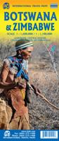
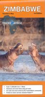
Wegenkaart - landkaart Botswana - Zimbabwe | ITMB

0
Een degelijke kaart met aanduidingen van o.a. nationale parken, vliegveld, benzinepomp, dirt-roads en kleine plattegrond van hoofdstad. Als overzichtskaart goed te gebruiken. 7th Edition 1:1,600,000/11:1,000,000 on waterproof stone paper Both Botswana and its neighbour, Zimbabwe, form a common entity and a British heritage in Central Southern Afri...

Alle aanbiedingen van dit product

Verkoper
Bezorging
Prijs
DeZwerver.nl logo
DeZwerver.nl
2,95
14,95

Anderen bekeken ook

Wegenkaart - landkaart Botswana - Zimbabwe | ITMB
Een degelijke kaart met aanduidingen van o.a. nationale parken, vliegveld, benzinepomp, dirt-roads en kleine plattegrond van hoofdstad. Als overzichtskaart goed te gebruiken. 7th Edition 1:1,600,000/11:1,000,000 on waterproof stone paper Both Botswana and its neighbour, Zimbabwe, form a common entity and a British heritage in Central Southern Africa, but there the resemblance ends. The Bechuana formed an alliance of sorts with the Pritish to protect them from the Boers in the then-nearby Transvaal. Upon a peaceful transition to independence as Botswana, it has evolved into a democratic and peaceful country. Zimbabwe, formerly Rhodeisa, is a failed state, although potentially, Zimbabwe could dominate tourism if governmental affairs were orderly. This map focuses on Botswana simply because that country is a beacon of orderly pleasantness in the continent; well run, routistacally well developed, with good infrastructure, and close to the game preserves of both South Africa and Zimbabwe. …
14,95
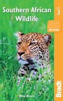
Natuurgids Southern African Wildlife - Botswana, Leshoto, Mozambique, Zuid-Afrika, Swaziland & Zimbabwe | Bradt Travel Guides
Uitstekende natuurgids voor Botswana, Leshoto, Mozambique, Zuid-Afrika, Swaziland & Zimbabwe met meer dan 300 kleurenfoto's. This new, thoroughly revised edition of Bradt's Southern Africa Wildlife guide provides an overview of all southern African wildlife - not only 'big game' and other large mammals, but also birds, reptiles, amphibians and invertebrates. Excellent for independent travellers, it is reliable as a standalone guide combining both wildlife and visitor information, and is also a perfect complement to traditional field guides. Countries covered include Botswana, Lesotho, Mozambique, Namibia, South Africa, Eswatini and Zimbabwe, with Malawi and Zambia both added to this new edition.   Colour photographs illustrate all key species and the engaging text extends beyond basic identification features to illuminate the natural history and ecology of the wildlife that visitors will encounter. Text has been updated throughout to reflect the latest conservation initiatives and wil…
27,95
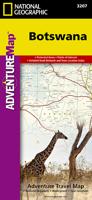
Wegenkaart - landkaart 3207 Adventure Map Botswana | National Geographic
Wegenkaart van Botswana met vermelding van veel bezienswaardigheden, nationale parken en attrakties. Watervast en scheurvast. Juist door deze vermeldingen onderscheidt de kaart zich van andere wegenkaarten. National Geographic's Botswana Adventure Map is designed to meet the unique needs of adventure travelers with its durability and accurate information. This folded map provides global travelers with the perfect combination of detail and perspective, highlighting hundreds of points of interest and the diverse and unique destinations within the country. The map includes the locations of cities and towns with a user-friendly index, plus a clearly marked road network complete with distances and designations for major highways, main roads, and tracks and trails for those seeking to explore more remote regions.   The front side of the Botswana map details the northern region of the country, from Namibia to the north and west, to the bordering country of Zimbabwe to the east. The reverse s…
18,50
Reisgids Southern Africa - zuidelijk Afrika - Botswana, Lesotho, Malawi, Mozambique, Namibië, Zambia, South Africa, Zimbabwe | Lonely Planet
De perfecte reisgids voor zowel de georganiseerde als de zelfstandige reiziger. Naast een algemene inleiding van het land / streek vol met praktische informatie over hoe je er het beste kunt reizen: slapen, eten, vervoer, excursies ... alles kun je er in vinden. Engelstalig. An astonishingly diverse region fused by its prolific wildlife, breathtaking landscapes and remnants of ancient culture, Southern Africa is Africa at its most memorable. Lonely Planet will get you to the heart of Southern Africa, with amazing travel experiences and the best planning advice.   Lonely Planet Southern Africa is your passport to the most relevant, up-to-date advice on what to see and skip, and what hidden discoveries await you. Clamber up the world’s oldest sand dunes in Sossusvlei, step back in time on Mozambique Island, or enjoy world-class wildlife-watching in Etosha National Park; all with your trusted travel companion. Get to the heart of Southern Africa and begin your journey now!   Inside Lonel…
24,95
Reisgids Zimbabwe | Bradt Travel Guides
Voor vele landen net zo goed, zo niet beter dan de Planet. Beduidend soberder uitgevoerd, maar ook met veel informatie voor backpackers en met veel kaartmateriaal. Een aanrader! The new fifth edition of Bradt's Zimbabwe remains the only detailed, standalone guide from a major publisher to cover one of the premier safari and cultural destinations in southern Africa. Best known for the Victoria Falls, which leaves visitors awed by the world's largest curtain of falling water, Zimbabwe offers manifold other experiences for the intrepid traveller - from evocative wildlife to fascinating arts, jaw-dropping landscapes to astonishing World Heritage sites. Soak up the laid-back atmosphere of the capital, Harare, with its bustling arts scene and trendy restaurants, or head to the mighty Zambezi River for fast-flowing adventure. Visit national parks that offer a variety of wildlife encounters: enjoy canoe-based game-viewing at Mana Pools (where African painted dog is a highlight) or remote camp…
30,95
Wegenkaart - landkaart Kgalagadi - Tourist Map of Kgalagadi Transfrontier Park Botswana | Shell
Zeer bijzondere landkaart van het grensgebied van Botswana en Zuid Afrika. Uitermate handig zijn de GPS coordinaten van de meest belangrijke punten als campings of uitzichtpunten. De kaart is gebaseerd op een luchtfoto, waarbij alle details zijn ingetekend. The map: The map consists of a large map of the entire Park on the front of the map. On the back is enlargements of six maps - the South African side, Mabuasehube, Swart Pan area, Gemsbok Wilderness Trail, Mabuasehube Wilderness Trail and of the Kaa Kalahari Concession. Satellite images were used and the roads were tracked by GPS. There are 168 GPS coordinates on this map. Establishment of a Transfrontier Park: On the 7 th of April 1999 Botswana and South Africa signed a bilateral agreement in which they agreed to manage their adjacent national parks, Gemsbok National Park in Botswana and Kalahari Gemsbok National Park in South Africa, as a single ecological unit – the Kgalagadi Transfrontier Park. It is the first formally declared…
19,95
Wegenkaart - landkaart Chobe National Park | Botswana | Shell
Zeer bijzondere goede landkaart van Chobe National Park in Botswana. Uitermate handig zijn de GPS coordinaten van de meest belangrijke punten als campings of uitzichtpunten. De kaart is gebaseerd op een luchtfoto, waarbij alle details zijn ingetekend. The Chobe river front is one of Botswana's top wildlife destinations. It has the advantage that it is accessible by tar road. The blue sparkling water of the Chobe attracts thousands of animals and birds. It is especially famous for its abundance of elephants and exquisite sunsets. The main game drive route follows the river and game-viewing is truly fantastic. Apart from huge herds of elephants, buffalo, sable and zebra, it is the only place in Botswana where one can see the Puku, a water-loving antelope that resembles the Lechwe. The birdlife is spectacular. As soon as the rain starts most of the elephants disappear. Savute In sharp contrast to the lush Chobe river front is the almost desert-like landscape of Savute, especially so duri…
20,95
Wegenkaart - landkaart Botswana | Reise Know-How Verlag
Uitstekende kaart van Botswana. Tweetalige kaart (Engels en Duits). Door ingetekende lengte- en breedtegraden is het gebruik van GPS mogelijk. Met hoogtelijnen en uitgebreid wegennetwerk: daarnaast worden ook de afstanden tussen belangrijke plaatsen duidelijk leesbaar weergegeven. Het kleurgebruik is zodanig dat je een goede indruk krijgt van hoogteverschillen en soorten landschap. Natuurlijk staan de toeristische bezienswaardigheden duidelijk vermeld. Met centrumkaart van Gabarone. Gedrukt op water- en scheurvast papier! Polyart is een synthetisch product vrij van giftige stoffen dus duurzaam. Het papier gaat echt lang mee. Topography is indicated by altitude colouring with numerous spot heights and names of mountain ranges and passes. Salt lakes, swamps, seasonal rivers and glacier are also shown. Detailed presentation of the road network includes minor roads and tracks and railways are also shown.   Internal administrative units are presented with their boundaries and names. Nation…
15,95
Wegenkaart - landkaart Moremi - Tourist Map of Moremi Game Reserve Botswana | Shell
Zeer bijzondere landkaart van Moreni Game Reserve in Botswana. Uitermate handig zijn de GPS coördinaten van de meest belangrijke punten als campings of uitzichtspunten. De kaart is gebaseerd op een luchtfoto, waarbij alle details zijn ingetekend. The map: The Moremi map is based on satellite photos. The front of the map consists of a map of the entire Reserve and on the back are six separate maps of Khwai river-front east, Khwai river-front west, an orientation map of Moremi, Xakanaxa area and the Moanachira river, Xakanaxa game-drive area and Bodumatau area. The roads were tracked by GPS and there are 162 GPS co-ordinates on the map. General: As part of the Okavango Delta, Moremi consists of permanent swamp, seasonally swamped areas and dry land. It is one of the prime tourist destinations in Botswana and offers water activities, top game-viewing, some of the best bird-life in Africa and incredible scenery. Not to be missed! Locality and size: The Moremi Game Reserve is nestled withi…
17,50

Klanten-reviews van Wegenkaart - landkaart Botswana - Zimbabwe | ITMB

Er zijn nog geen beoordelingen voor dit productBen jij de eerste die een review plaatst?

Meer over Wegenkaart - landkaart Botswana - Zimbabwe | ITMB

Productomschrijving

Een degelijke kaart met aanduidingen van o.a. nationale parken, vliegveld, benzinepomp, dirt-roads en kleine plattegrond van hoofdstad. Als overzichtskaart goed te gebruiken.

7th Edition 1:1,600,000/11:1,000,000 on waterproof stone paper Both Botswana and its neighbour, Zimbabwe, form a common entity and a British heritage in Central Southern Africa, but there the resemblance ends. The Bechuana formed an alliance of sorts with the Pritish to protect them from the Boers in the then-nearby Transvaal. Upon a peaceful transition to independence as Botswana, it has evolved into a democratic and peaceful country. Zimbabwe, formerly Rhodeisa, is a failed state, although potentially, Zimbabwe could dominate tourism if governmental affairs were orderly. This map focuses on Botswana simply because that country is a beacon of orderly pleasantness in the continent; well run, routistacally well developed, with good infrastructure, and close to the game preserves of both South Africa and Zimbabwe. The map includes a large inset map of Gaborone, the capital, but most visitors fly into Maun, in the north, which is close to the country's greatest assets, the Okavango Delta, home of one of the greatest wildlife preserves on earth. Personally, I prefer the central Kalahari Desert area, because it is so unique, but wildlife viewing is the source of the country's top rating as a tourist destination. To the west is Namibia, another country that has evolved into a sensible independent country, and to the east and south is South Africa. One can enter Zimbabwe at Kazanula or at Plumtree, to visit Victoria Falls, one of the great physical attractions of Africa. The second side of our maps shows this country in great detail, and having lived in the country for several years, I can attest to its attractiveness. Inset maps of Harare, the capital, Bulawayo, Victoria Falls, and the Great Zimbabwe Ruins make this map essential for anyone visiting this country. A word of caution must be fiven here, in that the condition of many of the roads has deteriorated overtime, petrol is often unavailable, and basic foodstuffs are costly. The map has been printed on durable tear-resistant stone paper, and should outlast any visit.

Productinformatie

    Verken gerelateerde categorieën

    Webshop.nl maakt gebruik van cookies. Ga je verder op onze website, ga dan akkoord met het plaatsen van cookies en de verwerking van deze data door ons en vermelde partners.