webshop.nl
Categorieën
  Sluiten

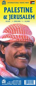
Wegenkaart - landkaart Palestine & Jerusalem - Palestina | ITMB

This is a new title for ITMB and the first time a separate map for that portion of the area known as Palestine and controlled by Palestinians has been published. This is essentially an attempt to show a political reality that exists, in that no one denies that both the West Bank and the Gaza Strip exist, albeit as a tightly-controlled entity that i...
13,95

Webshops met dit product

Webshop
Bezorging
Prijs

Anderen bekeken ook

Wegenkaart - landkaart Botswana - Zimbabwe | ITMB
Een degelijke kaart met aanduidingen van o.a. nationale parken, vliegveld, benzinepomp, dirt-roads en kleine plattegrond van hoofdstad. Als overzichtskaart goed te gebruiken. 7th Edition 1:1,600,000/11:1,000,000 on waterproof stone paper Both Botswana and its neighbour, Zimbabwe, form a common entity and a British heritage in Central Southern Africa, but there the resemblance ends. The Bechuana formed an alliance of sorts with the Pritish to protect them from the Boers in the then-nearby Transvaal. Upon a peaceful transition to independence as Botswana, it has evolved into a democratic and peaceful country. Zimbabwe, formerly Rhodeisa, is a failed state, although potentially, Zimbabwe could dominate tourism if governmental affairs were orderly. This map focuses on Botswana simply because that country is a beacon of orderly pleasantness in the continent; well run, routistacally well developed, with good infrastructure, and close to the game preserves of both South Africa and Zimbabwe. T…
13,95
Wegenkaart - landkaart USA Verenigde Staten | ITMB
Een degelijke kaart met aanduidingen van o.a. nationale parken, vliegveld, benzinepomp, dirt-roads en kleine plattegrond van hoofdstad. Als overzichtskaart goed te gebruiken. United States of America (USA) Travel Reference Map has been mapped before, but the USA is a huge country, extremely developed, and almost impossible to show on a map without over-simplification. Most commercial maps use small sheets of paper and print single-sided, making it impossible to show this vast country to advantage. Well, Lan’s been hard at work developing a ‘proper’ traveller’s aid to navigating around the USA, and here it is. We printed it on an exceptionally large sheet of paper, 39” tall by 54” wide (our normal printing size is 27”x39”). To do this, we merged our four existing databases into one, then split them so that the west side is on one side and the east side on the other. What results is a very large sheet, but a map at a VERY good scale. We were able to fit in 6,765 urban areas, all the Inte…
13,95
Wegenkaart - landkaart Bosnië en Montenegro | ITMB
For some reason, Bosnia Herzegovina has never attracted the attention of firms publishing maps. Understandably, since the breakup of Yugoslavia, the entire region has been somewhat unattractive for visitors. Also, Bosnia by itself is difficult to map, due to its shape. However, we have visited the country several times and find it to be interesting, friendly, and attractive. We were particularly impressed by Montenegro. Since it broke away from Serbia, this country has moved forward quickly. It uses the Euro as a currency, has lovely Mediterranean Sea resorts along its coast, and is a progressive country tying its future to the rest of Europe as a future EU member. The roads in both countries are good, and the damage done by civil in-fighting largely a thing of the past. Both countries are well-worth a visit. The map also includes Kosovo. Ethnically, it is probably more tied to Albania than to Bosnia, but geographically, Bosnia is closer and Kosovo is shown in good detail on this doubl…
13,95
Wegenkaart - landkaart Western Canada | ITMB
Een degelijke kaart met aanduidingen van o.a. nationale parken, vliegveld, benzinepomp, dirt-roads. Als overzichtskaart goed te gebruiken. This is actually our second attempt at mapping the western portion of Canada; the first covered everything from northwestern Ontario to the Pacific Ocean and, while it was an excellent map, the scale that such a huge area covered necessitated severe problems. In this version, all of British Columbia, Alberta, and the Yukon have been mapped from fresh digital data and presented at 1:1.4T scale. This would have been impossible when we prepared the first map. The Northwest Territories portion had to be compressed in two ways; first, the scale is 1:2M; second, only the portion with roads is shown. This is still an extremely large area. One has to consider the actual size of Canada when designing a map. Most countries in Europe would fit into this area, which only covers 20% of Canada. The Fort McMurray forest fire of a year ago covered an area larger th…
13,95
Wegenkaart - landkaart South Pacific Cruising & Samoa | ITMB
Een overzichtskaart van de zuidelijke Stille Oceaan met de cruise routes tussen de verschillende eilanden aangegeven. Op de achterzijde een overzichtskaart van Samoa This is a new venture for ITMB. Cruising is a rapidly-growing segment of the travel industry, experiencing double-digit growth rates annually. Obviously, this is a thriving market. In conjunction with several cruise ship lines, we have prepared a map of the South Pacific Ocean, which extends southwards from Hawai'i to the southern tip of New Zealand and eastwards from central Australia/Papua New Guinea to the Pitcairn Islands. Thus, it does not include the popular South East Asia and China coast routes. We think this has to change at a time when 25,000,000 people are travelling by cruise ships. At the same time, we must keep coverage area relevant for those end users of the artwork. Even at 1:12M, most of the area covered is water, with island countries such as Fiji, Tonga, Kiribati, Tahiti, and the Cook Islands being visi…
13,95
Wegenkaart - landkaart Africa North - Noord Afrika | ITMB
Een degelijke wegenkaart met aanduidingen van o.a. nationale parken, vliegveld, benzinepomp, dirt-roads. Als overzichtskaart goed te gebruiken. ITMB continues to refine its data base for Africa and introduce new titles that we hope meet market expectations. This map is one of the first of our enhanced scale maps that will gradually become the norm for regional maps of parts of the African continent. This map is also unique in that it does what I do not believe has been attempted before by any publisher - portraying the entire Mediterranean coastline from Morocco to the eastern edge of Egypt in one double-sided map. I admit, current political realities make this map somewhat challenging. One cannot cross, for example, between Morocco and Algeria, and Libya is in such a state of disarray at the moment that it is not practical to visit the country. However, the strength of this title is that it breaks new ground and looks at the countries north of Sahara as a comprehensive entity in great…
13,95
Wegenkaart - landkaart Wales & south of England - Zuid Engeland | ITMB
Een degelijke kaart met aanduidingen van o.a. nationale parken, vliegveld, benzinepompen. We are gradually increasing the scales for our data of Great Britain and this is our latest effort. Most visitors to the UK fly into one of London's four airports and combine a visit to the city with an opportunity to travel to various destinations within striking distance of London. England is so incredibly rich in heritage and scenic attractions that it is extremely difficult to portray the country as a map of the entire entity. As a result, England lends itself nicely to be divided into a central/northern portion and a southern portion. To fit areas as diverse as Cornwall and Norwich on one sheet, one needs to have a vertical frame, with Devon/Cornwall up to the top of Wales on one side and Wiltshire to Kent up to York (admittedly, not normally considered to be part of 'southern', but vertically, that's what happens. At this scale, all of southern England and all of Wales can be shown in good d…
13,95
Wegenkaart - landkaart Spitsbergen Svalbard | ITMB
North of Norway exists one of the northernmost communities in the world, an archipelago of islands called Svalbard in Norwegian, and better known as Spitsbergen in English. Until now, it has only been available in map format from the Norwegian Arctic Institute, and then only with difficulty. Side one shows the various islands as an entity. There is only one town of any size in the islands, called Longyearbyen, although there is a more northerly town called Pyramiden and an isolated community on the west coast called Alesund. This is true high Arctic adventure travel; one does not come here unprepared! Most of the islands are uninhabited and largely ice-covered. Edge Island, for example, is a large nature reserve, and Prins Karl Forland is a national park. We have translated land area names into English and placed the Norwegian names in brackets, but have tried leaving the Norwegian names in place wherever possible to assist with local usage. This is one of those ‘off the beaten path’ t…
13,95
Wegenkaart - landkaart Afghanistan | ITMB
Een degelijke kaart met aanduidingen van o.a. nationale parken, vliegveld, benzinepomp, dirt-roads en kleine plattegrond van hoofdstad. Als overzichtskaart goed te gebruiken. Legend Includes: Roads by classification, silk road, airports, towns, villages, ruins, national parks, lakes, swamps, points of interest and other information It is a bit difficult to credit Afghanistan having touristic potential at the moment, but it is an extremely important country right now, and that justifies a very good map of the country. This is our third edition of this country and each one keeps getting better. We can’t justify sending a researcher into a combat zone to gather data, but we are thankful to those aid workers and soldiers who have added to our information base and helped make this map more useful. In this edition, we are showing some new roads, reflecting the reality that the country is succeeding in improving its infrastructure in spite of a very tense political situation. We have also pla…
13,95
Wegenkaart - landkaart Scotland - Schotland | ITMB
Anyone who has been in this business for a few years remembers Ordnance Survey and their brilliantly detailed artwork. They should also remember that OS guarded this artwork religiously. That all changed when the then head of government in the UK, one soon-forgotten Gordon Brown, decreed that commercial OS artwork had to be discontinued and artwork had to be made more freely available to users. I expected an outpouring of new artwork by private UK firms. It did not happen; in fact, the range of travel maps decreased dramatically. However, OS artwork is still an excellent source of mapping artwork. This is a wonderful double-sided, detailed map of Scotland. It is both extremely detailed and accurate. We have added symbols for parks, historic sites, battlefields, country hotels, and anything else that we think would interest visitors. In order to portray Scotland to best scale advantage, the only inset included with this map are those of outlying islands, such as the Shetlands. ITMB also…
13,95

Klanten-reviews van Wegenkaart - landkaart Palestine & Jerusalem - Palestina | ITMB

Er zijn nog geen beoordelingen voor dit productBen jij de eerste die een review plaatst?

Meer over Wegenkaart - landkaart Palestine & Jerusalem - Palestina | ITMB

Productomschrijving

This is a new title for ITMB and the first time a separate map for that portion of the area known as Palestine and controlled by Palestinians has been published. This is essentially an attempt to show a political reality that exists, in that no one denies that both the West Bank and the Gaza Strip exist, albeit as a tightly-controlled entity that is not a country in the traditional sense of the word but is, nonetheless the homeland of millions of people and a self-governing entity. Jerusalem has been shown as an entity, without a border, in order to emphasize its importance as a unifying point of three great religions. Barricades do exist within the city, but these exist mostly to prevent clashes and reduce frictions, and we prefer to concentrate our hopes for Jerusalem as a future symbol of unity. Geographically, to fit both the southerly Gaza Strip area and the northerly West Bank portion together, it has been necessary to include large portions of Israel proper. The border has been shown for purposes of illustration only and in a generalized manner to represent reality and is not intended to indicate what would normally be a properly-defined border between nation states. This part of the world has been called Palestine since Roman times and until a more representative name can be created, we are stuck with using a name that is acceptably used to describe this part of the world. Sometimes, one has to go beyond what is comfortably safe and do something new. ITMB has been doing this since 1983; this is just another leap of faith.
Webshop.nl maakt gebruik van cookies. Ga je verder op onze website, ga dan akkoord met het plaatsen van cookies en de verwerking van deze data door ons en vermelde partners.