webshop.nl
Categorieën
  Sluiten

Meer Shell
Meer Shell in Puzzels

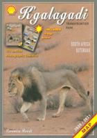
Wegenkaart - landkaart Kgalagadi - Tourist Map of Kgalagadi Transfront

0
Zeer bijzondere landkaart van het grensgebied van Botswana en Zuid Afrika. Uitermate handig zijn de GPS coordinaten van de meest belangrijke punten als campings of uitzichtpunten. De kaart is gebaseerd op een luchtfoto, waarbij alle details zijn ingetekend. The map: The map consists of a large map of the entire Park on the front of the map. On the ...

Webshops met dit product

Webshop
Bezorging
Prijs

Anderen bekeken ook

Wegenkaart - landkaart Kgalagadi - Tourist Map of Kgalagadi Transfront
Zeer bijzondere landkaart van het grensgebied van Botswana en Zuid Afrika. Uitermate handig zijn de GPS coordinaten van de meest belangrijke punten als campings of uitzichtpunten. De kaart is gebaseerd op een luchtfoto, waarbij alle details zijn ingetekend. The map: The map consists of a large map of the entire Park on the front of the map. On the back is enlargements of six maps - the South African side, Mabuasehube, Swart Pan area, Gemsbok Wilderness Trail, Mabuasehube Wilderness Trail and of the Kaa Kalahari Concession. Satellite images were used and the roads were tracked by GPS. There are 168 GPS coordinates on this map. Establishment of a Transfrontier Park: On the 7 th of April 1999 Botswana and South Africa signed a bilateral agreement in which they agreed to manage their adjacent national parks, Gemsbok National Park in Botswana and Kalahari Gemsbok National Park in South Africa, as a single ecological unit – the Kgalagadi Transfrontier Park. It is the first formally declared …
17,50
Wegenkaart - landkaart Moremi - Tourist Map of Moremi Game Reserve Bot
Zeer bijzondere landkaart van Moreni Game Reserve in Botswana. Uitermate handig zijn de GPS coördinaten van de meest belangrijke punten als campings of uitzichtspunten. De kaart is gebaseerd op een luchtfoto, waarbij alle details zijn ingetekend. The map: The Moremi map is based on satellite photos. The front of the map consists of a map of the entire Reserve and on the back are six separate maps of Khwai river-front east, Khwai river-front west, an orientation map of Moremi, Xakanaxa area and the Moanachira river, Xakanaxa game-drive area and Bodumatau area. The roads were tracked by GPS and there are 162 GPS co-ordinates on the map. General: As part of the Okavango Delta, Moremi consists of permanent swamp, seasonally swamped areas and dry land. It is one of the prime tourist destinations in Botswana and offers water activities, top game-viewing, some of the best bird-life in Africa and incredible scenery. Not to be missed! Locality and size: The Moremi Game Reserve is nestled within…
17,50
Wegenkaart - landkaart Botswana | Infomap
Goede betrouwbare kaart van Botswana. Met GPS coordinaten. Easy to read in a vehicle Practical, user-friendly scale Extensive countrywide accommodation listing and contact details Experienced-based tips and route comments Includes many off-road tracks GPS co-ordinates of intersections Border post information Many points of interest Distances, fuel points, airports Booking details for national parks Roads and tracks in the national park and reserves Inset of Tuli Block A classic. Our Botswana map, now in its 14th edition, is one of our top sellers. From more frequented destinations such as the country’s famous game parks to other lesser known ones like Tsodilo Hills – Botswana’s World Heritage site with over 4000 rock paintings – this map is a one-stop resource for both self-drive travellers and fly-in tourists alike. Use it to navigate your way from Gaborone to Maun, from Kasane down the Hunters Road to Khubu Island, from Twee Rivieren to the Kalahari, or simply use it as a…
15,95
Wegenkaart - landkaart South West Western Australia | Hema Maps
Hema's South West Western Australia Map features unequalled road and track information for this picturesque corner in Australia's largest state. A regional map for discovering South West Western Australia (WA). On the reverse side of the map are detailed inset maps of Nambung National Park, Avon Valley National Park, Lane Poole Reservation, the South West Corner, Stirling Range National Park, D, Entrecastreaux National Park and Albany Coast. Also included is tourist information for the Coral Coast, Perth, Avon Valley, the Great Southern Region, Peel, Blackwood River Valley, the Southern Forests, the Margaret River region and the Southern Coast.   The southwestern portion of Western Australia has a spectacular coastline, great surfing beaches, flowing rivers, tall forests, wineries, farms, quaint towns, bustling cities and numerous other attractions. While forest communities remain quiet, the coastal area from Bunbury to Margaret River and Augusta bursts at the seams on long weekends…
15,95
Wegenkaart - landkaart Okavango Delta - Tourist Map of the Okavango De
Zeer bijzondere landkaart van de Okavango Delta en Linyanti. Uitermate handig zijn de GPS coördinaten van de meest belangrijke punten als campings of uitzichtpunten. De kaart is gebaseerd op een luchtfoto, waarbij alle details zijn ingetekend. The map: The map of the Okavango and Linyanti was compiled by using LANDSAT satellite images. The main reason for a tourist map of the area is to indicate the localities of the lodges as well as the wildlife management areas in which they occur. Tourists to the Okavango often visit more than one lodge and this will give them a good idea of where they have been. On the back of the map are enlargements of the different tourist areas, which shows more detail of the landscape. There are no GPS co-ordinates on the Okavango map as all the Wildlife areas consist of private concessions, which are not open to the general public. The roads in the private concessions have also not been indicated as this may mislead the self-driving public, making them think…
17,50
Fietskaart 01 Cycling guides Cornwall | Goldeneye
Our maps are double-sided, printed on an A2 sheet with a concertina fold. This allows for easy folding and folding, and an ease of access to the mapping. The material is rain and tear-resistant. Our early maps were designed at the scale of 2 miles to 1 inch/1:126,720. The later designs along with digitalisation are 1: 100,000. We were encouraged by the Cycle Touring Club to convert our cartography toward the cycle market (to replace the out-of-print Bartholomew series). As time and the series progressed we have added more data: The National Cycle Network routes, Regional Routes, and Traffic-Free Family Routes, as and when they are developed. These routes are in addition to the Circular Routes Goldeneye Commissioned at the outset of our publishing schedule. We are also adding to new editions; bike shops, cycle hire, and tea rooms, along with the tourist attractions already featured. Our plan is to make available digital versions for cell phones and tablets and to update, on an annual ba…
15,95

Klanten-reviews van Wegenkaart - landkaart Kgalagadi - Tourist Map of Kgalagadi Transfront

Er zijn nog geen beoordelingen voor dit productBen jij de eerste die een review plaatst?

Meer over Wegenkaart - landkaart Kgalagadi - Tourist Map of Kgalagadi Transfront

Productomschrijving

Zeer bijzondere landkaart van het grensgebied van Botswana en Zuid Afrika. Uitermate handig zijn de GPS coordinaten van de meest belangrijke punten als campings of uitzichtpunten. De kaart is gebaseerd op een luchtfoto, waarbij alle details zijn ingetekend. The map: The map consists of a large map of the entire Park on the front of the map. On the back is enlargements of six maps - the South African side, Mabuasehube, Swart Pan area, Gemsbok Wilderness Trail, Mabuasehube Wilderness Trail and of the Kaa Kalahari Concession. Satellite images were used and the roads were tracked by GPS. There are 168 GPS coordinates on this map. Establishment of a Transfrontier Park: On the 7 th of April 1999 Botswana and South Africa signed a bilateral agreement in which they agreed to manage their adjacent national parks, Gemsbok National Park in Botswana and Kalahari Gemsbok National Park in South Africa, as a single ecological unit – the Kgalagadi Transfrontier Park. It is the first formally declared Transfrontier Park in southern Africa, but there are more underway. There were no human made barriers in the past but the parks were managed separately. Tourists are able to move freely within the park and they have a unified set of regulations. Management of internal affairs remain separate. Entry and camping fees on both sides are similar, depending on the exchange rate. Botswana side: The Botswana side of the park has been maintained in a natural condition as far as possible. The camping sites – there are no lodges or chalets – are in harmony with nature without any form of above-ground masonry. There are five areas of focus as far as visitors are concerned – the Nossob river valley, Mabuasehube, Swart Pan area and the two Wilderness trails (Mabuasehube 4x4 Trail and the Gemsbok Wilderness Trail). There are three public access routes - from Kaa gate to Nossob Camp, from Mabuasehube gate to Nossob and from Two Rivers to the Nossob valley. South African side: The game-drive routes are mainly in the two river valleys – the Nossob valley in the north and the Auob Valley in the south. Most of the roads do not require 4x4 vehicles. The three main camps have small shops, fuel, chalets, accommodation and camping. Apart from the two roads linking the valley routes, there is now a 4x4 route that passes Bitter Pan where there is a beautiful lodge open to 4x4 travelers on advanced bookings only. Where to stay or to camp: Botswana side: On the Botswana side is only camping. All the sites are in natural settings, completely free of fences, giving one the opportunity to enjoy the Kalahari in its natural state. There are camping sites at Rooiputs and at Polentswa in the Nossob valley and several sites on the Swart Pan circuit and in the Mabuasehube area. South Africa: There are three very well-equipped camps with chalets and huts, namely Twee Rivieren, Nossob and Mata Mata. They are all well developed and at Twee Rivieren there is also a restaurant. Each one of these camps has a small shop with meat, ice, soft and alcoholic drinks. There is fuel available at all three camps. All three camps offer night drives as well. There are also five new bush camps – Kalahari Tented Camp near Mata Mata, Bitterpan Bush Camp on the 4x4 route, Kielie Krankie, Grootkolk and Urikaruus, the latter three situated at the pans with the same names. They offer exclusivity, which one is not able to enjoy in the other camps.

Productspecificaties

Artikelnummer(s)
Brand
Shell

Verken gerelateerde categorieën

Webshop.nl maakt gebruik van cookies. Ga je verder op onze website, ga dan akkoord met het plaatsen van cookies en de verwerking van deze data door ons en vermelde partners.