webshop.nl
Categorieën
  Sluiten

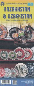
Wegenkaart - landkaart Kazachstan & Usbekistan | ITMB

Een degelijke kaart met aanduidingen van o.a. nationale parken, vliegveld, benzinepomp, dirt-roads en kleine plattegrond van hoofdstad. Als overzichtskaart goed te gebruiken. Kazachstan 1:3.000.000 Usbekistan schaal 1:1.580.000 The Stans of the former Soviet empire are difficult to map because in the aftermath of liberation, most place names, which...
13,95

Webshops met dit product

Webshop
Bezorging
Prijs

Anderen bekeken ook

Wegenkaart - landkaart Uzbekistan, Kyrgyzstan, Tajikistan | ITMB
Een degelijke kaart met aanduidingen van o.a. nationale parken, vliegveld, benzinepomp, dirt-roads en kleine plattegrond van hoofdstad. Als overzichtskaart goed te gebruiken.   Finally, our ITMB map of Uzbekistan is back in print! Tourism to the ‘Stans’ is increasing as these former parts of the Soviet Empire find their way in a changing world. This time, we have combined the country with the two other Stans on one side, which makes sense given their shape; then, on the reverse side, we have expanded the artwork to show Kyrgyzstan and Tajikistan to good advantage. The map also includes excellent inset maps of Samarkand, Tashkent, Dushanbe, and Bishkek, which I’m sure all are familiar names. Needless to say, all three countries count as ‘adventure’ travel. Facilities are good in major cities, but roads are of an uncertain quality, and accommodations sparse. Still, this is an exceptionally interesting part of the world. The traditional Great Silk Road passed through this region, and to t…
13,95
Wegenkaart - landkaart Turkmenistan - Afghanistan | ITMB
These two countries, bordering on Iran and Uzbekistan, are in a very volatile part of the world. They constitute the heart of Central Asia; a bit difficult to reach, but definitely suitable for adventure travel. Turkmenistan occupies one side of the sheet, and Afghanistan is on the other side at a better scale. Turkmenistan stretches from the Caspian Sea to a major river (the Amuder) that forms its eastern boundary with Uzbekistan and its border with Afghanistan. An inset map of the capital just north of the Iranian border, Ashgabat, is included. On the other side, Afghanistan is a lovely country and is slowly coming out of an extremely bad situation. It is still quite an unsafe country, and fighting could flare up again in the spring. Regardless, it is a strategically important country and one that ITMB has taken quite a bit of effort to make into a significant map. This is a very interesting map, of an of-the-beaten-track part of the world. It reflects the best information we have, b…
13,95
Wegenkaart - landkaart Kyrgyzstan and Tajikistan | ITMB
This is a new title for ITMB. The two Central Asian countries of Kyrgyzstan and Tajikistan are rapidly developing a touristic market and we feel that the world needs a good map to reflect their growing importance. The two ‘stans were part of the Soviet empire that fell apart in 1990, creating a dozen new countries. This double-sided map covers Kyrgyzstan on one side, with an inset map of its capital, Bishkek. The main attractions are Osh and Suyab, both ancient market centres on the Silk Road, and Lake Issyk-Kul, the world’s second largest alpine lake. The reverse side concentrates on Tajikistan mountainous country just west of the Himalayas, with an inset of its capital, Dushanbe. Both of these countries should be considered ‘adventure’ destinations.
13,95
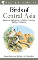
Vogelgids Centraal Azie - Birds of Central Asia | Bloomsbury
Birds of Central Asia is the first field guide to include the former Soviet republics of Kazakhstan, Kyrgyzstan, Turkmenistan, Uzbekistan and Tajikistan, along with neighbouring Afghanistan. This vast area includes a diverse variety of habitats, and the avifauna is similarly broad, from sandgrouse, ground jays and larks on the vast steppe and semi-desert to a broad range of raptors, and from woodland species such as warblers and nuthatches to a suite of montane species, such as snowcocks, accentors and snowfinches. Birds of Central Asia includes 141 high-quality plates covering every species (and all distinctive races) that occur in the region, along with concise text focusing on identification and accurate colour maps. Important introductory sections introduce the land and its birds. Birds of Central Asia is a must-read for any birder or traveller visting this remote region.   "For a long time, there's been something of a gap in field-guide coverage across the Palearctic. Europe is we…
50,95
Wegenkaart - landkaart Western Canada | ITMB
Een degelijke kaart met aanduidingen van o.a. nationale parken, vliegveld, benzinepomp, dirt-roads. Als overzichtskaart goed te gebruiken. This is actually our second attempt at mapping the western portion of Canada; the first covered everything from northwestern Ontario to the Pacific Ocean and, while it was an excellent map, the scale that such a huge area covered necessitated severe problems. In this version, all of British Columbia, Alberta, and the Yukon have been mapped from fresh digital data and presented at 1:1.4T scale. This would have been impossible when we prepared the first map. The Northwest Territories portion had to be compressed in two ways; first, the scale is 1:2M; second, only the portion with roads is shown. This is still an extremely large area. One has to consider the actual size of Canada when designing a map. Most countries in Europe would fit into this area, which only covers 20% of Canada. The Fort McMurray forest fire of a year ago covered an area larger th…
13,95
Wegenkaart - landkaart Gambia & Senegal | ITMB
Een degelijke kaart met aanduidingen van o.a. nationale parken, vliegveld, benzinepomp, dirt-roads en kleine plattegrond van hoofdstad. Als overzichtskaart goed te gebruiken. Gambia schaal 1:340.000 Senegal schaal 1:740.000 We combined Senegal with Gambia in this edition, but as two completely separate maps - Senegal on one side, and Gambia on the other. During our recent research trip to the two countries, it became obvious to us that the two countries are so inter-linked that it doesn't make sense to show one without the other. This new map has two covers, so the map can be displated Gambia side outwards, or Senegal side outwards. Both maps benefit from improved availability of information, thanks to our visit. Frankly, neither country appears to have progressed significantly over the past 40 years since my first visit, but I'm a cynic. The main east-west highways in both countries are being paved (again) by European countries providing foreign aid (again). No road mainenance camps a…
13,95
Wegenkaart - landkaart Vietnam - Laos - Cambodia | ITMB
Een degelijke kaart met aanduidingen van o.a. nationale parken, vliegveld, benzinepomp, dirt-roads. Als overzichtskaart goed te gebruiken. The former French-dominated region of Indochina evolved into three separate countries in the early 1950s. Vietnam, Laos, and Cambodia still retain strong ties and it is easy to travel from one country to another. Each has its particular charm, with a Top Attractions list highlighting the most popular attractions. Side 1 concentrates on the southern portion of the region and includes an inset map of Ho Chi Minh City; the second side covers the area from Sien Riep in Cambodia to the Chinese border areas of both Laos and Vietnam. An inset map of Hanoi is one this side. The region is prospering after many years of civil unrest, is friendly, safe, and easy to reach since Covid restrictions were removed last year. The new Chinese-built rail line through northern Laos to Chiang Kong in Thailand, and to Vientiane, Laos, is shown for the first time. This lin…
13,95
Wegenkaart - landkaart Mauritania & Mali | ITMB
Een degelijke kaart met aanduidingen van o.a. nationale parken, vliegveld, benzinepomp, dirt-roads en kleine plattegrond van hoofdstad. Als overzichtskaart goed te gebruiken. Mali 1:1.900.000 Mauretanië 1:2.200.000 In this edition, we have combined Mauritania with Mali. Although both are interesting countries, the two fit naturally together as a unit, albeit at slightly differing scales. Technically, this should be a 1st edition map, as it is the first time we have combined these two desert countries on to one sheet, but I ll let Robert at the Library of Congress worry about the niceties of bibliographic accuracy as soon as Trump allows him to do the work he loves for a salary. Mauritania was one of the most unusual countries I visited as a young traveller. Of course, I had an advantage, in that I was too young to know that what I was doing was supposed to be impossible. I entered from what was then the Spanish Sahara via a piste (a sandy track with multiple pathways, only some of whic…
13,95
Wegenkaart - landkaart South Pacific Cruising & Samoa | ITMB
Een overzichtskaart van de zuidelijke Stille Oceaan met de cruise routes tussen de verschillende eilanden aangegeven. Op de achterzijde een overzichtskaart van Samoa This is a new venture for ITMB. Cruising is a rapidly-growing segment of the travel industry, experiencing double-digit growth rates annually. Obviously, this is a thriving market. In conjunction with several cruise ship lines, we have prepared a map of the South Pacific Ocean, which extends southwards from Hawai'i to the southern tip of New Zealand and eastwards from central Australia/Papua New Guinea to the Pitcairn Islands. Thus, it does not include the popular South East Asia and China coast routes. We think this has to change at a time when 25,000,000 people are travelling by cruise ships. At the same time, we must keep coverage area relevant for those end users of the artwork. Even at 1:12M, most of the area covered is water, with island countries such as Fiji, Tonga, Kiribati, Tahiti, and the Cook Islands being visi…
13,95
Wegenkaart - landkaart Amazon & Brazil North | ITMB
We first mapped the Amazon River Basin for a rainforest protection conference many years ago, preparing what we thought was a pretty good rendition until we arrived at a conference full of experts who were able to add so much more data that we re-did the map before publishing it. We have updated it repeatedly as more information has come to light and are pleased to release this sixth version, which does something that we have wanted to do for some time - it adds a detailed map of the northern half of Brazil/Brasil to a river map that covers portions of seven different countries. The map is printed on revolutionary stone paper (tear-resistant, waterproof, friendly to the environment, and bio-degradable as well as extremely durable), and has two different cover pictures, so it can be marketed either as a map of Brasil or of the Amazon Basin - or both! It is also the only map of the river basin in print. As the world emerges from the era of Covid, this part of the world will once again do…
13,95

Klanten-reviews van Wegenkaart - landkaart Kazachstan & Usbekistan | ITMB

Er zijn nog geen beoordelingen voor dit productBen jij de eerste die een review plaatst?

Meer over Wegenkaart - landkaart Kazachstan & Usbekistan | ITMB

Productomschrijving

Een degelijke kaart met aanduidingen van o.a. nationale parken, vliegveld, benzinepomp, dirt-roads en kleine plattegrond van hoofdstad. Als overzichtskaart goed te gebruiken. Kazachstan 1:3.000.000 Usbekistan schaal 1:1.580.000 The Stans of the former Soviet empire are difficult to map because in the aftermath of liberation, most place names, which the Russian overlords had Russified were changed and not always to their original names or former spellings. Time has sorted out most nomenclature problems, and we hope that this version is letter perfect. In this updated edition for both countries, we have obviously tried our best to create a detailed and accurate map. The big difference between this edition and the previous one is the addition of Uzbekistan to the second side. The two countries seem to share certain common characteristics, as do the other three more easterly Stans, so we feel that combining similarities is better for end users than keeping separate sheets for each country. The advantage of this new map is that buyers get two country maps for the price of one. We feel that we also benefit, by providing end users with something that they need, affordably. Uzbekistan will continue to be available as a separate title.   Legend Includes: Road by classification, Main Road, Shipping Route, National Park, Lake, Glacier, Salt Flat, Water Well, Point of Interest and much more...
Webshop.nl maakt gebruik van cookies. Ga je verder op onze website, ga dan akkoord met het plaatsen van cookies en de verwerking van deze data door ons en vermelde partners.