webshop.nl
Categorieën
  Sluiten

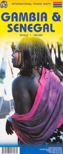
Wegenkaart - landkaart Gambia & Senegal | ITMB

Een degelijke kaart met aanduidingen van o.a. nationale parken, vliegveld, benzinepomp, dirt-roads en kleine plattegrond van hoofdstad. Als overzichtskaart goed te gebruiken. Gambia schaal 1:340.000 Senegal schaal 1:740.000 We combined Senegal with Gambia in this edition, but as two completely separate maps - Senegal on one side, and Gambia on the ...
13,95

Webshops met dit product

Webshop
Bezorging
Prijs

Anderen bekeken ook

Wegenkaart - landkaart Rwanda & Burundi | ITMB
Een degelijke landkaart van Rwanda & Burundi met aanduidingen van o.a. nationale parken, vliegveld, benzinepomp, dirt-roads en kleine plattegrond van hoofdstad. Als overzichtskaart goed te gebruiken. The two central African countries of Rwanda and Burundi are gradually returning to prosperity. They are both very interesting countries, scenically attractive, and relatively untouched by modernism. Both have suffered serious unrest in the past, but have moved on and are determined to have a bright and happy future. The people are marvelous; one can’t express in a brief paragraph the warmth and friendliness of the ordinary people of both countries. This is really a part of Africa everyone should visit. It’s a very special place, and I’m pleased to introduce the latest edition of an excellent map for two of my favourite places. As with past editions, this is actually two completely separate maps, with Rwanda on one side and Burundi on the other. There are two different covers, so the map ca…
13,95
Wegenkaart - landkaart Mauritania & Mali | ITMB
Een degelijke kaart met aanduidingen van o.a. nationale parken, vliegveld, benzinepomp, dirt-roads en kleine plattegrond van hoofdstad. Als overzichtskaart goed te gebruiken. Mali 1:1.900.000 Mauretanië 1:2.200.000 In this edition, we have combined Mauritania with Mali. Although both are interesting countries, the two fit naturally together as a unit, albeit at slightly differing scales. Technically, this should be a 1st edition map, as it is the first time we have combined these two desert countries on to one sheet, but I ll let Robert at the Library of Congress worry about the niceties of bibliographic accuracy as soon as Trump allows him to do the work he loves for a salary. Mauritania was one of the most unusual countries I visited as a young traveller. Of course, I had an advantage, in that I was too young to know that what I was doing was supposed to be impossible. I entered from what was then the Spanish Sahara via a piste (a sandy track with multiple pathways, only some of whic…
13,95
Wegenkaart - landkaart Fiji & Tonga | ITMB
Een degelijke kaart met aanduidingen van o.a. nationale parken, vliegveld, benzinepomp, dirt-roads en kleine plattegrond van hoofdstad. Als overzichtskaart goed te gebruiken. We have spent more time updating and revising our Fiji map than any map in recent times. We even brought in a Fijian cartographer to ensure that the information would be best we could make. The many islands of Fiji are a beachcomber's paradise and as a 'get-away-from-it-all' vacation destination, Fiji is hard to beat. With this edition, we have added the island kingdom of Tonga to one side, with Fiji filling the other side and spilling over on to Tonga'side. Both countries are lovely, but the reality of two compantible neighbouring countries is the only way we can maintain coverage of two very nice parts of the world. The Fiji side includes a very good inset map of Suva and the Tonga side an inset of Nuku'Alofa - and if you didn't know that these are the two capitals, you do now!
13,95
Wegenkaart - landkaart Western Canada | ITMB
Een degelijke kaart met aanduidingen van o.a. nationale parken, vliegveld, benzinepomp, dirt-roads. Als overzichtskaart goed te gebruiken. This is actually our second attempt at mapping the western portion of Canada; the first covered everything from northwestern Ontario to the Pacific Ocean and, while it was an excellent map, the scale that such a huge area covered necessitated severe problems. In this version, all of British Columbia, Alberta, and the Yukon have been mapped from fresh digital data and presented at 1:1.4T scale. This would have been impossible when we prepared the first map. The Northwest Territories portion had to be compressed in two ways; first, the scale is 1:2M; second, only the portion with roads is shown. This is still an extremely large area. One has to consider the actual size of Canada when designing a map. Most countries in Europe would fit into this area, which only covers 20% of Canada. The Fort McMurray forest fire of a year ago covered an area larger th…
13,95
Wegenkaart - landkaart South Pacific Cruising & Samoa | ITMB
Een overzichtskaart van de zuidelijke Stille Oceaan met de cruise routes tussen de verschillende eilanden aangegeven. Op de achterzijde een overzichtskaart van Samoa This is a new venture for ITMB. Cruising is a rapidly-growing segment of the travel industry, experiencing double-digit growth rates annually. Obviously, this is a thriving market. In conjunction with several cruise ship lines, we have prepared a map of the South Pacific Ocean, which extends southwards from Hawai'i to the southern tip of New Zealand and eastwards from central Australia/Papua New Guinea to the Pitcairn Islands. Thus, it does not include the popular South East Asia and China coast routes. We think this has to change at a time when 25,000,000 people are travelling by cruise ships. At the same time, we must keep coverage area relevant for those end users of the artwork. Even at 1:12M, most of the area covered is water, with island countries such as Fiji, Tonga, Kiribati, Tahiti, and the Cook Islands being visi…
13,95
Wegenkaart - landkaart Togo en Benin | ITMB
Een degelijke kaart met aanduidingen van o.a. nationale parken, vliegveld, benzinepomp, dirt-roads en kleine plattegrond van hoofdstad. Als overzichtskaart goed te gebruiken. Togo and Benin. These two countries have developed an incredible tourism industry and are very popular with visitors. They are larger than one expects; small in comparison to neighbouring Nigeria, but large as countries go. This map is brand new artwork at a much more attractive scale than the previous version; printed double-sided with much more information than was available to us when the original map was being developed. We’ve also added a few capsule comments about interesting facts related to the two countries, and large inset maps of Lome and Porto Novo. The map is divided into a north half and south half, as most attractions are in the south. As with all ITM maps, this one shows physical features, road conditions, and petrol stations in more isolated parts of both countries. Legend Includes: Roads by class…
13,95
Wegenkaart - landkaart Kazachstan & Usbekistan | ITMB
Een degelijke kaart met aanduidingen van o.a. nationale parken, vliegveld, benzinepomp, dirt-roads en kleine plattegrond van hoofdstad. Als overzichtskaart goed te gebruiken. Kazachstan 1:3.000.000 Usbekistan schaal 1:1.580.000 The Stans of the former Soviet empire are difficult to map because in the aftermath of liberation, most place names, which the Russian overlords had Russified were changed and not always to their original names or former spellings. Time has sorted out most nomenclature problems, and we hope that this version is letter perfect. In this updated edition for both countries, we have obviously tried our best to create a detailed and accurate map. The big difference between this edition and the previous one is the addition of Uzbekistan to the second side. The two countries seem to share certain common characteristics, as do the other three more easterly Stans, so we feel that combining similarities is better for end users than keeping separate sheets for each country.…
13,95
Wegenkaart - landkaart Jersey - Guernsey - Sark - Alderney (Kanaaleilanden) | ITMB
Goede detailkaart van alle kanaaleilanden. Het is zo gedetailleerd dat zelfs straatnamen er op staan. De kaart is ook nog eens geplastificeerd en daarmee scheur- en watervast.  ITMB is pleased to re-introduce the Channel Islands map area after a lengthy hiatus of preparing new artwork. The first version of this part of Europe was licensed artwork by a local firm in Jersey, and upon running out of copies of the printed map, we opted to prepare fresh artwork of our own to continue this interesting corner of the continent to continue to be available. The islands, collectively known in English as the Channel Islands, are one of those anomalies that make Europe so attractive. They are part of Great Britain, but not part of the UK; hence, they are not part of the EU. They are self-governing entities ‘owned’ by the Queen in her role of being Duchess of Normandy. This is, of course, merely a hereditary situation, but the islands were the personal possessions of William the Conqueror in 1066, a…
13,95
Wegenkaart - landkaart US Virgin Islands & Puerto Rico | ITMB
Puerto Rico: schaal 1:190.000 US Virgin Islands: schaal 1:50.000   We are really pleased with this new edition of Puerto Rico. We spent part of August, 2020, touring the island and geo-referencing its many highways. The island is bigger and more densely road-networked than we thought, so we'll have to complete the job on our next visit, but the roads are now much more precisely shown accurately than was possible before satellite imagery. The map looks great on an Ipad screen as well. The map also shows updated inset maps of San Juan, Ponce, Mayaguez, Aguadilla, and Arecibo. Puerto Rico is part of the United States, so has all the benefits, but is internally self-governing. With this edition we are including a map of the other US colonial territory, the US Virgin Islands. The Danish West Indies was purchased from Denmark in 1917 and is an integral part of the USA, with all its benefits, but is, like Puerto Rico, neither fish nor fowl. It is internally self-governing and a great retireme…
13,95
Wegenkaart - landkaart Paraguay & Bolivia South | ITMB
Een degelijke kaart met aanduidingen van o.a. nationale parken, vliegveld, benzinepomp, dirt-roads en kleine plattegrond van hoofdstad. Als overzichtskaart goed te gebruiken. Technically, this is a new title for ITMB, in that it is not merely an updating of a previous edition, but it is still a map of Paraguay, basically, so we count it as an updated edition with part of Bolivia included. Expanding the area of coverage benefits visitors combining Paraguay and Bolivia into one trip. The first side covers Bolivia from La Paz south to the Paraguayan border, with inset maps of Potosi and Santa Cruz. The second side concentrates on Paraguay itself, with inset maps of Asuncion, the Asuncion region, and northern Paraguay. Small bits of bordering countries also are included. Road connections within Paraguay have been shown to good advantage. Both countries, being land-locked, are somewhat isolated, making travel to them something more adventuresome than visits to neighbouring countries. Howeve…
13,95

Klanten-reviews van Wegenkaart - landkaart Gambia & Senegal | ITMB

Er zijn nog geen beoordelingen voor dit productBen jij de eerste die een review plaatst?

Meer over Wegenkaart - landkaart Gambia & Senegal | ITMB

Productomschrijving

Een degelijke kaart met aanduidingen van o.a. nationale parken, vliegveld, benzinepomp, dirt-roads en kleine plattegrond van hoofdstad. Als overzichtskaart goed te gebruiken. Gambia schaal 1:340.000 Senegal schaal 1:740.000 We combined Senegal with Gambia in this edition, but as two completely separate maps - Senegal on one side, and Gambia on the other. During our recent research trip to the two countries, it became obvious to us that the two countries are so inter-linked that it doesn't make sense to show one without the other. This new map has two covers, so the map can be displated Gambia side outwards, or Senegal side outwards. Both maps benefit from improved availability of information, thanks to our visit. Frankly, neither country appears to have progressed significantly over the past 40 years since my first visit, but I'm a cynic. The main east-west highways in both countries are being paved (again) by European countries providing foreign aid (again). No road mainenance camps are being constructed, however. Both countries have created resort communities for oceanside tourism development, which are shown on the map, as well as all road improvement projects we could verify. Both countries are full of smiling people, and are friendly to visitors, but Gambia has police/military check-points every 10 kms or so.   Legend Includes: Roads by classification, Airports, Bus Stations, Hospitals, Lighthouses, Points of Interest, Archeological Sites, Information Centres, Gas Stations, Embassies, Campsites, Museums, Lodgings, Churches, Mosques, Ferries, Beaches and more.
Webshop.nl maakt gebruik van cookies. Ga je verder op onze website, ga dan akkoord met het plaatsen van cookies en de verwerking van deze data door ons en vermelde partners.