webshop.nl
Categorieën
  Sluiten

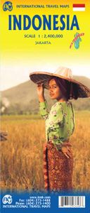
Wegenkaart - landkaart Indonesië - Indonesia | ITMB

Een degelijke landkaart van Indonesië met aanduidingen van o.a. nationale parken, vliegvelden en grote wegen. Als overzichtskaart goed te gebruiken. De nadruk ligt echter vooral op de natuurkundige aspecten. Scheur- en watervast! Met een kleine kaart van Jakarta. The hundreds of islands making up the island nation of Indonesia make a double-sided m...
13,95

Webshops met dit product

Webshop
Bezorging
Prijs

Anderen bekeken ook

Wegenkaart - landkaart Sumatra | ITMB
Een degelijke kaart met aanduidingen van o.a. nationale parken, vliegveld, benzinepomp, dirt-roads en kleine plattegrond van hoofdstad. Als overzichtskaart goed te gebruiken. This double-sided map has taken longer than expected to come into print, but we think that the wait is worthwhile. Sumatra is the large island west of Java, and extends our detailed mapping of Indonesia by providing a vibrant map of a beautiful but earthquake-prone part of the Indonesian archipelago. Due to its shape and setting, the map also includes Singapore and the southern portion of the Malay peninsula. The two main access points to Sumatra are by ferry from Singapore via Batum Island, and from Java, or by air. This map also extends our islands of the world series, which includes Borneo, Bali/Lombok, Java, and New Guinea (in preparation). Touristically, Sumatra is not well-known, so is ideal for experienced travelers to explore. The island offers several hot springs, royal palaces, colonial towns, and nation…
13,95
Wegenkaart - landkaart Java | ITMB
Indonesia is a huge and varied country of many islands and many cultures. The Javanese dominate the country. Not only is the island centrally located, but the rich soil and hard-working people has turned the island into the economic powerhouse driving the country’s economy. Indonesia’s capital, Jakarta, is located on the island’s north shore, and is the subject of a separate ITM map. This map concentrates on the island’s many charms: the temples of Yogyakarta, the colonial architecture of Surabaya, and the rustic charm of mountainous East Java. The map abounds in insets, including central Jakarta at 1:25 000, but also Cirebon, Bandung, and Solo, Semarang, Surabaya, Yogyakarta, Malang, and Yoga to Prambanan at 1:90,000, and the Dieng Plateau at 1:35,000. The famous island of Krakatoa is also included. This map is double-sided (east/west). Roads by classification, ferry route, ruins, bird sanctuary, national parks, volcanoes, non-active volcanoes, hotel, surfing, beaches, waterfalls, hin…
13,95
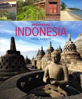
Reisgids - Fotoboek Enchanting Indonesia | John Beaufoy
The Republic of Indonesia is a vast archipelago presenting a kaleidoscope of sights for travellers. The range of activities available is equally sparkling with diving, surfing and sunbathing in and beside the coastal waters, and mountain climbing, trekking and paragliding on and over the land. Java is the home of the Jakarta, the bustling capital city, which has a wealth of cultural attractions, such as the still-operational port of Old Batavia. Elsewhere on Java are the UNESCO World Heritage Sites of Borobudur and Prambanan Temples. A chain of volcanoes forms the backbone of the island offering many opportunities for the adventurous. Bali and Lombok are justly renowned for their dive sites and their beautiful beaches. These are also a feature of Sulawesi and Manado whose interiors are thick with rainforests abundant with wildlife. Kalimantan on Borneo is a big draw for ecotourists, especially the Orang-utan sanctuary. Sumatra is dramatically picturesque: the lakes, mountains and fores…
15,50
Wegenkaart - landkaart Spitsbergen Svalbard | ITMB
North of Norway exists one of the northernmost communities in the world, an archipelago of islands called Svalbard in Norwegian, and better known as Spitsbergen in English. Until now, it has only been available in map format from the Norwegian Arctic Institute, and then only with difficulty. Side one shows the various islands as an entity. There is only one town of any size in the islands, called Longyearbyen, although there is a more northerly town called Pyramiden and an isolated community on the west coast called Alesund. This is true high Arctic adventure travel; one does not come here unprepared! Most of the islands are uninhabited and largely ice-covered. Edge Island, for example, is a large nature reserve, and Prins Karl Forland is a national park. We have translated land area names into English and placed the Norwegian names in brackets, but have tried leaving the Norwegian names in place wherever possible to assist with local usage. This is one of those ‘off the beaten path’ t…
13,95
Wegenkaart - landkaart Maui, Kauai, & Molokai | ITMB
At long last, we have finally found time to complete our detailed mapping of the American state of Hawaii. The island of Maui may not be at well-known as Oahu, which is extremely popular with Japanese honeymooners, but it is as attractive touristically. Our coverage covers most of Side 1 and includes a detailed inset map of Wailuku, the principal urban area, as well as insets of Lahaina on the west coast and Wailea resort area. This side also includes a map of the island of Lanai, with its main urban area of Lanai City as an inset. Side 2 concentrates on the islands of Molokai, Kauai, and the lightly populated island of Ni’ihau, and includes detailed inset maps of Lihue, Kaunakakai, and Po’ipu, all of which are major resort destinations. The islands are loaded with beaches and places to stay, but also with attractions, which are shown on the map. This is a beautiful map, one of the best we have ever produced, and is a fitting companion to our maps of Big Island, and Oahu/Honolulu, as w…
13,95
Wegenkaart - landkaart Seychellen & Indische Oceaan | ITMB
Aan de ene kant een degelijke kaart van de Seychellen, schaal 1:45.000, met aanduidingen van o.a. nationale parken, vliegveld, benzinepomp, dirt-roads. As overzichtskaart goed te gebruiken. Aan de andere kant een overzicht van de Indische oceaan, schaal 1:10.000.000   This is actually two brand new maps in one.  This is a brilliant new map of the Seychelles archipelago and a first-ever map of the entire Indian Ocean. The islands of the Seychelles are too widely-spaced to portray except by as a series of ten insets. The main island is Mahe, which also houses the capital of Victoria (inset provided) and numerous resorts. Many of the islands have French names, reflecting the colonial to-and-fro that typified relations between Britain and France. Praslin, Curiuse, Falicite, La Digue, and Desroches are not names that bring immediate recognition, but they are the names of islands belonging to the Seychelles. The map shows dozens of resorts, as well as restaurants, touristic sites, historic s…
13,95
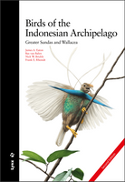
Vogelgids Birds of the Indonesian Archipelago - Indonesië | Lynx
Prachtige vogelgids met harde kaft. The first ornithological field guide covering the vast chain of the Indonesian archipelago has been completely revised following years of meticulous research. This second edition now encompasses over 2,800 illustrations, including 325 entirely new figures and nearly 500 alterations to the original artwork, supplemented by 1,350 maps of all regularly occurring species. The species are mapped with improved accuracy by including three magnified geographical regions, or by a larger archipelago-wide map frame. The book describes all 1,456 bird species known to occur in the region, including 628 endemics, 106 vagrants, 4 introduced species and 10 species yet to be formally described. Together these represent over 13% of global bird diversity. Importantly, all subspecies are described in detail. The guide fully covers the biogeographic regions of the Greater Sundas (Sumatra, Borneo, Java and Bali) and Wallacea (Sulawesi, the Moluccas and the Lesser Sundas),…
45,-
Wegenkaart - landkaart Scotland - Schotland | ITMB
Anyone who has been in this business for a few years remembers Ordnance Survey and their brilliantly detailed artwork. They should also remember that OS guarded this artwork religiously. That all changed when the then head of government in the UK, one soon-forgotten Gordon Brown, decreed that commercial OS artwork had to be discontinued and artwork had to be made more freely available to users. I expected an outpouring of new artwork by private UK firms. It did not happen; in fact, the range of travel maps decreased dramatically. However, OS artwork is still an excellent source of mapping artwork. This is a wonderful double-sided, detailed map of Scotland. It is both extremely detailed and accurate. We have added symbols for parks, historic sites, battlefields, country hotels, and anything else that we think would interest visitors. In order to portray Scotland to best scale advantage, the only inset included with this map are those of outlying islands, such as the Shetlands. ITMB also…
13,95
Wegenkaart - landkaart Jersey - Guernsey - Sark - Alderney (Kanaaleilanden) | ITMB
Goede detailkaart van alle kanaaleilanden. Het is zo gedetailleerd dat zelfs straatnamen er op staan. De kaart is ook nog eens geplastificeerd en daarmee scheur- en watervast.  ITMB is pleased to re-introduce the Channel Islands map area after a lengthy hiatus of preparing new artwork. The first version of this part of Europe was licensed artwork by a local firm in Jersey, and upon running out of copies of the printed map, we opted to prepare fresh artwork of our own to continue this interesting corner of the continent to continue to be available. The islands, collectively known in English as the Channel Islands, are one of those anomalies that make Europe so attractive. They are part of Great Britain, but not part of the UK; hence, they are not part of the EU. They are self-governing entities ‘owned’ by the Queen in her role of being Duchess of Normandy. This is, of course, merely a hereditary situation, but the islands were the personal possessions of William the Conqueror in 1066, a…
13,95
Wegenkaart - landkaart Java & Bali | Periplus
Goede overzichtskaart van zowel Java als Bali. Door kleurgebruik met name hoogtes goed zichtbaar. Met afstandstabel, toeristische aanduidingen. The Java & Bali Travel Map from Periplus is designed as a convenient, easy-to-use tool for travelers. Created using durable coated paper, this map is made to open and fold multiple times, whether it's the entire map that you want to view or one panel at a time.   Following highways and byways, this map will show you how to maneuver your way to banks, gardens, hotels, golf courses, museums, monuments, restaurants, churches and temples, movie theaters, shopping centers and more!   This 4th edition includes maps and plans that are scaled to:   Area Maps: Western Java 1:600,000 Eastern Java 1:600,000 Bali 1:600,000 Southern Bali 1:120,000 Yogyakarta 1:100,000 City Plan: Central Jakarta 1:70,000 Periplus Travel Maps cover most of the major cities and travel destinations in the Asia-Pacific region. The series includes an amazing variety of fascinatin…
11,95

Klanten-reviews van Wegenkaart - landkaart Indonesië - Indonesia | ITMB

Er zijn nog geen beoordelingen voor dit productBen jij de eerste die een review plaatst?

Meer over Wegenkaart - landkaart Indonesië - Indonesia | ITMB

Productomschrijving

Een degelijke landkaart van Indonesië met aanduidingen van o.a. nationale parken, vliegvelden en grote wegen. Als overzichtskaart goed te gebruiken. De nadruk ligt echter vooral op de natuurkundige aspecten. Scheur- en watervast! Met een kleine kaart van Jakarta. The hundreds of islands making up the island nation of Indonesia make a double-sided map inevitable in order to show any significant amount of detail. Side 1 shows the western half, starting with Sumatra in the upper left and including Java and most of the island of Borneo (Kalimantan Province to the Indonesians). This side also includes a large inset map of central Jakarta (for better detail see our separate map of the city); ditto for Sumatra, Java, and Borneo. Bali, Lombok, and Sumbawa islands are in the lower right portion of the map, and most of Malaysia and all of Singapore are included, simply because they are there. The infamous volcanic island of Krakatoa is located just to the west of Java. The other side of the map covers the less-travelled and therefore more interesting eastern islands – Sulawesi, Flores, New Guinea (West Irian Province), and Timor are the best known. Komodo National Park, home of the fierce lizards called Komodo Dragons, is on the map. Ferry routes between the islands are shown and are quite reliable, but sailings are subject to weather conditions. Indonesia is a very large country, and this map shows it in good detail. However, it is also a country that covers a very large area. For this reason, ITMB has also published several sectional maps of islands within the country in order to show touristic areas with an improved scale. Bali & Lombok, Borneo, Java, Jakarta, and Sumatra maps are also available from ITMB.    Legend Includes: Motorway, Major Highway, Main Road, Other Road, Railway, Ferry Route, River / Waterfall and Lake, International Airport, Domestic Airport, Hotel, Longhouse / Shelter / Lodge, Museum, Hot Spring, Fort / Fortress, Skiing,National Park, Zoo, Beach, Water Sport, Diving, Fishing, Wild Life / Bird Reserve, etc.
Webshop.nl maakt gebruik van cookies. Ga je verder op onze website, ga dan akkoord met het plaatsen van cookies en de verwerking van deze data door ons en vermelde partners.