webshop.nl
Categorieën
  Sluiten

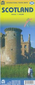
Wegenkaart - landkaart Scotland - Schotland | ITMB

Anyone who has been in this business for a few years remembers Ordnance Survey and their brilliantly detailed artwork. They should also remember that OS guarded this artwork religiously. That all changed when the then head of government in the UK, one soon-forgotten Gordon Brown, decreed that commercial OS artwork had to be discontinued and artwork...
13,95

Webshops met dit product

Webshop
Bezorging
Prijs

Anderen bekeken ook

Spoorwegenkaart - Wegenkaart - landkaart Scotland Far North & Islands Railway & Road | ITMB
Great Britain, by its shape, is difficult to map. The population is dense, the road network intense, and the coastline convoluted. A map of the British Isles shows only the major features. Sectional maps of just England, or Just Wales, make little sense, due to the geographic shape of the island kingdom. Scotland also needs more than one map to show its treasures in sufficient detail. ITMB previously issued Scotland Central and South, and now extends its coverage at 1:300,000 to the sparsely-populated highlands and the isolated Western, Orkney, and Shetland island archipelagos that are usually shrunk to insignificance on most maps, as insets. This double-sided map covers the area from Loch Lochy south of Invergarry to John O’Groats in the north, and from the Western islands of Uist and Lewis to the Moray Firth and Craigellachie in the east. The second side has to duplicate part of the first side in order to extend the artwork further eastward to include Aberdeen and northward to includ…
13,95
Wegenkaart - landkaart Wales & south of England - Zuid Engeland | ITMB
Een degelijke kaart met aanduidingen van o.a. nationale parken, vliegveld, benzinepompen. We are gradually increasing the scales for our data of Great Britain and this is our latest effort. Most visitors to the UK fly into one of London's four airports and combine a visit to the city with an opportunity to travel to various destinations within striking distance of London. England is so incredibly rich in heritage and scenic attractions that it is extremely difficult to portray the country as a map of the entire entity. As a result, England lends itself nicely to be divided into a central/northern portion and a southern portion. To fit areas as diverse as Cornwall and Norwich on one sheet, one needs to have a vertical frame, with Devon/Cornwall up to the top of Wales on one side and Wiltshire to Kent up to York (admittedly, not normally considered to be part of 'southern', but vertically, that's what happens. At this scale, all of southern England and all of Wales can be shown in good d…
13,95
Wegenkaart - landkaart Great Britain - Engeland - Schotland | ITMB
  Een degelijke kaart met aanduidingen van o.a. nationale parken, vliegveld, benzinepomp, dirt-roads en kleine plattegrond van hoofdstad. Als overzichtskaart goed te gebruiken.   This is the third set of artwork for Great Britain that we have published and the first that is completely our own artwork (the previous versions were joint ventures). In mapping, as in life, one has to differentiate between the political entity known as the United Kingdom and the geo-political reality of Greater Britain, which includes the Channel Islands, the Isle of Man, and various assorted entities that are loosely attached to the UK by history. We have tried, in this edition, to combine a detailed road map with a touristic sites map. Given that Britain is both densely covered by thousands of narrow laneway passing themselves off as sub-B level roads and by having the greatest treasure trove in the world of castles, manor houses, gardens, museums, and interesting places worth visiting, and the task of por…
13,95
Wegenkaart - landkaart England & Wales - Engeland | ITMB
Een degelijke kaart met aanduidingen van o.a. nationale parken, vliegveld, benzinepompen. ITMB publishes a map of Great Britain, but each portion of GB needs its own map to show roads and attractions in more detail. This is a brilliant map of both England and Wales, showing the entire 'country' in a double-sided format. The place names index is formidable, but England in particular is a series of little villages, so it has been very difficult to decide what to include and what to leave out. This map is showing motorways, divided carriageways, all A & B highways, railway lines, airports, historic sites and touristic attractions, parks and gardens, and just about everything that we could fit on to the page to provide users with a detailed, usable map. We have been able to fit all of southern England/Wales as far north as Chester/Lincoln on side A and with a little overlap, from those cities north to the well over the Scottish border, up to Perth/Dundee filling side B. The Isle of Man and…
13,95
Wegenkaart - landkaart 3326 Adventure Map Scotland - Schotland | National Geographic
Wegenkaart van Schotland met vermelding van veel bezienswaardigheden, nationale parken en attrakties. Watervast en scheurvast. Juist door deze vermeldingen onderscheidt de kaart zich van andere wegenkaarten. National Geographic's Scotland AdventureMapis designed to meet the needs of adventure travelers with its durability and detailed, accurate information. The map includes the locations of cities and towns with a user-friendly index, a clearly marked road network complete with distances and designations for roads/highways, plus secondary routes for those seeking to explore off the beaten path.    AdventureMaps differ from a traditional road map because of the specialty content that they include. Each map contains hundreds of diverse and unique recreational, ecological, cultural and historic destinations - outside of the major tourist hubs. National Geographic AdventureMaps are the perfect companion to a guidebook, yet far easier to pack!    The Scotland AdventureMap is printed in the …
17,50
Wegenkaart - landkaart South America north- Zuid Amerika noordelijke deel | ITMB
Dekt het noordelijke deel van Zuid Amerika tot aan de grens van Chili - Paraguay - Rio de Janeiro. South America North Travel Reference Map (replacing South America North West) is brand new and is another brilliant cartographic coup for Lan and our production staff. She has come up with a way to preserve the wonderfully detailed artwork of the original version first published in 1980 by Kevin Healey, the co-founder of ITMB, and subsequently published by ITMB in four succeeding updated editions. We retired the artwork several years ago, feeling that the market preferred more detailed country maps, but repeated requests for a map of this nature convinced us to have a look at it again. This map replaces the former map of North West South America at a better scale than was previously thought possible and with the additional benefit of covering ALL of the northern half of South America on a double sided sheet. We have also re-introduced the capsule comments so loved by map aficionados in pa…
13,95
Wegenkaart - landkaart Liechtenstein & Oostenrijk West | ITMB
Europe is dotted with mini-states that exist solely for historic reasons but are fiercely independent. Liechtenstein, surrounded by Switzerland on its west and south and Austria on its other borders, is such a state. It is larger and more diverse than many imagine and is quite a popular ski resort region. Side 1 is a detailed map of the principality, framed on the west by the Rhine River and a bit of Switzerland and on the east by Austria. Most development occurs in the Rhine Valley in a north-south direction, dominated by the capital city of Vaduz. There are five access points from Switzerland across the Rhine, one from the south, and two from Austria in the north. The ski haven of Malbun is prominently shown, and the scale of the map is detailed enough to name every major street. This also enabled us the opportunity to include schools, shopping areas, post offices, and churches, as well as a wide range of eating establishments. Walking/hiking trails have also been included. This is t…
14,95
Wegenkaart - landkaart Cuba West | ITMB
Een degelijke wegenkaart met aanduidingen van o.a. nationale parken, vliegveld. Als overzichtskaart goed te gebruiken. his is a brand new title for ITMB and reflects the growing interest in travel to Cuba resulting from improved relations with the USA. Licenses to fly into the country from a dozen cities have already been approved; 60 more are awaiting approval. All are for flights into Havana and Varadero airports – in other words, the western half of the country. ITMB already has an exceptionally good map of the entire country. We also have a separate map of Havana. This map expands the scale and opens the information for the western half of the island nation as a double-sided map, with the portion west of Havana (La Habana) to Pinar del Rio province in the far west and south to the Isla de la Juventud (better known, but mis-named, as the Bay of Pigs Invasion Site). This side also has an excellent map of the Varadero beach resort area as an inset, and a map of greater Havana. The oth…
13,95
Wegenkaart - landkaart Egypt & Cairo | ITMB
Following the so-called Arab spring of a few years ago, northern Africa experienced much turbulence. Egypt experienced the overthrow of the government, the installation of a radical religious-oriented replacement, and the installation of military governance. Tourism plummeted. Most map publishers discontinued their maps of the country. Five years later, Egypt has stabilized and tourism is growing. We feel that the time is right to re-introduce our ITMB map of Egypt. This version focuses on the portions of the country that have been re-opened for tourism, which means from the Mediterranean coastline south to the Aswan Dam. The portion further south remains closed for the moment, as is the border crossing with Sudan. We have also been forced to leave off the Great Sand Sea and the Western Desert portions for the same reason of unrest, as the border areas with Libya remain very unstable. However, we have provided a large inset map of Egypt, covering everything, in the area of desert. We h…
13,95
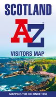
Wegenkaart - landkaart Visitors map Scotland - Schotland | A-Z Map Company
xplore the whole of Scotland from Dumfries and Galloway in the South to the Orkney Islands in the North. With detailed road mapping and illustrated town plans of major cities, this feature rich, helpful tourist guide is ideal for touring around Scotland. Published at a clear 8.7 miles to 1 inch scale (5.51 cm to 1 km), this handy map is a detailed and informative exploration of what Scotland has to offer.   Highlights include: 8 inset street maps to major cities and popular destinations, including: Edinburgh, Glasgow, Stirling, and Cairngorms National Park, with detailed descriptions and places of interestLocations of visitor centres and tourist information sitesUseful key to map symbols making it a clear and easy readMore than 700 places of interest The perfect map for exploring Scotland whether you are a tourist or a local.
11,50

Klanten-reviews van Wegenkaart - landkaart Scotland - Schotland | ITMB

Er zijn nog geen beoordelingen voor dit productBen jij de eerste die een review plaatst?

Meer over Wegenkaart - landkaart Scotland - Schotland | ITMB

Productomschrijving

Anyone who has been in this business for a few years remembers Ordnance Survey and their brilliantly detailed artwork. They should also remember that OS guarded this artwork religiously. That all changed when the then head of government in the UK, one soon-forgotten Gordon Brown, decreed that commercial OS artwork had to be discontinued and artwork had to be made more freely available to users. I expected an outpouring of new artwork by private UK firms. It did not happen; in fact, the range of travel maps decreased dramatically. However, OS artwork is still an excellent source of mapping artwork. This is a wonderful double-sided, detailed map of Scotland. It is both extremely detailed and accurate. We have added symbols for parks, historic sites, battlefields, country hotels, and anything else that we think would interest visitors. In order to portray Scotland to best scale advantage, the only inset included with this map are those of outlying islands, such as the Shetlands. ITMB also publishes a separate, less detailed map of Scotland on one side with Edinburgh of the other side. The new Scotland map has also been upgraded to being printed on plastic paper for durability. It also makes a good umbrella for when the Scotch mist falls! By the way, our forthcoming map of England and Wales should be available in about two months.    Map size: 27*39"   Legend Includes: Roads by classification, Motorway, Divided Highway, Main Road, Ferry Route, Point of interest, Castle, Museums, Theme Park, Zoo, Golf course, National Park, and much more.
Webshop.nl maakt gebruik van cookies. Ga je verder op onze website, ga dan akkoord met het plaatsen van cookies en de verwerking van deze data door ons en vermelde partners.