webshop.nl
Categorieën
  Sluiten

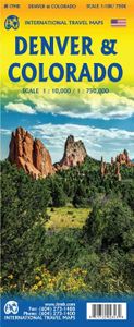
Wegenkaart - landkaart Denver and Colorado | ITMB

Een degelijke kaart met aanduidingen van o.a. nationale parken, vliegveld, benzinepomp, dirt-roads en kleine plattegrond van hoofdstad. Als overzichtskaart goed te gebruiken. This is a brand new title for ITMB. Denver, the ‘mile-high’ city on the eastern slopes of the Rocky Mountains, is a vibrant, fairly modern city. It is the state capital, and t...
13,95

Webshops met dit product

Webshop
Bezorging
Prijs

Anderen bekeken ook

Wegenkaart - landkaart Brisbane & Queensland | ITMB
Australia is a very large country. It is also very unevenly populated, with most of the people living close to the eastern coast. Brisbane is the second-largest city in Australia, and the preferred landing spot for most international flights. This makes Brisbane an attractive point of entry to Australia for visitors. The city has several attractions, which are noted on the map, several transit lines, also noted, and an interesting ferry boat system along the Brisbane River. The city is also the capital of Queensland, which occupies the north-east quarter of the continent and fills the second side of the map. Our map of the state stretches from the northern tip of Cape York to beyond the southern boundary of the state to just south of Sydney, in New South Wales. An inset map of central Sydney is included, but the strength of the map is the fact that Queensland is covered in excellent detail. ITMB also has a separate map of Sydney.   Legend Includes: Roads by classification, Rivers and L…
13,95
Wegenkaart - landkaart Hawaii Volcanoes National Park & Big Island | ITMB
Een degelijke kaart met aanduidingen van o.a. nationale parken, vliegveld, benzinepomp, dirt-roads. Als overzichtskaart goed te gebruiken. We didn't suspect, when we started developing this title, that Mauna Loa Volcano would erupt as soon as our map of the national park was printed, but it did! It is on the news every night, and a marvelous touristic attraction. How many of us can ever see a massive eruption of molten lava? Now, we can! (at least, from a safe distance). The national park occupies one side of the map and is the latest in ITMB's series of national parks. By the nature of such parks, we show all the features and elevations, but in this case, we'll add the proviso that heights and lava flows are changing the landscape on a daily basis. Volcanoes are sort of like elephants-they go where they please! The reverse side of the sheet is a map of Big Island, where the park is located. Its name comes from being the largest island in area of all the Hawaiian archipelago. The map i…
13,95
Wegenkaart - landkaart - Stadsplattegrond Toronto & Southern Ontario - Ontario zuid | ITMB
Overzichtskaart van het zuiden van Ontario - schaal 1:600.000 - met op de andere kant een grote plattegrond van Toronto op schaal 1:12.000 Legend Includes: Roads by classification, Accomodations, Museum, Churches, Buildings, Points of tourist, Public Interests, Post Offices, Police Stations, Schools, Live Theatres, Cinemas, Ruins, Bus Terminals, Ferry Terminals, Service Areas, Hospitals, Ports, Mines, RCMP, Major Airports, Secondary Airports, Camp Grounds, National Park and Equivalent Reserves, Ski, Picnic Sites, and much more.   Toronto is the largest city in Canada by far. Touristically, its attraction rests with its central core, from High Park in the west to the Don River in the east, and from the park-like islands in Lake Ontario to Bloor Street in the north. In this area, one finds remnants of the oldest portion of ‘muddy York’, the original fort built to deter American raiders (close to the exhibition grounds), Campbell House (at Queen & University), and the first public school…
13,95
Wegenkaart - landkaart Yellowstone National Park and Wyoming | ITMB
The USA is a vast and wonderful land to explore. ITMB is steadily increasing our coverage of this important travel destination and this month concentrates on the State of Wyoming, with a detailed travel map on one side, including small portions of adjacent states of Utah, Colorado, Nebraska, South Dakota, Montana, and Idaho. The state is lightly populated, with Cheyanne as its capital and main city. Interstates 80 and 90 both traverse the state, with Interstate 25 being the only north-south motorway. Yellowstone National Park occupies the northwest corner of the state and also occupies the second side of the sheet with an extremely detailed map. Yellowstone is the first area in the world to be proclaimed as a national protected area (Banff was second), and Yellowstone remains the paramount preserved wilderness environment in the world. There are several small urban areas within the park for accommodations and servicing, such as West Thumb, Canyon City, and Mammoth Hot Springs. The main…
13,95
Nieuw
Wegenkaart - landkaart Muscat / Oman | ITMB
The very name Muscat and Oman entices one! The peninsula at the access point to the Persian/Arabian Gulf sounds very exotic – and it is! This double-sided map focuses on the city and region of Muscat on side one at a detailed scale, noting the Grand Mosque, the Mutrah Souk, and the Royal Opera House as well as showing hotels, shopping areas, and other sites of touristic interest. Muscat used to be a British protectorate, but is now part of Oman, albeit physically separated from it by a portion of the UAE. The country fills side 2. Oman is portrayed as a north-south alignment, as it is long and not particularly wide, and nicely fills the sheet, with an inset of Salalah, close to the Yemeni border. Connections to nearby Abu Dhabi and Dubai are also shown. Oman is a haven of peaceful co-existence, and tourists are welcome, so this map is designed to encourage visitors  
13,95
Wegenkaart - landkaart Tasmania & Victoria | ITMB
Een degelijke wegenkaart van Tasmanie & Victoria, schaal 1:1.800.000, en Tasmanië, schaal 1:800.000 met aanduidingen van o.a. nationale parken, vliegveld, benzinepomp, dirt-roads. Als overzichtskaart goed te gebruiken. The island of Tasmania is Australia’s smallest state, but is packed with touristic delights. Hobart is the capital and a charming Victorian city in the south of the island. Much of the west coast is a large nature preserve with limited access and most development is close to the northern shore, centred on Devonport and its ferry connections with Melbourne, in Victoria State. Tasmania also administers several offshore islands, such as King, Flinders, and Bruny. We have included a Top Attractions listing for the reader to enjoy. The other side of the sheet is the Australian mainland state of Victoria, best known as the home of Melbourne and the beautiful coastal highway to Adelaide. A basic inset map of Melbourne is included, but the focus of the map is on the recreational…
13,95
Wegenkaart - landkaart Canada | ITMB
Een degelijke kaart met aanduidingen van o.a. nationale parken, vliegveld, benzinepomp, dirt-roads en kleine plattegrond van hoofdstad. Well, it’s about time, eh?!? ITMB, after only thirty years on the go, finally gets around to publishing a map of Canada. When we first started mapping, there was a pressing need for good maps of Central and South America, then of Africa, then etc etc and we never found time to concentrate on our own country until fairly recently. This map was prepared by Natural Resources Canada and is, as a result, as accurate a map as one could hope to have. We are very proud of it, and very pleased to be able to use such top-rate cartography. The map covers all of the land mass of Canada, from its southernmost point to the top of Ellesmere Island and from the Atlantic coast to the Pacific. It’s an excellent map, but I’m going to give one proviso. Canada is the second-largest country on the face of the planet and there is no way that a single-sided sheet can portray …
13,95
Wegenkaart - landkaart South Pacific Cruising & Samoa | ITMB
Een overzichtskaart van de zuidelijke Stille Oceaan met de cruise routes tussen de verschillende eilanden aangegeven. Op de achterzijde een overzichtskaart van Samoa This is a new venture for ITMB. Cruising is a rapidly-growing segment of the travel industry, experiencing double-digit growth rates annually. Obviously, this is a thriving market. In conjunction with several cruise ship lines, we have prepared a map of the South Pacific Ocean, which extends southwards from Hawai'i to the southern tip of New Zealand and eastwards from central Australia/Papua New Guinea to the Pitcairn Islands. Thus, it does not include the popular South East Asia and China coast routes. We think this has to change at a time when 25,000,000 people are travelling by cruise ships. At the same time, we must keep coverage area relevant for those end users of the artwork. Even at 1:12M, most of the area covered is water, with island countries such as Fiji, Tonga, Kiribati, Tahiti, and the Cook Islands being visi…
13,95
Wegenkaart - landkaart Laos | ITMB
Een degelijke kaart van Laos met aanduidingen van o.a. nationale parken, vliegveld, benzinepomp, dirt-roads en kleine plattegronden van Vientiane, Luang Prabang we're very pleased to introduce you to this new, double-sided, map at a great scale, with fantastic detail. To me, the north side is the most interesting, covering the portion of Laos from Vientiane, the capital, to the Chinese border. Detailed inset maps of Vientiane and Louang Prabang, the temple city, are included on this side, as are bits of both Thailand and Vietnam. The south portion fills the other side of the sheet, including a goodly portion of Vietnam, showing all border crossings. Much of Thailand has had to be obscured, unfortunately, to make room for the place names index, but the immediate border areas are shown, including the rail line south from Vientiane. In an interesting departure from previous ITMB maps, the back cover consists of a detailed inset map of Vientiane at 1:16,000 scale, making it easy to use in …
13,95
Wegenkaart - landkaart Oklahoma & Texas | ITMB
Een degelijke wegenkaart met aanduidingen van o.a. nationale parken, vliegveld, benzinepomp, dirt-roads. Als overzichtskaart goed te gebruiken. ITMB is pleased to announce the newest addition to our range of titles on the USA. Increasingly, we are developing our artwork to cover the larger states attractively and comprehensively, but also, we hope sensibly. Texas and Oklahoma share a common heritage of having been formed out of land taken from others through the long-held policy of Manifest Destiny. Today, Texas is the second largest State in the union (after Alaska), and is the only State to have previously been an independent country. It also includes the oldest urban area in the USA, Presidio, founded by the Spaniards to guard the ford over the Rio Grande. Because of its shape, and the natural proximity of the State of Oklahoma along its northern edge, combining the two States just made sense. The map is presented double-sided (top half/bottom half) on waterproof paper that is durab…
13,95

Klanten-reviews van Wegenkaart - landkaart Denver and Colorado | ITMB

Er zijn nog geen beoordelingen voor dit productBen jij de eerste die een review plaatst?

Meer over Wegenkaart - landkaart Denver and Colorado | ITMB

Productomschrijving

Een degelijke kaart met aanduidingen van o.a. nationale parken, vliegveld, benzinepomp, dirt-roads en kleine plattegrond van hoofdstad. Als overzichtskaart goed te gebruiken. This is a brand new title for ITMB. Denver, the ‘mile-high’ city on the eastern slopes of the Rocky Mountains, is a vibrant, fairly modern city. It is the state capital, and the gold-coated dome of the legislative building highlights the wealth and strength of the state. The Denver Zoo is becoming one of the great attractions of the city, as are the Center for Performing Arts and the Museum of Science and Nature. Larimer Square is the focal point for entertainment, and Coors Field for sports. Our map shows a wide-ranging number of accommodations and eateries, and notes all points of interest. The State of Colorado map fills the reverse side of the sheet and, due to the positioning of the state’s boundaries, nicely fills the 40x28 sheet size of the map. Small portions of neighbouring states show around the edges, but the focal point is definitely north-south Interstate 25 and east-west Interstate 70. Denver is, by far, the largest urban area in the state, but other familiar cities show well – Boulder, Colorado Springs, the ski resort of Vail, Kit Carson’s home town of Burlington, and the old mining town of Silverton. The map shows all motorways and highways and, as far as we can determine, every road going anywhere. Hundreds of wilderness campsites are shown, as well as RV parks, parks, ancient ruins, and natural features. Legend Includes: Major Highway, Trail, Railway, Attraction, Park, Lake, Point of interest, Notable Building, Hotel, Restaurant, Railway Station, Car Park, Zoo, Golf Course etc.
Webshop.nl maakt gebruik van cookies. Ga je verder op onze website, ga dan akkoord met het plaatsen van cookies en de verwerking van deze data door ons en vermelde partners.