webshop.nl
Categorieën
  Sluiten

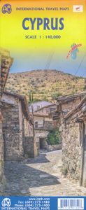
Wegenkaart - landkaart Cyprus | ITMB

Goede gedetailleerde kaart van Cyprus. De kaart is tweezijdig en gedrukt op scheur- en watervast papier. Voelt zwaarder aan, maar gaat langer mee! Kaartbeeld is helder met een mooi kleurgebruik waarbij je goed kunt zien hoe de hoogteverdeling is. Wegen en spoorlijnen staan er goed op, maar ook bijvoorbeeld extra aanduidingen voor bezienswaardighede...
13,95

Webshops met dit product

Webshop
Bezorging
Prijs

Anderen bekeken ook

Wegenkaart - landkaart Western Canada | ITMB
Een degelijke kaart met aanduidingen van o.a. nationale parken, vliegveld, benzinepomp, dirt-roads. Als overzichtskaart goed te gebruiken. This is actually our second attempt at mapping the western portion of Canada; the first covered everything from northwestern Ontario to the Pacific Ocean and, while it was an excellent map, the scale that such a huge area covered necessitated severe problems. In this version, all of British Columbia, Alberta, and the Yukon have been mapped from fresh digital data and presented at 1:1.4T scale. This would have been impossible when we prepared the first map. The Northwest Territories portion had to be compressed in two ways; first, the scale is 1:2M; second, only the portion with roads is shown. This is still an extremely large area. One has to consider the actual size of Canada when designing a map. Most countries in Europe would fit into this area, which only covers 20% of Canada. The Fort McMurray forest fire of a year ago covered an area larger th…
13,95
Wegenkaart - landkaart Portland & Oregon | ITMB
This is a brand new title from ITMB. Portland is the largest city in the American state of Oregon. It is not the capital; that distinction belongs to Salem, about 50 miles to the south, but Portland is an actual sea-going port, although it is a hundred miles away from the ocean. It is situated on the majestic Columbia River, which at one time formed the border between British-controlled Canada and the emerging United States. That changed after 1842, with the Oregon Treaty, under which both governments agreed to "share" the territory. At that time, the British capital was Astoria, a lovely town at the mouth of the Columbia, but the Governor, realizing that sharing with the Americans meant capitulation to the Americans, moved the capital north to Victoria, on what was then designated a separate colony. Regardless, today both Portland and the State of Oregon present some of the nicest scenery in America. Our portrayal of the city goes from the Northwest Freemont Bridge in the north (the I…
13,95
Wegenkaart - landkaart Mexico Central & Mexico City | ITMB
Goede wegenkaart met duidelijk kleurgebruik. Het betreft een deel van Mexico met op de achterkant een stadsplattegrond van het centrale deel van Mexico City. MC is the largest city in the Western Hemisphere, with a population of 28,000,000 (or twice as big as New York City!). It would be impractical to portray the entire urban area on one map and have it make sense, so we show the portion of greatest interest to visitors, from the Chapultepec Zoological Park in the west to the incredibly busy Tapo Bus Terminal in the east, and from the railway station in the north to the southern east-west motorway just south of the main hospital complex. Much of MC’s touristic interest is concentrated in the Zona Rosa, Reforma, and Zocalo segments of the city centre, and these are shown in detail, noting hotels, major restaurants, shopping areas, and points of interest.   The map also includes inset maps of the San Angel area just north of the university, an inset map of the greater Mexico City Federa…
13,95
Wegenkaart - landkaart Indonesië - Indonesia | ITMB
Een degelijke landkaart van Indonesië met aanduidingen van o.a. nationale parken, vliegvelden en grote wegen. Als overzichtskaart goed te gebruiken. De nadruk ligt echter vooral op de natuurkundige aspecten. Scheur- en watervast! Met een kleine kaart van Jakarta. The hundreds of islands making up the island nation of Indonesia make a double-sided map inevitable in order to show any significant amount of detail. Side 1 shows the western half, starting with Sumatra in the upper left and including Java and most of the island of Borneo (Kalimantan Province to the Indonesians). This side also includes a large inset map of central Jakarta (for better detail see our separate map of the city); ditto for Sumatra, Java, and Borneo. Bali, Lombok, and Sumbawa islands are in the lower right portion of the map, and most of Malaysia and all of Singapore are included, simply because they are there. The infamous volcanic island of Krakatoa is located just to the west of Java. The other side of the map …
13,95
Wegenkaart - landkaart Japan North & Hokkaido | ITMB
Een degelijke kaart met aanduidingen van o.a. nationale parken, vliegveld, benzinepomp, dirt-roads en kleine plattegrond van hoofdstad. Als overzichtskaart goed te gebruiken. In one sense, this is a brand new map, in that the artwork is all brand new. In another sense, it is our map of Hokkaid re-worked into a more marketable format. In any case, it is a very much-needed sectional map of that portion of Japan from Tokyo northwards. Hokkaido is actually one of the most interesting parts of Japan to visit. The island was opened to settlement only after the Ameicans forced Japan to allow contacts with foreign countries in 1868, thanks to Admiral Peary and Gunboat Diplomacy. Hokkaido has been relatively untouched by Japan’s rush to economic dominance, so is the country’s skiing capital in winter and the part of Japan most similar to America. An inset map of Sapporo is included. The other side shows the main island of the country from Nagoya and Toyama (which are considerably west of Tokyo)…
13,95
Wegenkaart - landkaart Somalië & Hoorn van Afrika | ITMB
Een degelijke kaart met aanduidingen van o.a. nationale parken, vliegveld, benzinepomp, dirt-roads en kleine plattegrond van hoofdstad. Als overzichtskaart goed te gebruiken. Met aan de ene zijde een kaart van Somalië, schaal 1:1.700.000, en op de andere zijde een overzichtskaart van de Hoorn van Afrika, schaal 1:3.400.000 Somalia is one of the more interesting off-the-beaten-path countries. The area around Mogadishu prefers to call itself Somalia, but controls only a portion of the overall country area. Then there is Jubaland, on the Kenyan border, aligned very closely to the former Italian colony boundaries of the same name. Truly, an amazing juxtaposition of countries within countries! The reverse side of the sheet presents a very interesting regional perspective of the area between the northern border of Ethiopia, a small portion of Sudan and a reasonable portion of South Sudan, all of Uganda, most of Kenya, all of Djibouti, and a fair portion of Eritrea, as well as the former Aden…
13,95
Wegenkaart - landkaart 92G Lower Mainland British Columbia - Richmond and New Westminster | ITMB
Goede wegenkaart van British Columbia met topografische uitsnede van Richmond en Westminster. Topographic/Recreation Map 92G&92G2 and G3 - With the 2010 Winter Olympics bearing down on us, this very timely map presents a lovely regional map showing all of the Olympic venues (the Games are being held in Vancouver, Richmond, UBC, Whistler, and the Callaghan Valley – not just in Vancouver). The area of coverage is from Everett (just north of Seattle) in the USA to north of Pemberton, and from Victoria in the west to Chilliwack in the east on the one side, and a detailed 1:50,000 topo map of the Richmond/New Westminster/Surrey/Langley outer urban areas of Metro Vancouver. Both maps are Government of Canada NTS maps, overlaid with touristic and recreational information by ITMB, which holds the copyright on behalf of the Queen (I love being able to say that). The Lower Mainland portion is particularly useful, in that it includes the east coast of Vancouver Island, from Victoria to Nanaimo an…
13,95
Wegenkaart - landkaart Kamchatka Peninsula & Russia Far east | ITMB
Een degelijke kaart met aanduidingen van o.a. nationale parken, vliegveld, benzinepomp, dirt-roads en kleine plattegrond van hoofdstad. Als overzichtskaart goed te gebruiken. Schaal: Kamchatka 1 : 1,700.000 & Eastern Siberia 1 : 3.600.000 This is the most recently released title in our Russia series. In this revised edition, we have expanded the area of coverage to include the portion of Russia known as the Far East Republic and the eastern portions of Siberia (in January, we released Siberia itself). Lets start with the Kamchatka peninsula itself. This is a very interesting adventure travel destination, famous for its geothermal geysers and its isolation from the rest of Russia. There is only one city of any size, Petropavlovsk Kamchatsky (which I genuinely hope is colloquially known as PK), the capital and location of the peninsula only significant airport. We have included an inset map of the city. We also include a map of the famous Valley of Geysers (south of Klyuchi). Interesting…
13,95
Wegenkaart - landkaart Ierland | ITMB
As technology improves, we are able to produce more detailed maps than was previously possible. Such is the case with Ireland, a part of the world consisting of two countries divided by religion and history. Preparing a map of Ireland as a double-sided map means cutting the island into two geographic portions. Side 1 covers the northern half. This includes the portion known as Northern Ireland, or Ulster, and a fair portion of the Republic of Ireland, or Eire; essentially everything north of Dublin and west to Counties Mayo and Galway. Side 2 covers the southern half of the island from just north of Dublin to the outer tips of County Kerry. It also includes a nice inset map of central Dublin. Naturally, all motorways and roads are included, as are touristic attractions, camping/caravan sites, ferry terminals, and Top Attractions. This is a very detailed travel map of the island, printed on waterproof paper for durability. We had great fun driving around Ireland researching this map. It…
14,95
Wegenkaart - landkaart South Pacific Cruising & Samoa | ITMB
Een overzichtskaart van de zuidelijke Stille Oceaan met de cruise routes tussen de verschillende eilanden aangegeven. Op de achterzijde een overzichtskaart van Samoa This is a new venture for ITMB. Cruising is a rapidly-growing segment of the travel industry, experiencing double-digit growth rates annually. Obviously, this is a thriving market. In conjunction with several cruise ship lines, we have prepared a map of the South Pacific Ocean, which extends southwards from Hawai'i to the southern tip of New Zealand and eastwards from central Australia/Papua New Guinea to the Pitcairn Islands. Thus, it does not include the popular South East Asia and China coast routes. We think this has to change at a time when 25,000,000 people are travelling by cruise ships. At the same time, we must keep coverage area relevant for those end users of the artwork. Even at 1:12M, most of the area covered is water, with island countries such as Fiji, Tonga, Kiribati, Tahiti, and the Cook Islands being visi…
13,95

Klanten-reviews van Wegenkaart - landkaart Cyprus | ITMB

Er zijn nog geen beoordelingen voor dit productBen jij de eerste die een review plaatst?

Meer over Wegenkaart - landkaart Cyprus | ITMB

Productomschrijving

Goede gedetailleerde kaart van Cyprus. De kaart is tweezijdig en gedrukt op scheur- en watervast papier. Voelt zwaarder aan, maar gaat langer mee! Kaartbeeld is helder met een mooi kleurgebruik waarbij je goed kunt zien hoe de hoogteverdeling is. Wegen en spoorlijnen staan er goed op, maar ook bijvoorbeeld extra aanduidingen voor bezienswaardigheden, campings en zelfs benzinepompen.  Cyprus is a lovely Mediterranean island; a popular tourist destination for Europeans. It is also a very historic island, with roots going back to Phoenician times and probably before. Politically, the island is divided into Turkish-controlled Northern Cyprus and EU-member Cyprus, the southern two-thirds of the island. Most travel is to the southern portion, with numerous resort hotels and beaches lining the coast. This is also the most economically-developed part of the island, as the northern portion has not been recognized by anyone except Turkey, which still maintains a significant military presence in areas they control. It is possible for tourists to pass through the green zone in Nicosia from south to north and back safely and efficiently. The north portion is, in my opinion, more interesting simply because it is less travelled. When we were visiting the island to research it, we spent most of our time driving mountainous roads, discovering interesting villages (and occasionally, military outposts), but we never felt fearful or were harassed by anyone. To me, the most fascinating part of the island was the very contentious Famagusta city area right on the border that is now an abandoned city covering many blocks of high-rises. We were able to drive through quite a bit of it before being waved off by Turkish soldiers. Regardless of politics, the island is a dream resort for anyone. We have tried to be fair to both sides of this divided island; a wonderful place to explore or enjoy on a beach North or South! Legend Includes: Roads by classification, Rivers and Lakes, National Park, Airports, Points of Interests, Highways, Main Roads, Zoos, Fishing, and much more...
Webshop.nl maakt gebruik van cookies. Ga je verder op onze website, ga dan akkoord met het plaatsen van cookies en de verwerking van deze data door ons en vermelde partners.