webshop.nl
Categorieën
  Sluiten

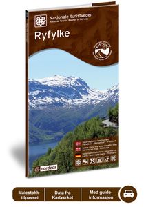
Wegenkaart - landkaart 02 Nasjonale Turistveger Ryfylke | Nordeca

Speciale map met daarin een wegenkaart van een Nationale Toerist Route in Noorwegen. Naast een gedetailleerde landkaart van schaal 1: 50.000 met hoogtelijnen en toeristische aanduidingen staat op de achterzijde toeristische informatie, alsmede adressen voor eten, drinken en overnachting.   De kaart beschrijft spectaculaire uitzichtpunten, natuurfen...
29,95

Webshops met dit product

Webshop
Bezorging
Prijs

Anderen bekeken ook

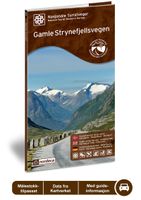
Wegenkaart - landkaart 09 Nasjonale Turistveger Gamle Strynefjellsvegen | Nordeca
Speciale map met daarin een wegenkaart van een Nationale Toerist Route in Noorwegen. Naast een gedetailleerde landkaart van schaal 1: 50.000 met hoogtelijnen en toeristische aanduidingen staat op de achterzijde toeristische informatie, alsmede adressen voor eten, drinken en overnachting.   De kaart beschrijft spectaculaire uitzichtpunten, natuurfenomenen, attracties, accommodaties, horeca en bezienswaardigheden langs de Nationale Toeristenweg. De teksten op de kaart zijn drietalig: Noors, Engels en Duits.   En elke map is ook nog eens voorzien van 5 XL-ansichtkaarten van het gebied. Als aandenken of om te versturen.   This road between eastern and western Norway, which dates back over 100 years, is an experience in its own right. Old stone walls meticulously crafted by hand and long rows of guard stones define the character of the road leading across the mountain plateau. In the olden days, many routes through the mountains were used for transport on foot and on horseback, but the jour…
29,95
Wegenkaart - landkaart 08 Nasjonale Turistveger Sognefjellet | Nordeca
Speciale map met daarin een wegenkaart van een Nationale Toerist Route in Noorwegen. Naast een gedetailleerde landkaart van schaal 1: 80.000 met hoogtelijnen en toeristische aanduidingen staat op de achterzijde toeristische informatie, alsmede adressen voor eten, drinken en overnachting.   De kaart beschrijft spectaculaire uitzichtpunten, natuurfenomenen, attracties, accommodaties, horeca en bezienswaardigheden langs de Nationale Toeristenweg. De teksten op de kaart zijn drietalig: Noors, Engels en Duits.   En elke map is ook nog eens voorzien van 5 XL-ansichtkaarten van het gebied. Als aandenken of om te versturen.   This journey along a route that has connected Norway between east and west for centuries includes Northern Europes highest mountain pass, at 1 434 metres above sea level. The Sognefjell road starts in the lush cultural landscape of Bøverdalen valley in the east and crosses the mountain plateau, with panoramic views of glaciers and towering mountains, before descending thr…
29,95
Wegenkaart - landkaart 05 Nasjonale Turistveger Aurlandsfjellet | Nordeca
Speciale map met daarin een wegenkaart van een Nationale Toerist Route in Noorwegen. Naast een gedetailleerde landkaart van schaal 1: 50.000 met hoogtelijnen en toeristische aanduidingen staat op de achterzijde toeristische informatie, alsmede adressen voor eten, drinken en overnachting.   De kaart beschrijft spectaculaire uitzichtpunten, natuurfenomenen, attracties, accommodaties, horeca en bezienswaardigheden langs de Nationale Toeristenweg. De teksten op de kaart zijn drietalig: Noors, Engels en Duits.   En elke map is ook nog eens voorzien van 5 XL-ansichtkaarten van het gebied. Als aandenken of om te versturen.   This drive takes you from one fjord to the next via a high mountain crossing with snow along the road most of the summer. The viewing platform at Stegastein, a natural place to make a stop, provides a dizzying view of the fjord landscape. The Nærøyfjord, a designated World Heritage Site, offers breath-taking scenery. The Flåm railway line and the Aurlandsdalen valley, oth…
29,95
Wegenkaart - landkaart 13 Nasjonale Turistveger Helgelandskysten | Nordeca
Speciale map met daarin een wegenkaart van een Nationale Toerist Route in Noorwegen. Naast een gedetailleerde landkaart van schaal 1: 250.000 met hoogtelijnen en toeristische aanduidingen staat op de achterzijde toeristische informatie, alsmede adressen voor eten, drinken en overnachting.   De kaart beschrijft spectaculaire uitzichtpunten, natuurfenomenen, attracties, accommodaties, horeca en bezienswaardigheden langs de Nationale Toeristenweg. De teksten op de kaart zijn drietalig: Noors, Engels en Duits.   En elke map is ook nog eens voorzien van 5 XL-ansichtkaarten van het gebied. Als aandenken of om te versturen.   National Tourist Route Helgelandskysten, which is connected by six ferries, offers a wealth of contrasts as it passes through a verdant cultural landscape interspersed with craggy peaks, glaciers, sweeping coastlines and swirling ocean currents. Many remarkable natural phenomena are found along this route. In the south you will pass the peaks of the Seven Sisters and th…
29,95
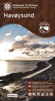
Wegenkaart - landkaart 17 Nasjonale Turistveger Havøysund | Nordeca
Speciale map met daarin een wegenkaart van een Nationale Toerist Route in Noorwegen. Naast een gedetailleerde landkaart van schaal 1: 50.000 met hoogtelijnen en toeristische aanduidingen staat op de achterzijde toeristische informatie, alsmede adressen voor eten, drinken en overnachting.   De kaart beschrijft spectaculaire uitzichtpunten, natuurfenomenen, attracties, accommodaties, horeca en bezienswaardigheden langs de Nationale Toeristenweg. De teksten op de kaart zijn drietalig: Noors, Engels en Duits.   En elke map is ook nog eens voorzien van 5 XL-ansichtkaarten van het gebied. Als aandenken of om te versturen.   National Tourist Route Havøysund takes you to the far north. The route follows the Arctic Ocean and meanders through a rugged landscape of cliffs and untamed nature where the bare mountains touch the ocean's edge. The fishing village of Havøysund offers an intriguing opportunity to visit a vibrant community on the coast of Finnmark. Along this weather-beaten coastline, f…
29,95
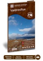
Wegenkaart - landkaart 06 Nasjonale Turistveger Valdresflye | Nordeca
Speciale map met daarin een wegenkaart van een Nationale Toerist Route in Noorwegen. Naast een gedetailleerde landkaart van schaal 1: 50.000 met hoogtelijnen en toeristische aanduidingen staat op de achterzijde toeristische informatie, alsmede adressen voor eten, drinken en overnachting.   De kaart beschrijft spectaculaire uitzichtpunten, natuurfenomenen, attracties, accommodaties, horeca en bezienswaardigheden langs de Nationale Toeristenweg. De teksten op de kaart zijn drietalig: Noors, Engels en Duits.   The road across the Valdresflye plateau offers sweeping views of mountains and open expanses, from which it seems to swoop into the Jotunheimen massif like the beginning of an endless journey. To the north, you can catch a view of the Jotunheimen National Park, where the mountains are steeper and wilder than to the south, where the landscape widens into serene, rolling hills. Here, cultural landscapes dominate, with mountain pastures and a number of tourist lodges that have long tra…
29,95
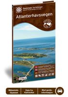
Wegenkaart - landkaart 12 Nasjonale Turistveger Atlanterhavsveien | Nordeca
Speciale map met daarin een wegenkaart van een Nationale Toerist Route in Noorwegen. Naast een gedetailleerde landkaart van schaal 1: 50.000 met hoogtelijnen en toeristische aanduidingen staat op de achterzijde toeristische informatie, alsmede adressen voor eten, drinken en overnachting.   De kaart beschrijft spectaculaire uitzichtpunten, natuurfenomenen, attracties, accommodaties, horeca en bezienswaardigheden langs de Nationale Toeristenweg. De teksten op de kaart zijn drietalig: Noors, Engels en Duits.   En elke map is ook nog eens voorzien van 5 XL-ansichtkaarten van het gebied. Als aandenken of om te versturen.   Atlanterhavsvegen is a superb manifestation of successful interaction between people and nature. The seven bridges that arch between the islets and skerries on the edge of the ocean, providing magnificent views for travellers, are an outstanding feat of engineering. In 2005, Atlanterhavsvegen was awarded the distinction of being named Norway's Architectural Monument of th…
29,95
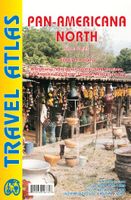
Wegenkaart - landkaart - Wegenatlas Pan-Americana North | ITMB
Wegenatlas - A5 formaat - verschillende schalen - voor de het Noord-Amerikaanse gedeelte van de Pan-Americana ( Pan-American Highway ) van Alaska langs the Pacific kust van British Colombia in Canada, de staten Washington, Oregon en Californie, Mexico, Guatemala tot Panama.   The Pan-American Highway was created by the USA to improve road communications within the Western Hemisphere post-WW2. The highway started at the Mexican border and eventually reached somewhere south of Santiago in Chile. It was a vote-buying gimmick by the Americans to fund allies, but it also created an essential 'spine' road through Central America to the Darien Gap and along the west coast of South America to the then-limits of Chile. Driving the Pan-Am has become a travel experience. More recently, the improvement in more northerly highways, such as the Dalton Highway from Fairbanks to Prudhoe Bay in Alaska, the paving of most of the Stewart Highway through British Columbia, and the tremendous improvement in …
16,50
Fietskaart Cycling guides Dartmoor - South Devon | Goldeneye
Dartmoor. One of England’s greater National Parks; the Forest of Dartmoor covers 365 square miles and contains the highest ground in England south of the Peak District. On its desolate moorland tracks the wanderer can believe they are further from a public road than anywhere in the country, but on the fringes lush valleys lead down on every side to thick woodland, green vegetation and picturesque villages. Dartmoor is well known for its wildlife - attractive herds of ponies, seemingly wild but in fact individually owned, foxes, badgers and otters - also the occasional adder. Fallow, roe and Sitka deer can often be seen, but the red deer of Exmoor have never penetrated the area. Buzzards, kestrels and various Birds of Prey are frequently seen, as well as the wheatear, while crows, ravens and the skylark are fairly commonplace. The Moor abounds in prehistoric remains. There are also many deserted medieval villages with remains of the traditional ‘longhouse’ buildings. For centuries tin m…
12,95
Wegenkaart - landkaart Turistkort Danmark med Margueritruten + bykort - Margrietroute | Scanmaps
Nordisk Korthandel has published a new Tourist Map of Denmark and Major Cities with The Marguerite Route.   As a newly added feature the Tourist map of Denmark includes the scenic Marguerite Route.   The Marguerite route is a 3600 km long route through the danish landscape, and was opened in 1991 by Queen Margrethe of Denmark. The route runs through beautiful regions of Denmark, and in most places it is possible to cycle or walk along the route. Most of the route is situated on small roads, and therefore it is not the quickest or shortest way from point A to B, but instead it is an invitation to visit the many attractions, that you will find in Denmark. It runs through the danish mainland and is therefore not covering islands like Bornholm and Samsø. If you want to leave the mainland, you can find information, on ferry routes that depart from danish harbours, on the map.   The route uses the daisy flower as a symbol, and you will find it on the road signs, that are placed alongside the…
16,95

Klanten-reviews van Wegenkaart - landkaart 02 Nasjonale Turistveger Ryfylke | Nordeca

Er zijn nog geen beoordelingen voor dit productBen jij de eerste die een review plaatst?

Meer over Wegenkaart - landkaart 02 Nasjonale Turistveger Ryfylke | Nordeca

Productomschrijving

Speciale map met daarin een wegenkaart van een Nationale Toerist Route in Noorwegen. Naast een gedetailleerde landkaart van schaal 1: 50.000 met hoogtelijnen en toeristische aanduidingen staat op de achterzijde toeristische informatie, alsmede adressen voor eten, drinken en overnachting.   De kaart beschrijft spectaculaire uitzichtpunten, natuurfenomenen, attracties, accommodaties, horeca en bezienswaardigheden langs de Nationale Toeristenweg. De teksten op de kaart zijn drietalig: Noors, Engels en Duits.   En elke map is ook nog eens voorzien van 5 XL-ansichtkaarten van het gebied. Als aandenken of om te versturen.   This route through constantly changing scenery brings you from lush fjords to stark mountains. The drive through the Ryfylke region is a varied one, with small towns and communities interspersed among flourishing farmland and a versatile business and industrial base. Sauda, which is famous for its smelting industry, is situated between mountain peaks and waterfalls innermost in Ryfylke. In Sauda, and in the old zinc mines of the Allmannajuvet gorge, you can experience Norwegian industrial history first hand. The trip across the Sauda mountains into the Røldal valley is spectacular, along a road that snakes through the towering mountain landscape. Some of Norways most well-known attractions, such as the Prekestolen cliff and plateau (Pulpit Rock), the Lysefjord and the wedged boulder called Kjæragbolten, can be explored on short detours from the route. National Tourist Route Ryfylke runs from Oanes on the Lysefjord, via Sauda to Hordalia in the Røldal valley over a total distance of 183 kilometres (National Road 13, County Road 46/520). The route includes two ferries that offer you a different perspective on the fjord scenery. The stretch from Helandsbygd to Røldal is closed in the winter season. This road usually closes in November and reopens in June.   Fakta: - Eksklusiv innpakning - Unikt innhold - Flotte og illustrative bilder - Tre språk(norsk, engelsk og tysk) - Bilder og informasjon rett i kartet - Egne postkort medfølger
Webshop.nl maakt gebruik van cookies. Ga je verder op onze website, ga dan akkoord met het plaatsen van cookies en de verwerking van deze data door ons en vermelde partners.