webshop.nl
Categorieën
  Sluiten

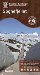
Wegenkaart - landkaart 08 Nasjonale Turistveger Sognefjellet | Nordeca

Speciale map met daarin een wegenkaart van een Nationale Toerist Route in Noorwegen. Naast een gedetailleerde landkaart van schaal 1: 80.000 met hoogtelijnen en toeristische aanduidingen staat op de achterzijde toeristische informatie, alsmede adressen voor eten, drinken en overnachting.   De kaart beschrijft spectaculaire uitzichtpunten, natuurfen...
29,95

Webshops met dit product

Webshop
Bezorging
Prijs

Anderen bekeken ook

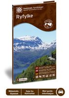
Wegenkaart - landkaart 02 Nasjonale Turistveger Ryfylke | Nordeca
Speciale map met daarin een wegenkaart van een Nationale Toerist Route in Noorwegen. Naast een gedetailleerde landkaart van schaal 1: 50.000 met hoogtelijnen en toeristische aanduidingen staat op de achterzijde toeristische informatie, alsmede adressen voor eten, drinken en overnachting.   De kaart beschrijft spectaculaire uitzichtpunten, natuurfenomenen, attracties, accommodaties, horeca en bezienswaardigheden langs de Nationale Toeristenweg. De teksten op de kaart zijn drietalig: Noors, Engels en Duits.   En elke map is ook nog eens voorzien van 5 XL-ansichtkaarten van het gebied. Als aandenken of om te versturen.   This route through constantly changing scenery brings you from lush fjords to stark mountains. The drive through the Ryfylke region is a varied one, with small towns and communities interspersed among flourishing farmland and a versatile business and industrial base. Sauda, which is famous for its smelting industry, is situated between mountain peaks and waterfalls inner…
29,95
Wegenkaart - landkaart 05 Nasjonale Turistveger Aurlandsfjellet | Nordeca
Speciale map met daarin een wegenkaart van een Nationale Toerist Route in Noorwegen. Naast een gedetailleerde landkaart van schaal 1: 50.000 met hoogtelijnen en toeristische aanduidingen staat op de achterzijde toeristische informatie, alsmede adressen voor eten, drinken en overnachting.   De kaart beschrijft spectaculaire uitzichtpunten, natuurfenomenen, attracties, accommodaties, horeca en bezienswaardigheden langs de Nationale Toeristenweg. De teksten op de kaart zijn drietalig: Noors, Engels en Duits.   En elke map is ook nog eens voorzien van 5 XL-ansichtkaarten van het gebied. Als aandenken of om te versturen.   This drive takes you from one fjord to the next via a high mountain crossing with snow along the road most of the summer. The viewing platform at Stegastein, a natural place to make a stop, provides a dizzying view of the fjord landscape. The Nærøyfjord, a designated World Heritage Site, offers breath-taking scenery. The Flåm railway line and the Aurlandsdalen valley, oth…
29,95
Wegenkaart - landkaart 13 Nasjonale Turistveger Helgelandskysten | Nordeca
Speciale map met daarin een wegenkaart van een Nationale Toerist Route in Noorwegen. Naast een gedetailleerde landkaart van schaal 1: 250.000 met hoogtelijnen en toeristische aanduidingen staat op de achterzijde toeristische informatie, alsmede adressen voor eten, drinken en overnachting.   De kaart beschrijft spectaculaire uitzichtpunten, natuurfenomenen, attracties, accommodaties, horeca en bezienswaardigheden langs de Nationale Toeristenweg. De teksten op de kaart zijn drietalig: Noors, Engels en Duits.   En elke map is ook nog eens voorzien van 5 XL-ansichtkaarten van het gebied. Als aandenken of om te versturen.   National Tourist Route Helgelandskysten, which is connected by six ferries, offers a wealth of contrasts as it passes through a verdant cultural landscape interspersed with craggy peaks, glaciers, sweeping coastlines and swirling ocean currents. Many remarkable natural phenomena are found along this route. In the south you will pass the peaks of the Seven Sisters and th…
29,95
Wegenkaart - landkaart 06 Nasjonale Turistveger Valdresflye | Nordeca
Speciale map met daarin een wegenkaart van een Nationale Toerist Route in Noorwegen. Naast een gedetailleerde landkaart van schaal 1: 50.000 met hoogtelijnen en toeristische aanduidingen staat op de achterzijde toeristische informatie, alsmede adressen voor eten, drinken en overnachting.   De kaart beschrijft spectaculaire uitzichtpunten, natuurfenomenen, attracties, accommodaties, horeca en bezienswaardigheden langs de Nationale Toeristenweg. De teksten op de kaart zijn drietalig: Noors, Engels en Duits.   The road across the Valdresflye plateau offers sweeping views of mountains and open expanses, from which it seems to swoop into the Jotunheimen massif like the beginning of an endless journey. To the north, you can catch a view of the Jotunheimen National Park, where the mountains are steeper and wilder than to the south, where the landscape widens into serene, rolling hills. Here, cultural landscapes dominate, with mountain pastures and a number of tourist lodges that have long tra…
29,95
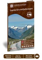
Wegenkaart - landkaart 09 Nasjonale Turistveger Gamle Strynefjellsvegen | Nordeca
Speciale map met daarin een wegenkaart van een Nationale Toerist Route in Noorwegen. Naast een gedetailleerde landkaart van schaal 1: 50.000 met hoogtelijnen en toeristische aanduidingen staat op de achterzijde toeristische informatie, alsmede adressen voor eten, drinken en overnachting.   De kaart beschrijft spectaculaire uitzichtpunten, natuurfenomenen, attracties, accommodaties, horeca en bezienswaardigheden langs de Nationale Toeristenweg. De teksten op de kaart zijn drietalig: Noors, Engels en Duits.   En elke map is ook nog eens voorzien van 5 XL-ansichtkaarten van het gebied. Als aandenken of om te versturen.   This road between eastern and western Norway, which dates back over 100 years, is an experience in its own right. Old stone walls meticulously crafted by hand and long rows of guard stones define the character of the road leading across the mountain plateau. In the olden days, many routes through the mountains were used for transport on foot and on horseback, but the jour…
29,95
Wegenkaart - landkaart 17 Nasjonale Turistveger Havøysund | Nordeca
Speciale map met daarin een wegenkaart van een Nationale Toerist Route in Noorwegen. Naast een gedetailleerde landkaart van schaal 1: 50.000 met hoogtelijnen en toeristische aanduidingen staat op de achterzijde toeristische informatie, alsmede adressen voor eten, drinken en overnachting.   De kaart beschrijft spectaculaire uitzichtpunten, natuurfenomenen, attracties, accommodaties, horeca en bezienswaardigheden langs de Nationale Toeristenweg. De teksten op de kaart zijn drietalig: Noors, Engels en Duits.   En elke map is ook nog eens voorzien van 5 XL-ansichtkaarten van het gebied. Als aandenken of om te versturen.   National Tourist Route Havøysund takes you to the far north. The route follows the Arctic Ocean and meanders through a rugged landscape of cliffs and untamed nature where the bare mountains touch the ocean's edge. The fishing village of Havøysund offers an intriguing opportunity to visit a vibrant community on the coast of Finnmark. Along this weather-beaten coastline, f…
29,95
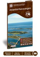
Wegenkaart - landkaart 12 Nasjonale Turistveger Atlanterhavsveien | Nordeca
Speciale map met daarin een wegenkaart van een Nationale Toerist Route in Noorwegen. Naast een gedetailleerde landkaart van schaal 1: 50.000 met hoogtelijnen en toeristische aanduidingen staat op de achterzijde toeristische informatie, alsmede adressen voor eten, drinken en overnachting.   De kaart beschrijft spectaculaire uitzichtpunten, natuurfenomenen, attracties, accommodaties, horeca en bezienswaardigheden langs de Nationale Toeristenweg. De teksten op de kaart zijn drietalig: Noors, Engels en Duits.   En elke map is ook nog eens voorzien van 5 XL-ansichtkaarten van het gebied. Als aandenken of om te versturen.   Atlanterhavsvegen is a superb manifestation of successful interaction between people and nature. The seven bridges that arch between the islets and skerries on the edge of the ocean, providing magnificent views for travellers, are an outstanding feat of engineering. In 2005, Atlanterhavsvegen was awarded the distinction of being named Norway's Architectural Monument of th…
29,95
Wegenkaart - landkaart - Wegenatlas Pan-Americana North | ITMB
Wegenatlas - A5 formaat - verschillende schalen - voor de het Noord-Amerikaanse gedeelte van de Pan-Americana ( Pan-American Highway ) van Alaska langs the Pacific kust van British Colombia in Canada, de staten Washington, Oregon en Californie, Mexico, Guatemala tot Panama.   The Pan-American Highway was created by the USA to improve road communications within the Western Hemisphere post-WW2. The highway started at the Mexican border and eventually reached somewhere south of Santiago in Chile. It was a vote-buying gimmick by the Americans to fund allies, but it also created an essential 'spine' road through Central America to the Darien Gap and along the west coast of South America to the then-limits of Chile. Driving the Pan-Am has become a travel experience. More recently, the improvement in more northerly highways, such as the Dalton Highway from Fairbanks to Prudhoe Bay in Alaska, the paving of most of the Stewart Highway through British Columbia, and the tremendous improvement in …
16,50
Wegenkaart - landkaart 01 Kaapstad - Cape Town and Surrounding Attractions | MapStudio
Het overzicht is soms misschien een beetje onduidelijk. maar de details in de inzetten en delen van de kaart zijn prima en voldoen goed voor het rondrijden met een eigen auto. Double-sided map, with a general road map on one side, plus numerous street plans and descriptions of four special routes on the reverse. The main map covers an area within reach as day trips from Cape Town, extending east to Swellendam and north to Langebaan. Road classification includes unsurfaced roads, intermediate driving distances on main and secondary roads, toll routes with gates, and mountain passes. Railways are shown with local stations. An impression of relief is provided by elevation tinting (perhaps somewhat confusing for regular map users - the higher the altitude, the greener the colour!), spot heights for main peaks, and names of mountain ranges. Nature and forest reserves, plus salt pans and marshes are indicated. Symbols mark local airfields, historical sites, caravan parks, many wine estates, …
16,95
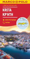
Wegenkaart - landkaart Kreta | Marco Polo
Goede wegenkaart voorzien van alle noodzakelijke aanduidingen. Daarnaast bijvoorbeeld ook campings, mooie wegen e.d. Crete on a double-sided, indexed map in MairDumont's Marco Polo series, with four street plans, plus special features to make route planning and navigating easier: a fold-out flap in the jacket shows the whole island highlighting popular locations, with the grid reference system in the margins making it easier to find various places on the main map.  Road network shows main and secondary roads with driving distances and highlights scenic routes. Smaller country roads or tracks, presented in white on a background with relief shading, are perhaps less clear to see than on maps with altitude colouring. In addition to the shading, topography is presented by numerous peaks and names of mountain ranges. E4 long-distance hiking route is marked, both the section across the central mountains and the variant along the south coast. Picturesque towns, places of interest and landscap…
12,95

Klanten-reviews van Wegenkaart - landkaart 08 Nasjonale Turistveger Sognefjellet | Nordeca

Er zijn nog geen beoordelingen voor dit productBen jij de eerste die een review plaatst?

Meer over Wegenkaart - landkaart 08 Nasjonale Turistveger Sognefjellet | Nordeca

Productomschrijving

Speciale map met daarin een wegenkaart van een Nationale Toerist Route in Noorwegen. Naast een gedetailleerde landkaart van schaal 1: 80.000 met hoogtelijnen en toeristische aanduidingen staat op de achterzijde toeristische informatie, alsmede adressen voor eten, drinken en overnachting.   De kaart beschrijft spectaculaire uitzichtpunten, natuurfenomenen, attracties, accommodaties, horeca en bezienswaardigheden langs de Nationale Toeristenweg. De teksten op de kaart zijn drietalig: Noors, Engels en Duits.   En elke map is ook nog eens voorzien van 5 XL-ansichtkaarten van het gebied. Als aandenken of om te versturen.   This journey along a route that has connected Norway between east and west for centuries includes Northern Europes highest mountain pass, at 1 434 metres above sea level. The Sognefjell road starts in the lush cultural landscape of Bøverdalen valley in the east and crosses the mountain plateau, with panoramic views of glaciers and towering mountains, before descending through valleys to the inner reaches of the Sognefjord with their tranquil villages in the west. Travelling this route across the roof of Norway provides the opportunity to experience vast mountain expanses, dramatic fjords and valleys and a landscape brimming with cultural heritage sites. Lom stave church, one of the biggest and most beautiful stave churches in our country, is one of its many highlights. In a former era, this route was the main artery connecting the coast with the inland regions. Salt and fish were brought eastwards and exchanged for butter, tar and pelts for the return journey. In those days, farmers and merchants travelled together when crossing the mountains so as not to be waylaid by highwaymen. Today it is safe to travel here, and the adventure along the road is found in the combination of magnificent mountain scenery, art and architecture. National Tourist Route Sognefjellet runs from Lom to Gaupne over a total distance of 108 kilometres (County Road 55). The mountain crossing is closed in the winter season; when it opens in early May, the road may be lined with banks of snow up to ten metres in height.   Fakta: - Eksklusiv innpakning - Unikt innhold - Flotte og illustrative bilder - Tre språk(norsk, engelsk og tysk) - Bilder og informasjon rett i kartet - Egne postkort medfølger
Webshop.nl maakt gebruik van cookies. Ga je verder op onze website, ga dan akkoord met het plaatsen van cookies en de verwerking van deze data door ons en vermelde partners.